Bøverbreen (Bøverbrean) is a 4 km long glacier in western Jotunheimen (Norway) that once blocked a valley. The glacier is not to miss from Sognefjellsvegen.
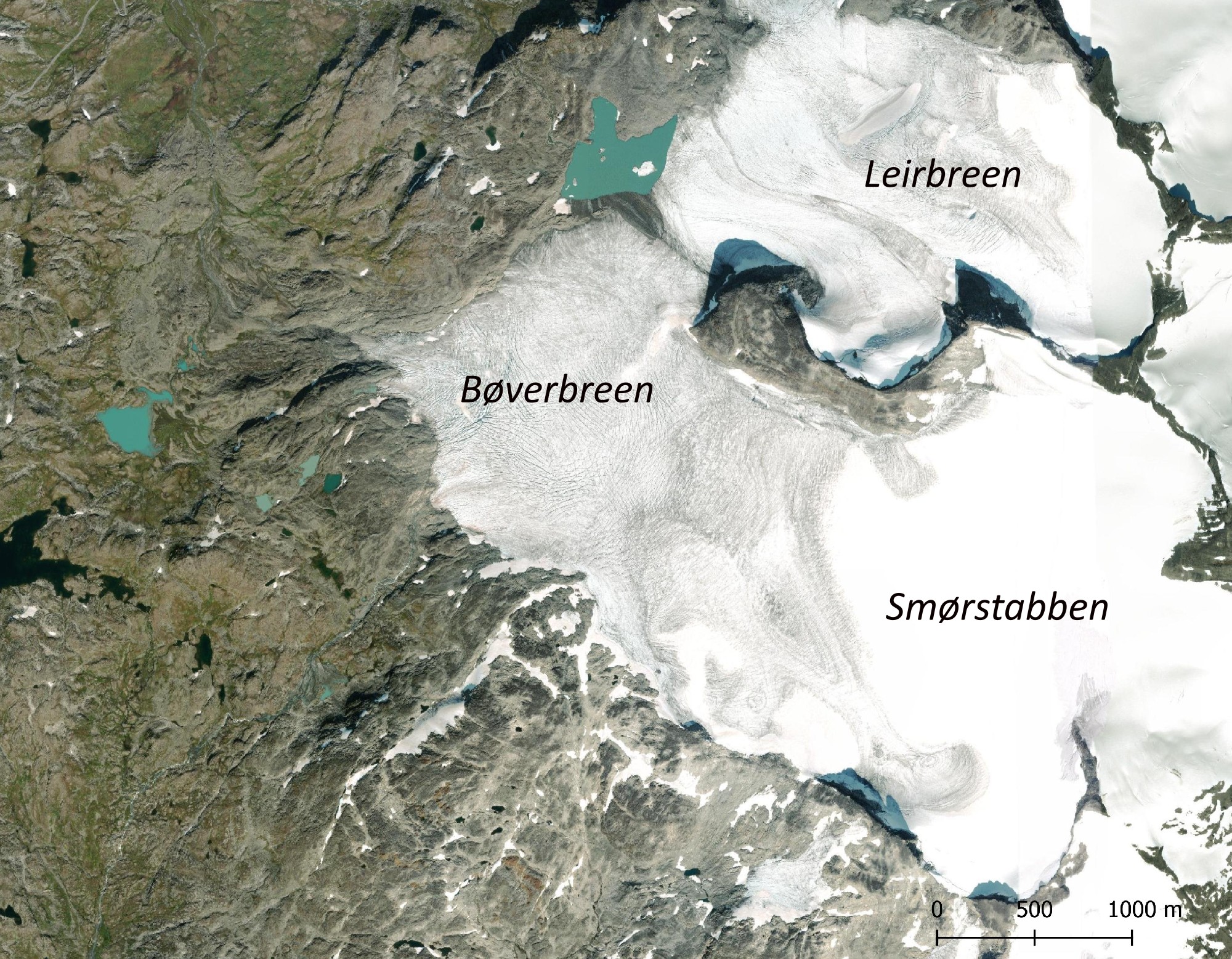
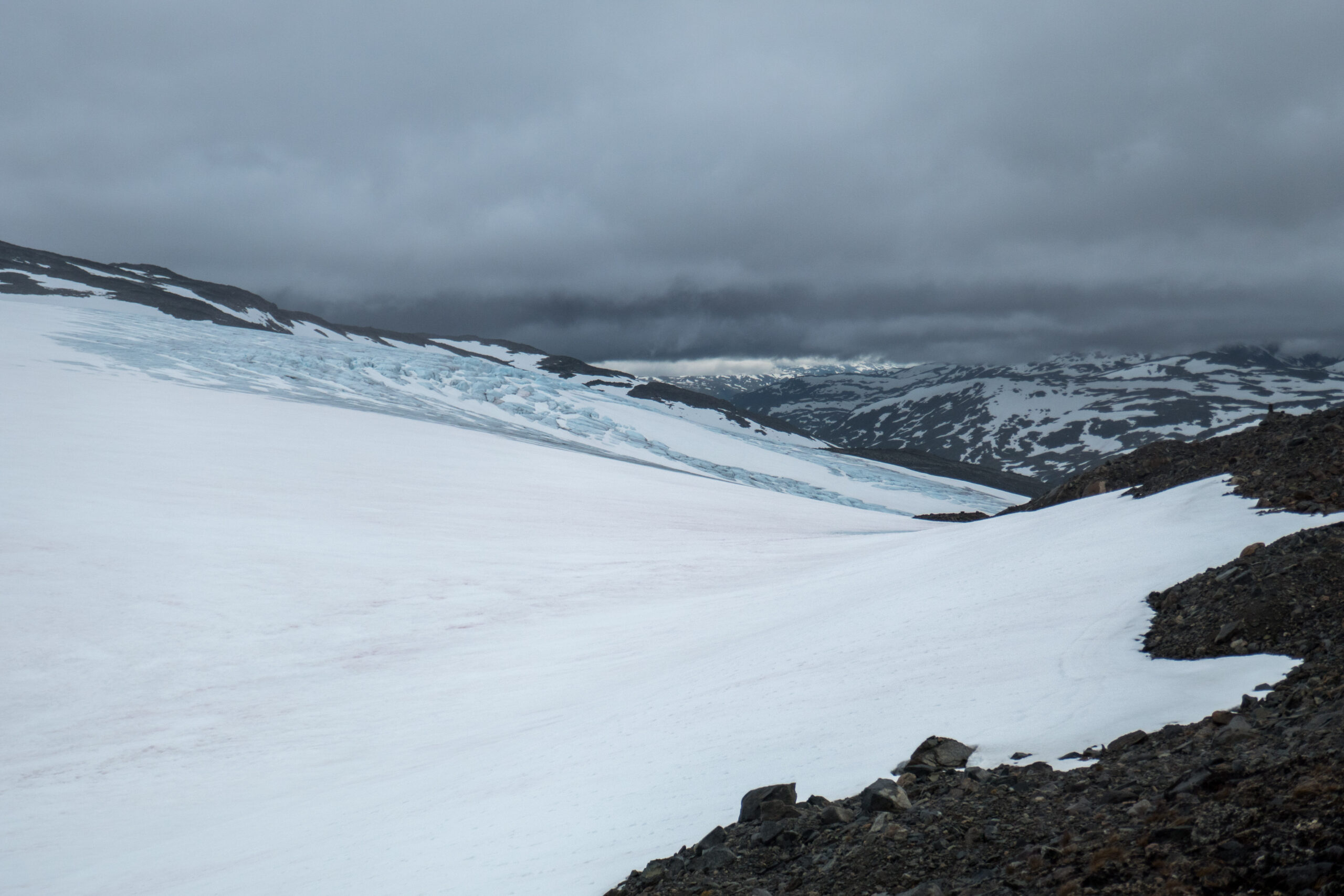
Bøverbreen starts as a flat ice field called Smørstabben, named after the surrounding mountain group. The ice field is some 2 by 2 km in size and lies 1800-1900 m above sea level. It slowly descends towards the northeast. Only the bottom kilometer of the glacier is steeper, with the snout terminating at 1450 m.
Orthophoto of Bøverbreen and adjacent Leirbreen, 2021.
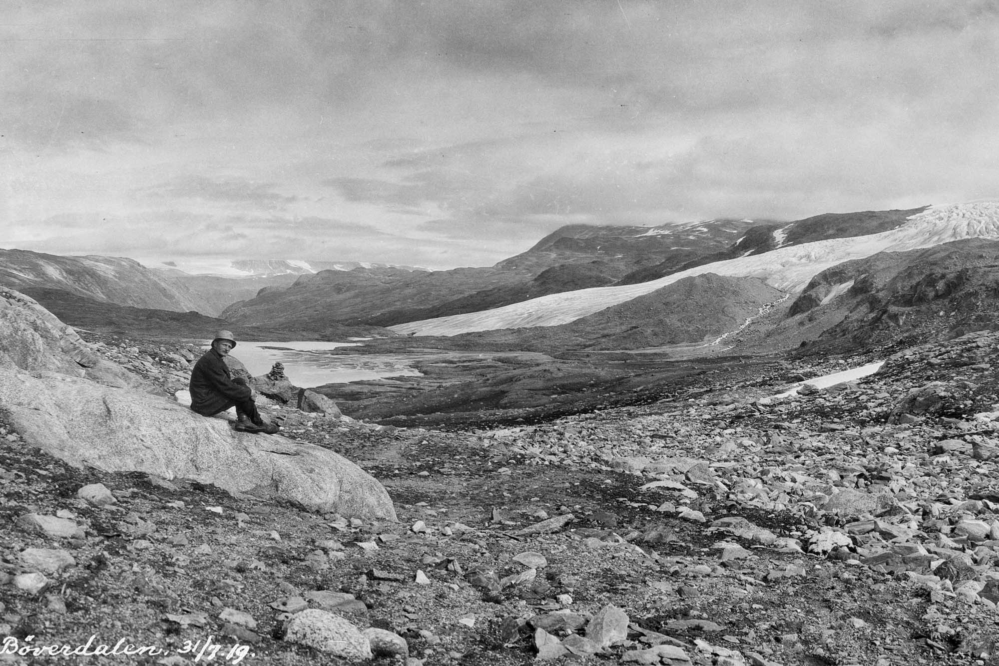
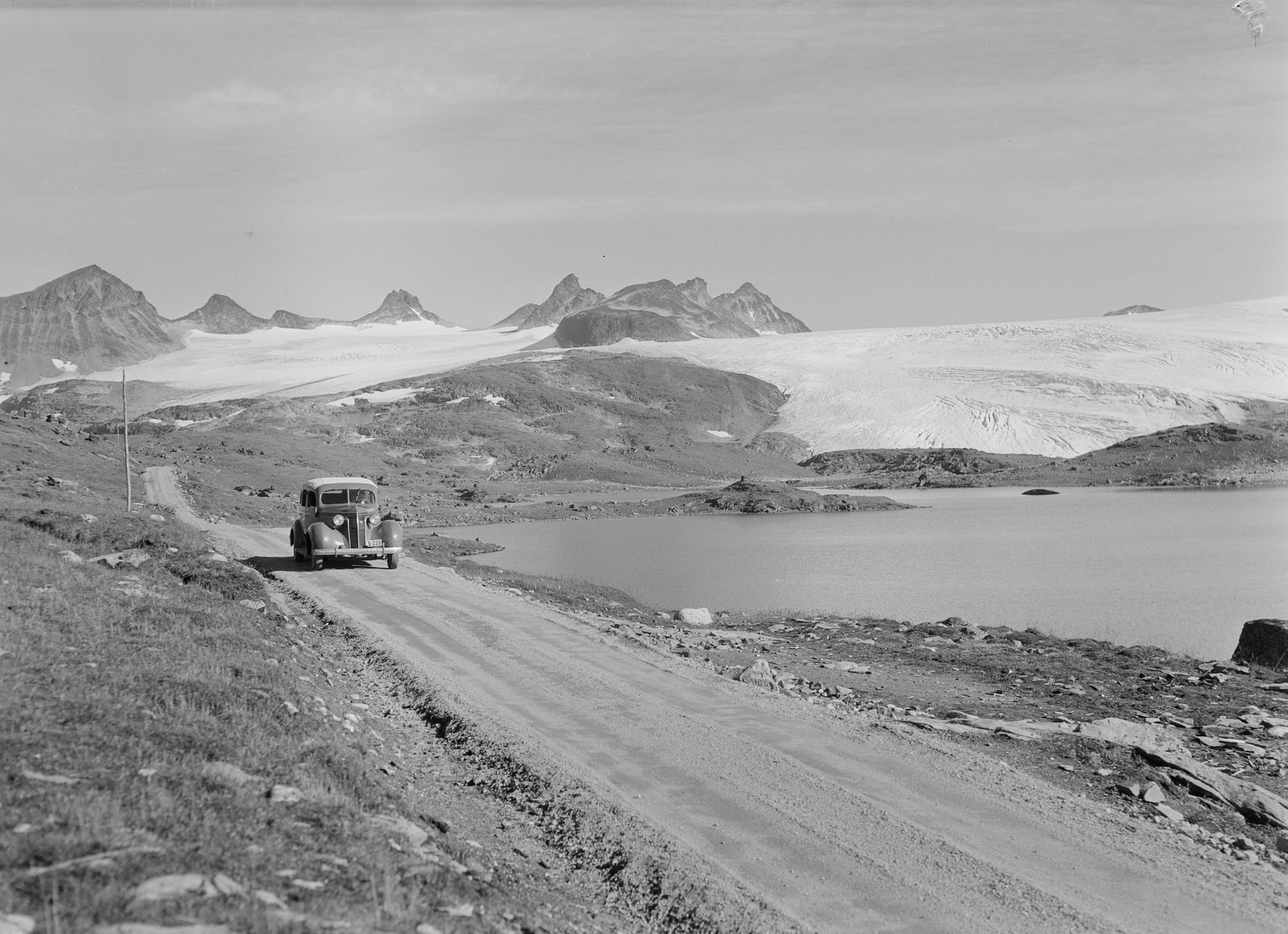
Bøverbreen in 1919, when it still reached the valley floor. The lake behind the man is a remnant of ice-dammed lake Bøvervatnet. Photographer: Jørgen Grundtvig-Olsen, University of Bergen Library photo ubb-go-a-0686.
Larger Bøverbreen
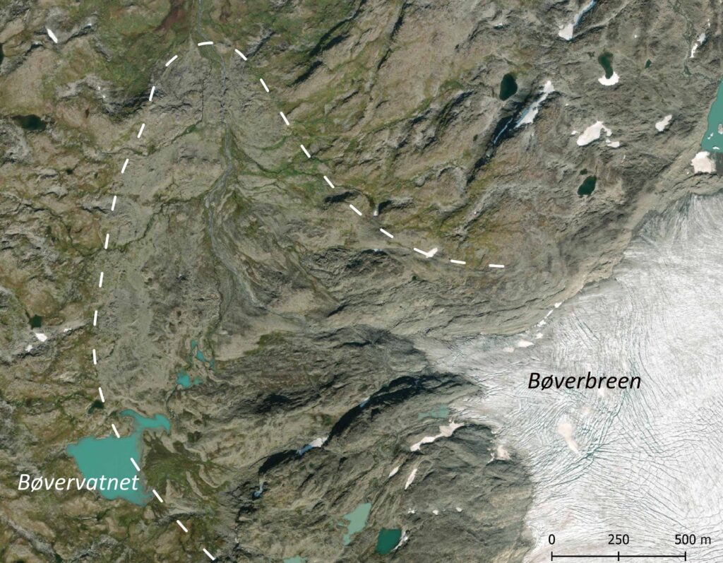
Back in the days, Bøverbreen descended much further into the valley. A few centuries ago the climate was a little bit cooler, so glaciers were bigger. Especially in the 17th and 18th century, when Bøverbreen was 1.5 km longer and ended almost 200 m further down.
Ice-dammed Lake
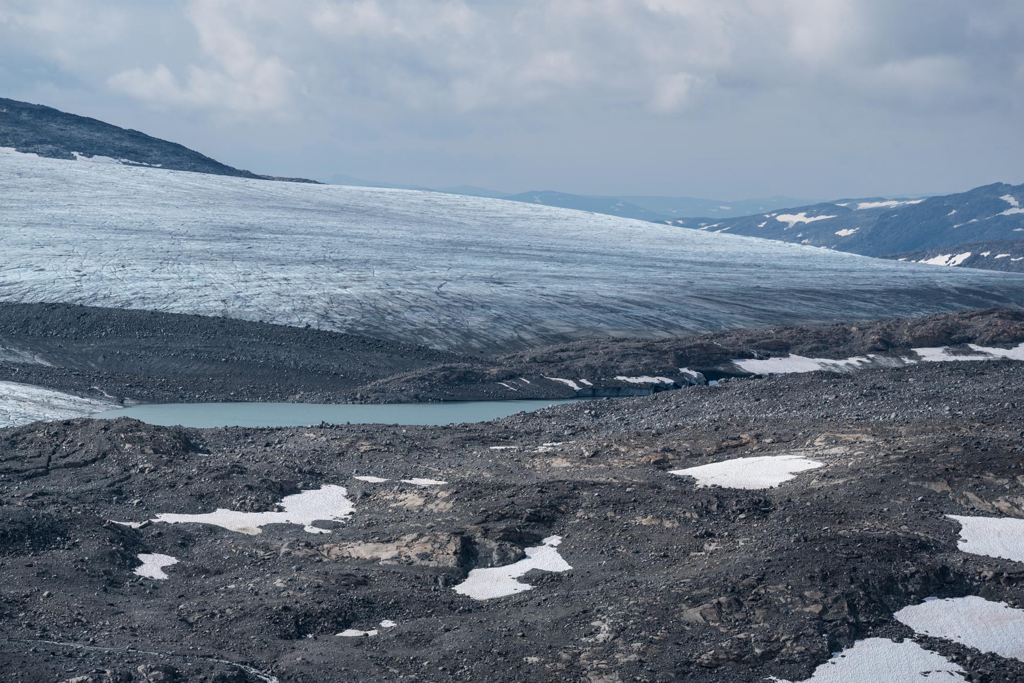
When Bøverbreen was that much larger, it blocked a valley, thereby creating an ice-dammed lake. The lake characteristics tells us more about the history of Bøverbreen. Its sediments, for example, show that the lake probably appeared around 1700 and the glacier thus reached the valley by then. The glacier began to retreat again in the late 1700’s and the lake ceased to exist around 1826 (Matthews et al., 1986). There is no evidence that the lake had ever been there before, so Bøverbreen was larger in the 1700’s than it has been since the end of the last ice age 9000 years ago (Matthews, 1991). Even after the glacier retreated from the valley floor, a part of the lake (now called Bøvervatnet) could survive thanks to moraines acting as dykes.
Aerial photo of Bøverbreen (2021) with its maximum extent in dashed white, when lake Bøvervatnet was ice-dammed.
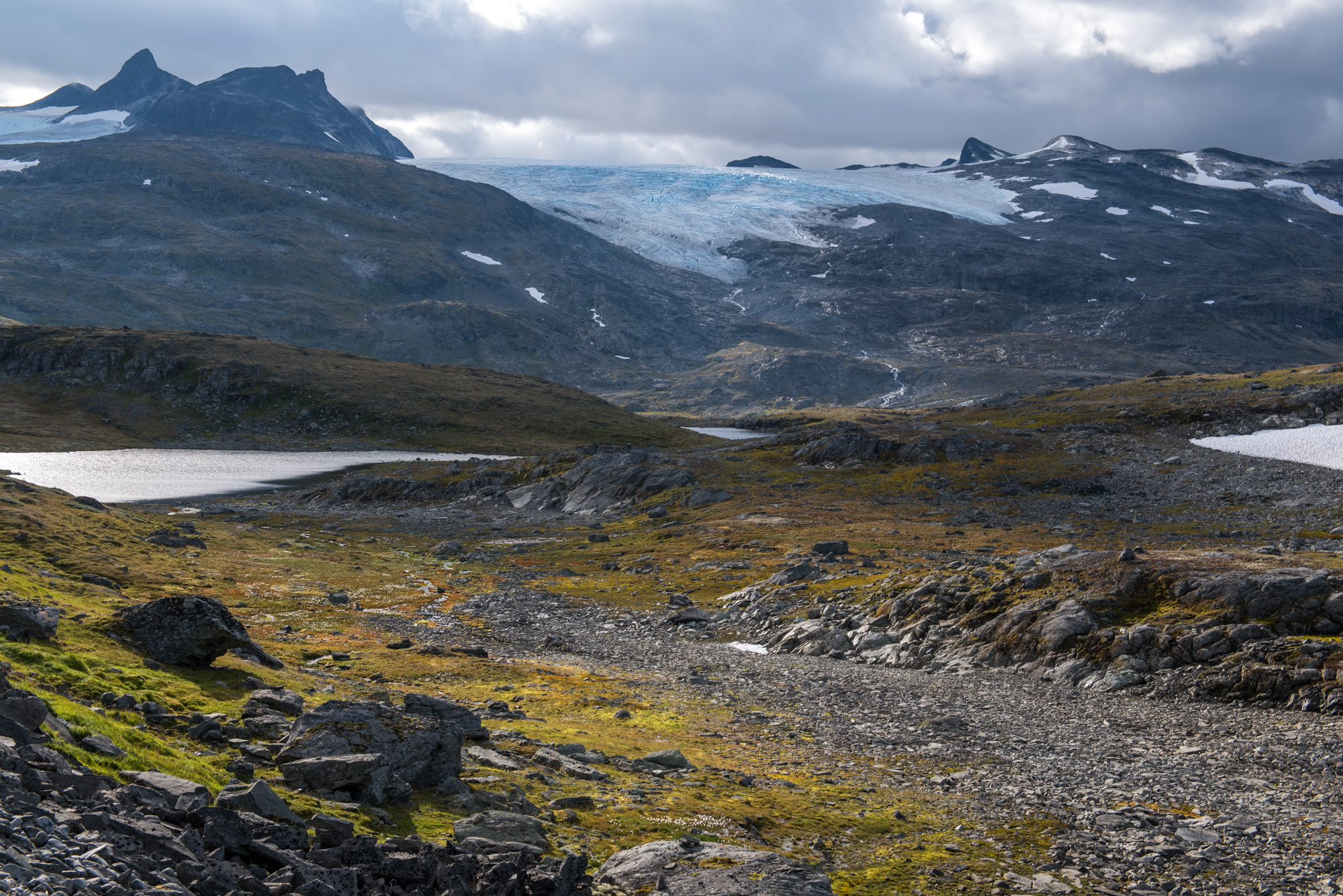
Sognefjellsvegen with Leirbreen (left) and Bøverbreen in the background.
Sognefjellsvegen
A lot of people must have seen Bøverbreen advancing, because the snout was only 600 m from an important route over Sognefjellet. People crossed here on their way from the coast to the inland and vice versa. They were guided by hundreds of impressive cairns that still stand today. A road opened over Sognefjellet in 1938 and this Sognefjellsvegen (or route F55) is a popular drive, not least because of the views of Bøverbreen. It also is the highest mountain pass road in Scandinavia.
First Photo in 1877
Thanks to the importance of Sognefjell for travelers, the first picture of Bøverbreen was already taken in 1877. It shows an impressive glacier, even though the glacier was already in retreat by then. Much more photos were taken from 1938 onwards, as the new road made it much easier to visit this area.
Bøverbreen in 1877 and 2024. Bron 1877: Knud Knudsen, University of Bergen Library photo ubb-kk-1318-1905.
1.5 km Loss
People measure the front position of Bøverbreen since 1903. By then, the glacier had already receded about 400 m. In the following decades the glacier kept receding and has lost another 1100 m by 2024. The annual loss varies greatly with summer temperatures, and lately ranges from just a few metres to almost hundred (NVE).
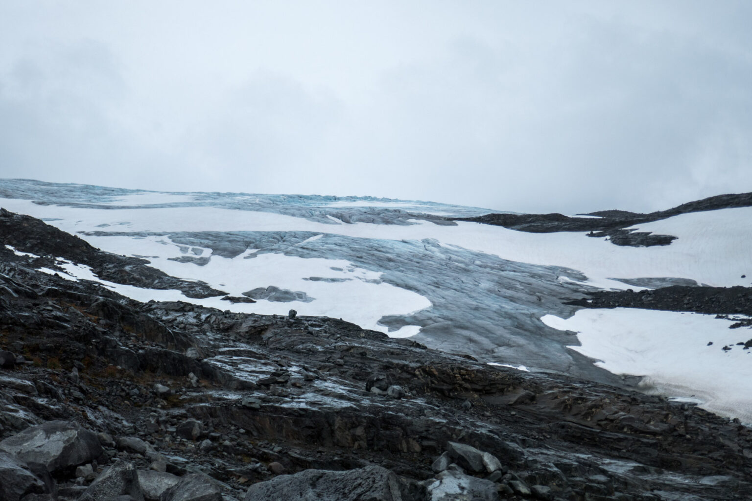
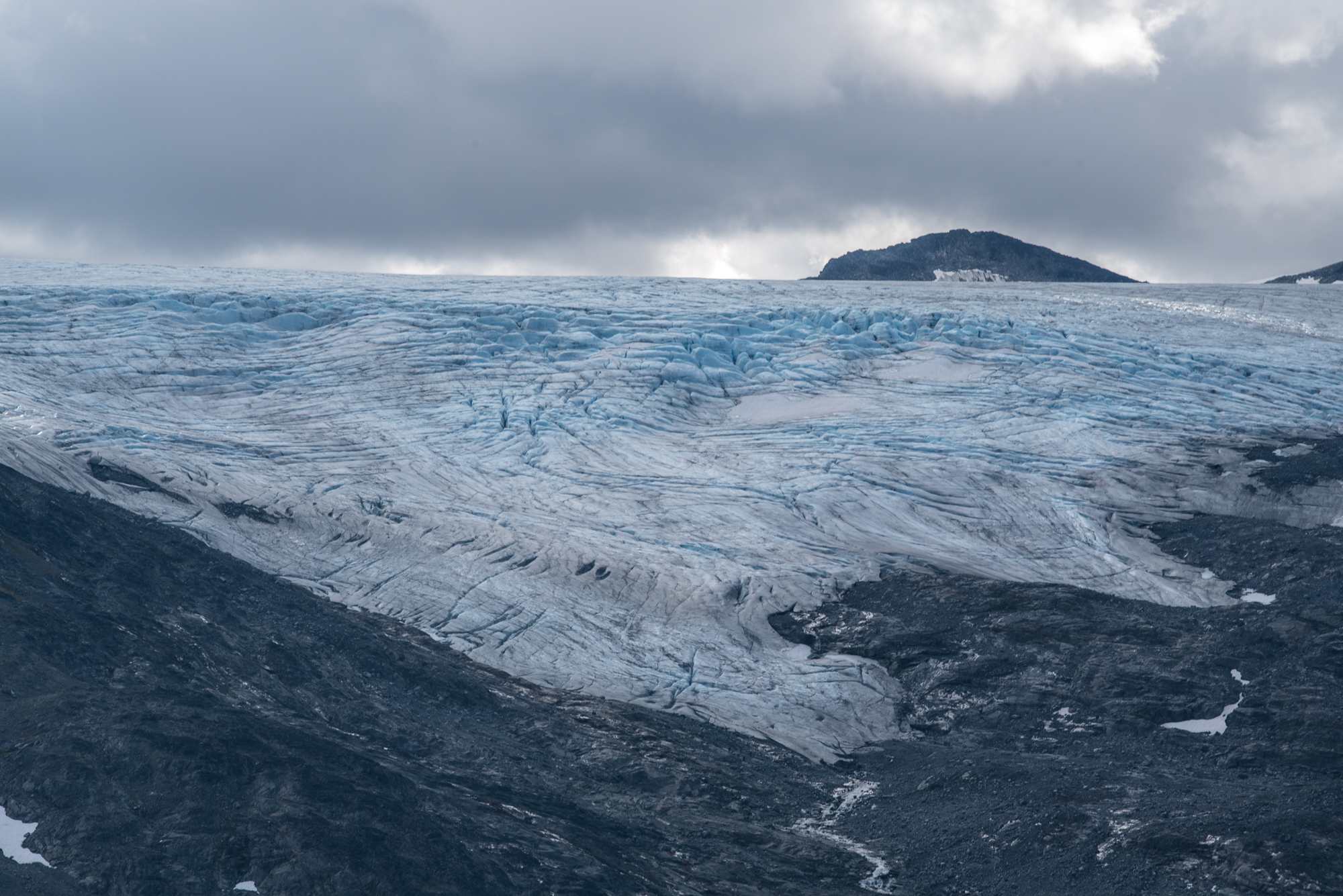
Bøverbreen in the snow-rich summer of 2020, when ice-loss was limited.
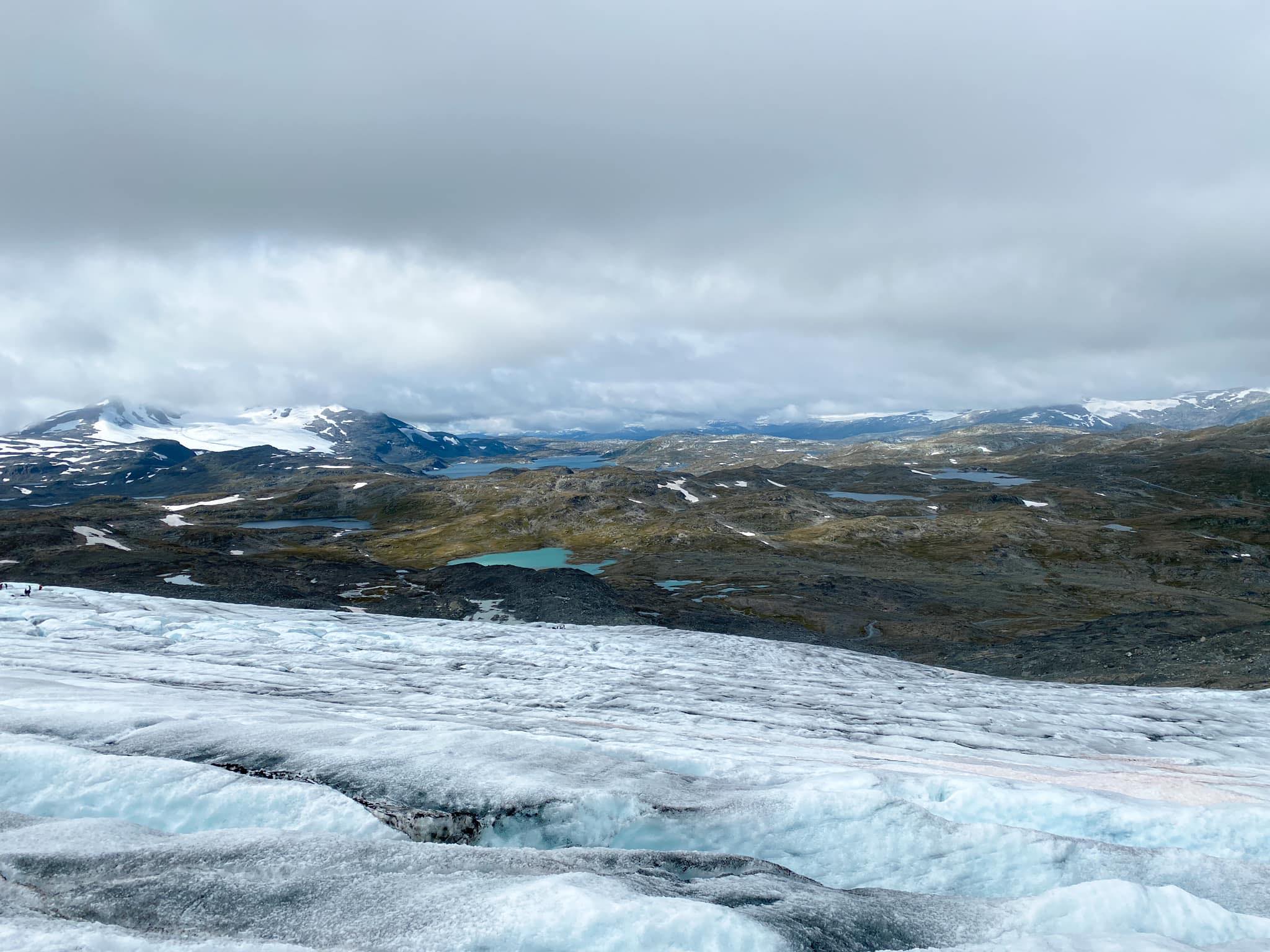
Glacier hike on Bøverbreen. Source: Fjellboms via Facebook.
Glacier Hikes
As the glacier loses ice, it gets increasingly difficult to organize glacier excursions here. Groups start from Sognefjellshytta or Krossbu to experience glacier ice, crevasses and seracs from up close. But due to its low elevation, the entire Bøverbreen (Smørstabben) will disappear. A drive over Sognefjellsvegen won’t be the same without glaciers.


")
")
