Gjertvassbreen is a 2 km long glacier in the Hurrungane massif.
Gjertvassbreen lies in the shadow of Styggedal ridge. Being very exposed, the ridge is popular among climbers. Traversing it brings you over some of the highest mountains in Norway, with Store Skagasølstind (2405) ranking as the country’s third highest peak. Though Galdhøpiggen (2469) and Glittertind (2452) are a little higher, Store Skagastølstind is much harder to reach.
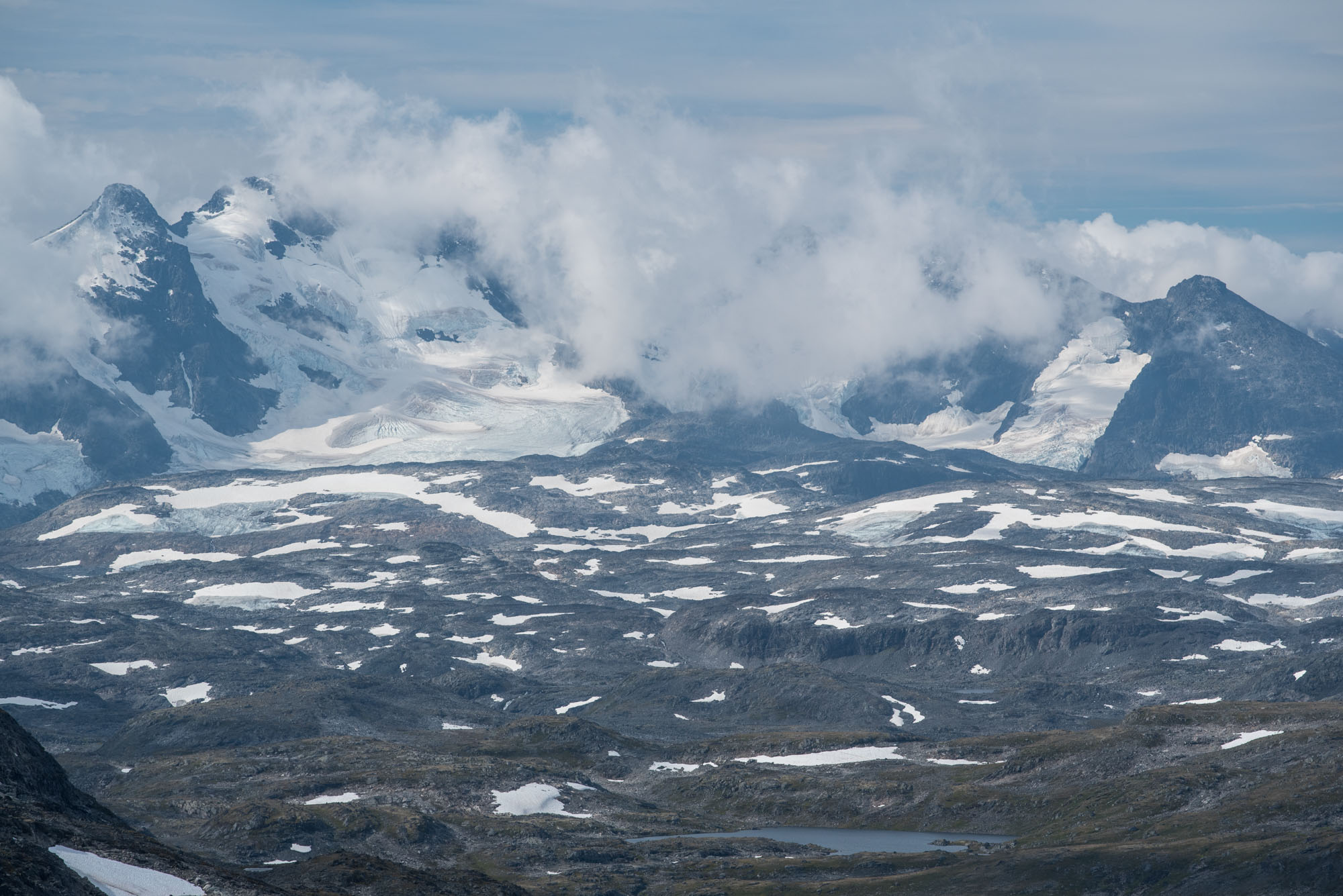
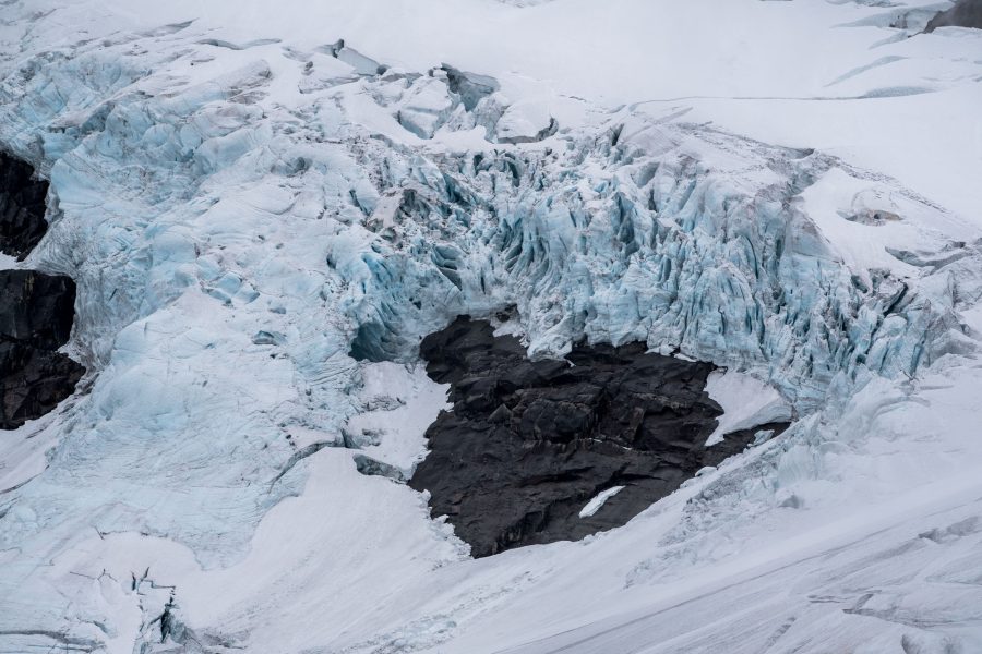
Snow slides down from the steep slopes of Styggedal ridge and accumulates to form Gjertvassbreen glacier. The Hurrunage massif actually bears its name from the sound of avalanches, as it literally means ‘’the noisemakers’’.
Gjertvassbreen flows down to just below 1600 m, where it halts above a cliff. When the oldest known photo of the glacier was taken in 1877, it had no trouble to pass the cliff and form a distinctive snout in Gjertvassdalen. That was still the case in the first half of the twentieth century, after which it retreated up-mountain.
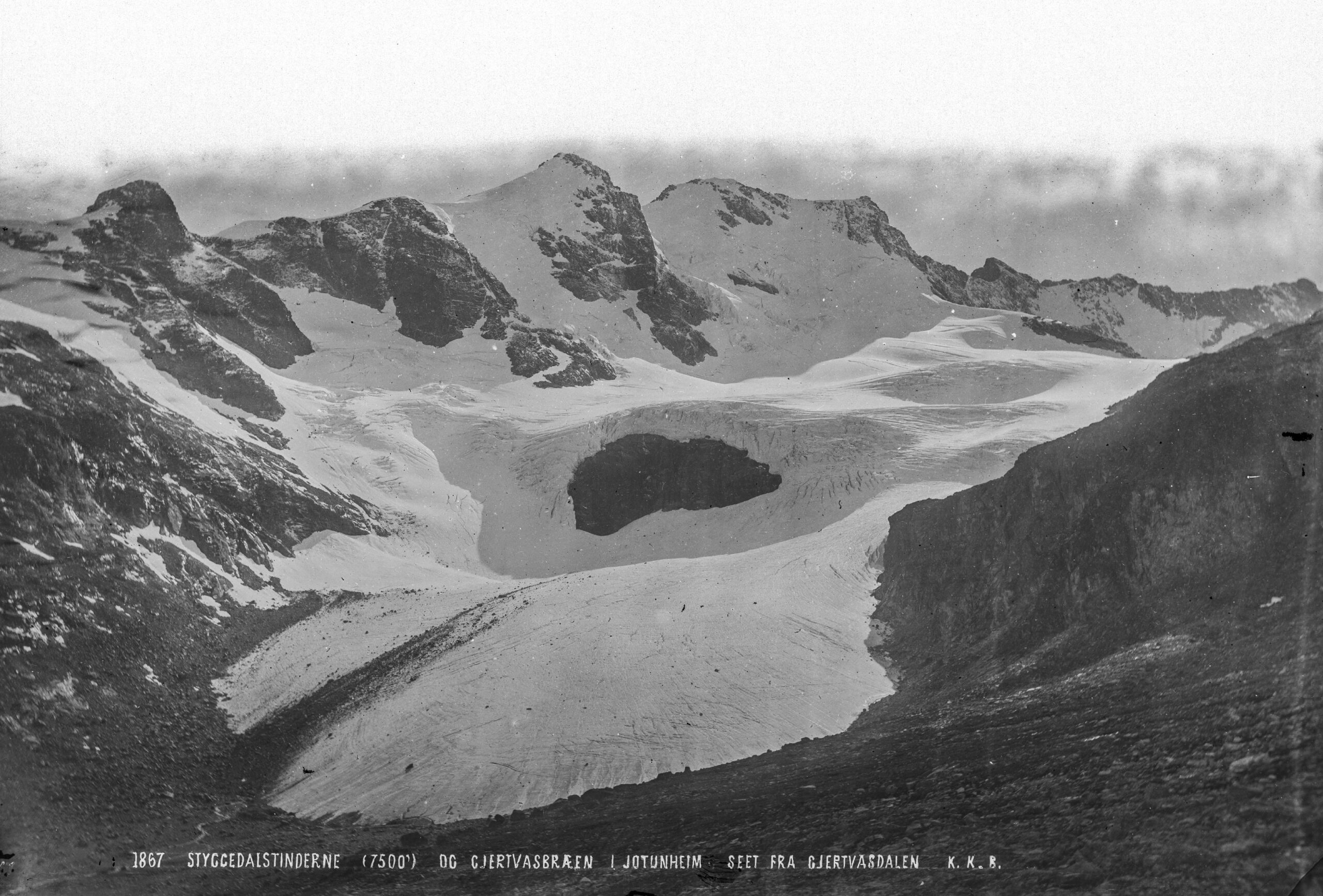
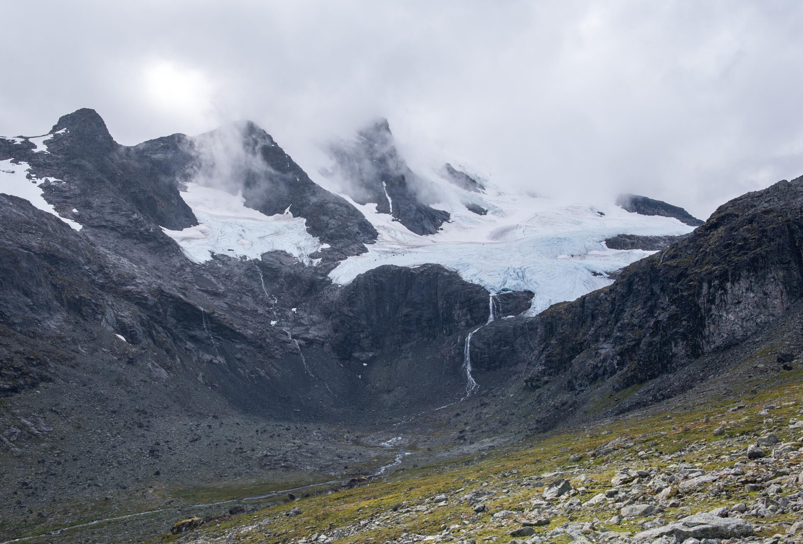
Gjertvassbreen in 1877 (left) and 2024. Source 1877: Knud Knudsen, collection University of Bergen Library photo ubb-kk-1318-1867.
Not much has changes here in the past decades. The ice still reaches up to the cliff, without falling over it. The ice is getting thinner though. One of the places where this is visible, is at the northern side moraine. Once created by the glacier, the moraine is now much higher than the surface of the ice.
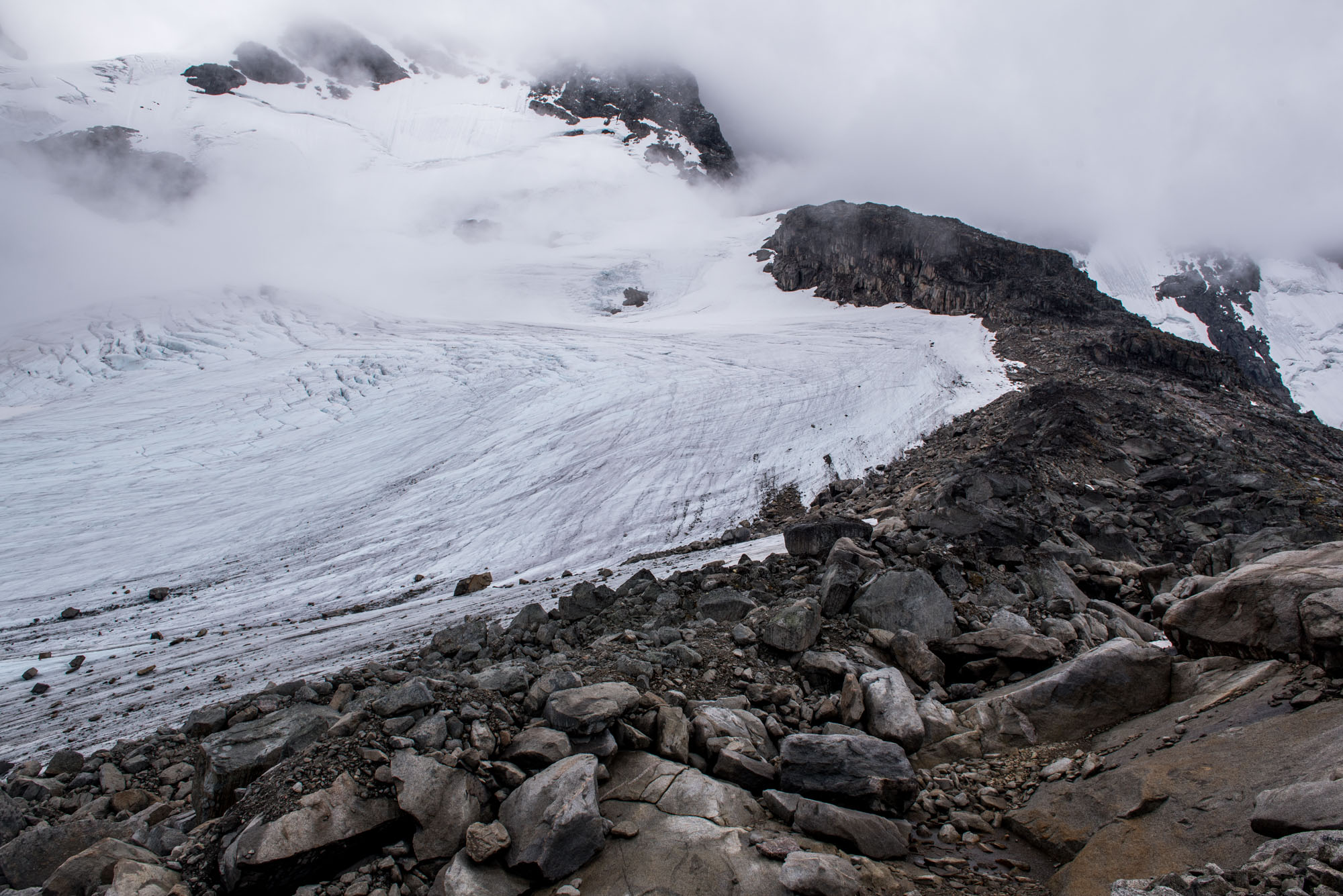
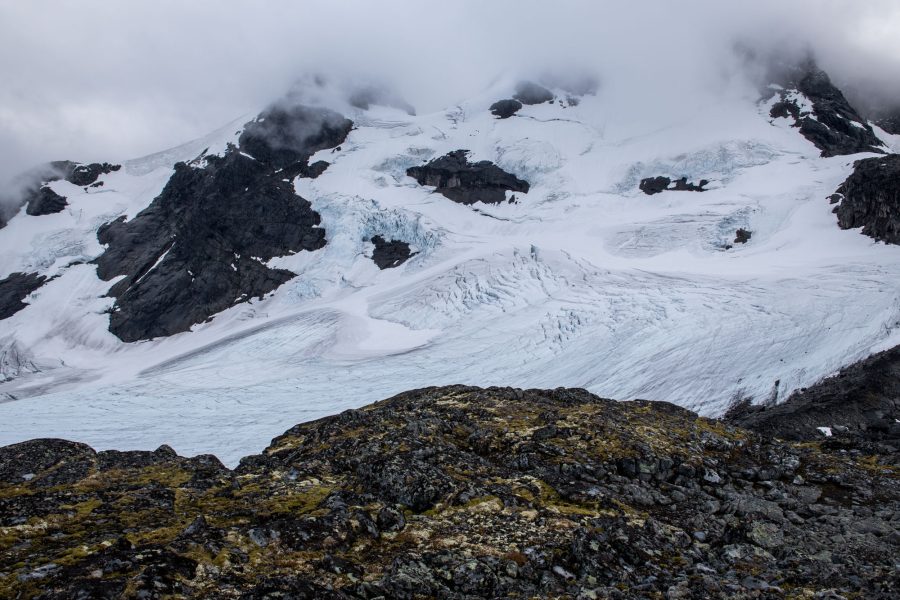
A walk through Gjertvassdalen is all you need to see Gjertvassbreen, but for a better view a hike up Ommane or the ridge between Gjertvass- and Styggedalsbreen is recommended. That will provide a good overview of Styggedalsryggen with its hanging glaciers and valley glaciers below.
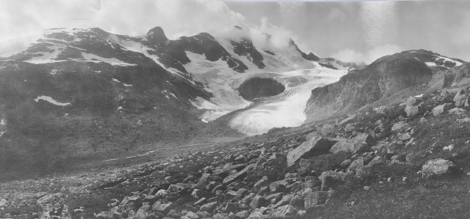
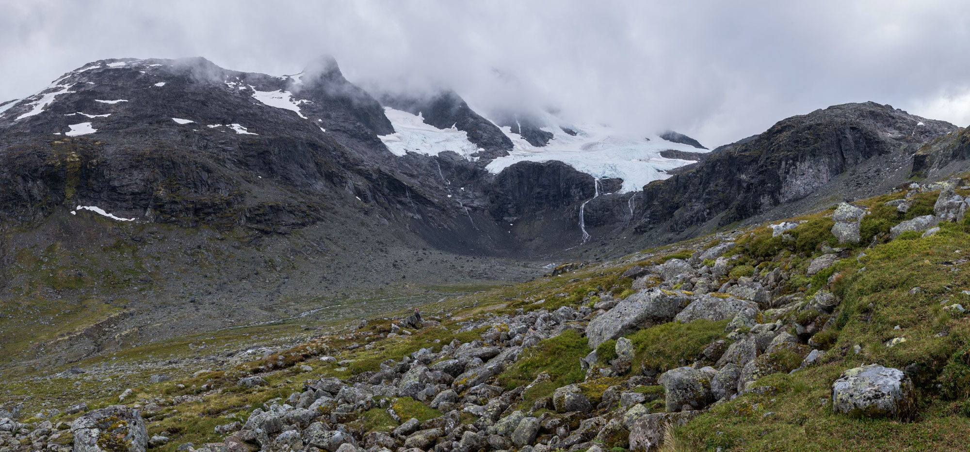
Gjertvassbreen in 1919 (left) and 2023. Photographer 1919: Jørgen Grundtvig-Olsen, collection University of Bergen Library photo ubb-go-a-0698.
Search within glacierchange: