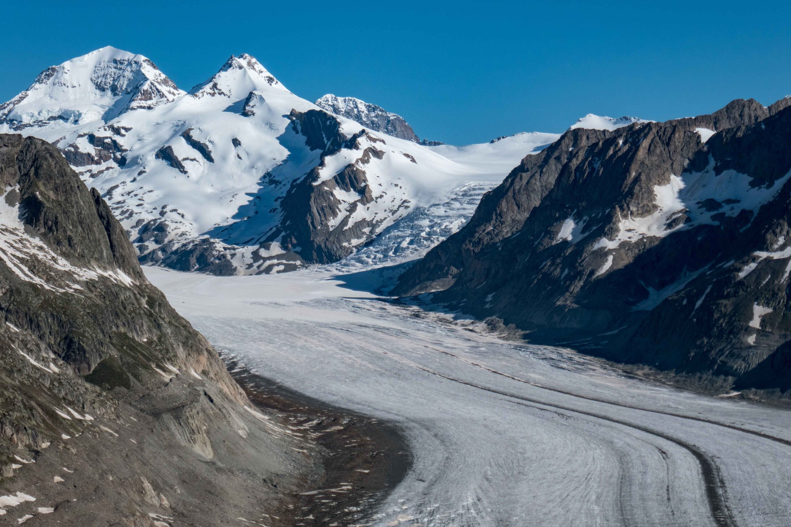
Great Aletsch Glacier (German: Grosser Aletschgletscher) is by far the longest glacier in the Alps. From head to toe it measures 21 km and descends to 1700 m above sea level.
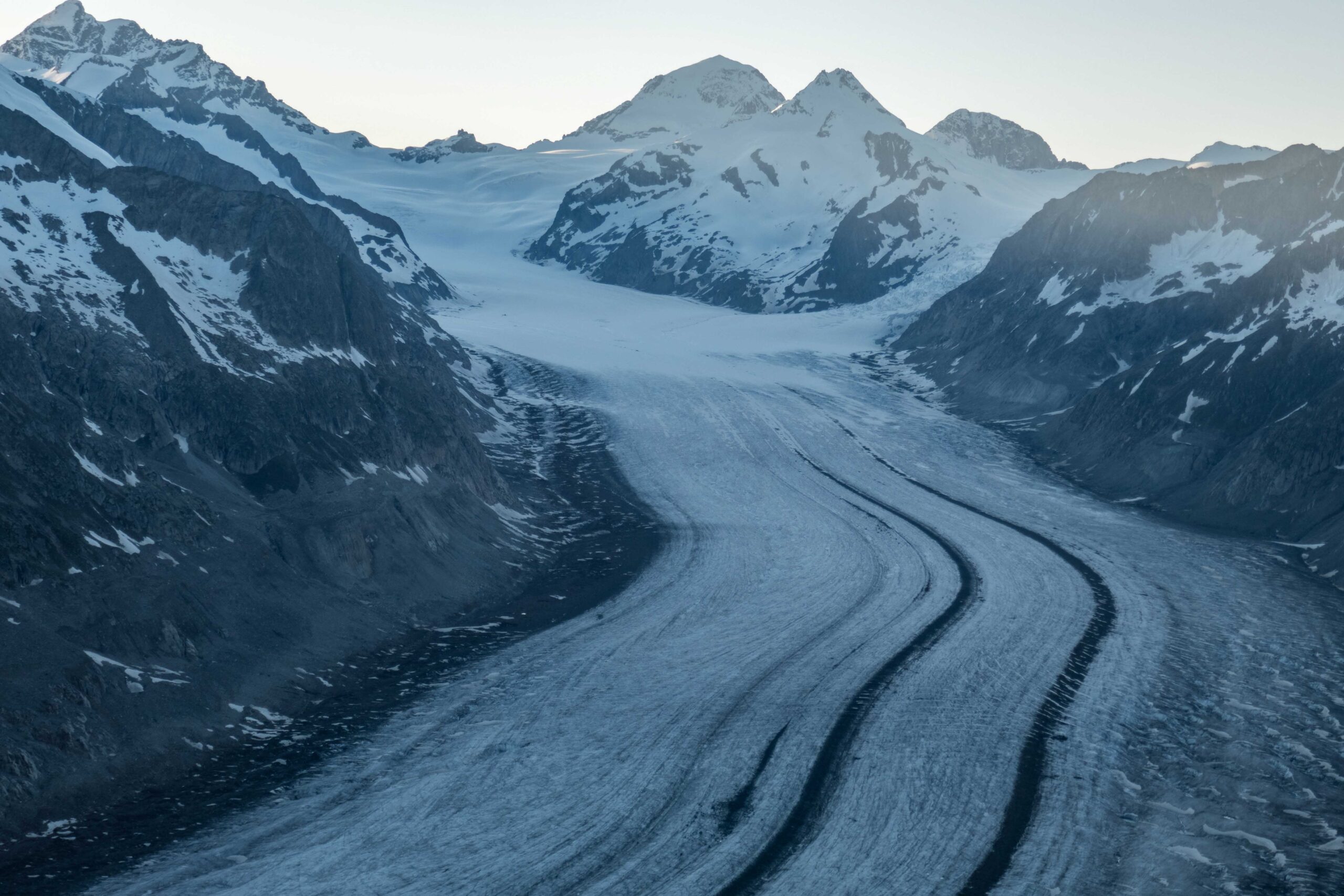
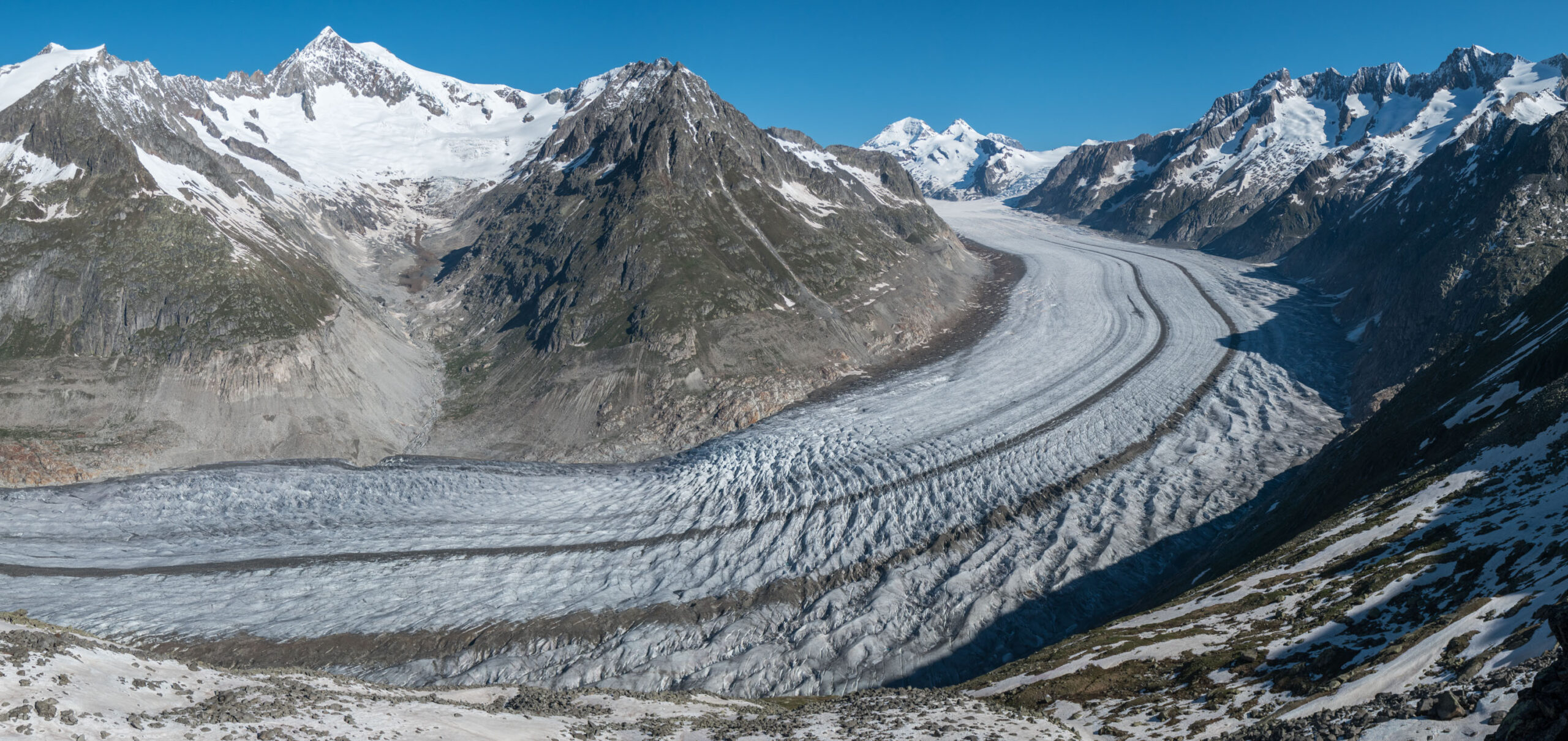
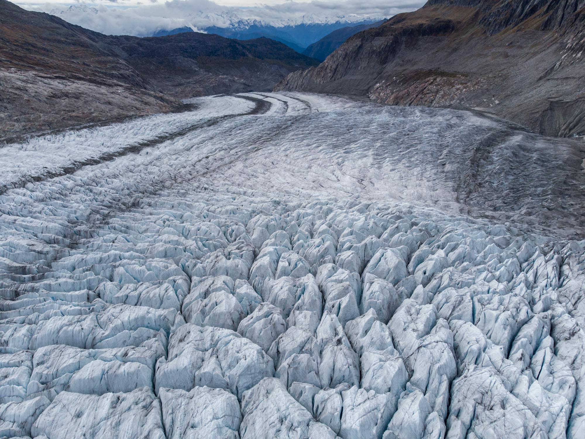
Aletsch Glacier comprises three different glaciers at its accumulation area. Grosser Aletschfirn is coming from the southwest, Jungfraufirn from the northwest and Ewigschneefäld from the north. They merge at Konkordiaplatz, an enormous ice field at 2700 m. There, the ice is an impressive 750 m thick, more than anywhere in the Alps.
Konkordiaplatz from the Eggishorn.
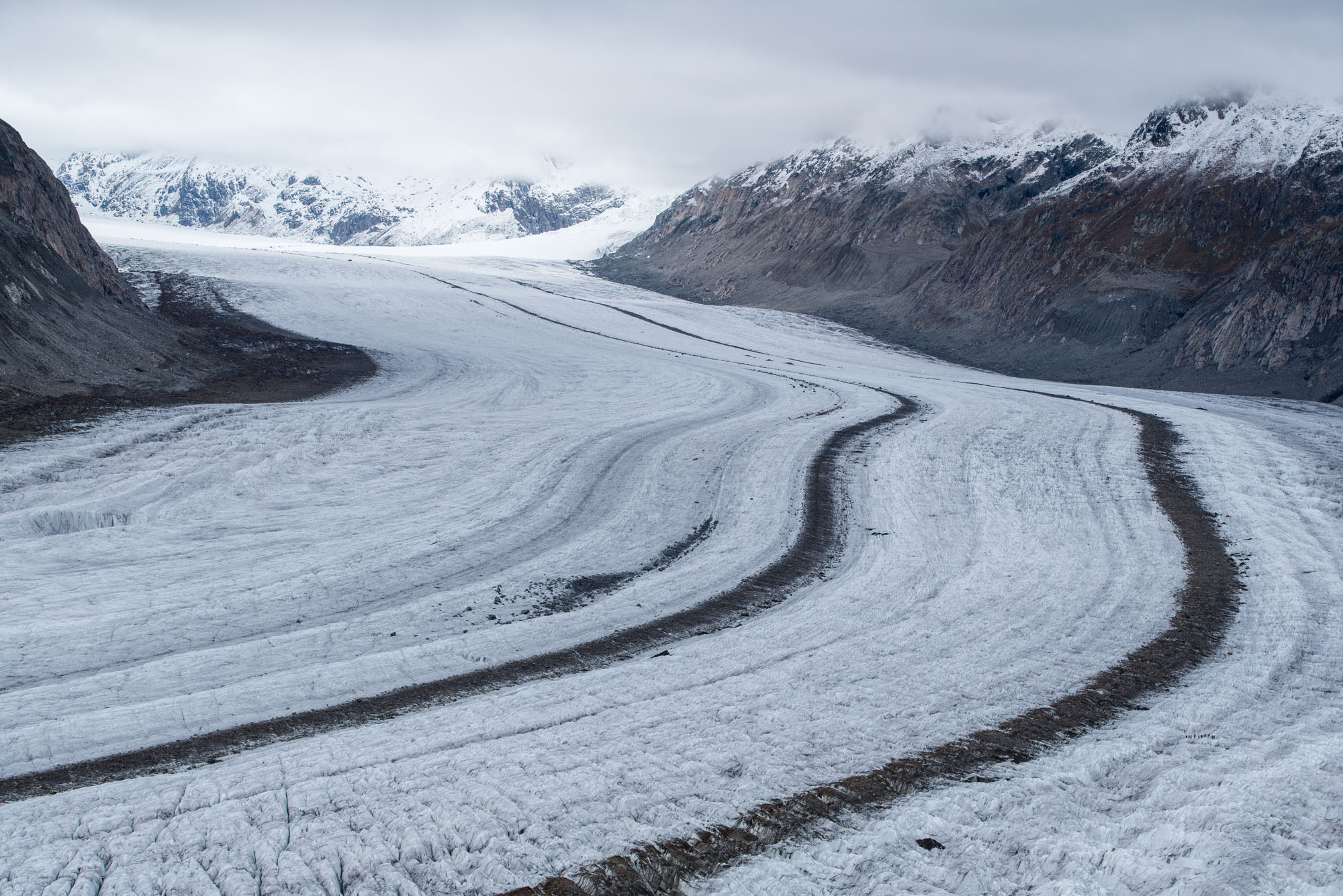
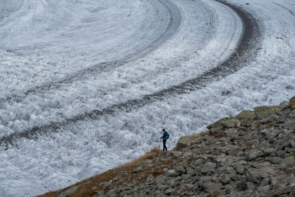
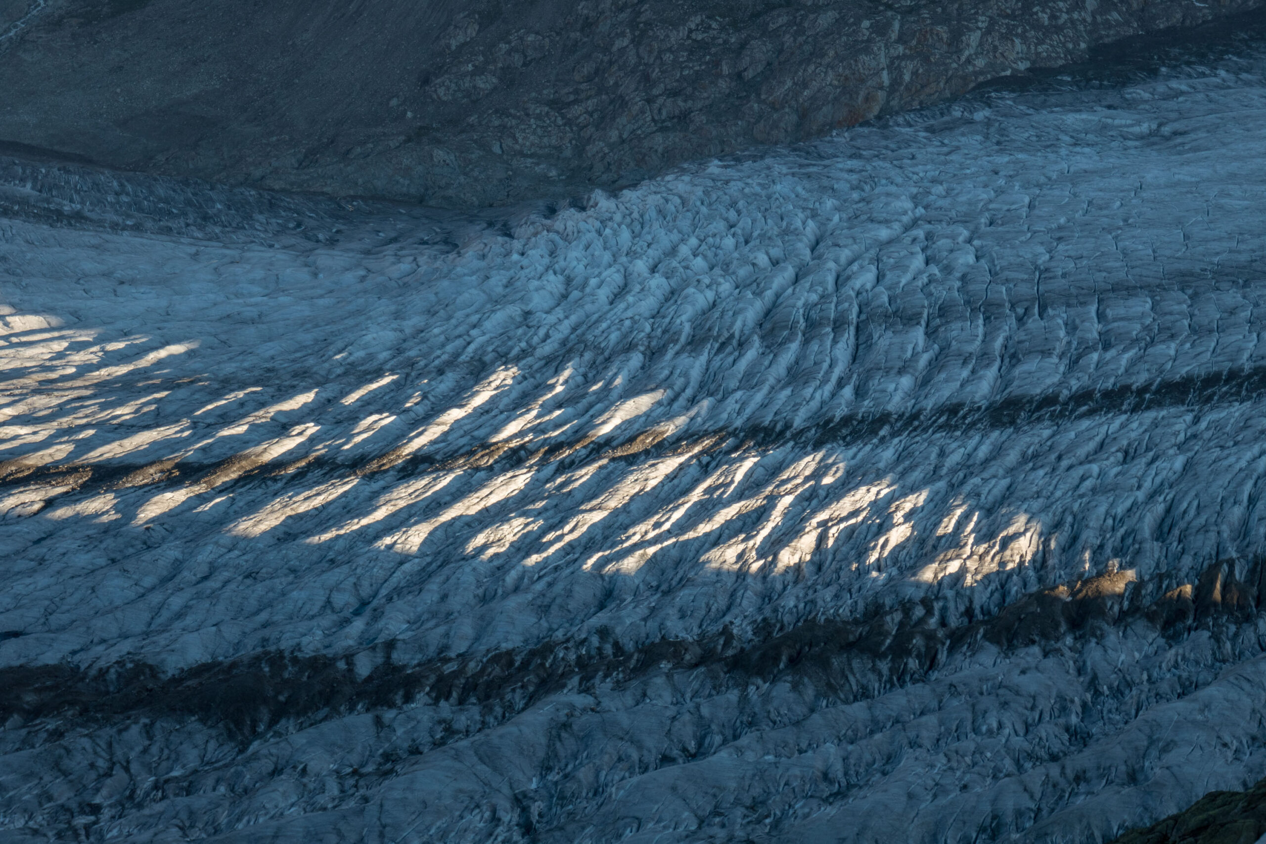
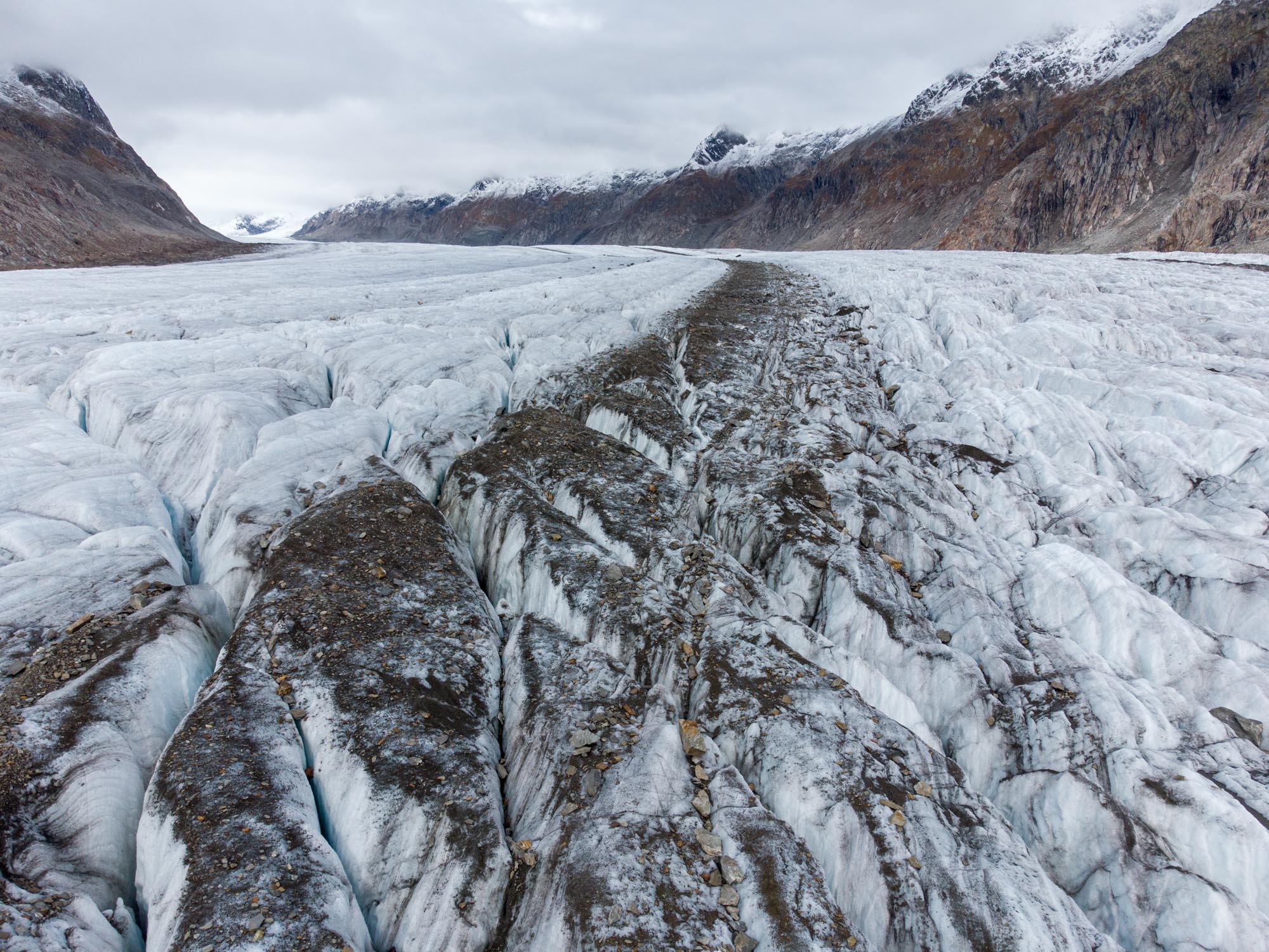
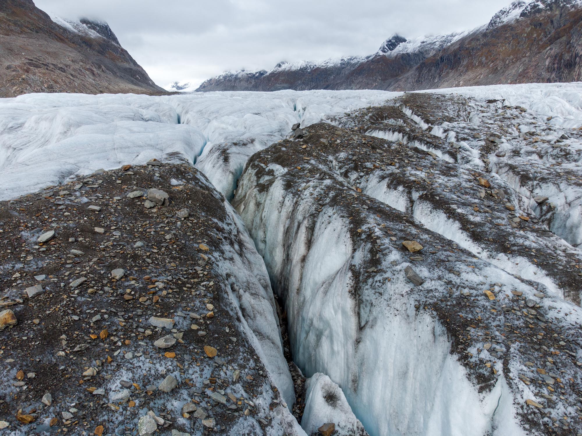
Medial Moraines
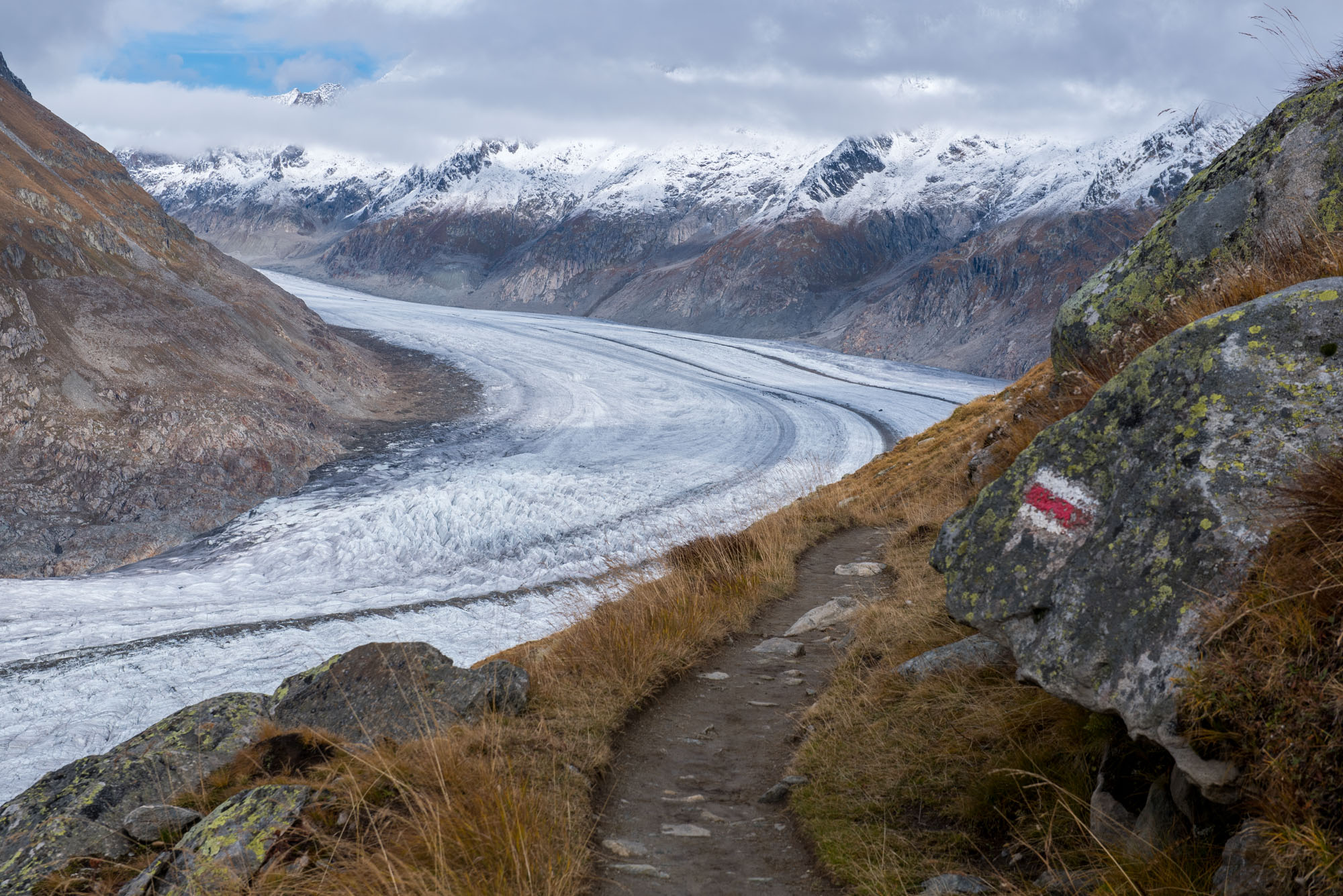
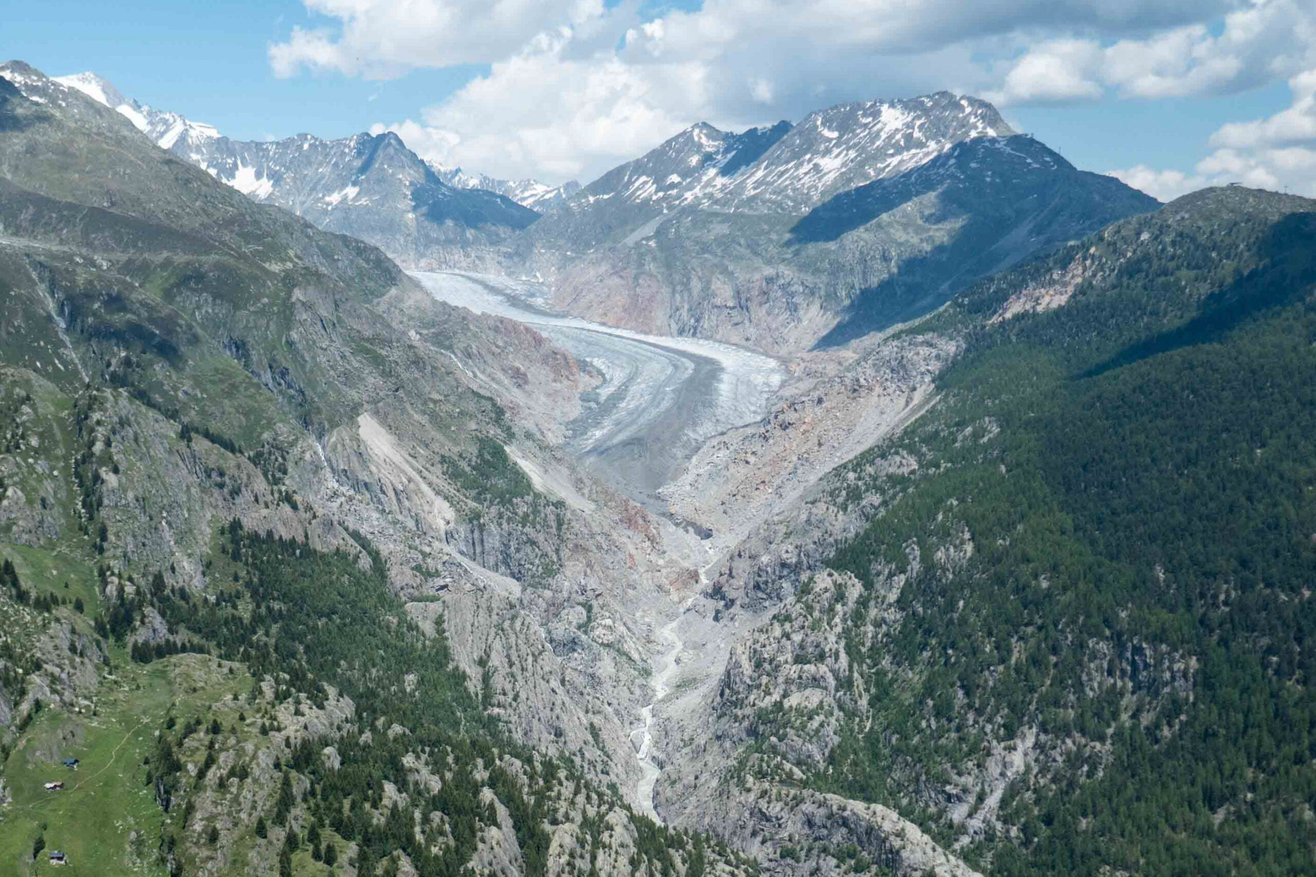
All three glaciers scrape the valley sides. Falling rocks land on the edge of the glacier and are transported down by the moving ice. Where the glaciers converge, their sides become the middle part. Suddenly, the rocks on top of the glacier are no longer at the edge, but form a trail of debris at the seam. These lines of rocks are called medial moraines and run all the way to the glacier’s snout, like conveyor belts. At Aletsch Glacier, the ice moves about 150 m per year.
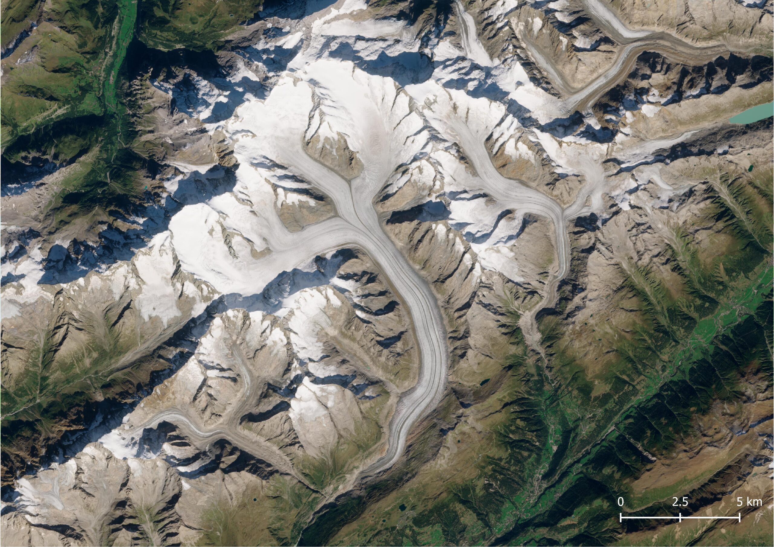
Satelietbeeld van de Grosser Aletschgletscher, augustus 2023. Bron: Sentinel-2 via Copernicus Browser.
Medial moraines on Aletsch Glacier, October 2024.
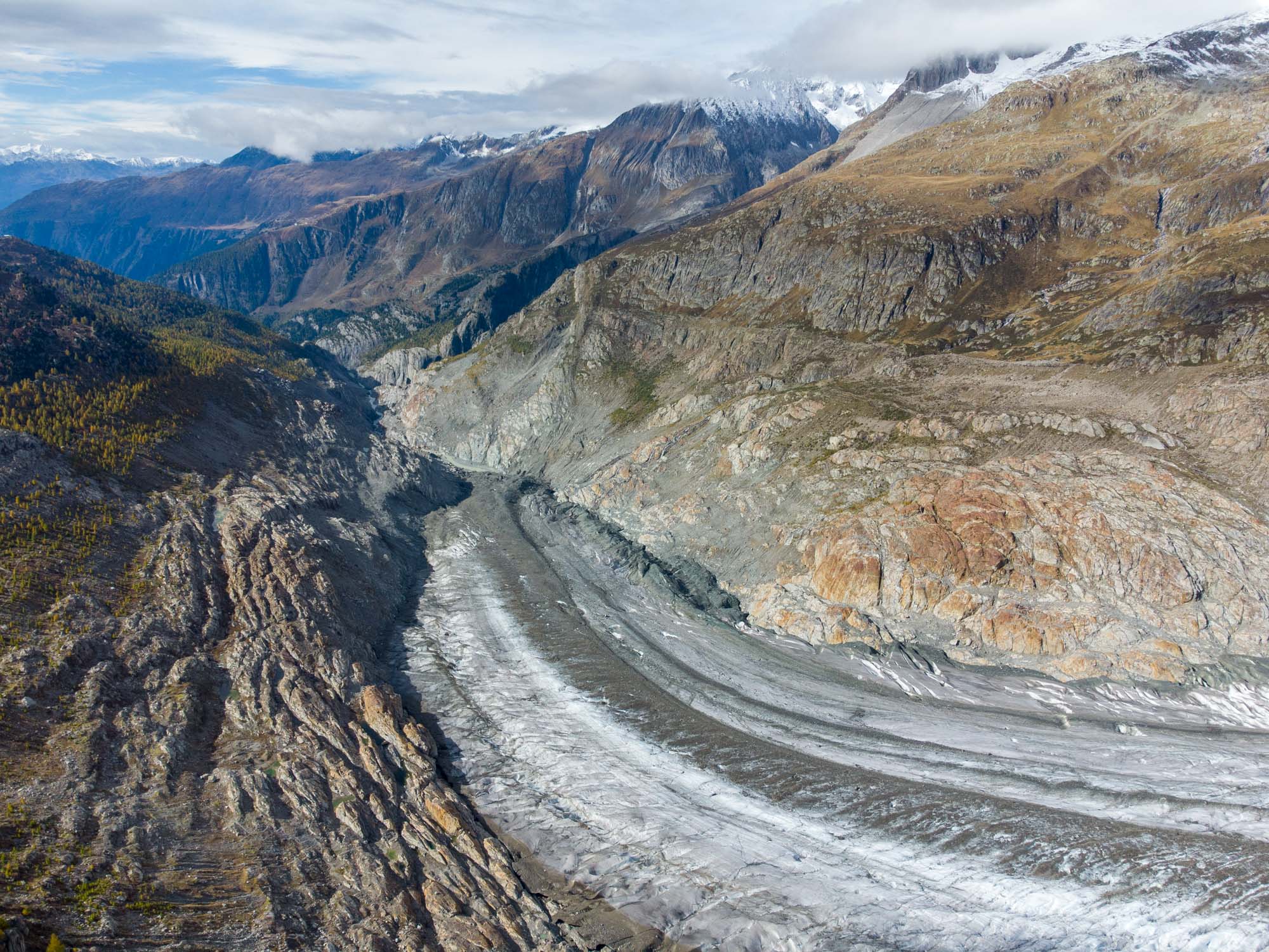
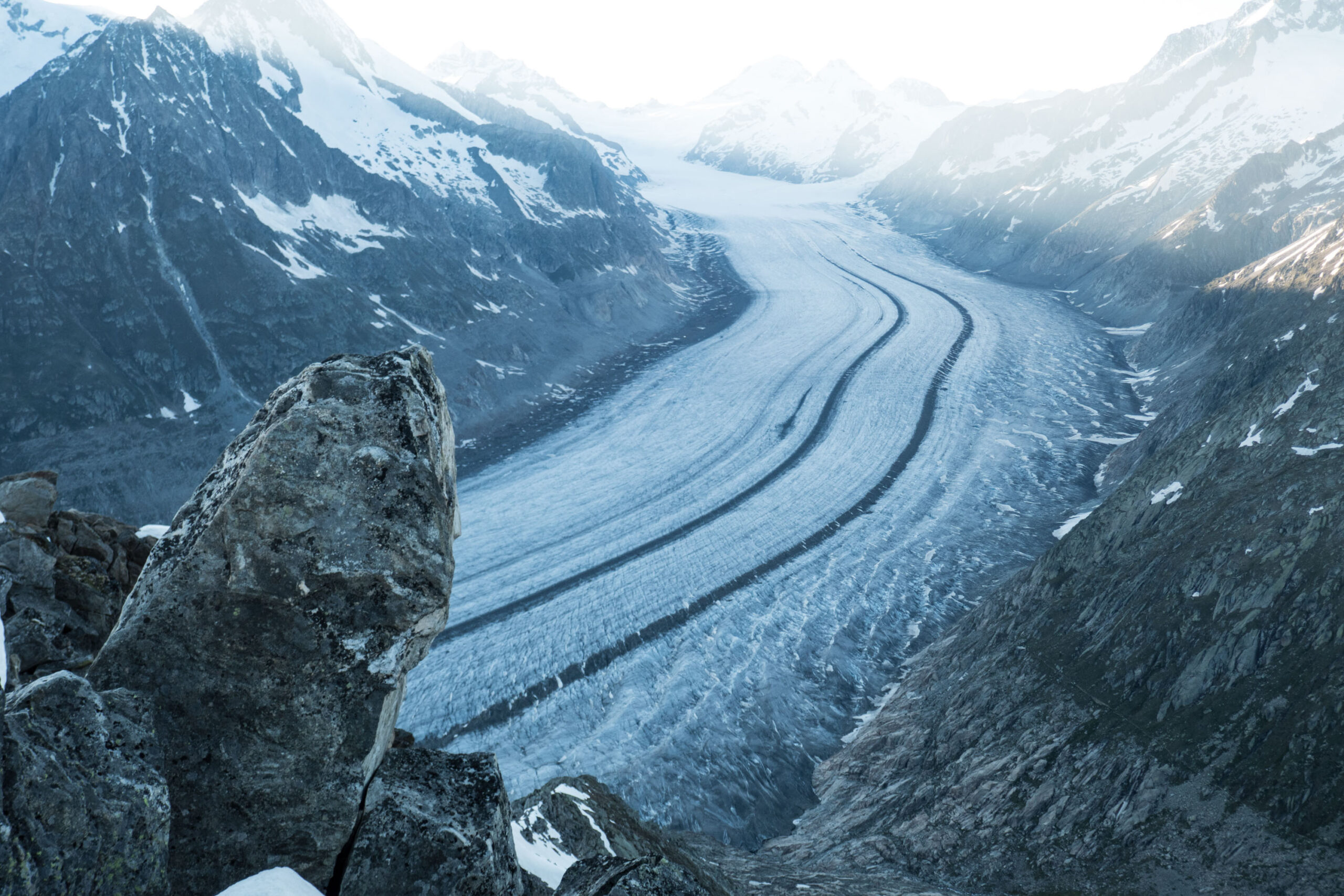
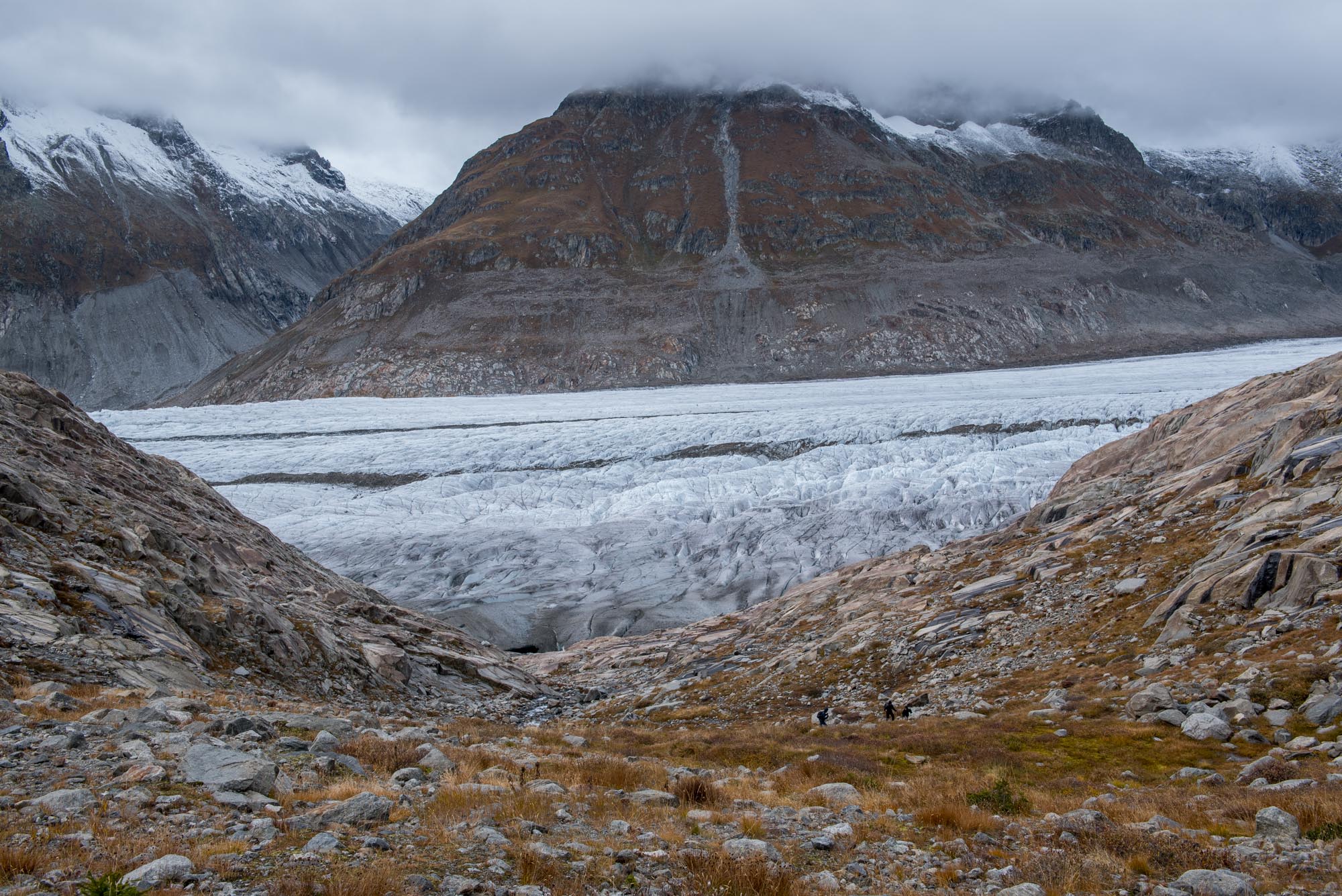
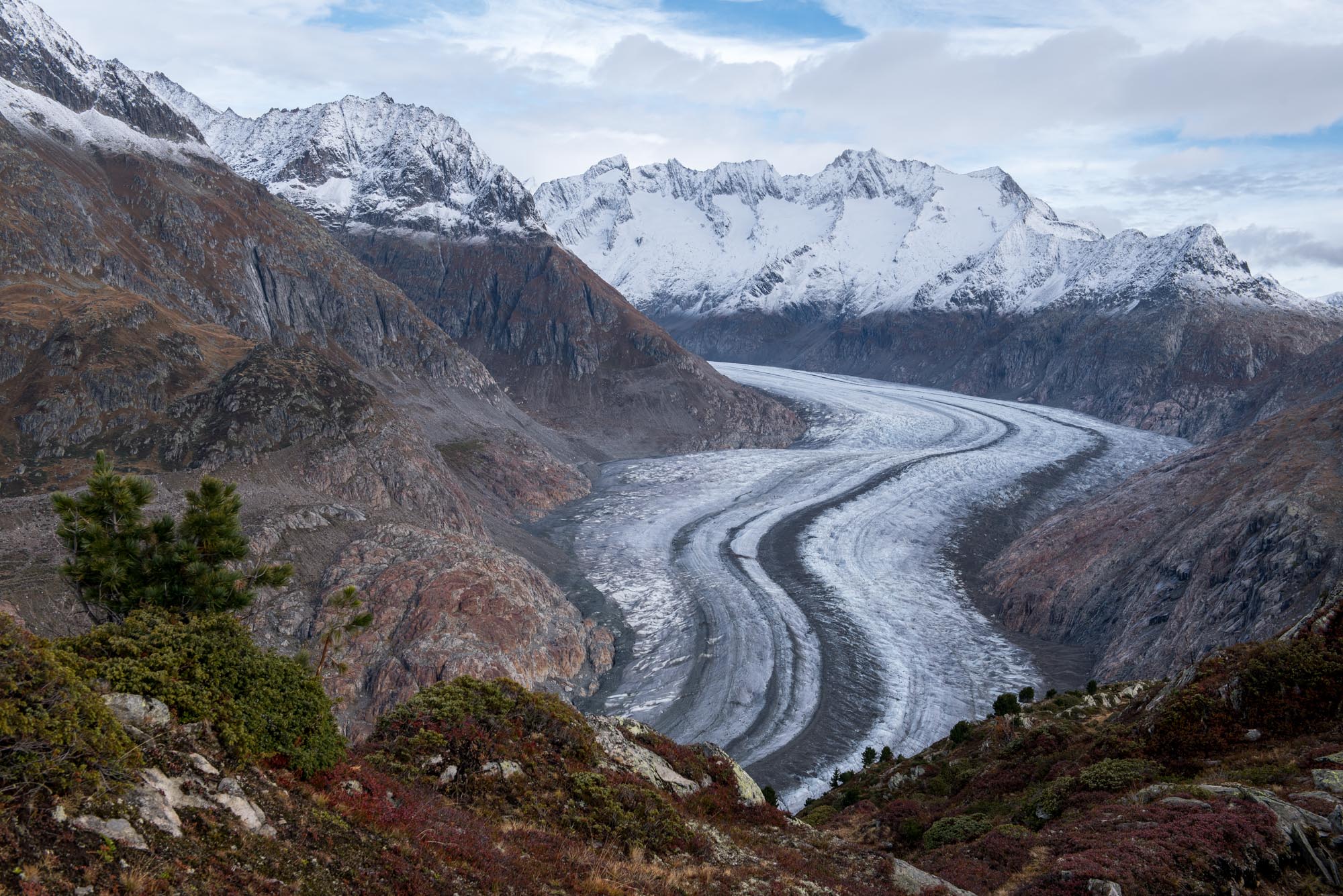
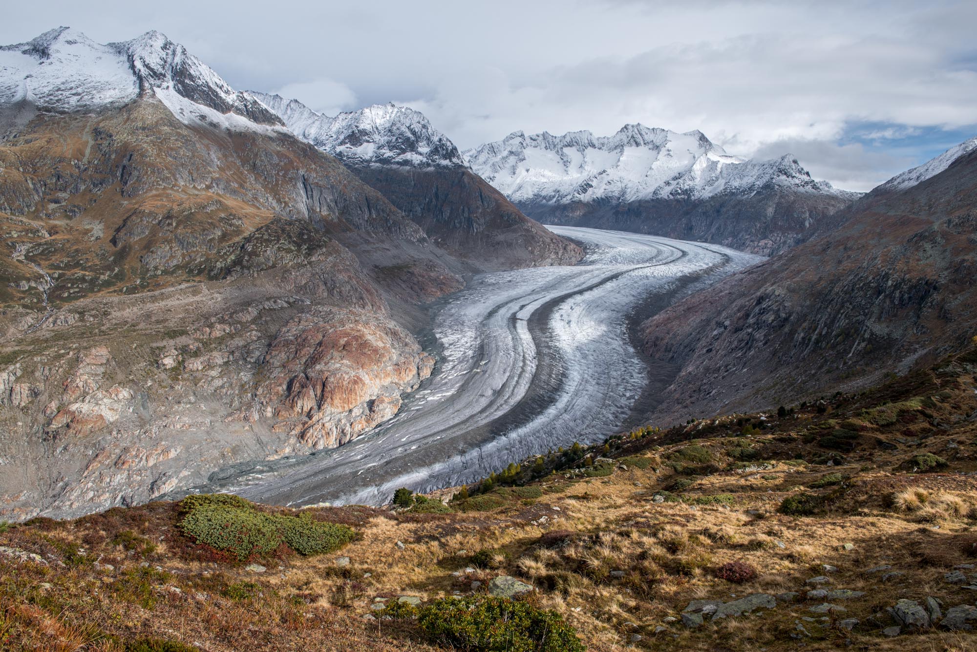
Aletsch Glacier from Eggishorn.
Eggishorn
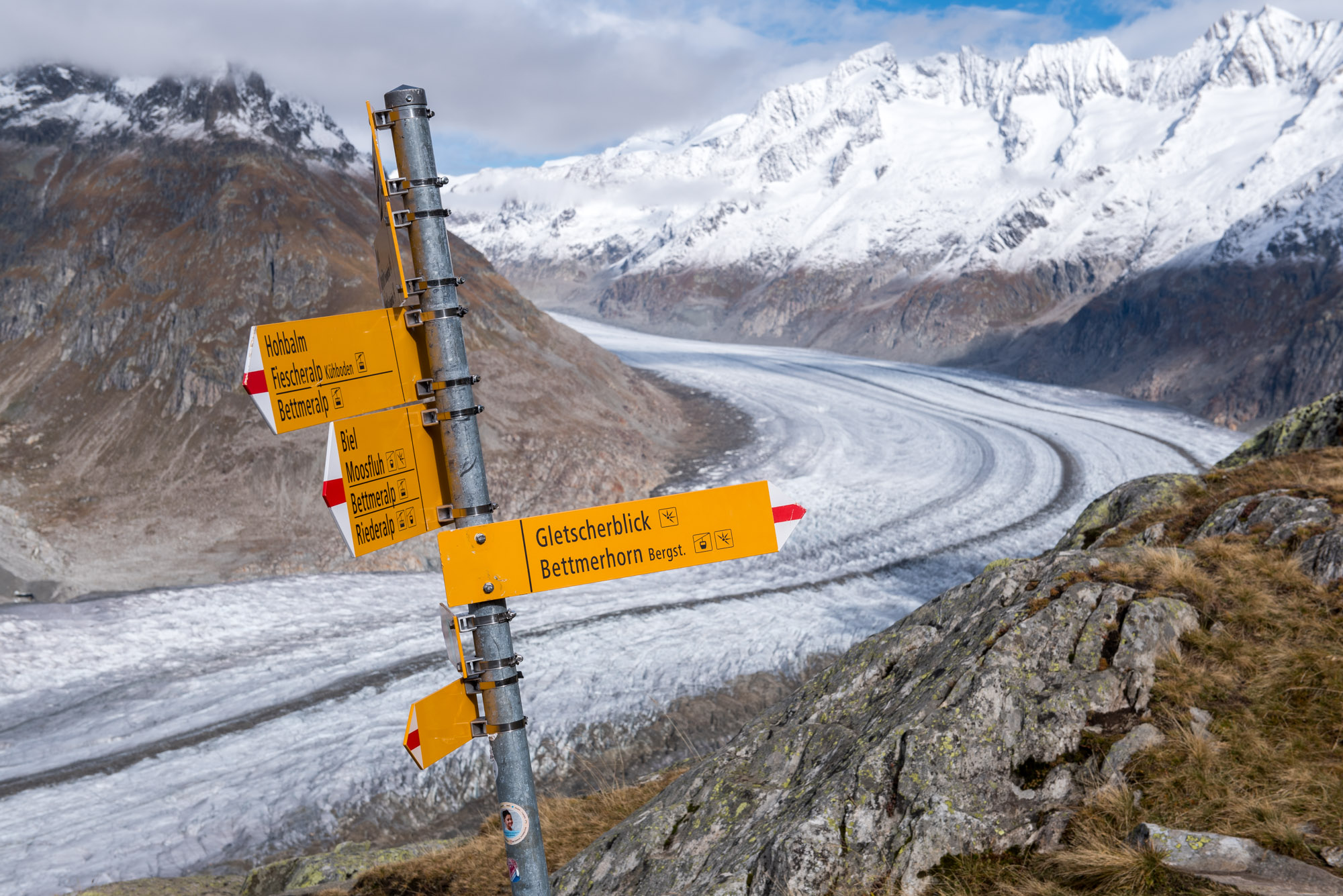
From Konkordiaplatz downwards, the glacier changes its direction from southeast to southwest. At its outer bend stand 3000 m high mountains and one of them is accessible by cable car. A short hike brings you to the top of Eggishorn, from where you can see the full length of Aletsch Glacier.
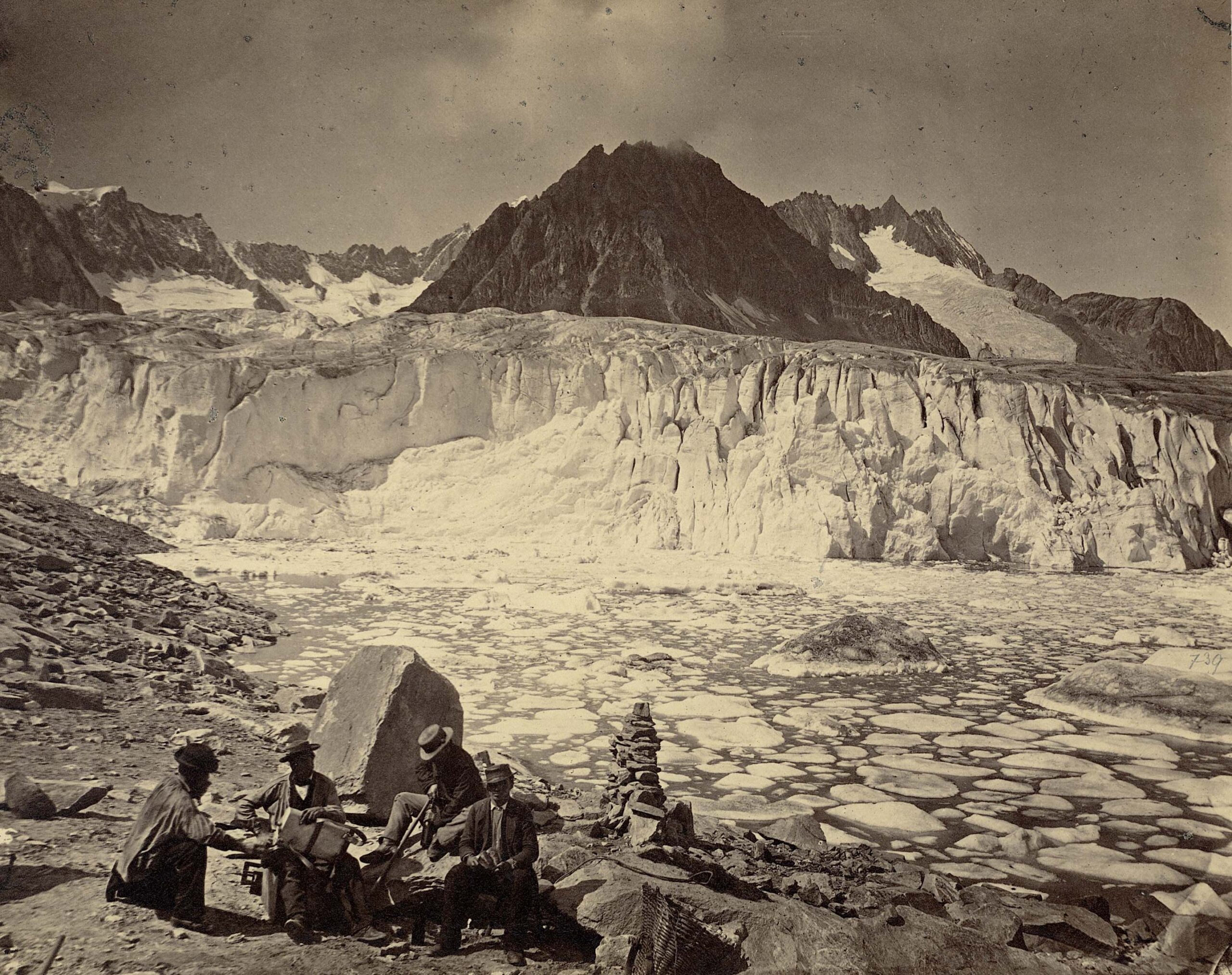
Märjelensee
The chain of mountains along Aletsch Glacier outer bend is interrupted by the Märjela valley. Back in the days, when the glacier was much thicker, the ice dammed this valley. Water couldn’t escape Märjela and formed an ice-dammed lake. Ice bergs calved into it, making it a popular tourist destination around 1900.
Märjelensee in 1865. Photographer: Adolphe Braun, Library ETH Zürich Hs_1458-GK-B005-1865.
Lost 3,5 km
Great Aletsch Glacier is shrinking since 1870. It already lost 3.5 km of its length. Over the course of this 150 year period the melt rates have increased considerably. While the glacier used to lose 10 to 20 meters annually, it now recedes at least 50 meters every year.
Märjelensee in 1908-1913 and 2024. Photographer 1908: Otto Lütschg, Library ETH Zürich photo Hs_1458-GK-B005-1908-0067-F.
Aletsch Glacier is thinning rapidly.
Thinning
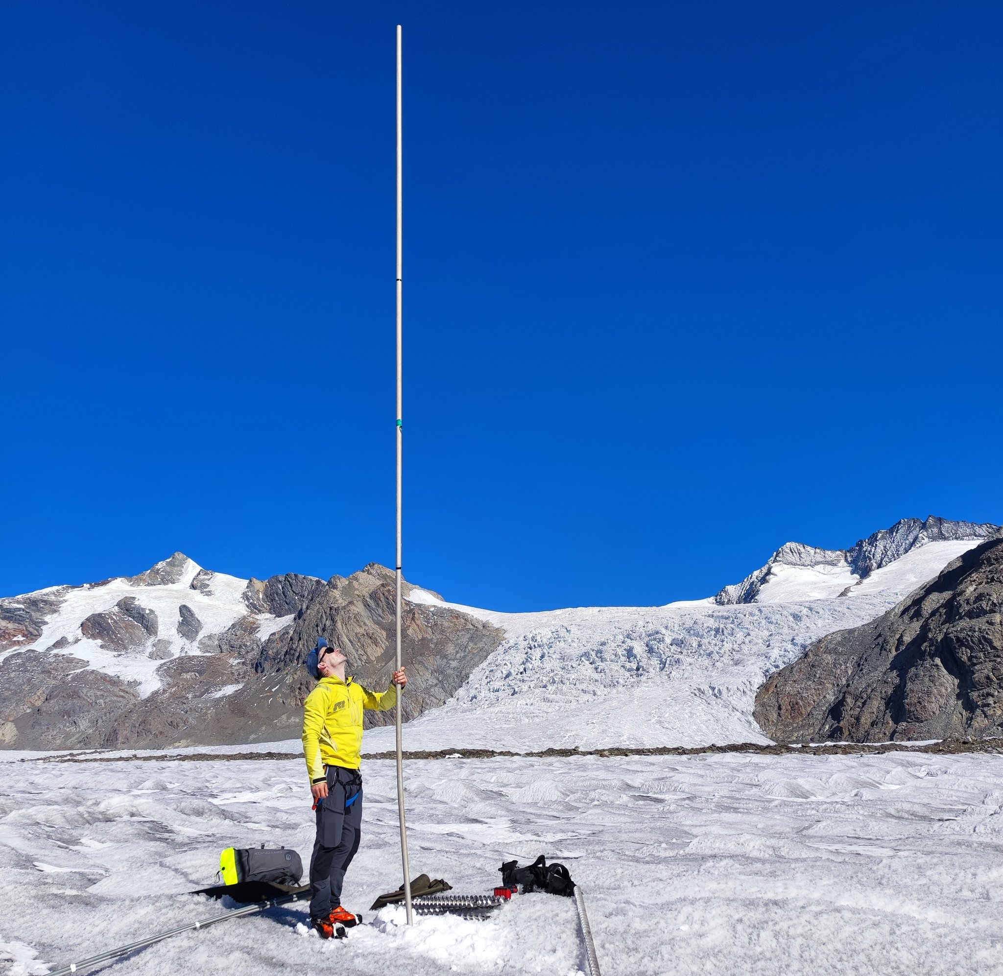
While recession can only be recorded at the glacier’s snout, thinning occurs everywhere. The entire surface of the glacier is lowering due to melt. Satellites registered an average annual loss of 8 m at the snout (at 1800 m) between 2011-2019. Higher up, the loss was logically tempered, but still close to 2 m per year at 3000 m (Leinss & Bernhard, 2011).
Aletsch Glacier in 1965 and 2024. Source 1965: Library ETH Zürich photo Hs_1458-GK-B005-1965-0250.
Record-breaking Melt
Ice loss has only increased since abovementioned numbers were published. 2022 and 2023 saw record-breaking melt rates. In 2022 the glacier even melted at 3500 m altitude and in 2023 the snout was lowered by an incredible 14 m (data: GLAMOS)! Those hot summers followed winters with little snow – a perfect storm.
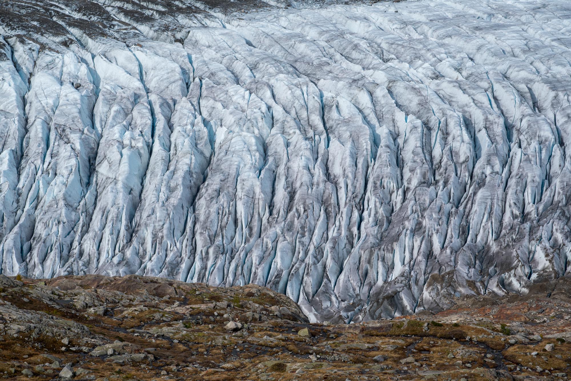
Path running alongside Aletsch Glacier, October 2024.
Out of Balance
The next year, 2024, illustrated the dramatic state of Alpine glaciers. The preceding winter brought lots of snow to the Alps, but the warm summer had no trouble catching up. In the end, 2024 was again a very bad year for Swiss glaciers (Huss, Bauder & Linsbauer, 2024). They are just too far out of balance with the current climate.
Losing 90%
Scientists have a hard time keeping up with climate change. When a group of prominent glaciologists modelled the future retreat of Aletsch Glacier, the hot summer of 2003 was their most extreme reference scenario. In hindsight, that would be an average year for glaciers in this decade. Or even a good one, depending on the coming years. Anyway, the study concluded that Aletsch Glacier is likely to lose 90% of its volume by 2100 (Jouvet et al., 2011).
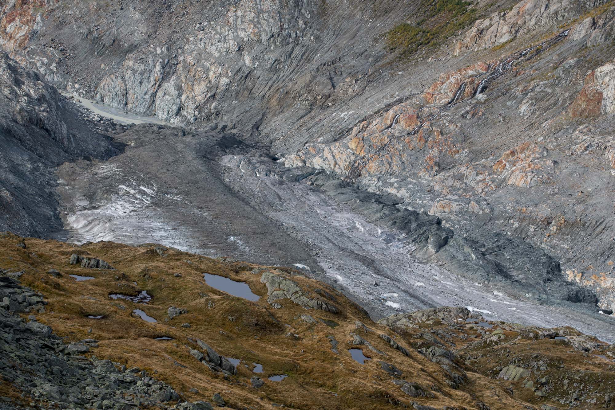
Snout of Aletsch Glacier.
800 m High Ladder?
Due to the continued ice loss, Aletsch glacier already lost its connection with Oberalteschgletscher and Mittelaletschgletscher (upper and middle Aletsch Glacier) a long time ago. Glacial thinning also makes glacier hikes increasingly difficult, because accessing the glacier gets harder. This is best illustrated at the Konkordiahütte, a mountain hut right above Konkordiaplatz. When the hut was built, it was almost at the same level as the glacier. But nowadays, the gap in elevation is bridged by a long series of ladders. Every few years a new one has to be added, until the valley floor is reached. Anyone looking forward to climb a 800 m high ladder?
Ice loss on Konkordiaplatz in 2022. Source: Matthias Huss, ETH Zürich.
View over Konkordiaplatz from the Konkordiahütte in 2015 (left) and 2023. Source: fotowebcam.eu.


