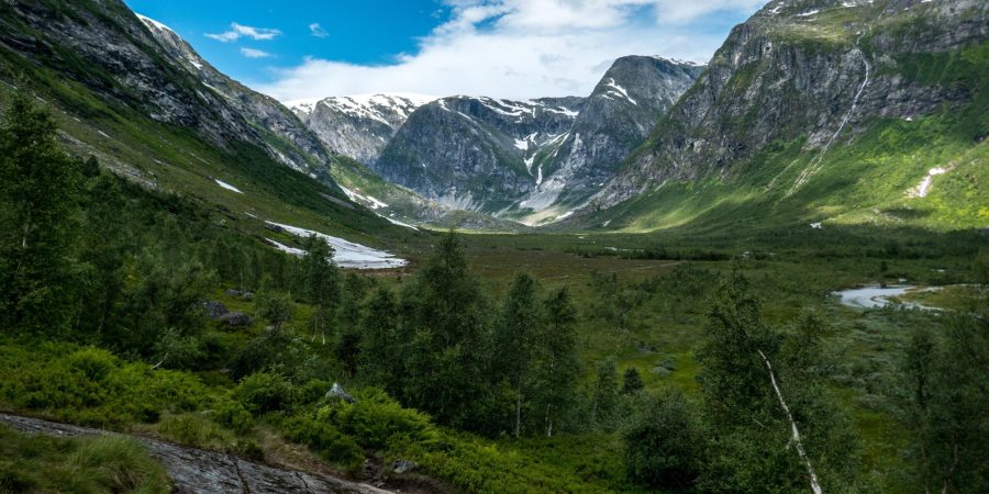
Many find Austerdalsbreen the most beautiful glacier in Norway. They could very well be right, as the flat snout with two icefalls in the background is indeed a spectacular sight. And a popular place to study.
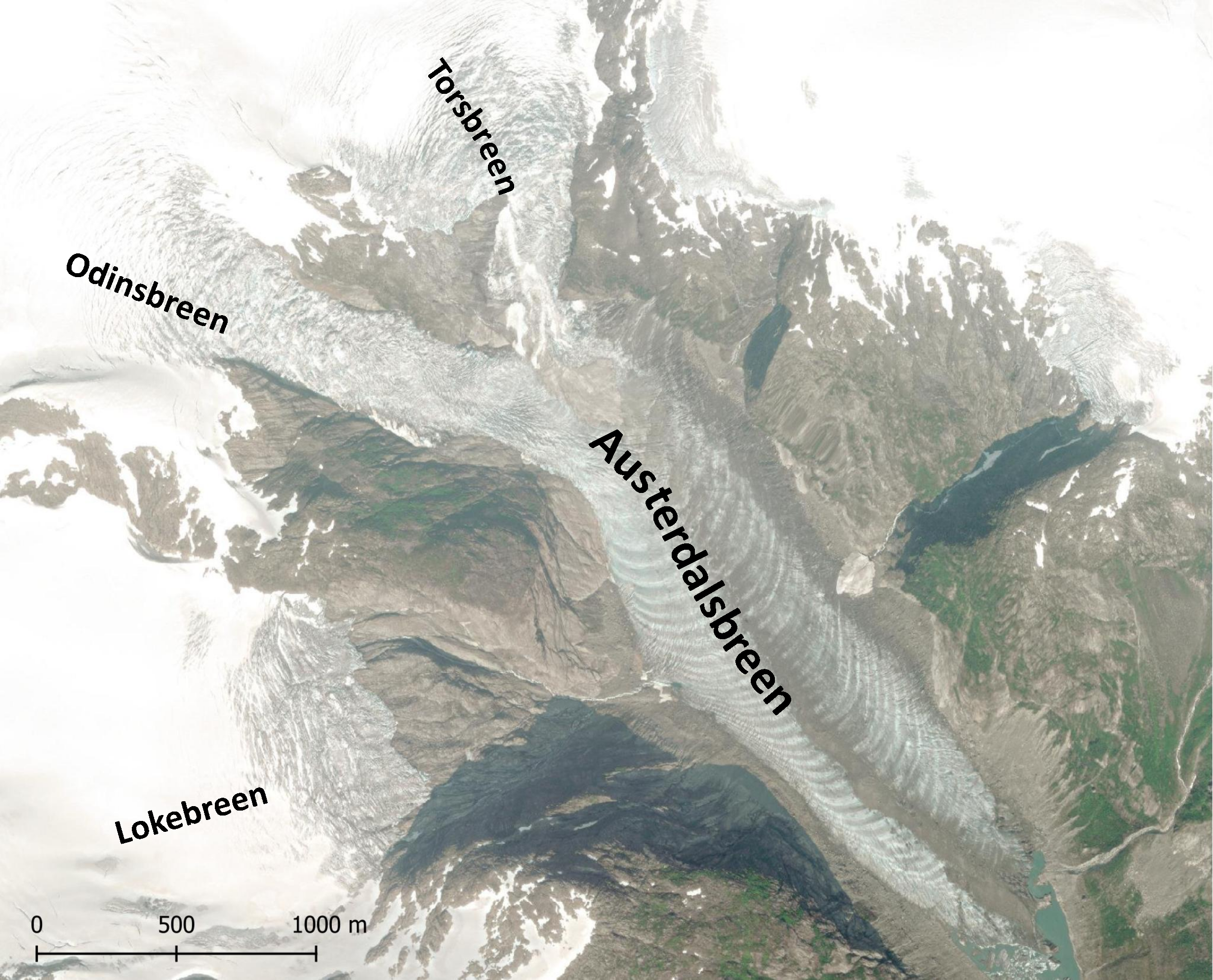
Starting at Jostedalsbreen ice cap, two icefalls come down 800 m and flow towards Austerdalen valley: Odinsbreen and Torsbreen. In the nineteenth century, a third icefall (Lokebreen) joined them. In the valley, the glacier is 3 km long and has the best ogives in all of Norway. The glacier snout partly floats in a lake.
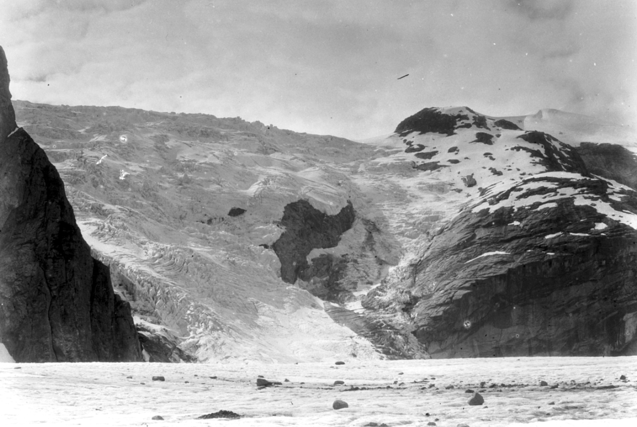
In the 1950’s, Austerdalsbreen was a popular destination for British natural scientists. They conducted extensive research at the icefalls and the flow pattern of the glacier. Students accompanied their professors to do the hard work: drilling holes into the ice, carrying wooden stakes for many miles and even carving out an ice tunnel, which sadly filled with water prematurely. In total, up to eighty people slept in tents at the glacier’s surface simultaneously (Nye, 1997).
Special attention was paid to the two ice falls feeding Austerdalsbreen: Odinsbreen and Torsbreen. Glaciologist John Nye arranged for photographs of the ice fall to be taken twice a day from the same rock. This way, he discovered a flow velocity 2 km a year. This extremely high speeds surprised everybody and gave rise to a complete new theory on the formation of the prominent ogives (bands) found in the snout of Austerdalsbreen: not oscillations in strain rates, but seasonal differences in icefall flow velocity and thus ice volume transport leads to bulges (summer) and troughs (winter) in the snout (Nye, 1959). The ice falling down the icefall in summer is melted more and makes for a lower part of the glacier than ‘winter-ice’, thus forming alternating bands of troughs and bulges.
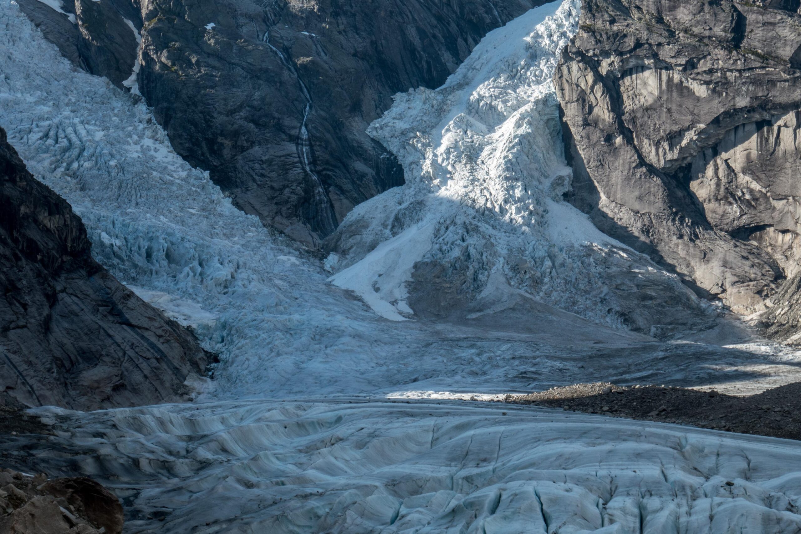
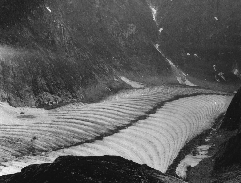
Ice spending the summer in the icefall collects more dust and debris. Therefore, this ice has a darker color than ice that spends winter there. So besides thinner (throughs), ‘summer-ice’ is also darker than ‘winter-ice’. Their differences in height are evened out within a few years, but their different colors are very persistent and are even amplified through the compression of the ice. Melt also helps to accentuate them, as dirt sticks more easily to the darker surfaces and in turn attracts even more dirt (King en Lewis, 1961). Furthermore, the ogives get arch-shaped, because flow velocity in the center of glaciers is higher than at the sides.
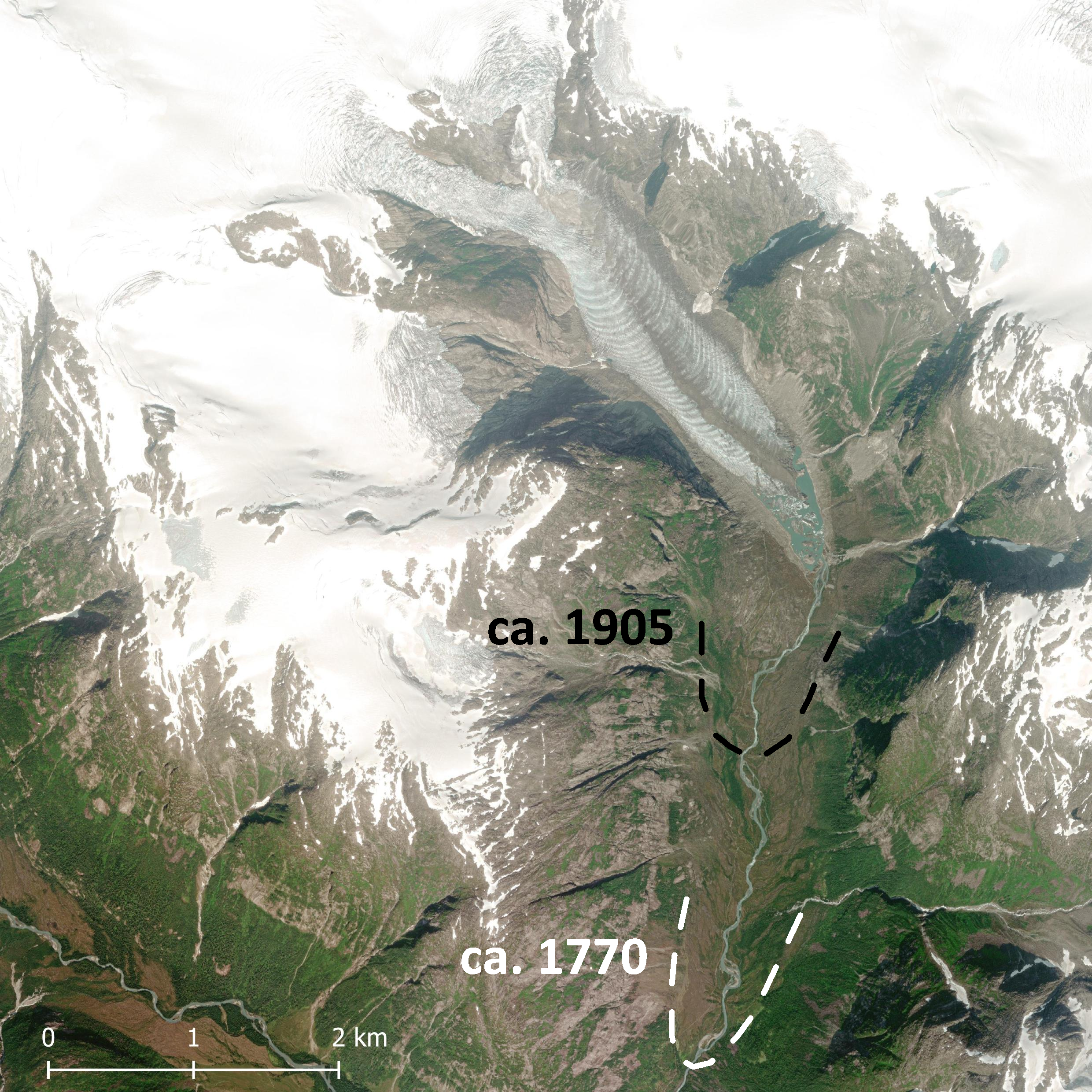
The British did their research at Austerdalsbreen 200 years after it reached its maximum extent. Around 1770, the glacier namely was bigger that it had been for thousands of years and was 4 km longer than at present. Not that long ago, in 1900, the glacier still extended 2 km further than it does now, not to mention its change in thickness. At the same time, this massive retreat opens up new research possibilities, like studying the way in which spiders and beetles colonize new grounds and how their communities change over time (Kloptsch et al., 2023).
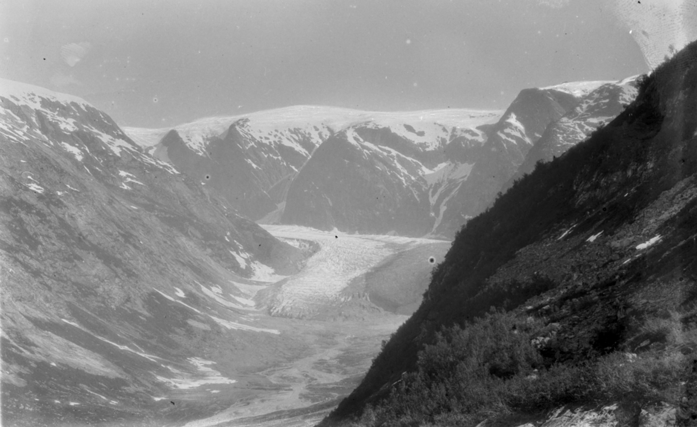
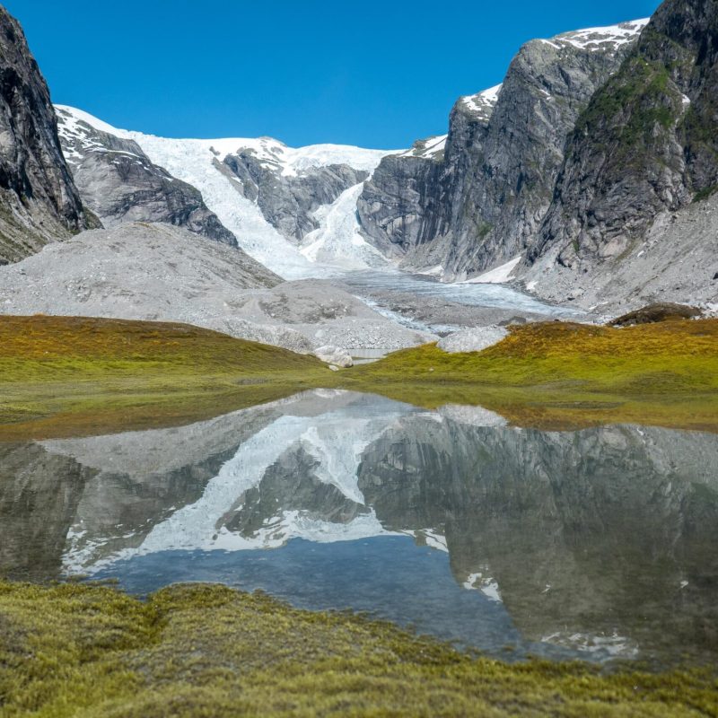
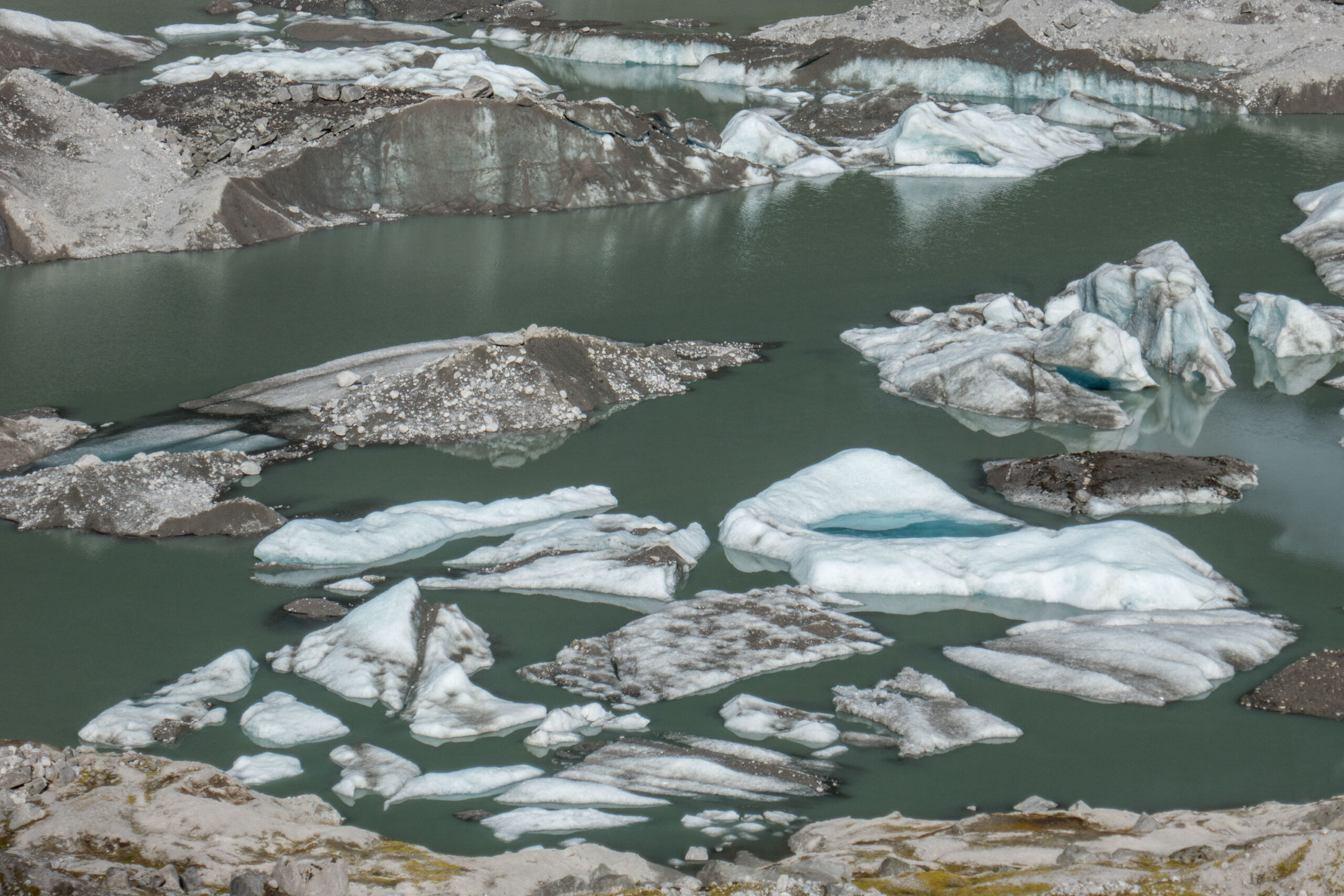
After Austerdalsbreen advanced a little bit in the 1990’s, the glacier started to melt quickly at the turn of the century. But because the snout was covered by stones as a result of the advance, it wasn’t until 2014 that its length really started to change significantly. Since then, small lakes appeared in front of Austerdalsbreen. They have merged into a single, expanding lake by now.
All those stones on top of the ice, together with the proglacial lake, make it hard to measure annual length change. A group of European scientists therefore decided that the evolution of Austerdalsbreen is better understood by measuring its surface elevation. They were able to do so for the period 1966-2021. Not surprisingly, the glacier thinned over those years and the rate by which strongly increased. For decades, the glacier melted from the top by about 1.5 m annually. But this number increased to 4 m recently and Austerdalsbreen even lost 11 m of its thickness in 2021 (Seier et al., 2023)! In this pace, the glacier is gone within 20 years.
Search within glacierchange: