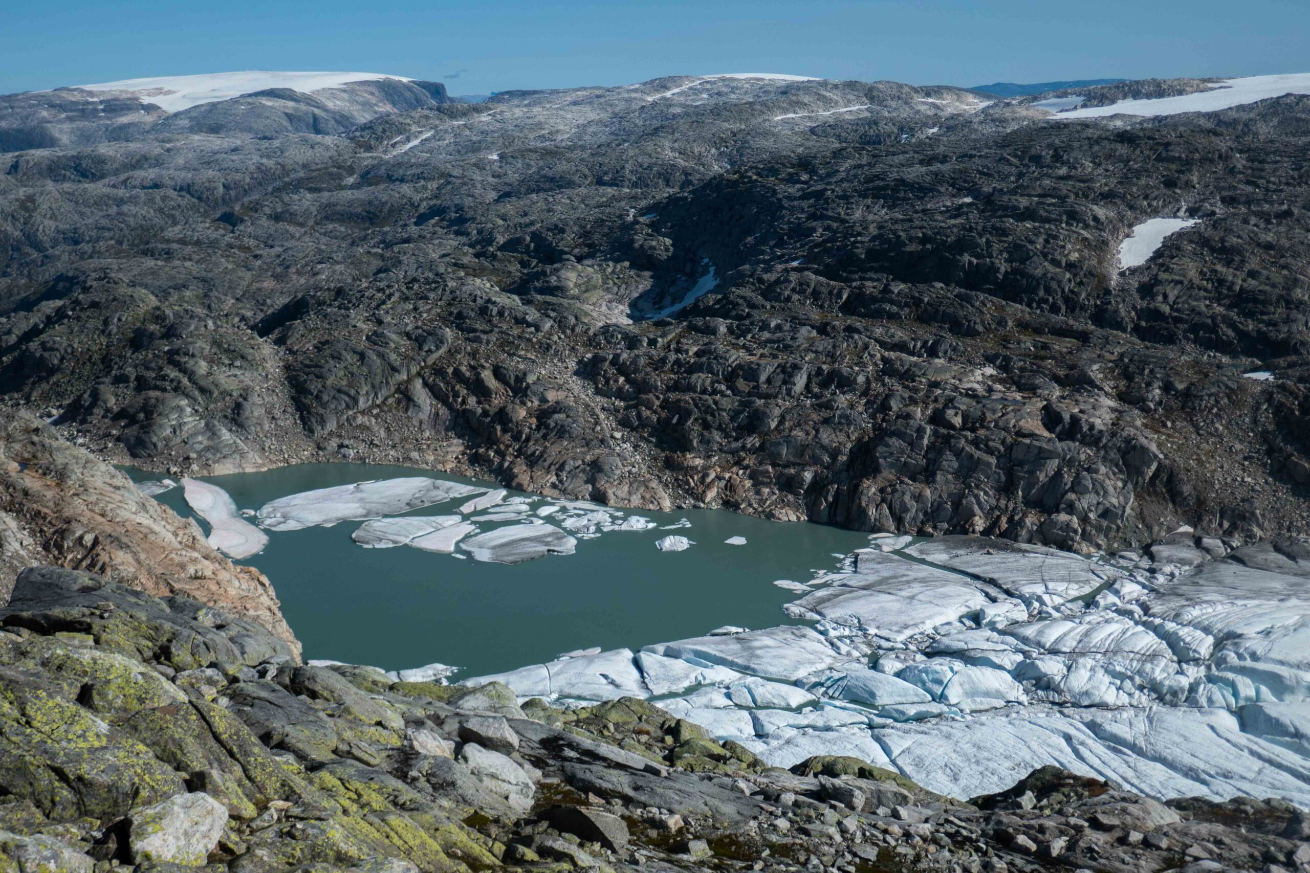
Breidablikkbrea is a northwestern outlet glacier of Folgefonna. It gently slopes down and terminates in a lake, in which the glacier partially floats. In the nineteenth century, a German made Breidablikkbrea into a touristic attraction.
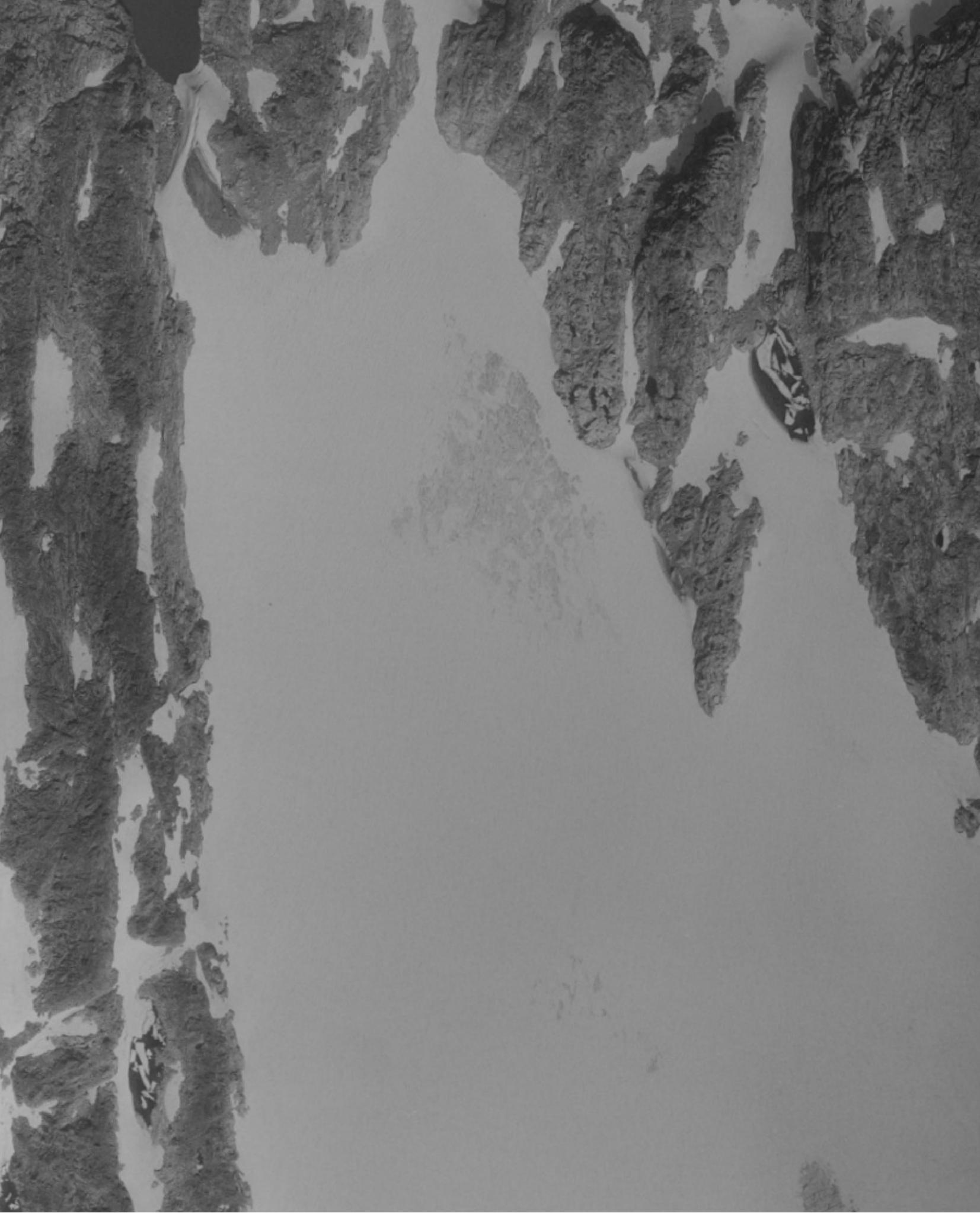
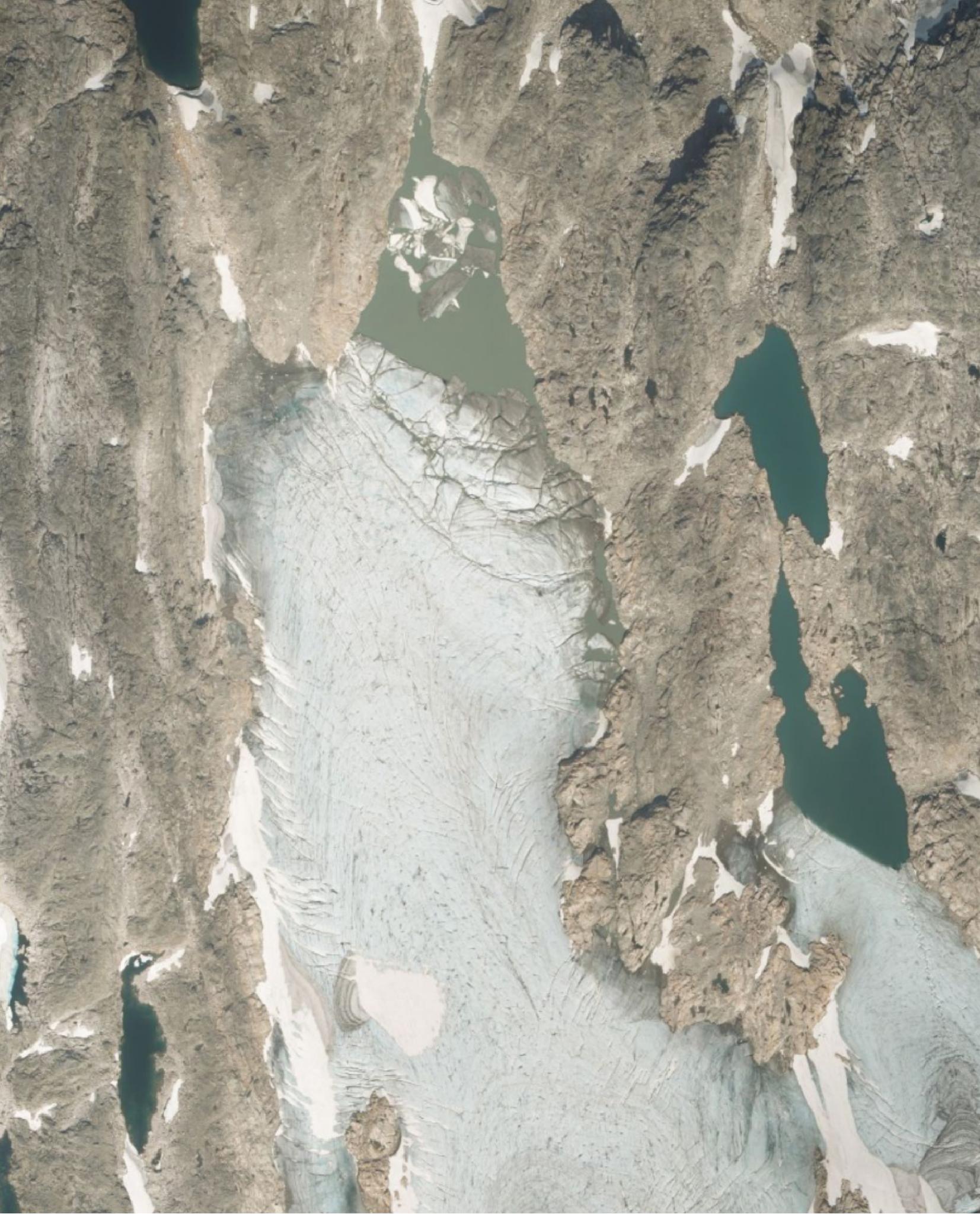
Orthophoto of reidablikkbrea in 1981 (left) and 2019. Source: norgeibilder.no.
Folgefonna is consists of three separate ice caps, of which the southernmost one is by far the biggest with 164 square kilometers. All three have a characteristic flat top, which in the case of (South) Folgefonna is just over 1600 meters high. Thanks to the practically horizontal central part of the ice cap, a large area is located above 1460 meters. In recent history this altitude represented the equilibrium line: the altitude at which annual snowfall equals melt. Surfaces located above the Equilibrium Line Altitude (ELA) gain mass, below it the area loses mass.
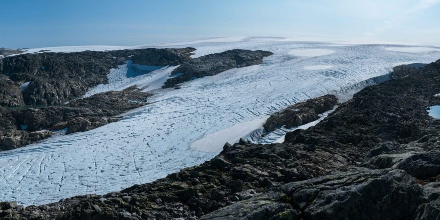
Due to climate change the ELA is rising. Warmer summers cause more snow to melt and in the shoulder seasons more precipitation falls as rain instead of snow. Less area of the ice cap is therefore gaining mass, more is losing at even faster rates. Over time, Folgefonna is therefore lowering and this process causes surface temperatures to rise (as temperatures are higher closer to sea level). All in all, the ice cap is no longer viable. Studies at local sediment deposits show that Folgefonna can’t survive if the equilibrium line altitude sinks below 1460 meters (Bakke et al., 2005), which is certainly the case by now.
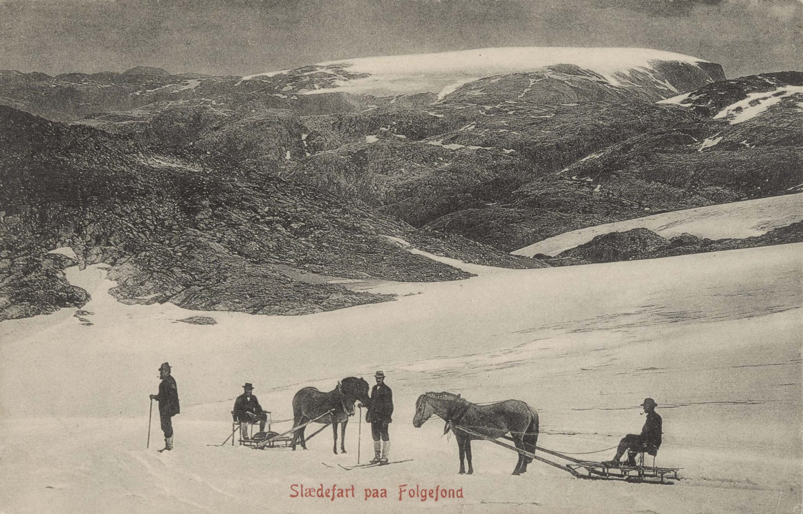
The present extent of Folgefonna is lagging behind the climate change. This means that the ice cap would keep shrinking, even if temperatures would stop rising right now. How different were circumstances for visitors in the nineteenth century, when an outlet glacier on the western side of Folgefonna caught a German’s eye. This ‘travel agent’ decided that this glacier, named Breidablikkbrea or wide view glacier, could attract tourists. He ordered local farmers to carve out a path in the mountain slopes, for horses had to carry the German upper-class a dreadful 1500 m upslope to the glacier. There the tourists were pulled over the ice cap by sleds and descended to Odda on horseback, where their ships picked them up again.
Nowadays people have to do all the hard work themselves, luckily. The hike starts at sea level, close to the village of Sunndal. First, the much smaller ice cap of ‘North’-Folgefonna (ca. 26 km2) comes into sight at an altitude of about 1100 meters. Although (South) Folgefonna is never far away, one has to ascend to 1320 meters to actually see it. At this viewpoint the shelter Breidablikk is located, which obviously also overlooks the Breidablikk glacier. From there it is another mile to Fonnabu, a much larger mountain hut at 1450 meters. The route follows a bumpy ridge parallel to the Breidablikkbrea, so there is plenty of time to see how the glacier is disintegrating into its own lake.
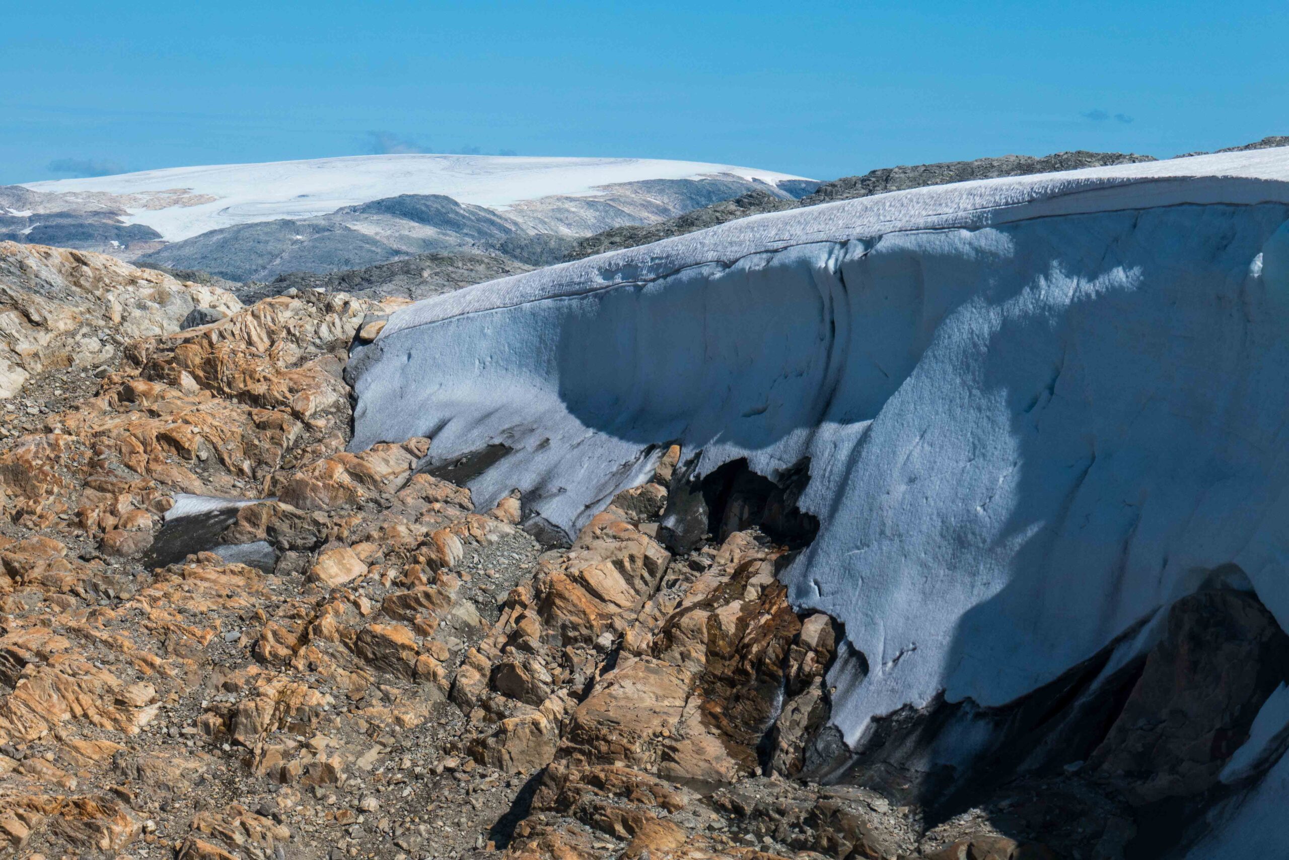
At Fonnabu hut, it is worth the extra stretch to keep walking until you reach the glacier. Strong winds shape the ice in a very peculiar way, with almost vertical margins. A bit like the leeward side of snow dunes. Just like two centuries ago, Fonnabu is still a popular starting point for glacier crossings. That’s still possible, despite considerable losses of ice. But the walk from the hut to the ice cap margin is a little bit longer every year. One day people will be able to cross the glacier without stepping onto ice at all.
Search within glacierchange: