Brenndalsbreen (formerly known as Åbrekkebreen) is a steep glacier in western Jostedalsbreen. It is one of the last surviving regenerated glaciers in Norway.
Brenndalsbreen is a glacier in Oldedalen. Most people associate this valley with the much better known Briksdalsbreen. Nevertheless, neighboring Brenndalsbreen is at least as beautiful. But the walk to the ice is a bit harder and it lacks the facilities that Briksdalsbreen has.
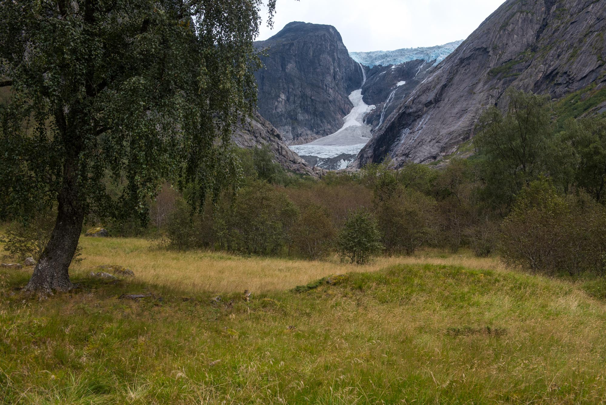
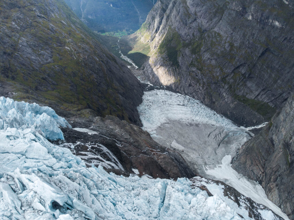
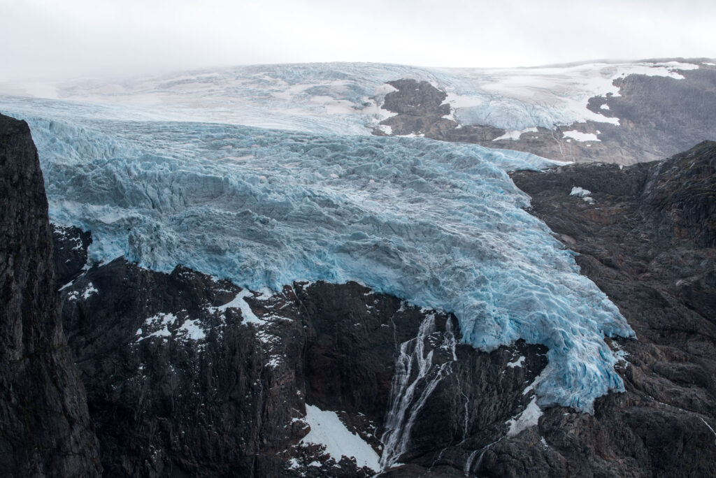
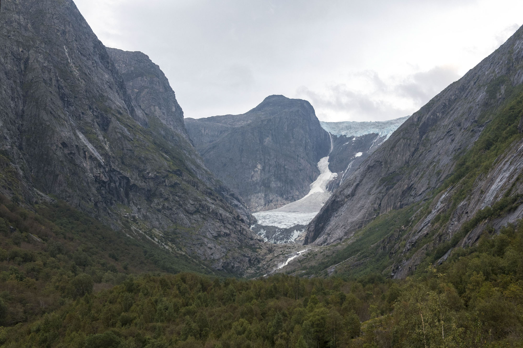
Brenndalsbreen is a western outlet glacier of Jostedalsbreen ice cap. At 1200 m above sea level the ice tumbles over a cliff. It falls some 400 m down and piles up to become a regenerated glacier below the cliff. A regenerated glacier is created by falling ice and is therefore not connected to the upper part of the glacier.
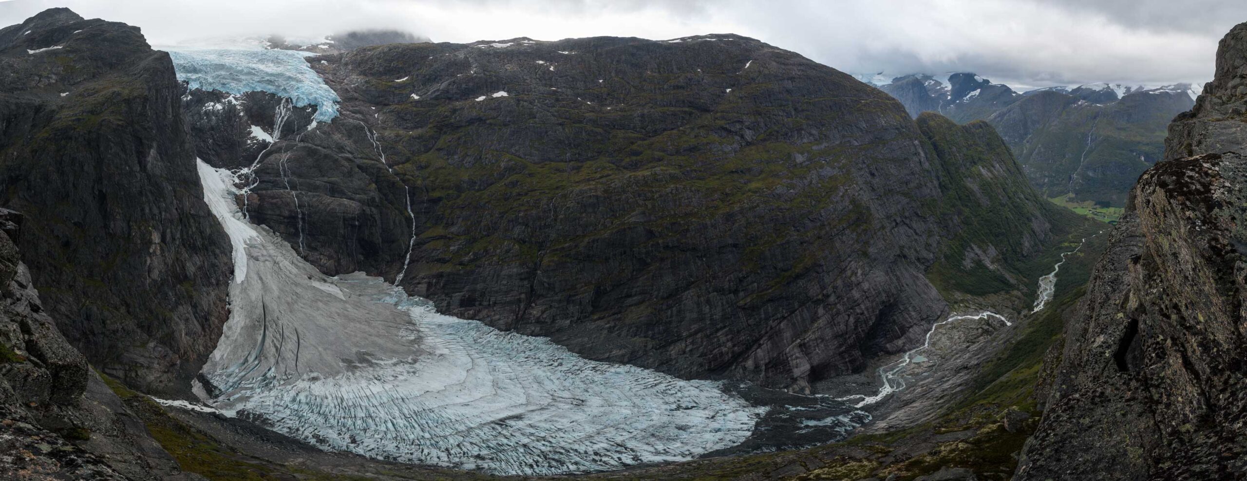
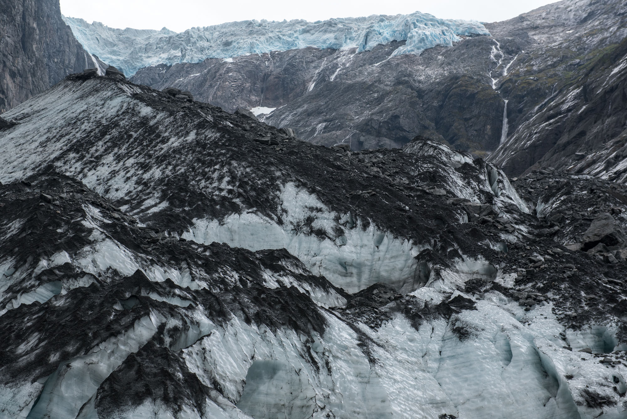
Besides ice, rocks also tumble down. Together they form a rock and ice avalanche cone confined by the narrow rock faces of Brenndalen valley. In winter and spring the avalanche is white. In summer and autumn the surface darkens due to the accumulation of dust, debris and sediments (Engen et al., 2024).
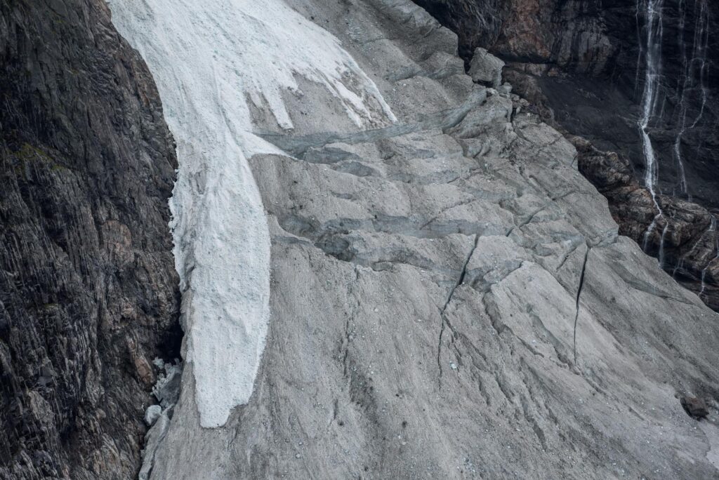
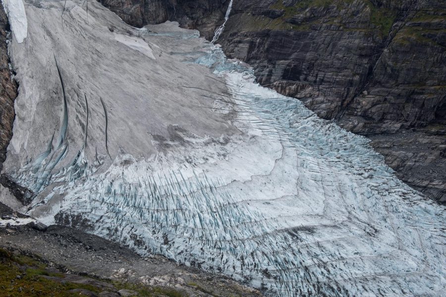
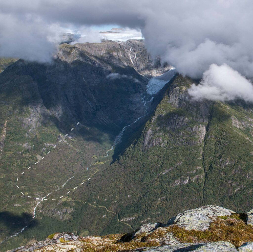
The seasonal difference is ice darkness gives rise to an alternation of annual bands in the regenerated glacier in which thin dark lines separate one year’s ice accumulation from the other. Each band is about 50 m wide forms in one year. This also means that the glacier moves at about 50 m per year.
To be honest, the alternating bands of Brenndalsbreen only stand out from a bird’s eye view. Luckily, a (demanding) trail leads all the way up to the ridge north of the glacier called Flatefjellet. Starting at the Kvame farm close to Oldevatnet (40 m a.s.l.) you follow a small path to Kvamssætra at 570 m. Then it’s another 700 m up to Flatsteinbu on the top of the ridge at almost 1300 m. Especially the final 300 m are quite steep.
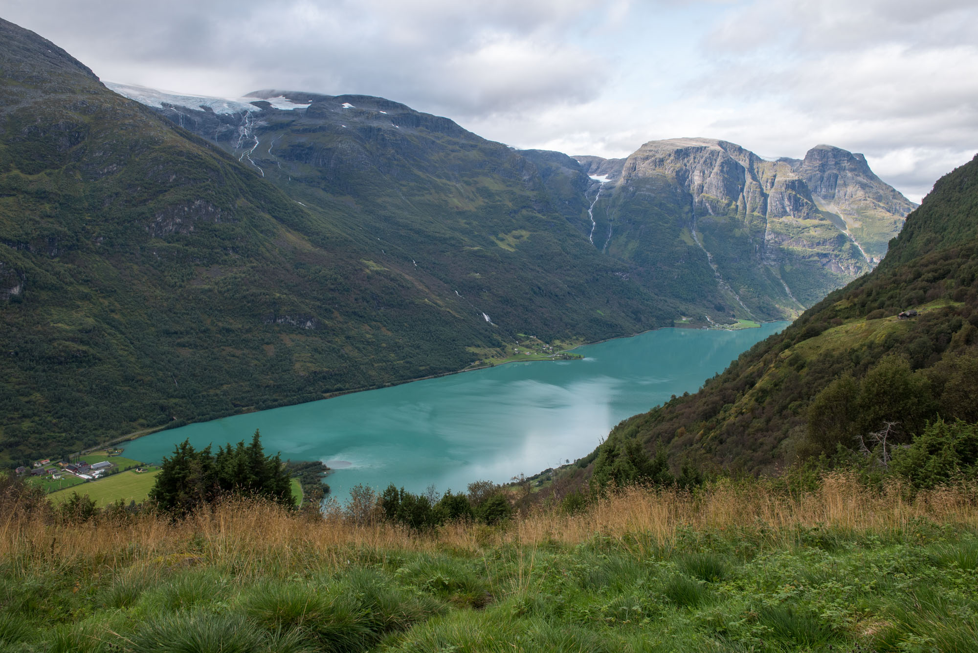
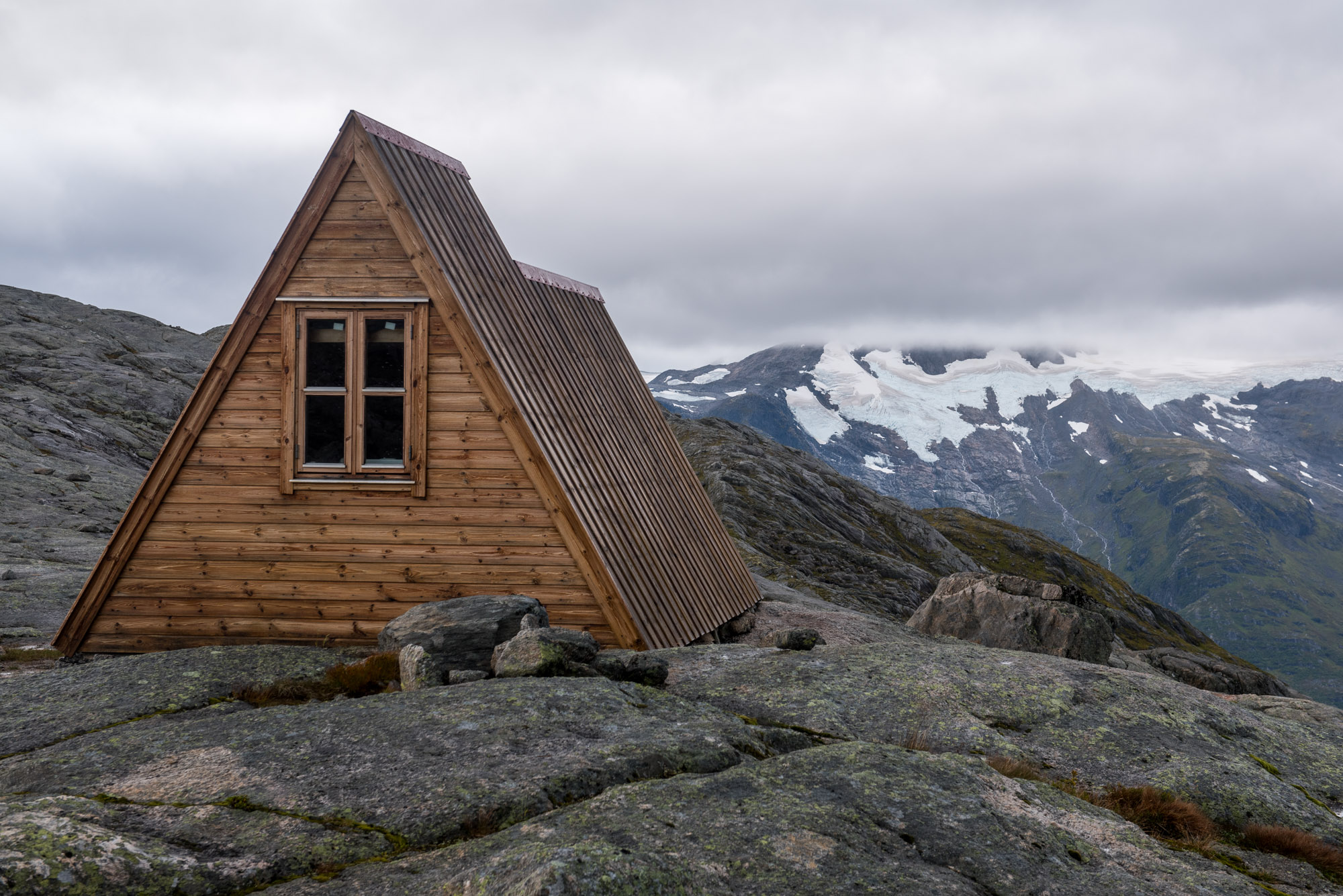
Flatsteinbu is situated on the northern side of Flatefjellet, the 400 m wide ridge. After traversing the ridge to the south you stand eye to eye with the ice avalanche of Brenndalsbreen. Chunks of ice frequently break loose and fall on the glacier below. From this height the stratification bands are clearly visible, as are the crevasses along the glacier’s margin.
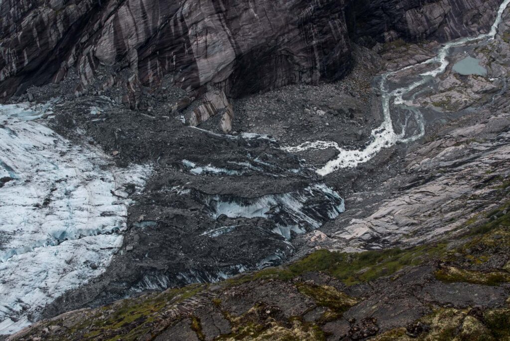
A part of the glacier is covered by a continuous layer of debris. This has everything to do with a large rock face collapse from the mountain side above the glacier in the spring of 2010. The rock avalanche deposited a large amount of stones on the glacier. Because the glacier moves forward, the debris was transported down-glacier and reached the front in 2020 (Engen et al., 2024). Since then the rocks melt out of the ice and are left behind by the retreating glacier.
The layer of debris slows down the retreat of Brenndalsbreen, as it insulates the ice. At present the glacier retreats some 10-20 m per year, while this was 30-50 m between 2010 and 2020. Still, melt has been even stronger in the past. Following a small advance in the 1990’s, the glacier retreated 300 m from 2005 to 2008. And in the 1940’s Brenndalsbreen lost a kilometer in just ten years (NVE).
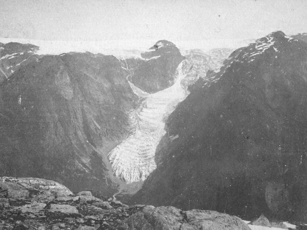
Prior to the massive ice loss of the 1940’s, Brenndalsbreen was about 2 km longer than at present. It occupied most of Brenndalen, including parts of the valley that now hold a nice forest and the braiding meltwater river. In those days the glacier was properly connected to Jostedalsbreen ice cap and therefore not a regenerated glacier.
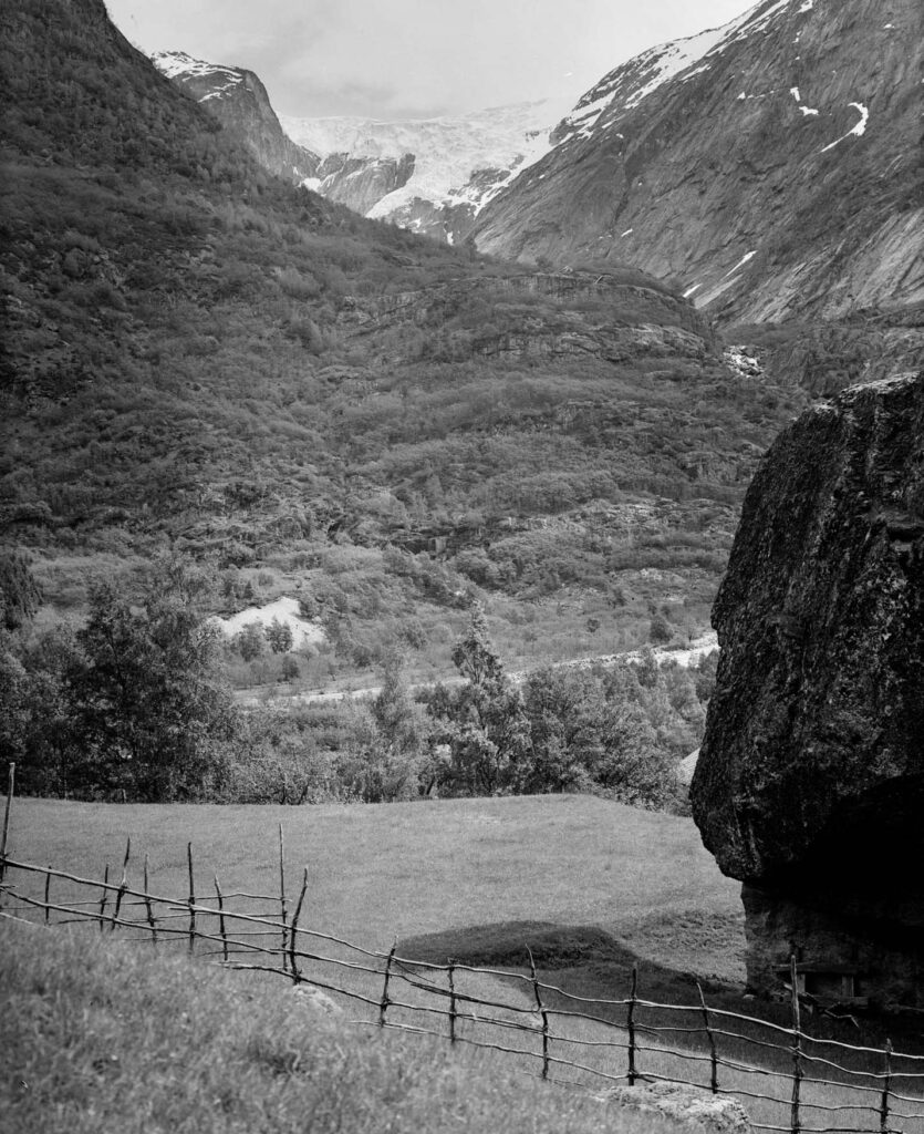
Brenndalen is a so-called hanging valley. That means there is a sudden drop where it is connected to a main valley, in this case Oldedalen. The difference in height is caused by the fact that Oldedalen was eroded deeper than Brenndalen. At the foot of this 150 m high cliff there once was a farm called Tungøyane. The farm has a sad but interesting history, because it was heavily affected by advancing glaciers in the 18th century. From around 1700 the farm suffered repeated damage to its fields and meadows by ravaging meltwater rivers. Taxes were lowered multiple times, but to no avail (Rekstad, 1902).
The impoverished farmers of Tungøyane moved their farm in 1728 to a marginally better place (as did their neighbors of Åbrekke three years before), but destruction continued. The glacier reached all the way to the mouth of Brenndalen. Ice tumbling down over the cliff piled up right next to the farm (a regenerated glacier avant la lettre). The farm was definitively destroyed by a landslide of ice on December 12th 1743, killing all livestock and sweeping away what little land was left. Only two horses and two persons (out of the alleged four) survived, including a solider that was coincidentally stationed there. The disaster happened at a time when the glacier reached its maximum extent, in 1743-1744 (Eide, 1955, Nesje, 1993).
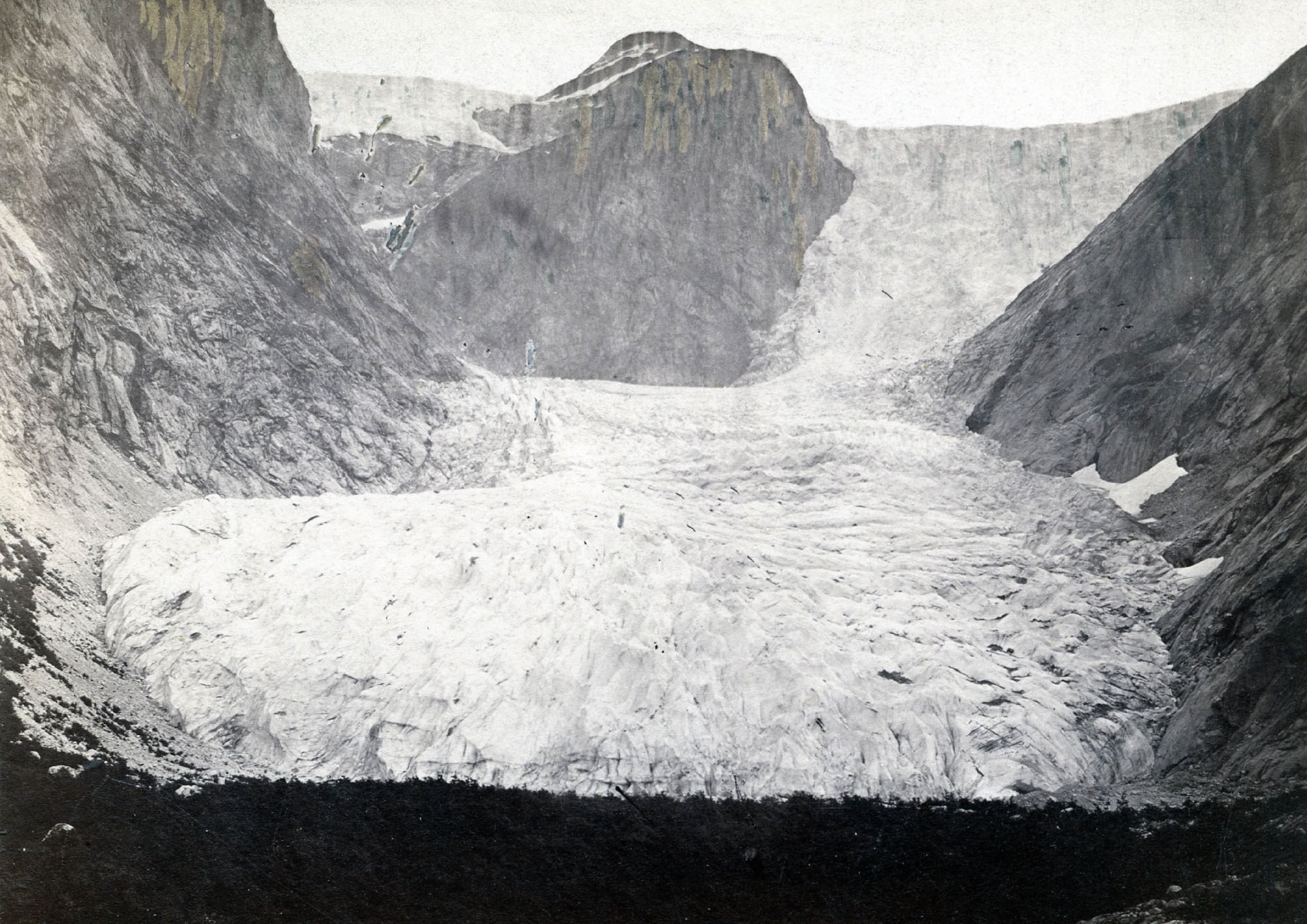
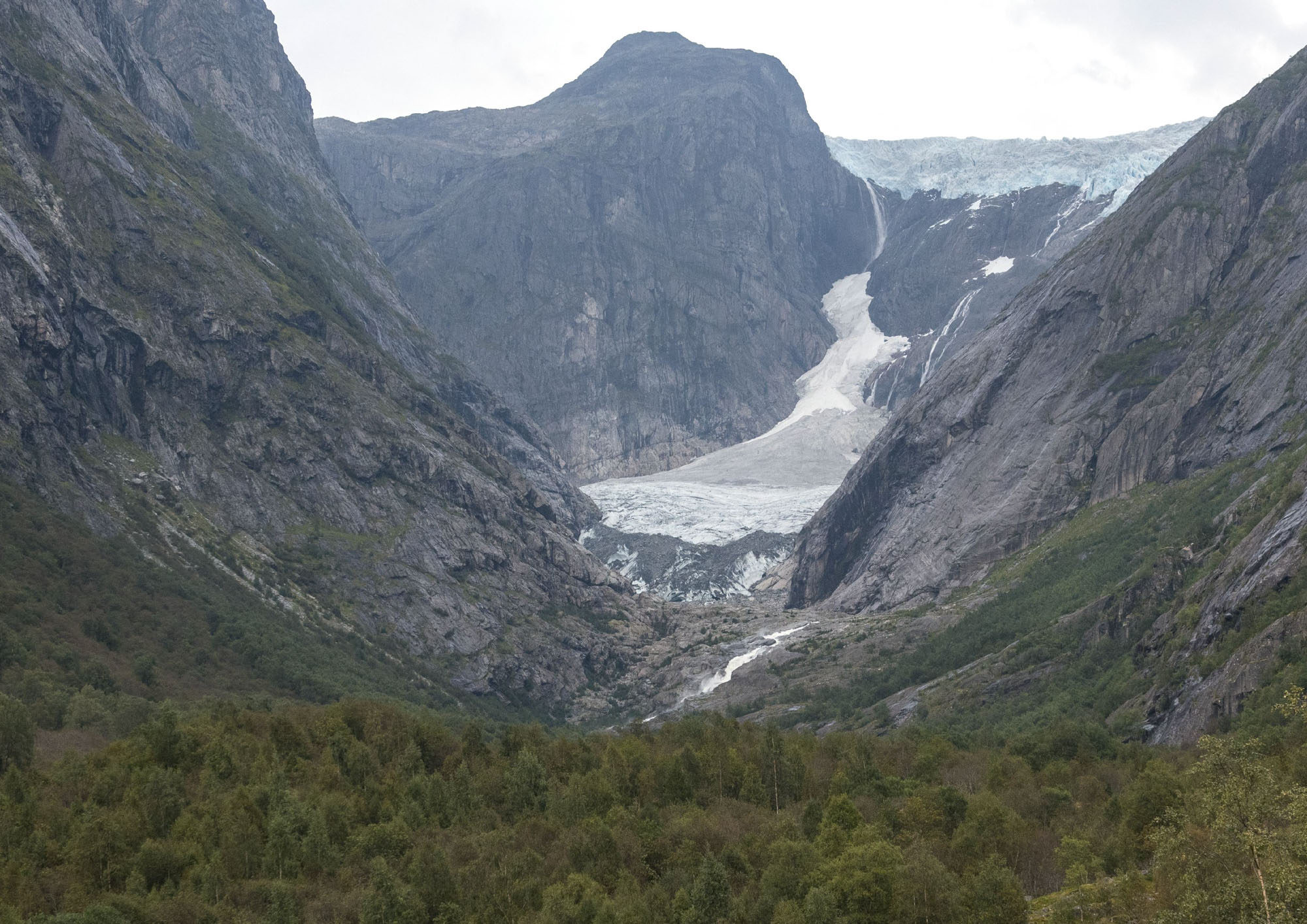
Brenndalsbreen in 1869 and 2024. Source 1869: Christen de Seue, Norges Geologisk Undersøkelse Fotoarkiv NGU001318.
Before Brenndalsbreen started to advance in the 17th century, Brenndalen is believed to have been deglaciated completely. It was no more than a ‘’white cow in the far distance’’, according to local legend (Nesje, 2023). The valley provided good pastures and woodlands in those days. The glacier was hanging above the valley like today, though without producing a regenerated glacier. That means that the glacier must have advanced a staggering 4 km until 1743, after which it retained its length for half a century. Rekstad namely wrote in 1902 that the local school teacher Martinus E. Bødal (almost 80-year-old at the time) was told by his grandfather that pieces of ice still crashed over the cliff into Oldedalen in the period 1775-1800 (Rekstad, 1902).
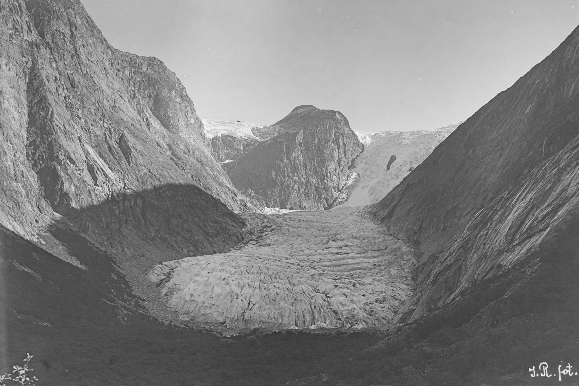
Brenndalsbreen in 1900 an 2024. Source 1900: John Berhanrd Rekstad, Bergen University Library photo ubb-jr-131-016.
When Brenndalsbreen was so much larger, it descended uninterrupted from the ice cap into Brenndalen. Moreover, the glacier also received ice from an avalanche-type glacier on the other side of Brenndalsnibba, a prominent mountain above the glacier. But as the climate changed in the 20th century there just wasn’t enough ice to sustain the icefall and the secondary tributary glacier. Instead, it became a regenerated glacier that lost almost 3 km since 1800. Though a great loss, Brenndalsbreen now is one of only few glaciers of this type left in Norway and definitely the most beautiful one.
Search within glacierchange: