Eyjabakkajökull is a 3 km wide surge-type outlet glacier of Vatnajökull ice cap. More scientists than tourist go there, as Eyjabakkajökull’s (remote) landscape helps to understand the behavior of the large ice sheets that have formed Europa.
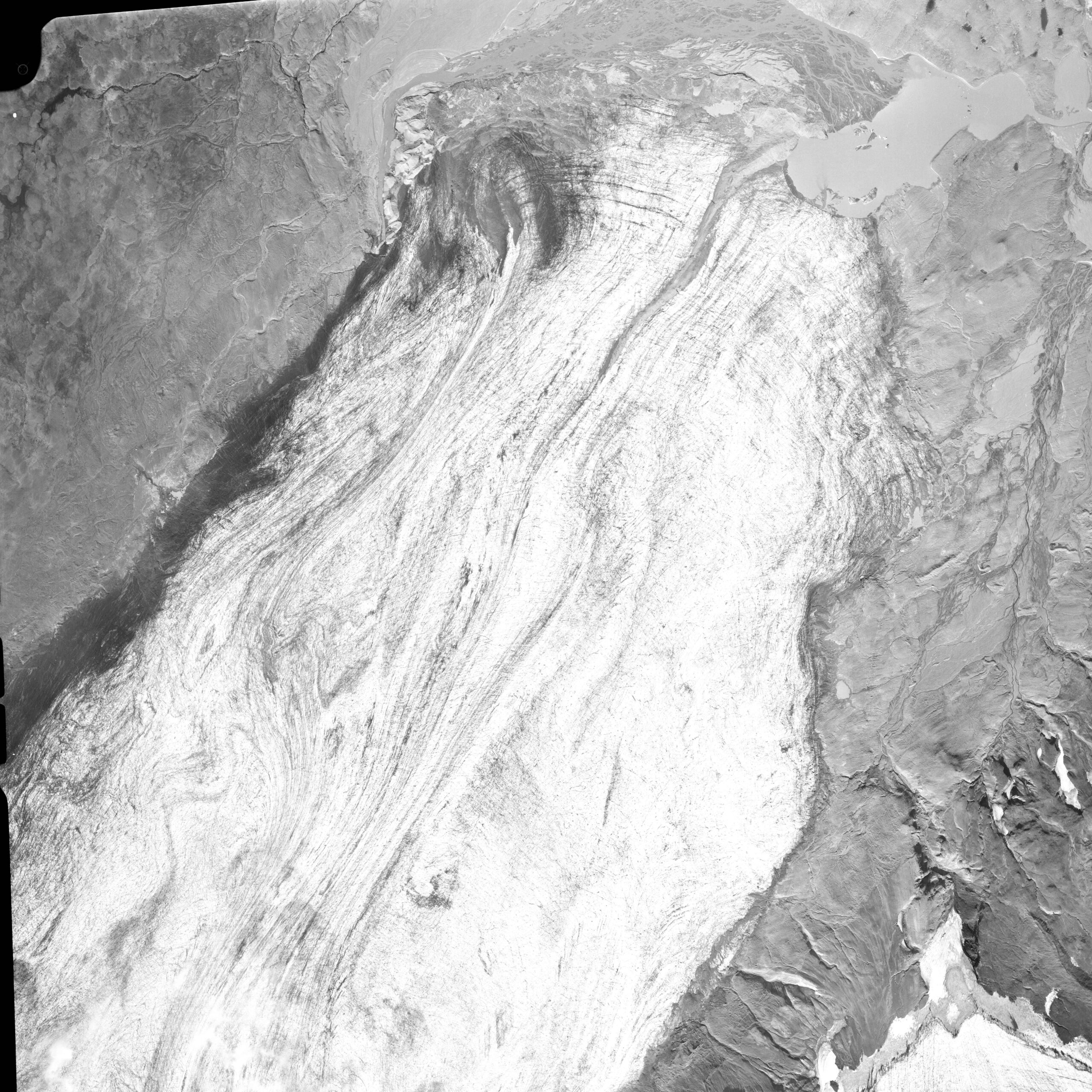
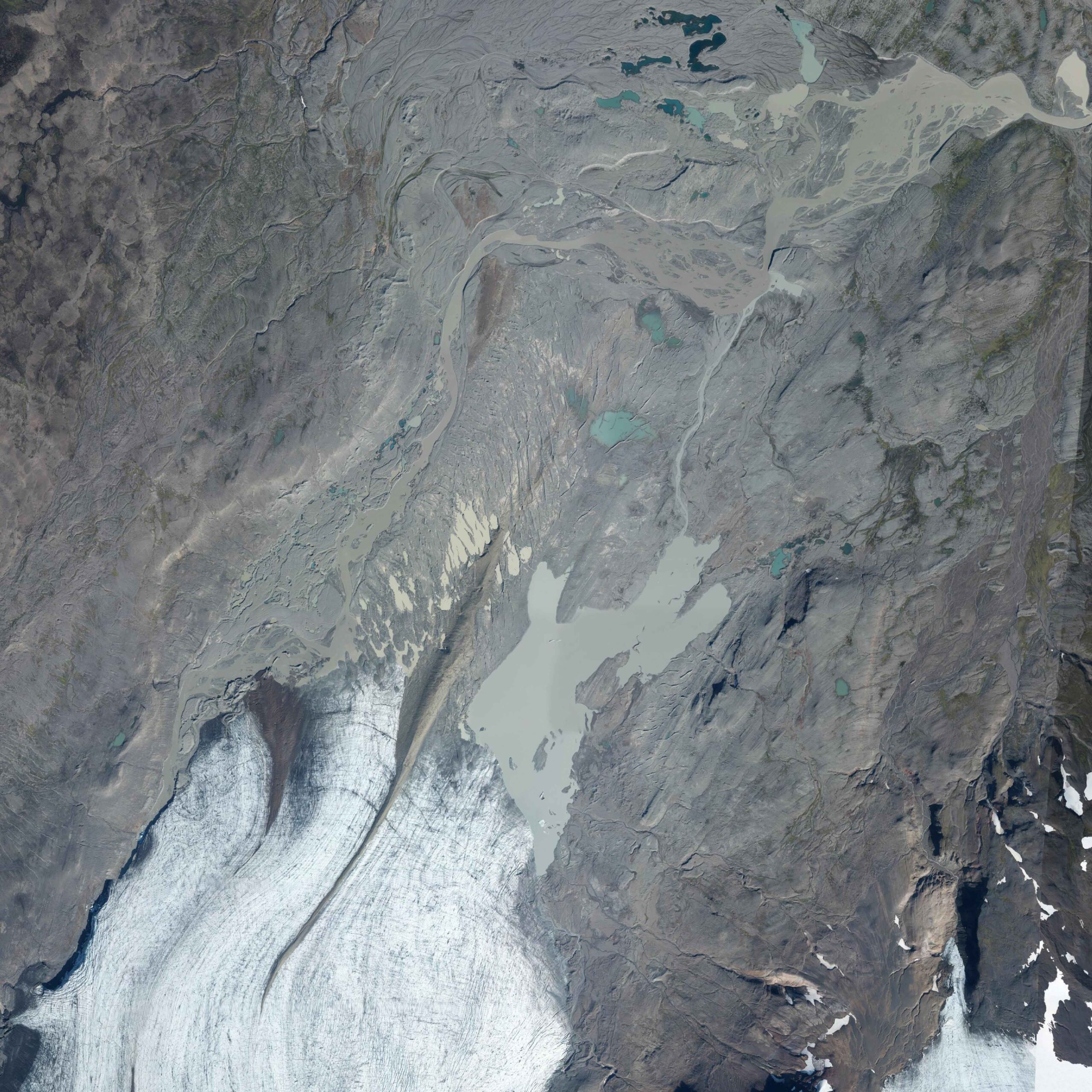
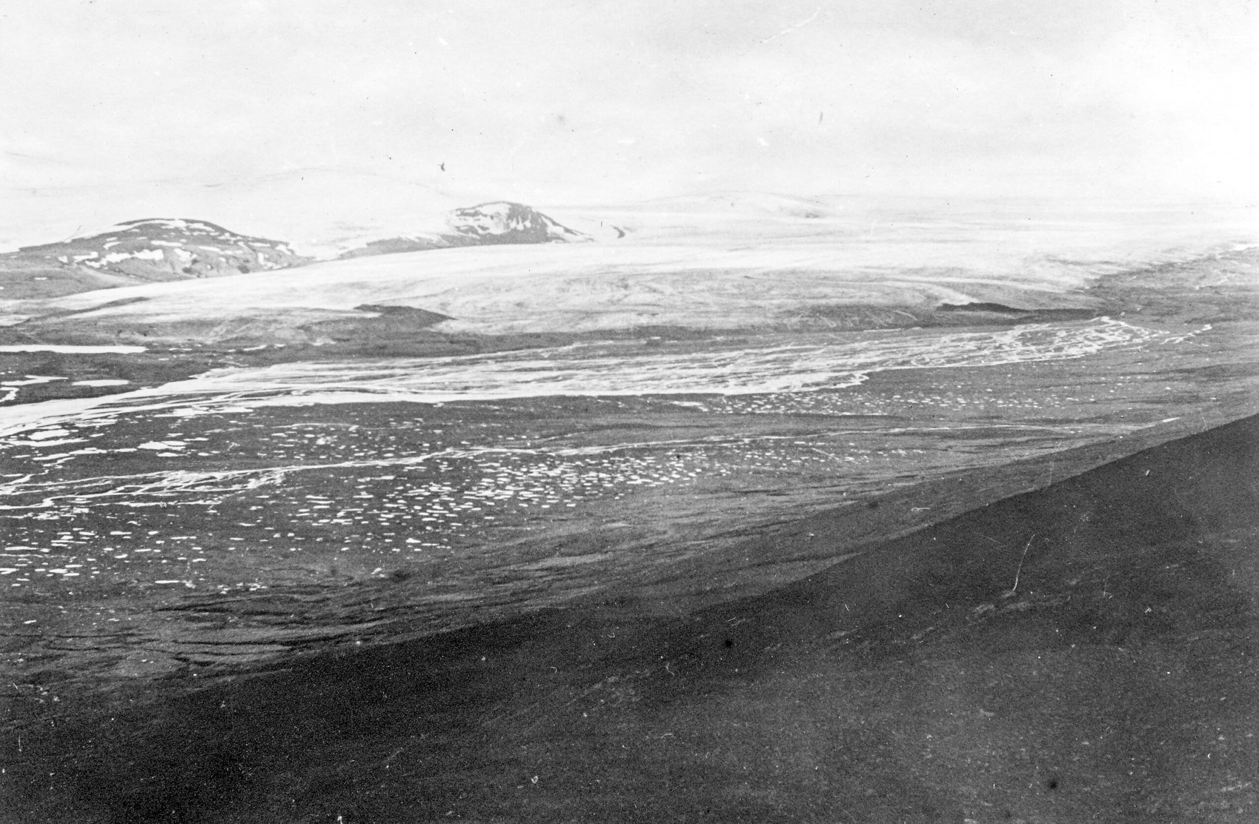
Eyjabakkajökull in 1984 (left) and 2020. Source: loftmyndasjá Landmaelingar Islands.
Eyjabakkajökull drains the northwestern part of Vatnajökull. It is a surge-type glacier, meaning that the glacier experiences periods of very strong increased flow velocities. It does so with intervals of about 40 years. The most recent one was in 1972, when Eyjabakkajökull advanced 2 km in total, at speeds of 30 m a day (Sharp, 1985a). Before that, the glacier surged in 1931-1938 and 1890. The surge of 1890 led Eyjabakkajökull to grow by 3-4 km. Never was the glacier more extensive than directly after the 1890 surge. Since then, the glacier has receded 6 km.
There are no accounts of surges before 1890. That doesn’t mean there weren’t any, though. Surging happens as a result of mass (ice) build-up at the upper part of a glacier, which isn’t transported to the snout gradually. Instead, the transport of ice happens periodically, with large intervals. Luckily, scientists have found a way to discover past surges, thanks to the glacier’s erosive power. When Eyjabakkajökull surges, it releases large quantities of light-colored clay sediments into its meltwater river. The clay is carried to lake Lögurinn where it subsides in layers. Thanks to intermediate layers of darker clays from another, non-glacial river, carbon of dead organisms and tephra layers of known volcanic eruptions, the surge-layers can be traced back.
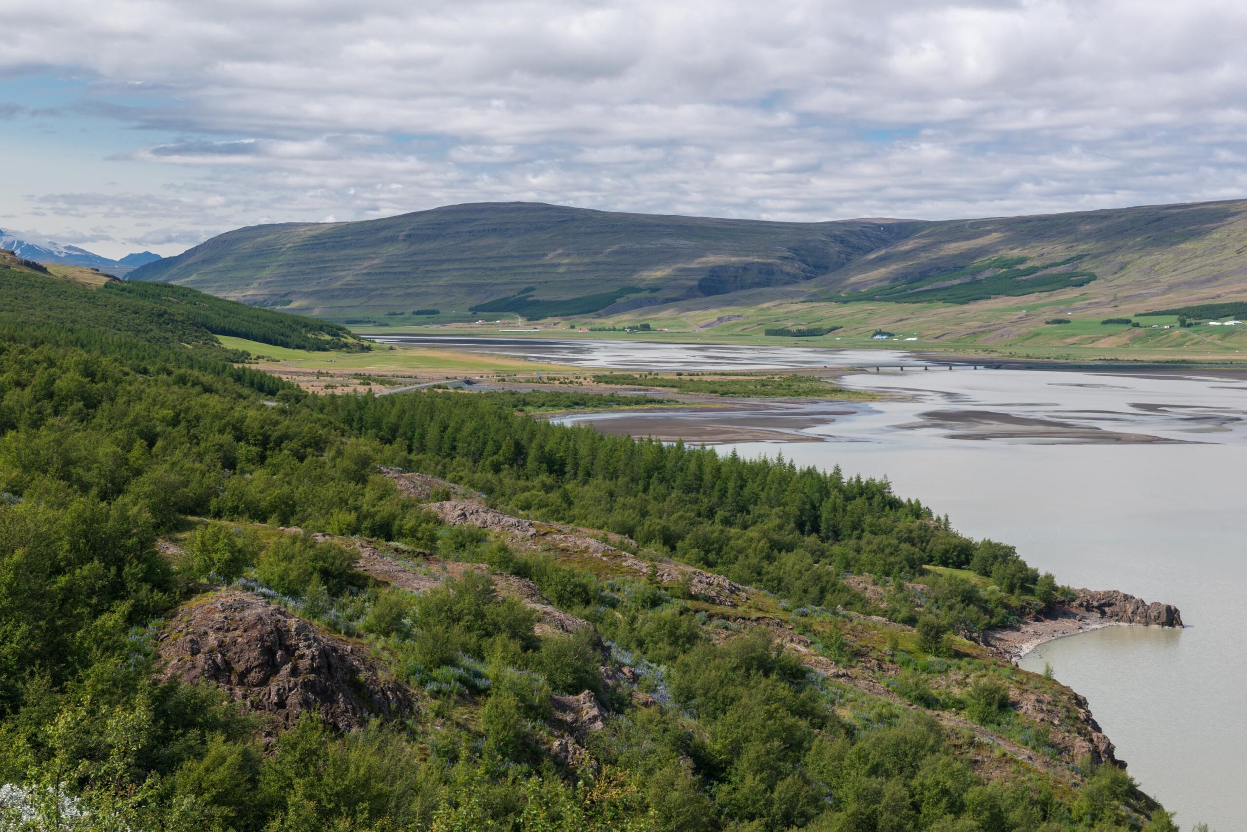
Scientists analyzed a 18 m thick sediment layer in Lögurinn lake, close to Egilsstaðir. The bottom layer subsided 10.500 ago, immediately after the ice sheet that covered the lake and the rest of Iceland had disappeared. For a thousand years, some glacial clays are still present in the sediments, but soon a period of total deglaciated kicks in. Between 9000 and 4400 years ago, Eyjabakkajökull doesn’t exist at all. Afterwards, the glacier formed again and slowly increased in size (Striberger et al., 2011).
From 2200 years ago onwards, the light-colored layers (varves), associated with glacial meltwater, are thicker. Surging leads to increased erosion, so more clay subsides in the lake. Because of melting ice, the glacier continues to deliver large amounts of sediments for some years after a surge event before it decreases. Darker-colored sediments start to dominate the varves again, until the next surge of Eyjabakkajökull. Thanks to the fact that light bands of clay indicate surges, it was concluded that Eyjabakkajökull surged about every 35 years, but the frequency increased in the 17th, 18th and 19th century to every 21-23 years (Striberger et al., 2011). The climate was cooler in those centuries, so the glacier accumulated mass faster and reaches its surge-threshold more quickly.
Besides surges, drainage of an ice-dammed lake also resulted in increased sedimentation. After the surge in 1972, a depression to the west of Eyjabakkajökull was dammed by the expanded glacier and filled with meltwater. This lake, called Háöldulón, recurrently drained and delivered significant amounts of rock flour to Lake Logurinn as well. The lake drained 15 times between 1972 and 1996, after which the lake stopped functioning (Striberger et al., 2010). It probably existed during previous surges as well.
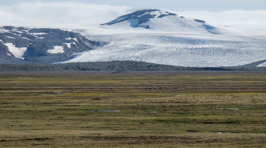
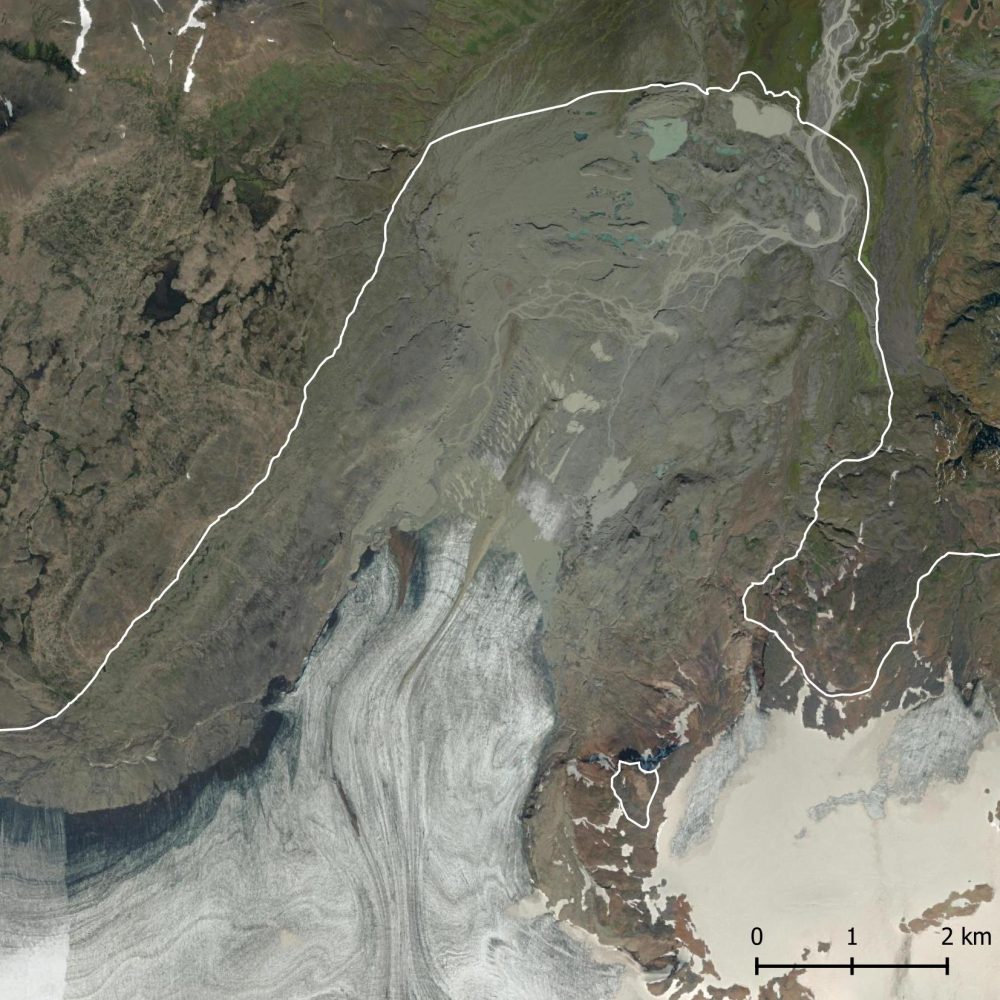
Surge events move vast amounts of sediments. Those sands and clays can end up at the bottom of lake Lögurinn, but can also settle closer to the glacier, in the flat valley of Jökulsá river. And it does. In fact, the sediments deposited on the vast plain in front of the glacier create a lush vegetation, despite its altitude of 650 m above sea level. Herds of Reindeer graze here and many Pink-footed geese nestle in between the grasses and mosses.
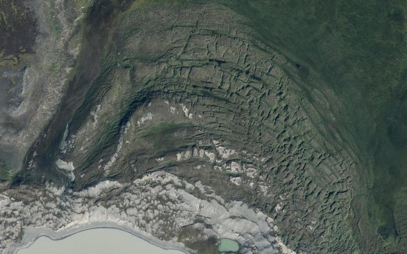
The surge of 1890 formed very special glaciotectonic end moraines. These ridges were created by the pressure of the ice in two distinct ways: single ridges formed where high porewater pressure forced the ground under the ice to extent horizontally, transporting it to the front and accumulate at the glacier margin. The second type of end moraine are large lobate end moraine ridges with multiple, often closely spaced crests. They are formed up to 300 m from the glacier by folding and thrusting of sheets of soil in front of the ice. Because the soils here partly consist of peat, rare sequences of imbricated (stacked) peat were created. For the very complicated details, see Benediktsson et al. (2010).
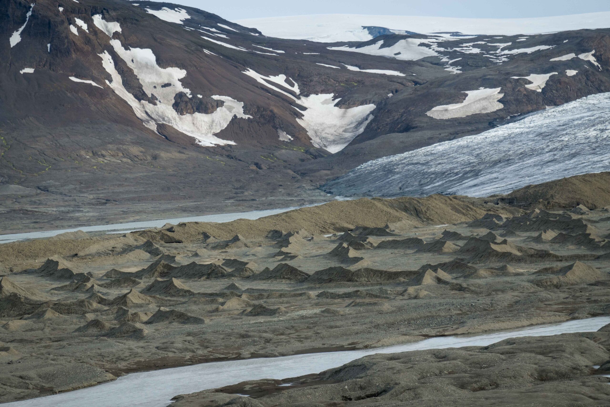
In the forefield of Eyjabakkajökull (and Brúarjökull to the west) there is a spectacular set of so called crevasse-squeezed ridges. They have steep sides, are 1-3 m high and 10 to 130 m long. Their name is a summary of their geomorphology: crevasse-squeezed ridges document the squeeze-up of subglacial sediment into open basal crevasses. This only occurs during or immediately after a surge, because only then the crevasses can penetrate to the base of the glacier. When the surge is over, the stagnant crevasses are filled with sediments. When the dead ice melts, the ridges are left behind. Therefore, they are characteristic of surge-type glaciers that do not move at all after surging is over (Sharp, 1985b).
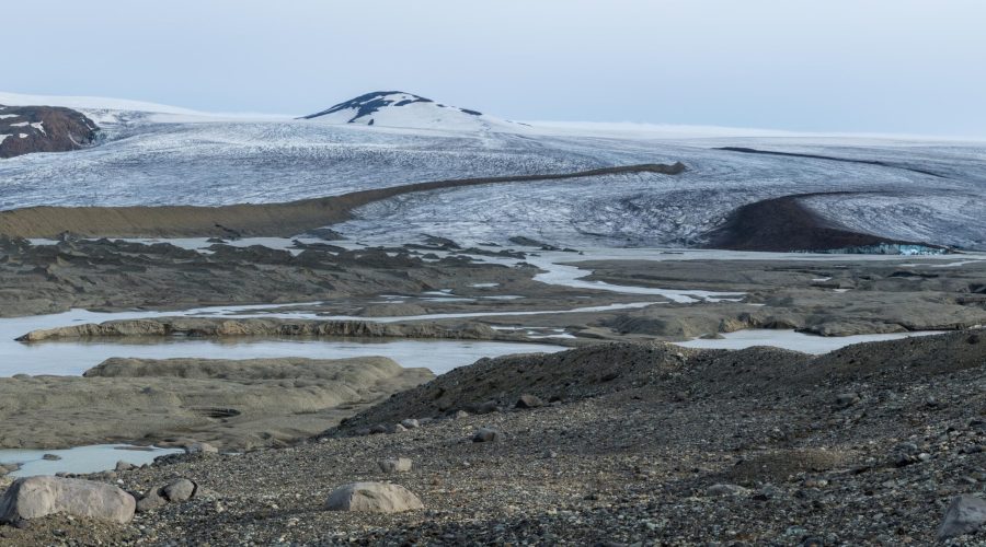
While crevasse-squeezed ridges emerge from underneath the ice, medial moraines emerge at the top of the glacier. On the surface of Eyjabakkajökull, two prominent middle moraines emerge about 3 km up-glacier. They are formed by rocks breaking off from two nunataks 7 and 9 km up-glacier from the snout. As both mountains are within the accumulation zone, the rocks get covered by new snow and ice and reappear in the ablation zone, where they melt out. The western one is quite black due to black basalts, the eastern one is more brownish. These thin layers of rock insulate the ice, so they ‘grow’ above the rest of the glacier. Even after the entire snout has melted, a slowly melting dyke of ice remains, covered by the material of the medial moraine.
The most spectacular characteristics of Eyjabakkajökull are associated with surging. But global warming prolongs the periods in between surges. In the 20th century, they happened about every 40 years. But the next one is long overdue, as no surges occurred since 1972. Will it ever happen? Maybe not: it could very well have become too warm for sufficient snow to accumulate to ever exceed the (unknown) surge-threshold.
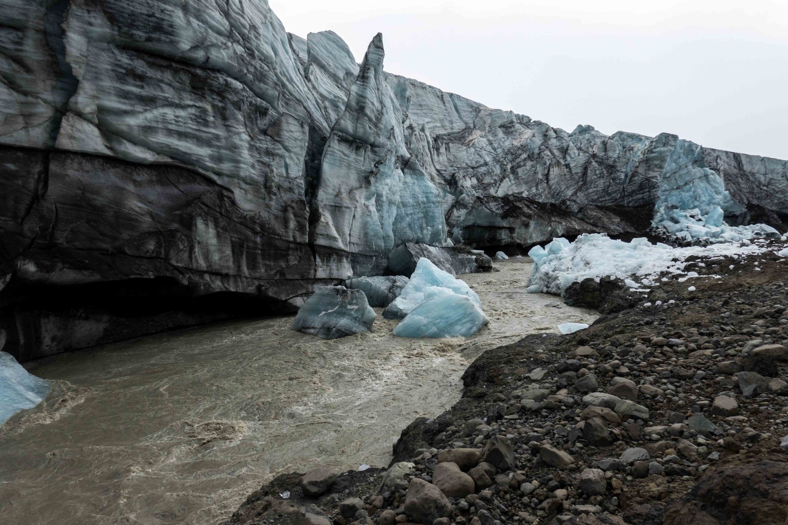
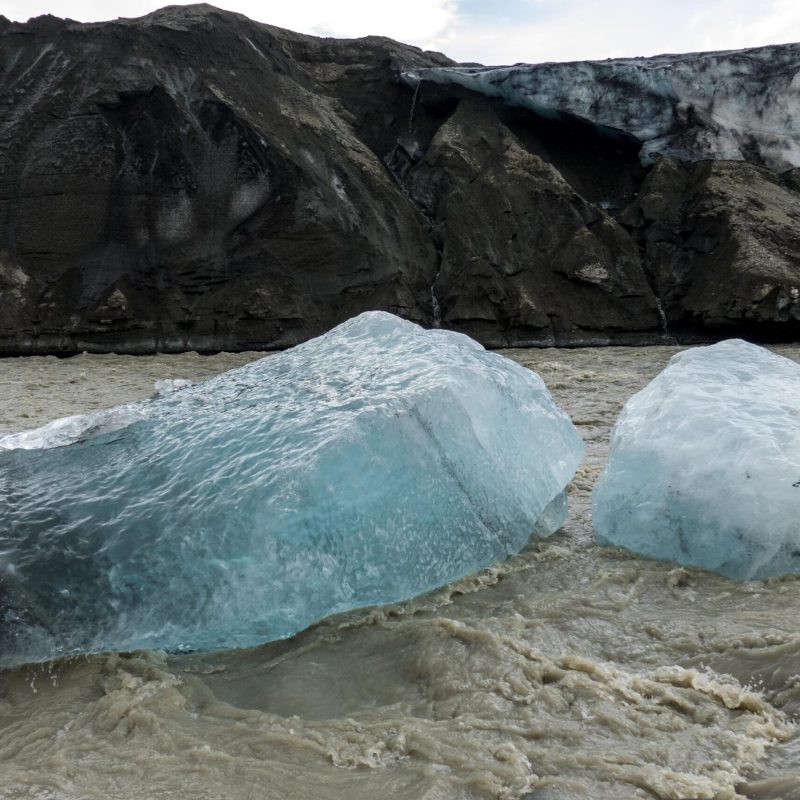
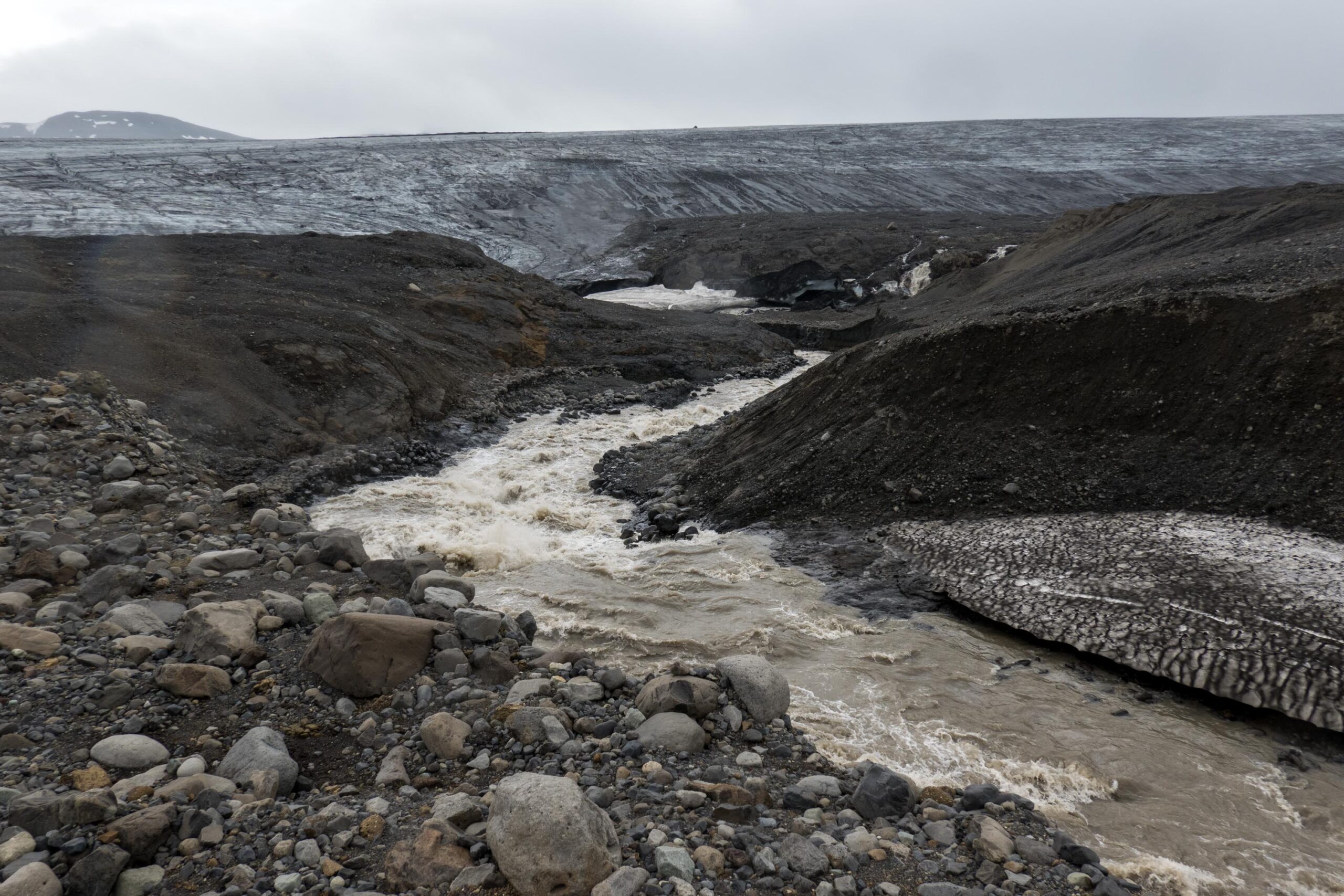
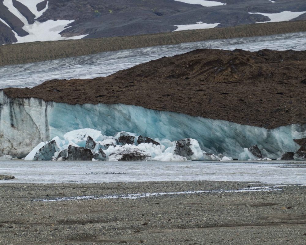
As chances are growing that surges have been removed from Eyjabakkajökull’s repertoire, we might have to shift our attention to melt. Luckily, Eyjabakkajökull is one of those glaciers that is does this in a spectacular wat. One of its meltwater rivers emerges from the western side of the glacier and erodes the ice. A steep ice cliff over a kilometer long and tens of meters high towers over the rushing river. Regularly, parts of the glacier collapse and plunge down.
Upon collapsing, the crystal blue ice emerges. It gets darker over time, as dirt collects at the surface due to melting. When chunks break off, icebergs end up in the river and all the way at the other shore. Because the river continuously melts the base of the ice cliff, the process has been going on for many years already and will keep operating in the coming years. A cold comfort, while we wait for a surge that probably never comes.

Search within glacierchange: