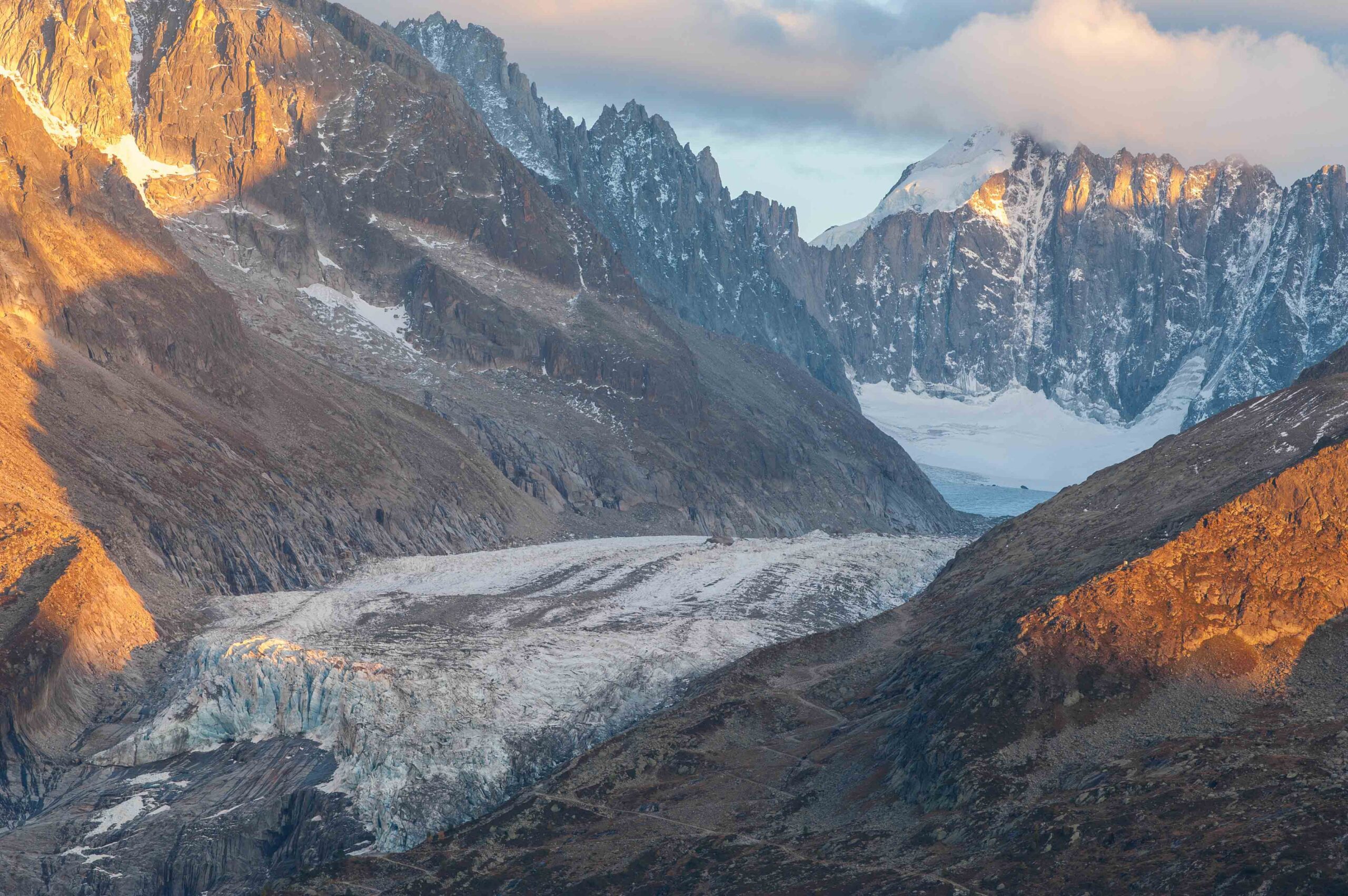
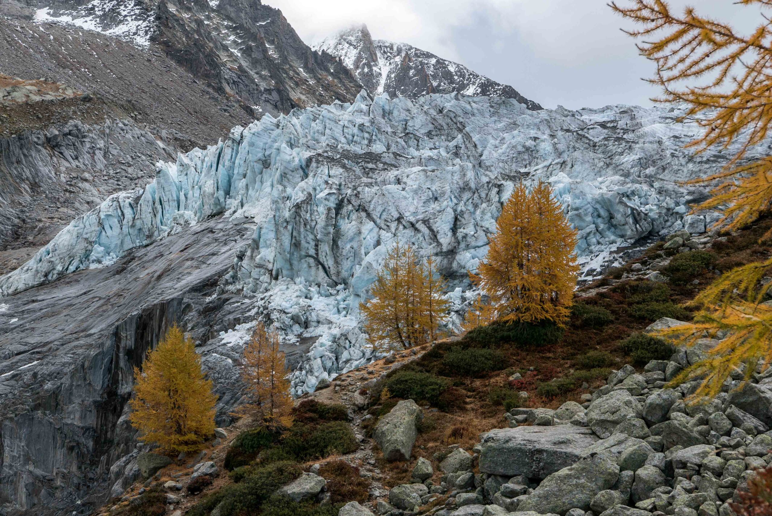
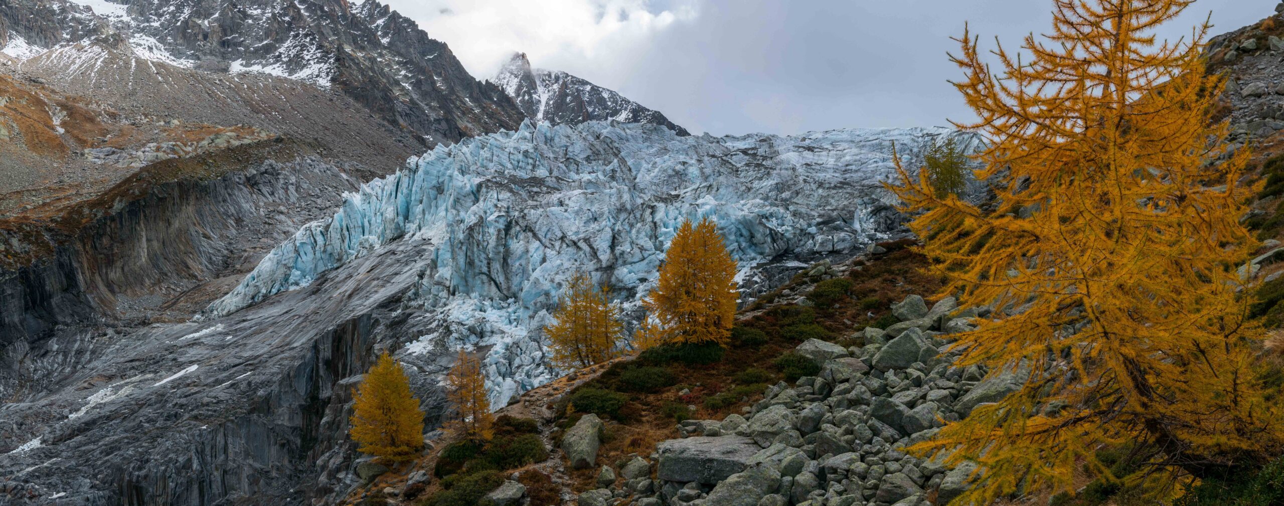
Glacier d’Argentière is the second largest glacier in France, after Mer de Glace. Both are situated in the Mont Blanc massif. Glacier d’Argentière terminates in front of a steep cliff. Chunks of ice fall down continuously, producing a rumbling sound you can be heard from afar.
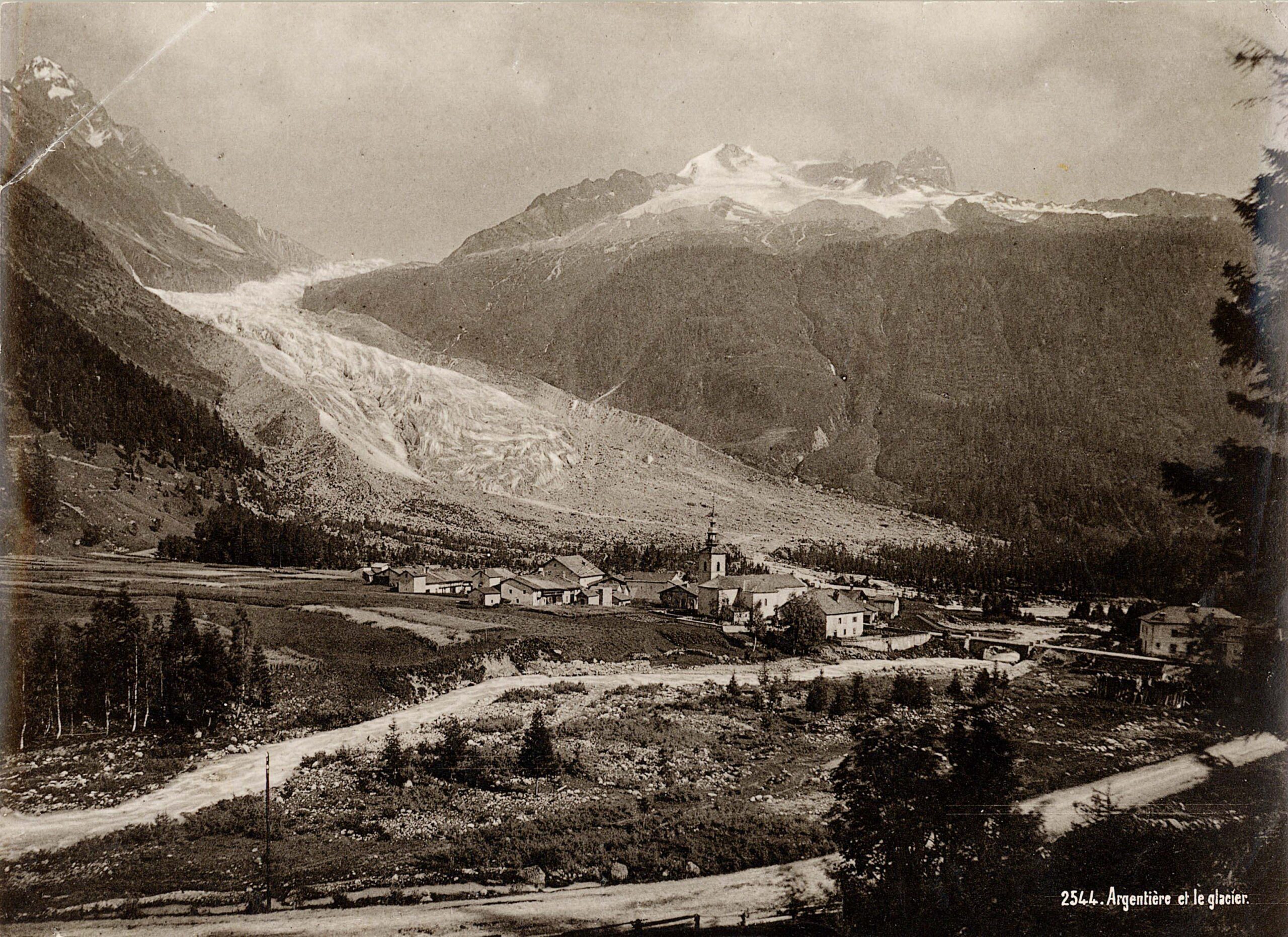
In the Alps, you often see glaciers surrounded by large areas of unvegetated land. This has everything to do with them receding: plants can’t colonize the mineral landscapes as fast as the glacier is uncovering them. But in the case of Glacier d’Argentière, things are different, thanks to a steep cliff right in front of the glacier. The glacier used to flow over the cliff down into the valley, stopping just before the town of Argentière. There, the glacier snout had an ice cave where meltwater left the glacier. In the nineteenth century many people were drawn to this spectacular phenomena. Nowadays the glacier stops in front of the cliff, so its length is multiple kilometers less than it used to be. But right above the cliff the glacier only thinned by some fifty meters and is still relatively close to the trees.
The village of Argentière with the glacier in the back, circa 1898. Source: Library ETH Zürich, Hs_1458-GK-BF01-1898.
Glacier d'Argentière ends above a cliff.
Glacier d'Argentière from Lacs des Chéserys.
Below the Glacier
The cliff only became visible in 1924. Before that, it was covered by the glacier. In 1955 and 1968 tunnels were made in the rocks to deviate melt water running underneath the glacier. The water is transported to Emosson reservoir for hydropower. Digging these tunnels gave a unique opportunity to make some kind of gallery directly beneath the glacier, where scientist could study it from below. To determine the flow velocity, for example, which varies between twenty centimeter (winter) and a meter (summer) per day (Dumoulin et al., 2010:247).
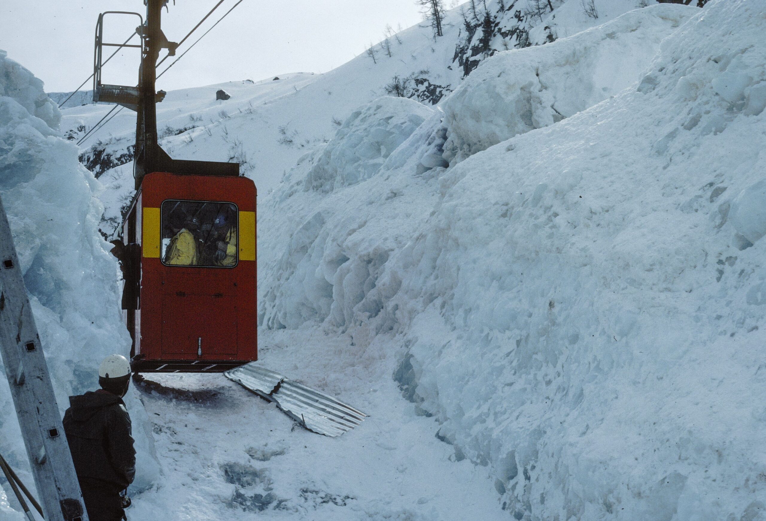
Cable Car Through the Glacier
In total, the glacier receded multiple kilometers over the last hundred fifty years. But in the 1980’s the Glacier d’Argentière advanced, thanks to increased snow fall and cool summers. Because of that, the glacier threatened a cable car. With the help of bulldozers and dynamite people tried to keep the cable car and its masts free from ice. After having advanced two hundred meters, the glacier started to recede again.
Because of the growing glacier, a trench was dug in the ice for the cable car to pass. Source: Library ETH Zürich, photo 385-09913.
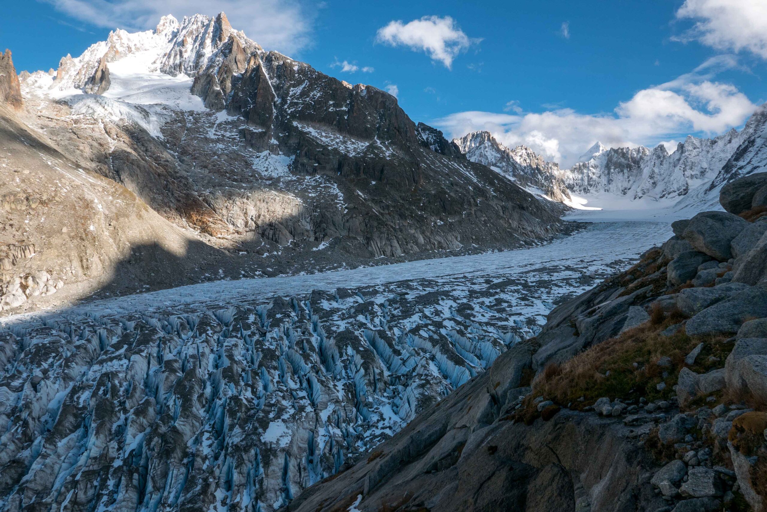
Flat part of Glacier d’Argentière, October 2022.
Highway
The part of the glacier above the cliff looks a bit like a highway: flat and straight, with its middle moraines acting as road marks. But drivers have to hit the brakes after a few hundred meters, when there is a speed bump underneath the glacier which creates lots of crevasses. Hikers can pass this part of the glacier via a series of ladders that are drilled in the rocks to the south. Climbing them brings you at the Moraine des Rognons, where you have spectacular views over the upper part of the glacier.
Climate Change
During winter, it’s hard to imagine the ice cold upper part of the glacier can actually melt. But it certainly does. The glacier hardly has any spot where more snow accumulates than melts. Snow only collects at the high mountains surrounding the glacier, all close to or even over four thousand meter high. But hardly any snow reaches the glacier in the form of ice. Tributaries of the glacier are cut off due to thinning and those that are still connected will eventually stop doing so. No matter how impressive you are, climate change will get you.

