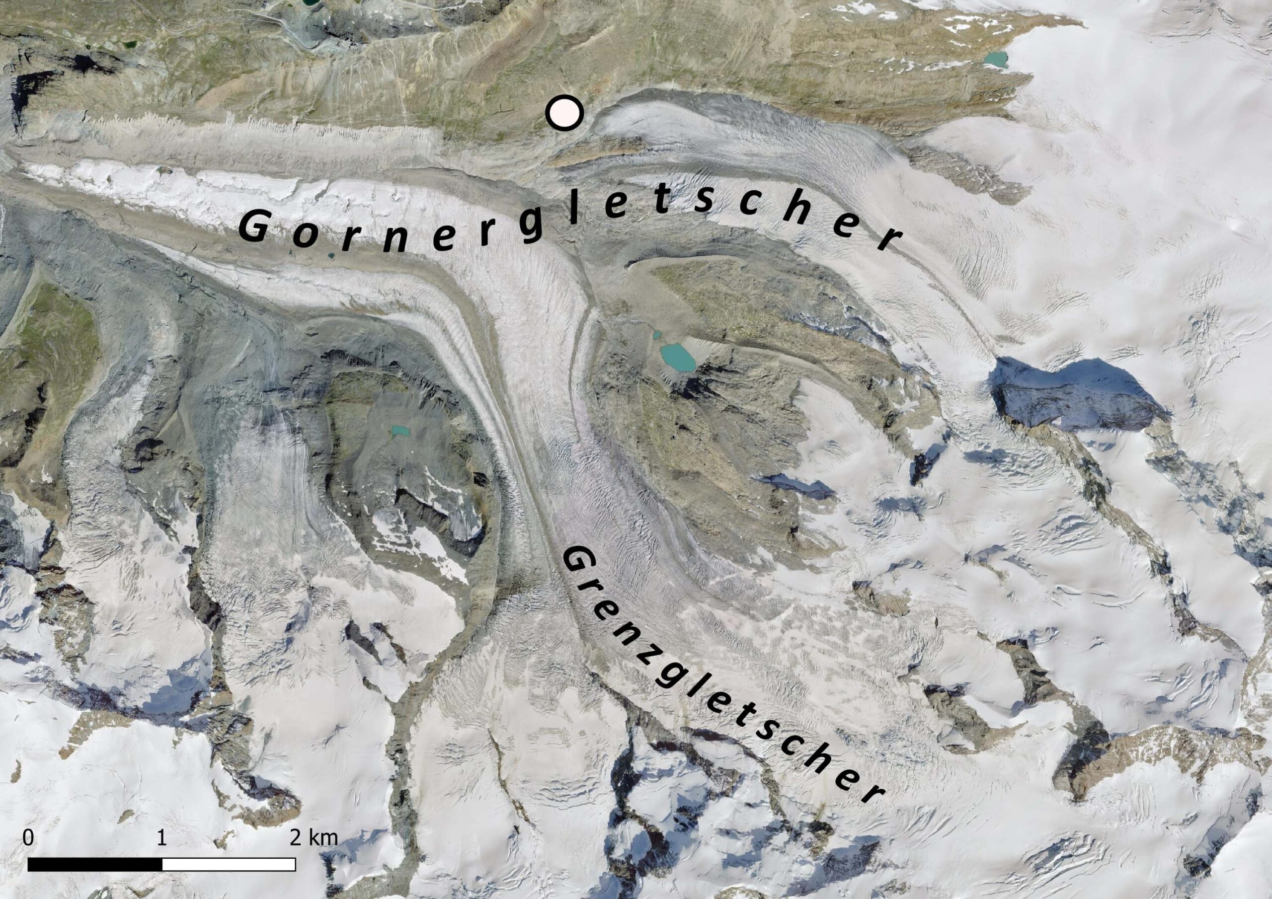
Gorner Glacier (Gornergletscher) is the second-largest glacier in Switzerland and the largest of Valais.
Gorner Glacier starts at the top of Switzerland’s highest mountain, Dufourspitze (4633, part of the Monte Rosa massif). The glacier measures 13 km in length, has an ice thickness of up to 385 m (2015) and is around 1,5 km wide. But these numbers have to be updated every year, as the glacier is out of balance with the warming climate. Gornergletscher loses some 50 m annually, as well as several meters of its thickness.
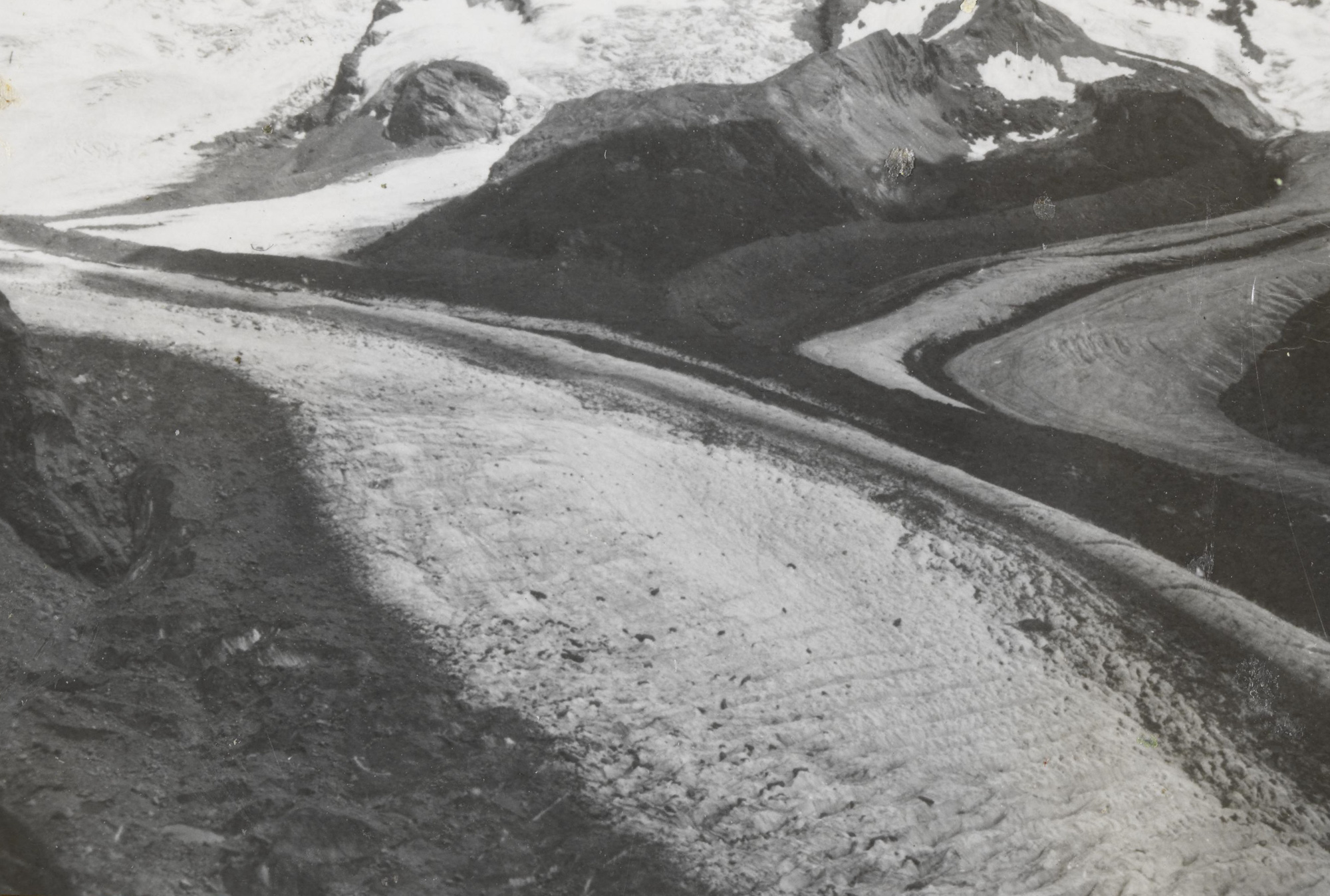

The snout of Gornergletscher in 1949 (left) and 2016. Source 1949: Library ETH Zürich, 1458-GK-B014-1949-0021.
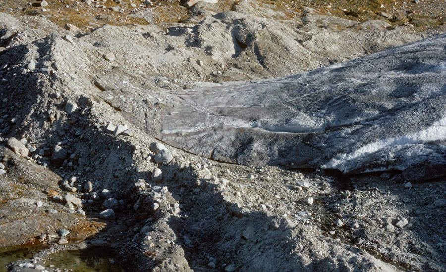
People measure Gornergletscher’s length change at the glacier’s snout, but there is also a place where nature itself keeps track of it. In the north, a sidelobe of Gornergletscher forms recessional moraines. This works as follows: Although Gornergletscher is overall receding, it advances in winter by a few meters, because the glacier keeps moving forward while melting temporarily stops. The advancing ice doesn’t reach all the way to the moraine of the previous winter, but forms a new ridge just in front of it. So the further away from the glacier, the older the moraines are.
Although annual moraines are quite common in places like Iceland, they are very rare in the Alps. In front of one of Gonergletscher’s tributaries, they are 0.5-1.5 m high and formed since at least 1980. They are composed of sediments deposit in front of the snout the previous summer and then pushed into a moraine. The spacing between them range from 5 to 15 m. The distance looks to be larger when winter temperatures are relatively mild, which could mean that this lobe of Gornergletscher advances more in colder winters (Lukas, 2012).
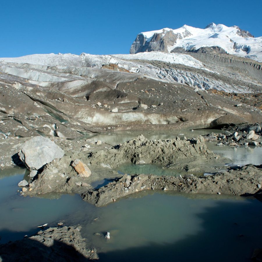
The recessional moraines are all composed of proglacial sediments (sandy and silty material that lies in front of the glacier), but are formed in three different ways. Firstly, sediments can freeze to the bottom of the snout and are subsequently transported to the front of the glacier during winter. Secondly, the glacier can act as a bulldozer, but only if the ice margin is very steep. And thirdly, the edge can be buried by fluvial sediments during summer, but only if the ice margin is very flat. In the following winter, the sediment-covered ice is somewhat compressed by pushing, leading to an ice-cored moraine.
Because the shape of Gornergletscher has changed over time, so did its moraines. The much steeper ice margin in the 1980’s and 1990’s has created bulldozered moraines, which are preserved very well. A thin and gently sloping ice margin, in contrast, forms moraines that incorporate dead ice. Under such conditions, the formation of ice-cored moraines from thick layers of supraglacial debris is also possible. Because both kinds of moraines have ice cores that keep melting, they are strongly deformed after initial deposition and much harder to recognize afterwards. Simply put: older moraines are better preserved than newer ones because of glacial thinning (Rettig et al., 2023).
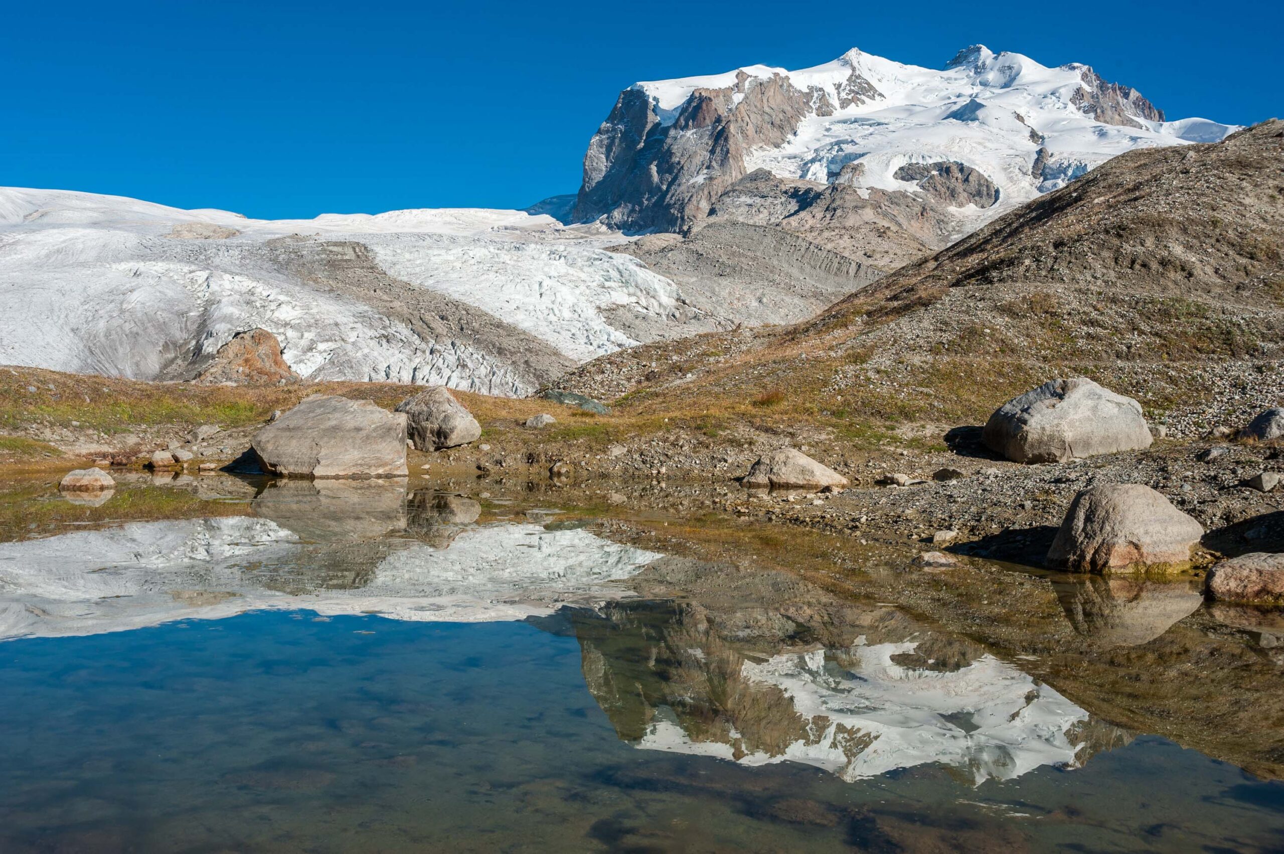
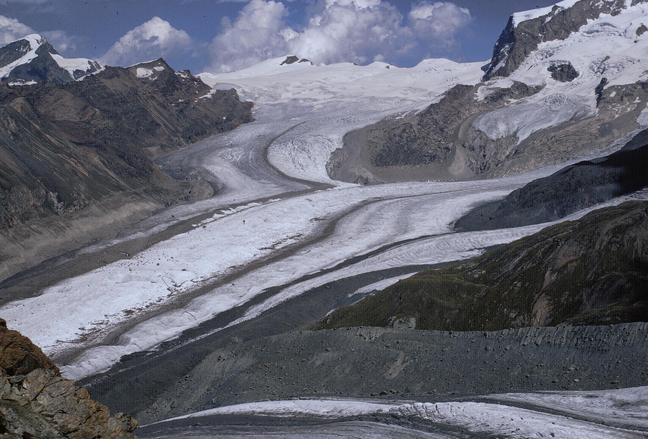
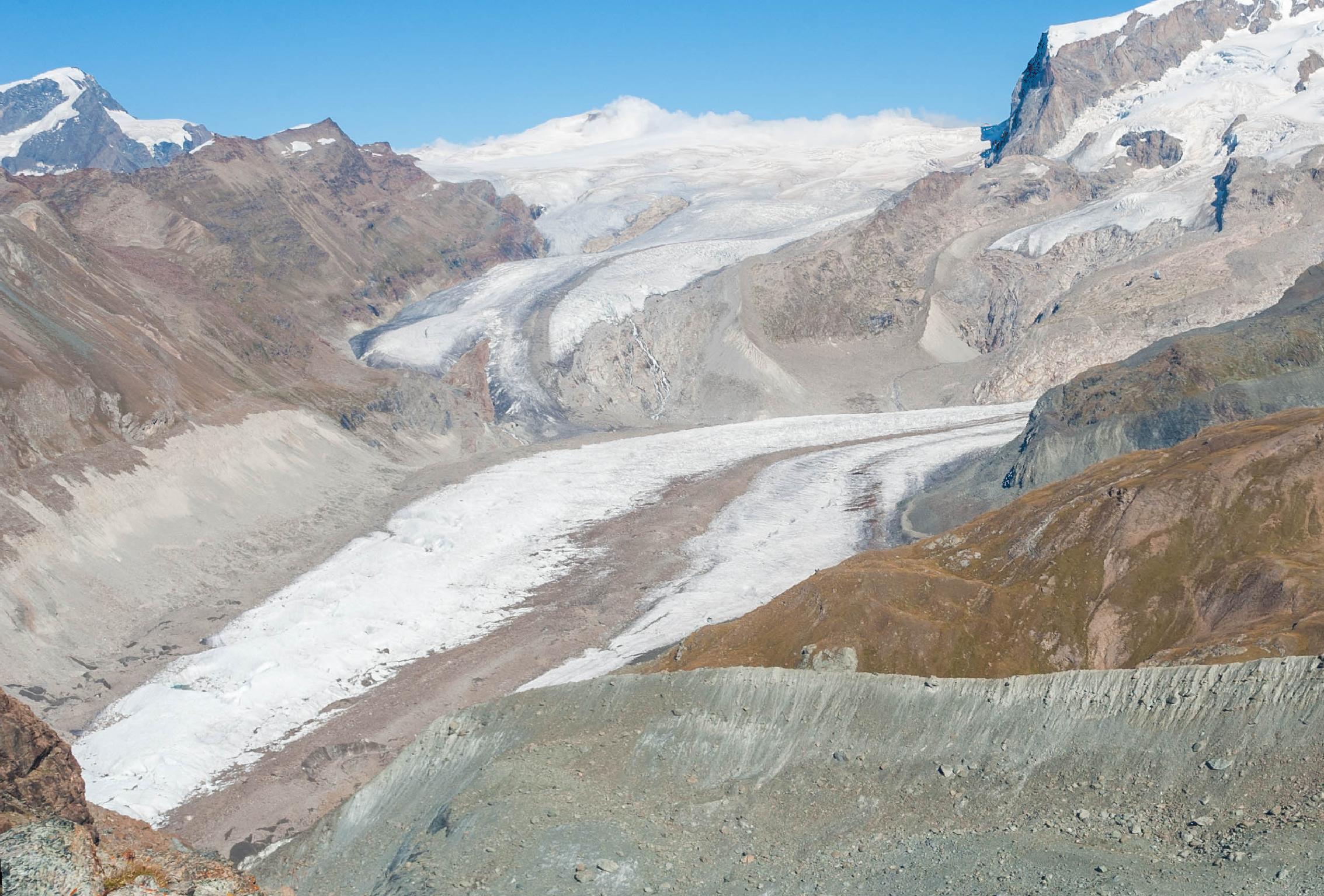
Gornergletscher in 1971 (left) and 2016. The recessional moraines are being formed at the left side of the glacier in the back. Source 1971: Library ETH Zürich, Dia_385-10326.
The annual moraines are not located in front of the main glacier, but at one of its tributaries. To complicate things, this side glacier is (also) called Gornergletscher. Until 2018 it was connected to the main trunk glacier called Grenzgletscher and together they formed the lower part of Gornergletscher. At the confluence of both glaciers lies a lake with a turbulent history: Gornersee.
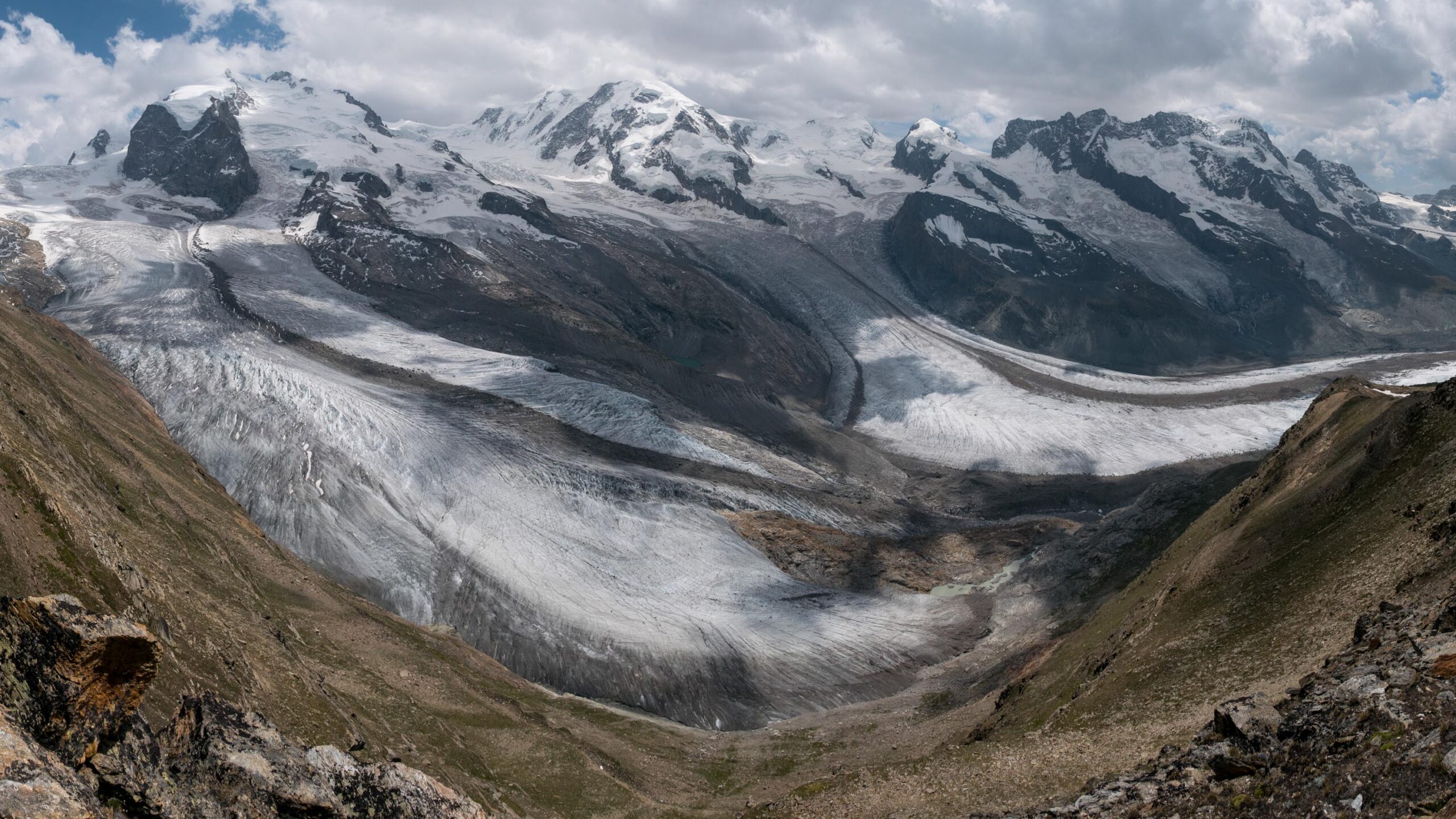
Gornersee was an ice-dammed lake to the east of Grenzgletscher. Meltwater filled the lake in spring and drained subglacially in summer in a matter of days. Upon drainage, the water found its way underneath the glacier and could be stored there for several days. The pressurized water lifted the glacier a little bit off its bed (20 cm at best), which reduced friction and speeded up the glacier. In some cases the flow velocity was almost doubled, but we’re only talking about a few centimeters a day extra (Garcia et al., 2019). Remarkably, it also pushed the ice a little bit sideways during drainage events (Sugiyama et al., 2010).
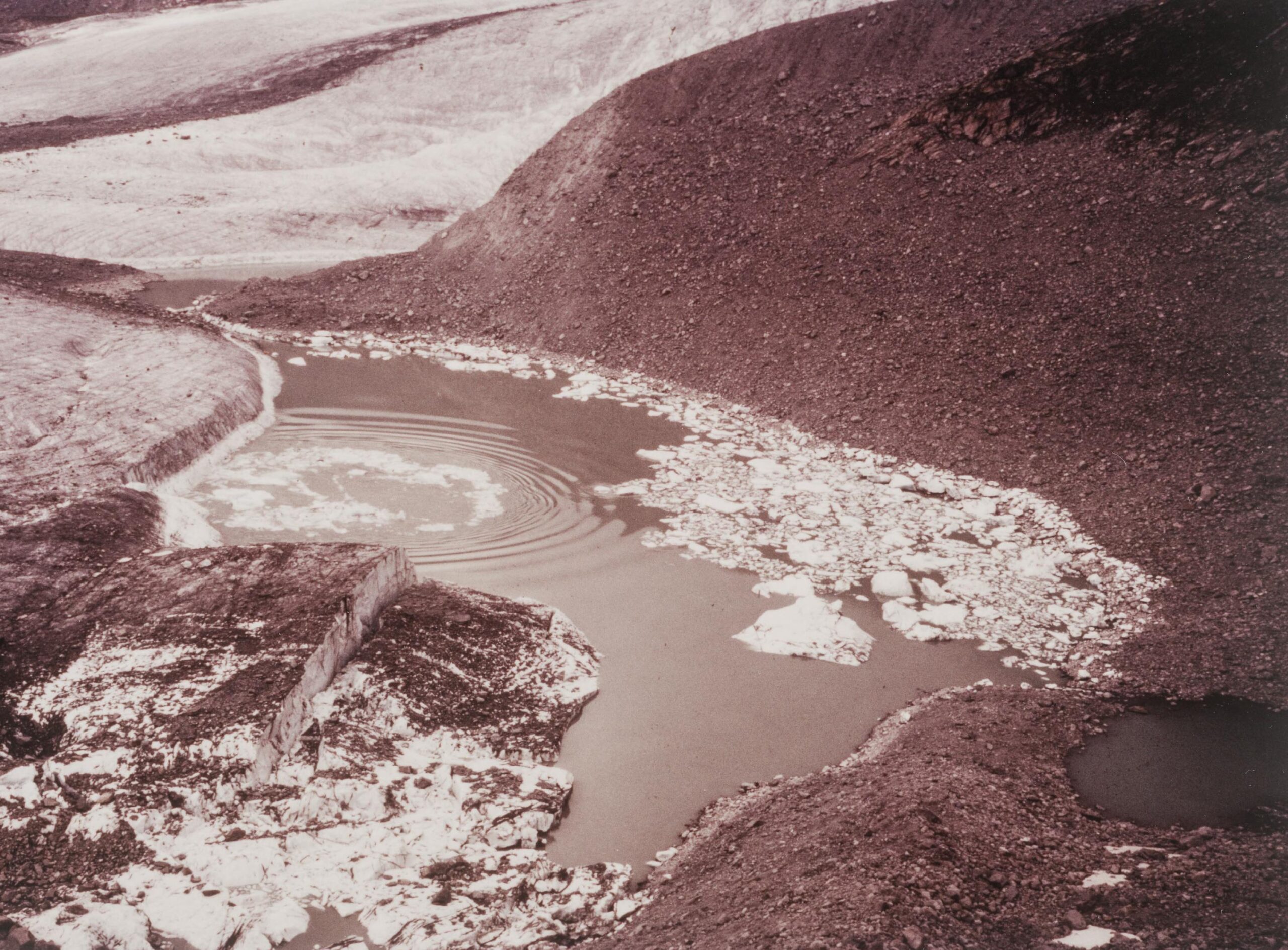
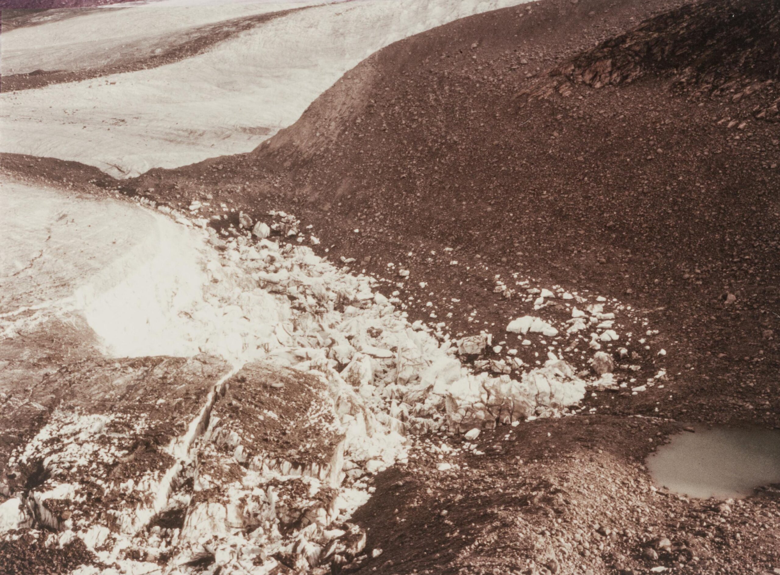
Two pictures of Gornersee 1979, prior to (left) and directly after drainage. Source: Library ETH Zürich.
In the first half of the 20th century, Gornersee could hold so much water that it regularly destroyed bridges, arable land and chalets. Even in 1966 there was widespread damage in the famous town of Zermatt, 5 km downstream. But as the glacier thinned, the capacity of the lake was reduced. It only temporarily increased around 2005, when the lake area was enlarged because of calving (Huss et al, 2007). Continued glacial thinning now prevents the lake from refilling.
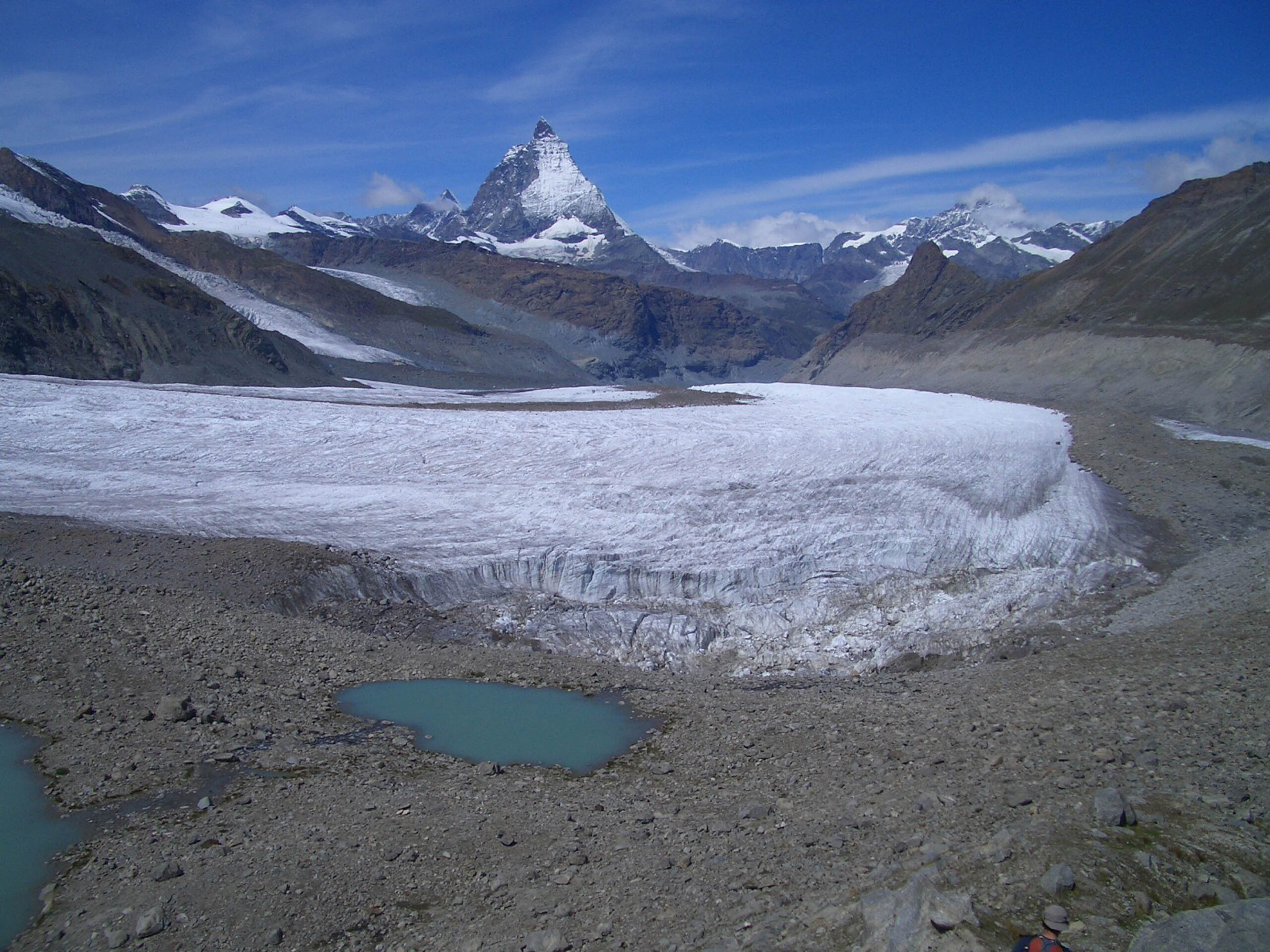
We’ve seen that climate change doesn’t only affect the size of Gornergletscher, but also influences ice dynamics. Moraine formation is altered and lake Gornersee, with its special effect on glacial flow, has disappeared (at least the glacier-dammed part did). The glacier will keep changing and the Gornergrat ridge to the north of it offers a beautiful viewpoint to see the glacier system falling apart.
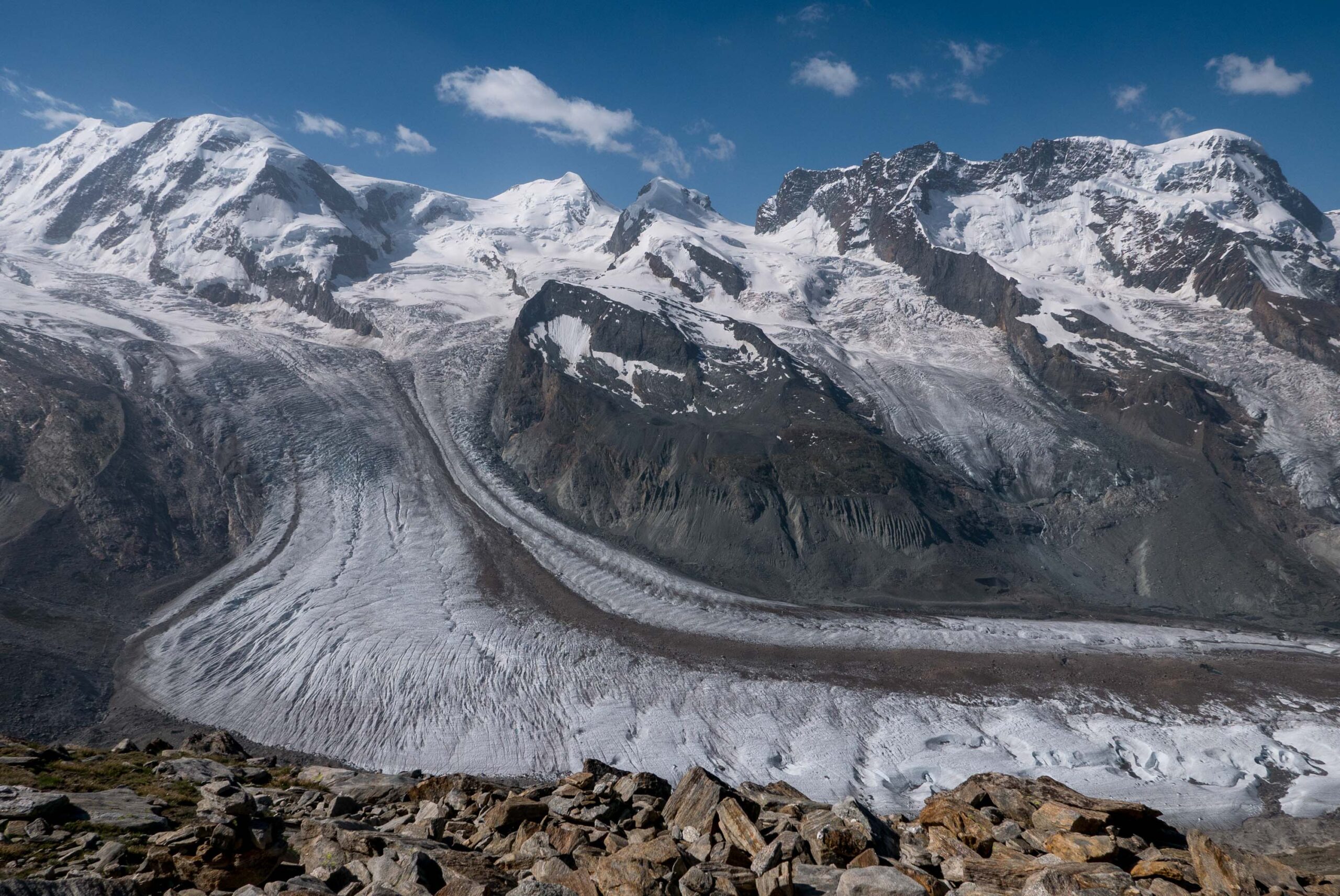
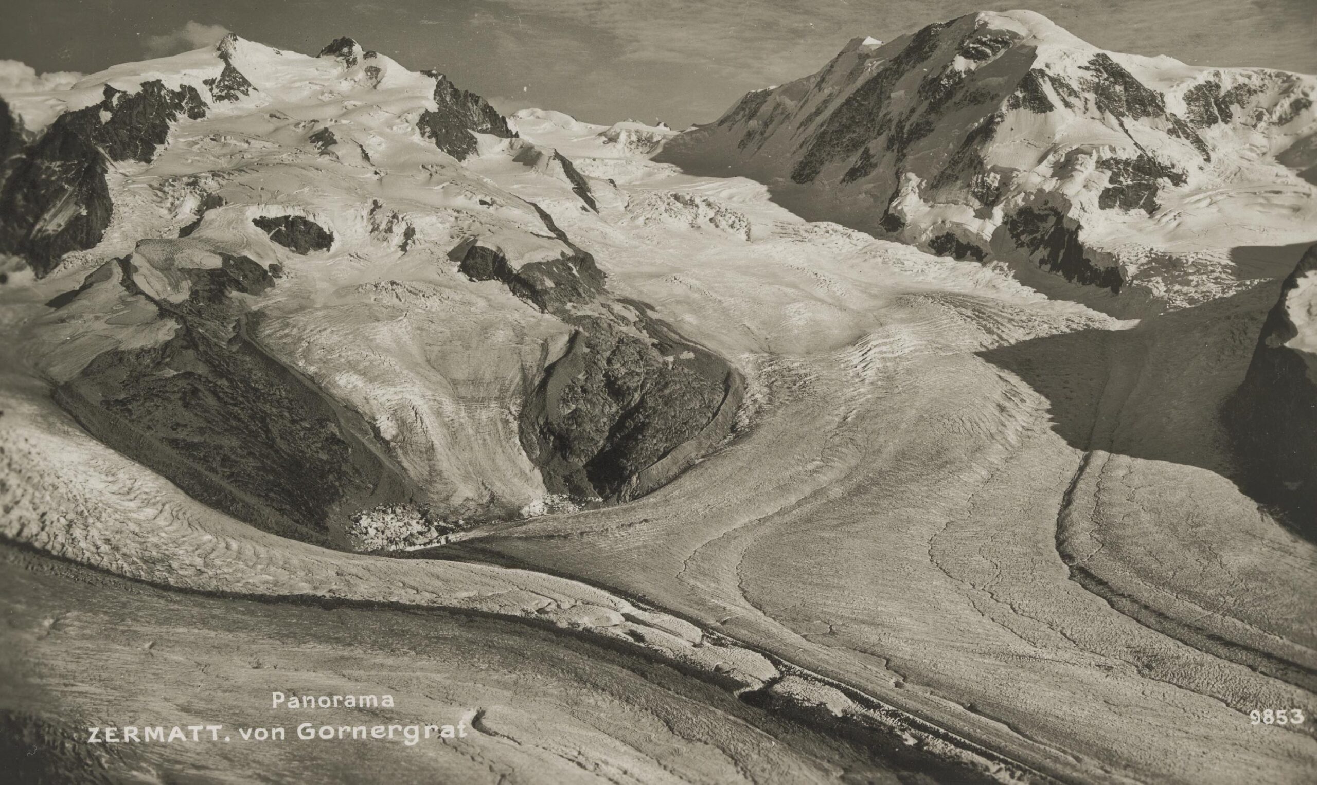
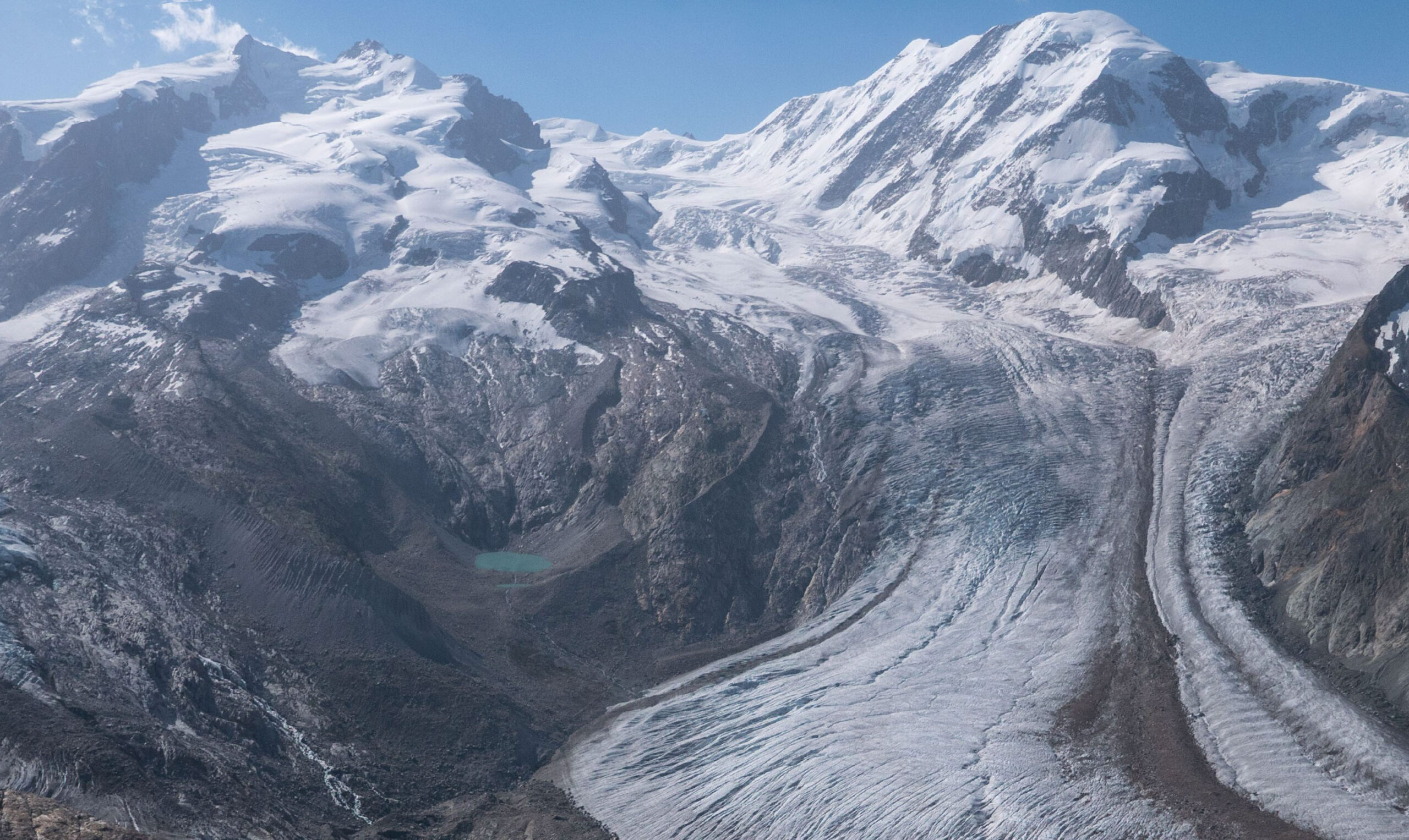
Gornergletscher in ca. 1920 (left) and 2022. Source 1920: Library ETH Zürich, PK_018095.
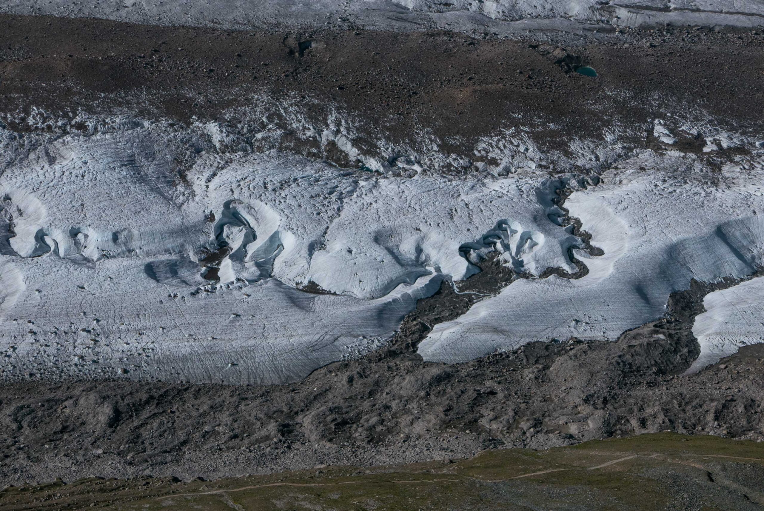
Gornergrat is a ridge 3000 m high to the north of Gornergletscher. A mountain rack railway leads from Zermatt to the top of the ridge. Thousands of people take the train in summer every day to see all those glaciated peaks surrounding the exclusive town of Zermatt. Below them, Gornergletscher dominates the view. On its surface, meltwater streams have formed meanders. Just like rivers do on land.
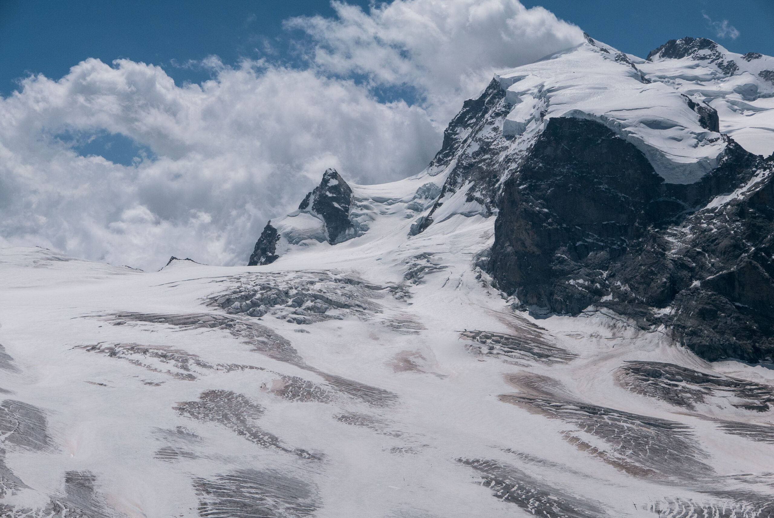
To the south of Gornergletscher, four smaller glacier descend the shaded side of a chain of mountains well over 4000 m high. All four have lost contact with Gornergletscher. Unterer Theodulgletscher and Triftgletscher did so in the mid-1990’s, Breithorngletscher around 2010 and Schwärzegletscher finally did in 2019. As mentioned before, tributary-Gornergletscher was disconnected from Grenzgletscher in 2018. As a result, the snout is receiving less ice, while melt is increasing. Therefore, Gornergletscher can’t survive and only the highest summits will be able to hold on to some glacial relicts.
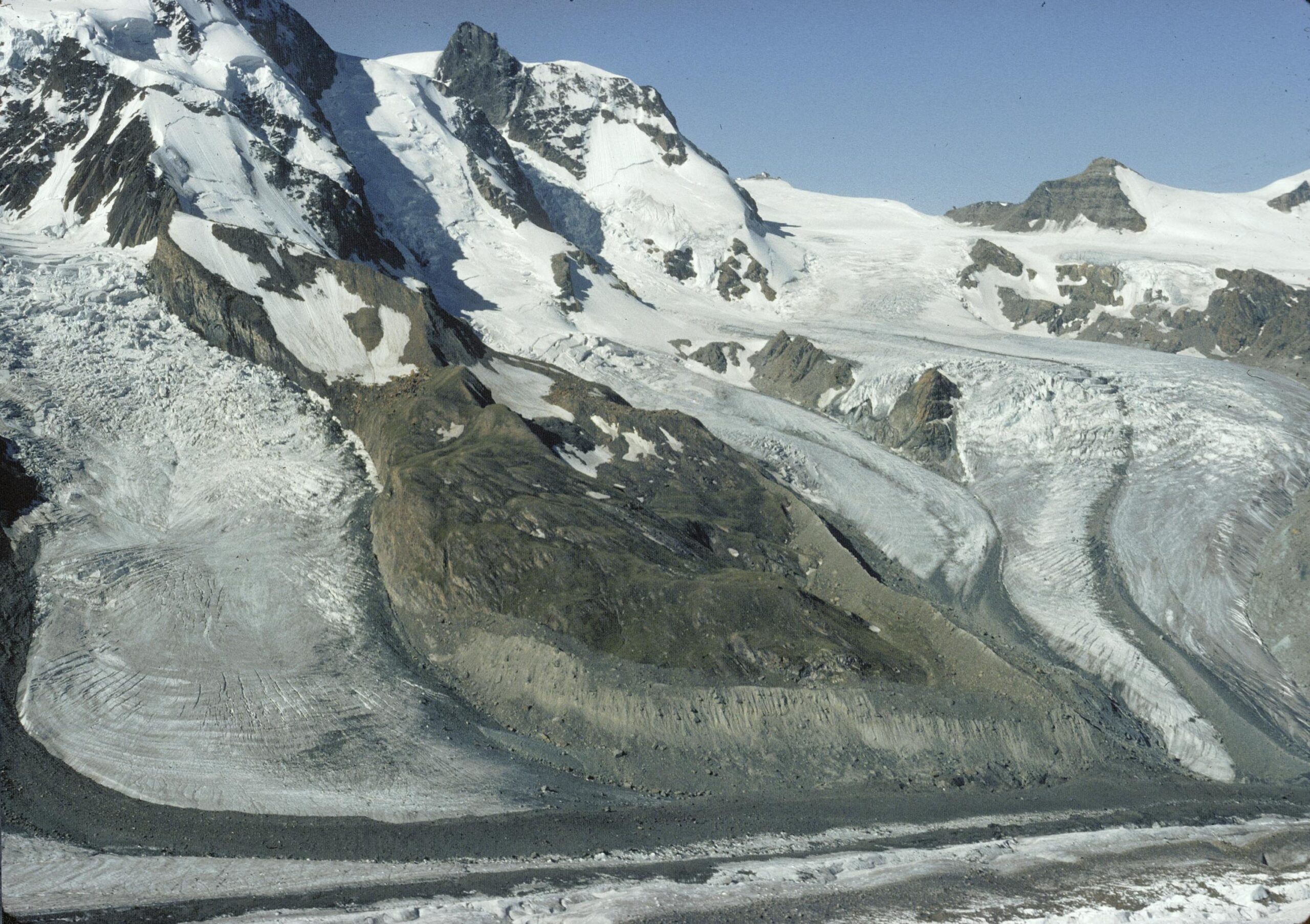
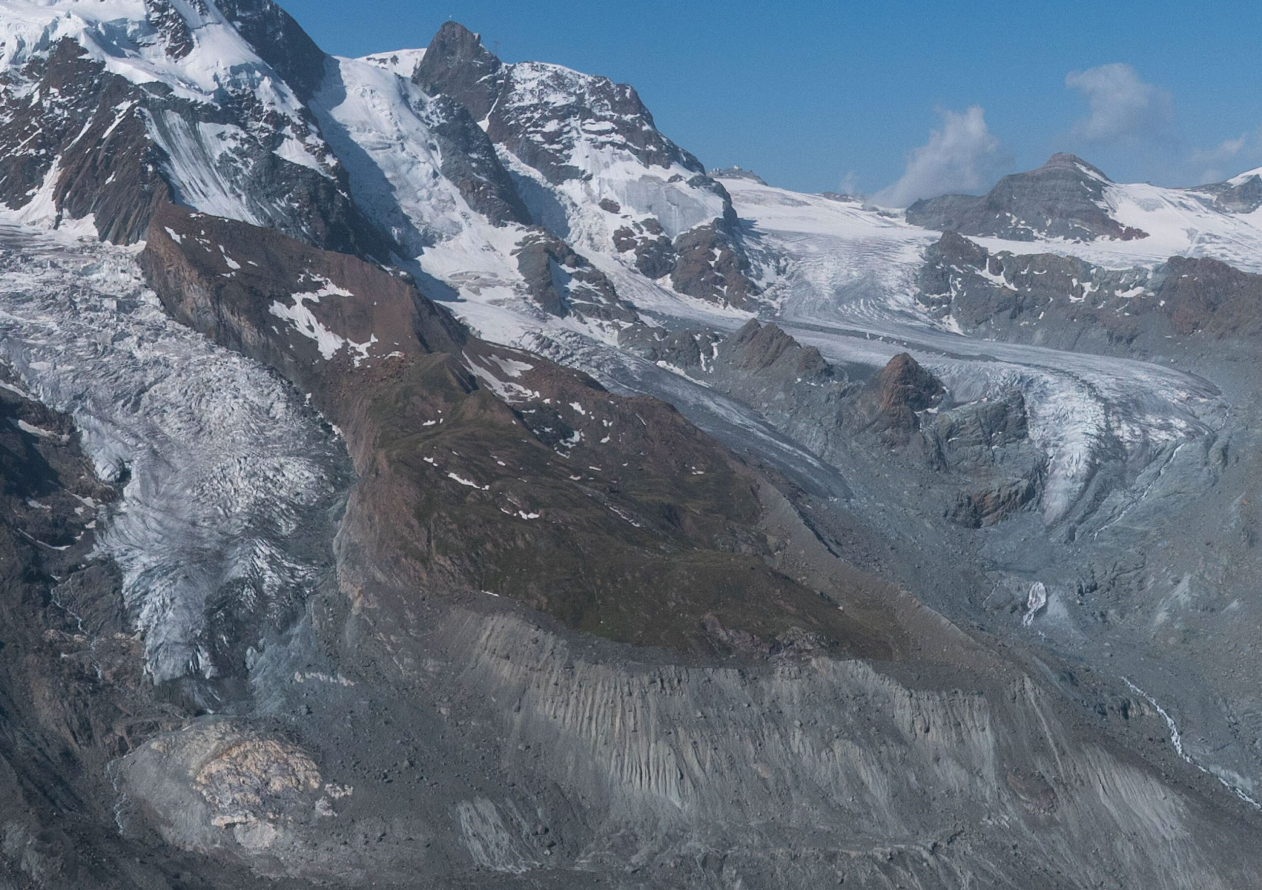
Breithorngletscher and Unterer Theodulgletscher in 1979 (left) and 2022.Both no longer reach Gornergletscher. Source 1979: Library ETH Zürich, Dia_385-12489.
Search within glacierchange: