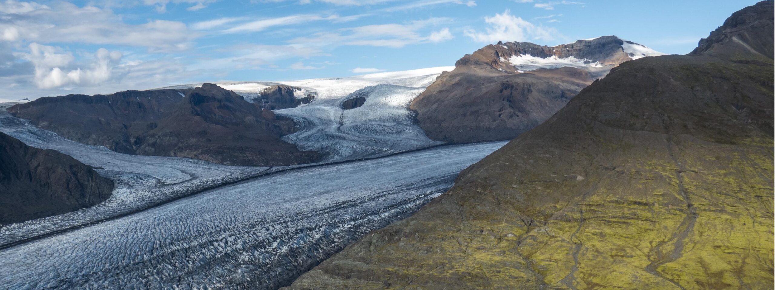
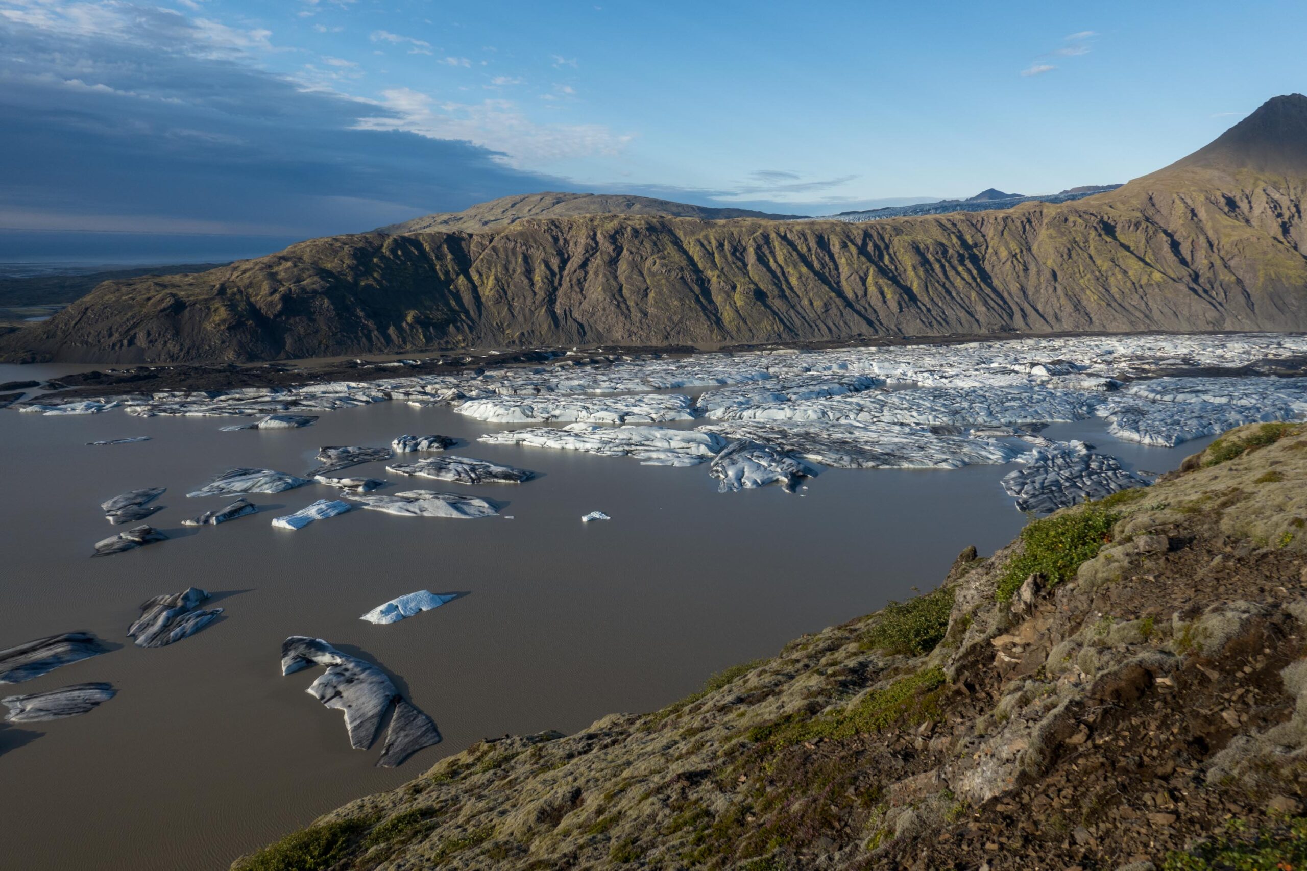
Heinabergsjökull is a southeastern outlet glacier of Vatnajökull. Its long snout is confined by mountains and used to dam two lakes.
Heinabergsjökull starts on Breiðabunga, a 1500 m high dome in the southeast of Vatnajökull ice cap. Three tributary glaciers plunge down from the dome and merge to form Heinabergsjökull. Its snout is some 14 km long and confined by two mountain ridges: Hafrafell to the west and Geitakinn to the east.
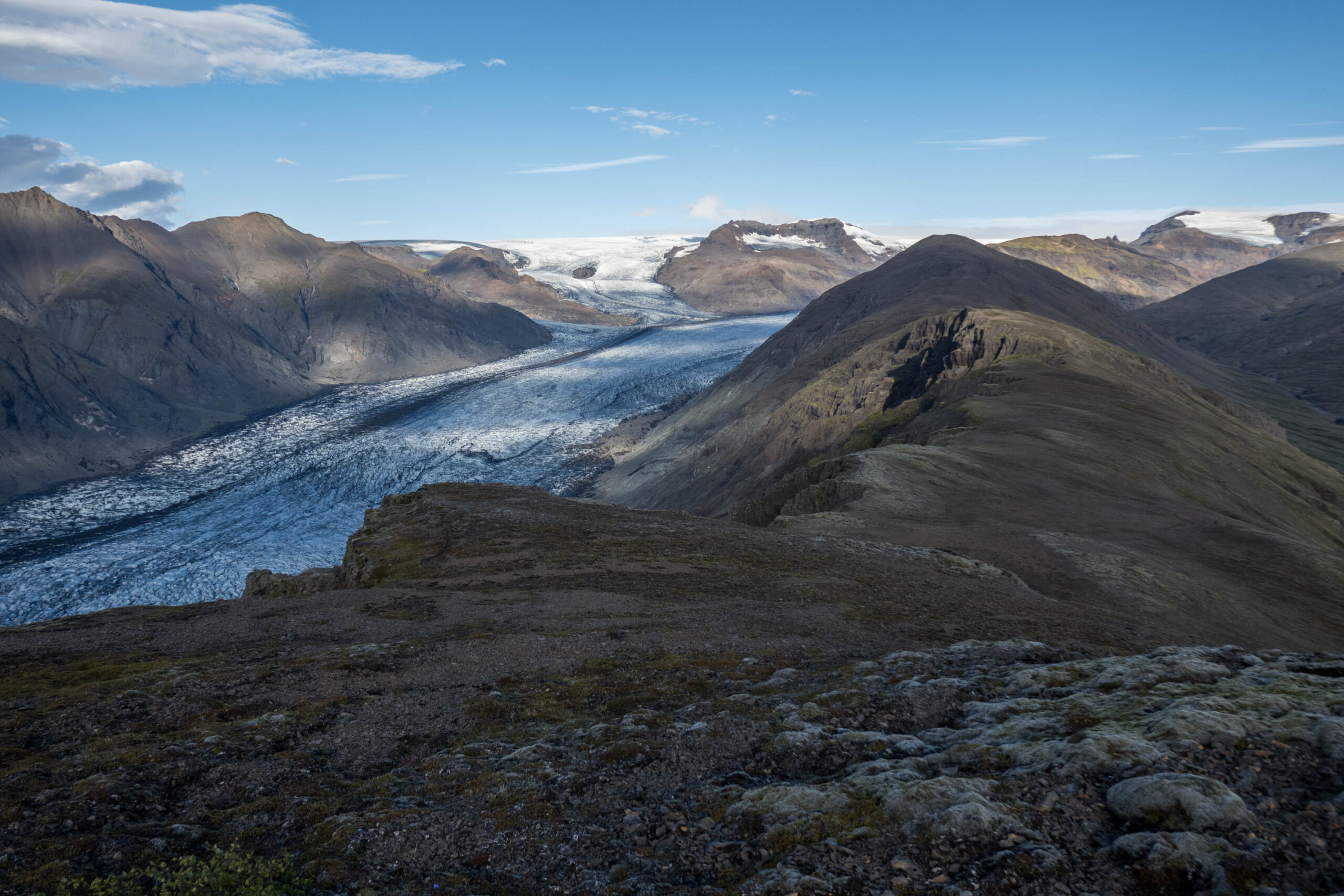
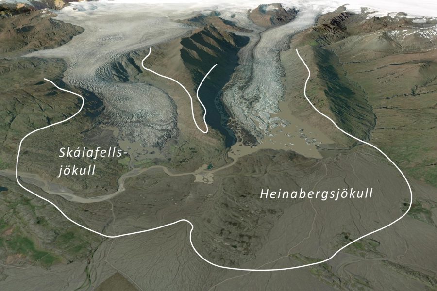
The snout nowadays terminates in a lake, after having receded 3 km since the end of the 19th century. Back then, the glacier merged with Skálafellsjökull in the west and possibly with Fláajökull in the east. But when Iceland was first settled a thousand years before, the glaciers were virtually non-existent and the valley that now holds Heinabergsjökull was vegetated (Björnsson, 2017: 473).
All the Vatnajökull outlet glaciers advanced from the 1400’s onwards due to a cooling climate. In the following centuries the encroaching ice and glacial rivers destroyed agricultural land. As Heinabergsjökull grew, tributary valleys became blocked by the ice. Consequently, these valleys filled with meltwater. Once the water pressure had risen high enough, the lakes would drain in a relatively short period. Such sudden floods or jökulhlaups destroyed almost all farms in front of Heinabergsjökull (Thorarinsson, 1939).
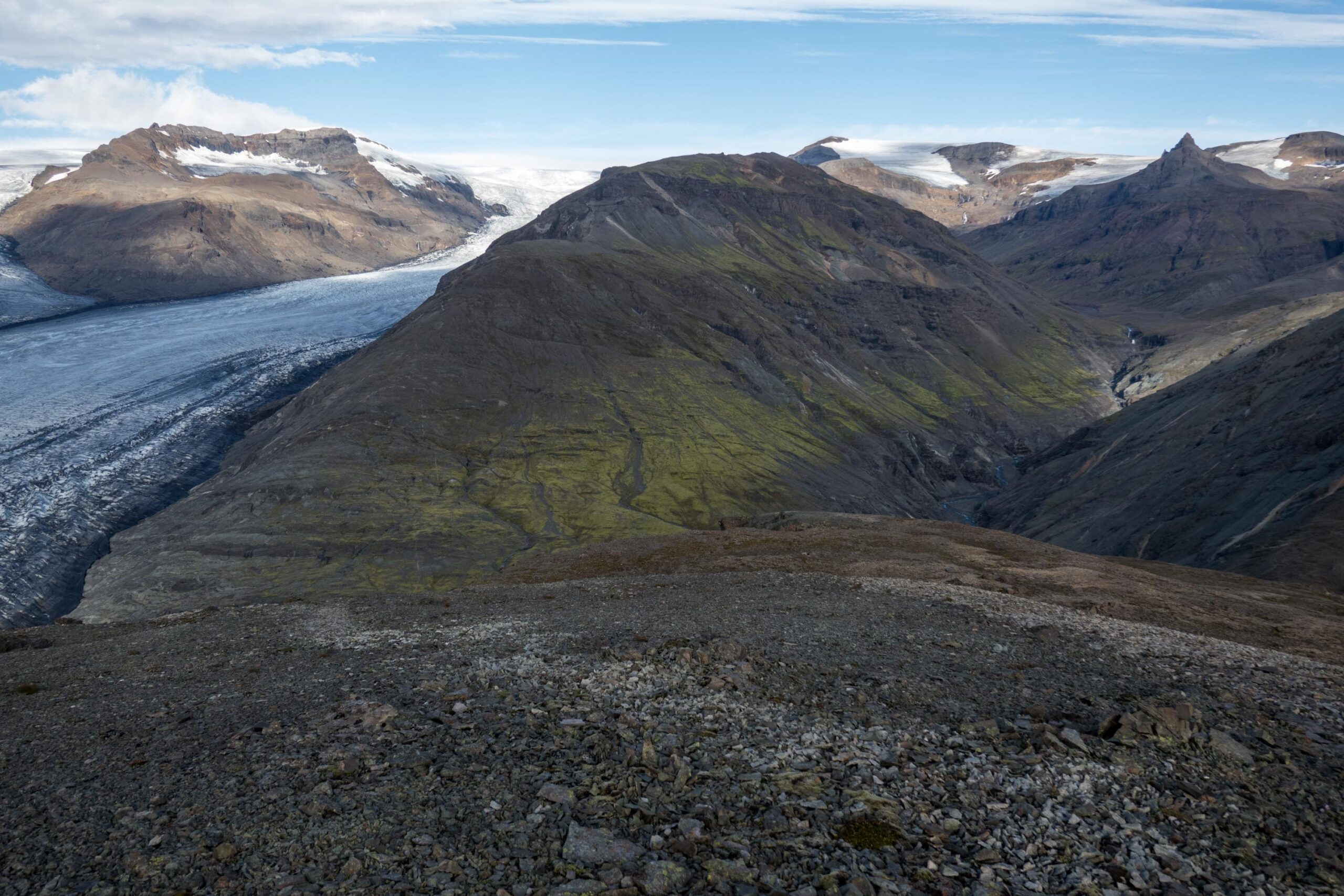
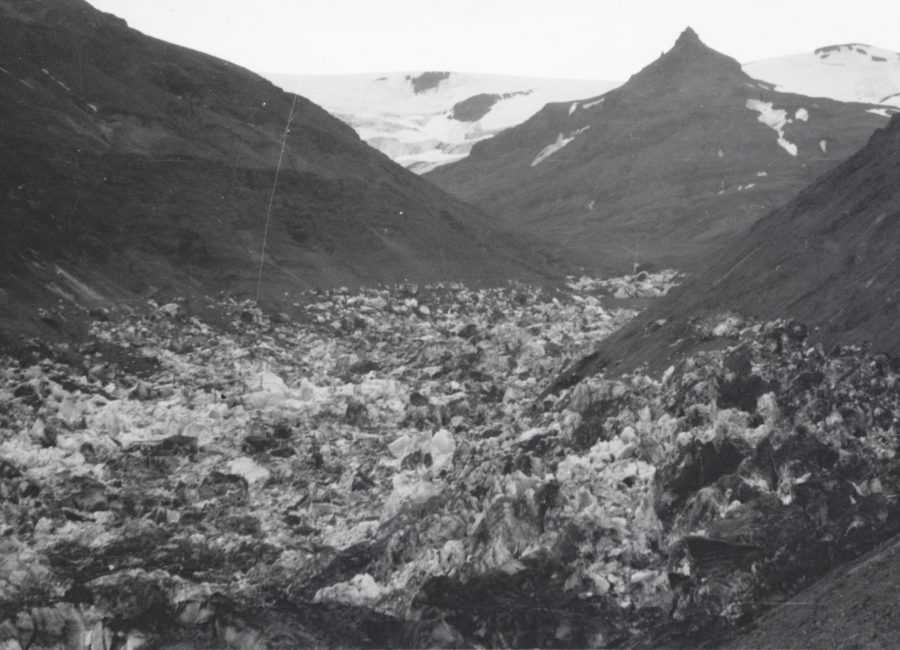
There used to be two ice-dammed valleys, both along the eastern side of Heinabergsjökull. The most dangerous one of the two was Vatnsdalur (Water valley). Its first recorded outburst occurred in 1898. Before that time, the glacier was so thick that the water of Vatnsdalur simply flowed over a bedrock threshold into Heinabergsdalur, another valley. After the first outburst, the lake emptied almost every summer, in later years even twice a year. Although the size of the floods decreased as the glacier thinned, the ice-dam was able to hold back some water until as recently as 2016.
Heinabergsjökull at the entrance of Vatnsdalur in 1938 (left) and 2023. The lake had just drained in 1938. Photo 1938: Sigurdur Thorarinsson, Jöklarannsóknafélag Íslands.
The other ice-dammed lake was located at the mouth of Heinabergsdalur and was called Dalvatn Lake. It came into existence as soon as the advancing glacier reached the valley entrance around 1750 and ceased to exist in the 1920’s, when the glacier retreated from the valley. Although the capacity of the lake was considerably smaller than Vatnsdalur (Björnsson, 2017:474), it was the only one producing floods during the 19th century. The ice dam at Vatnsdalur was too strong in het heydays of the glacier, so the water flowed over a col into Dalvatn.
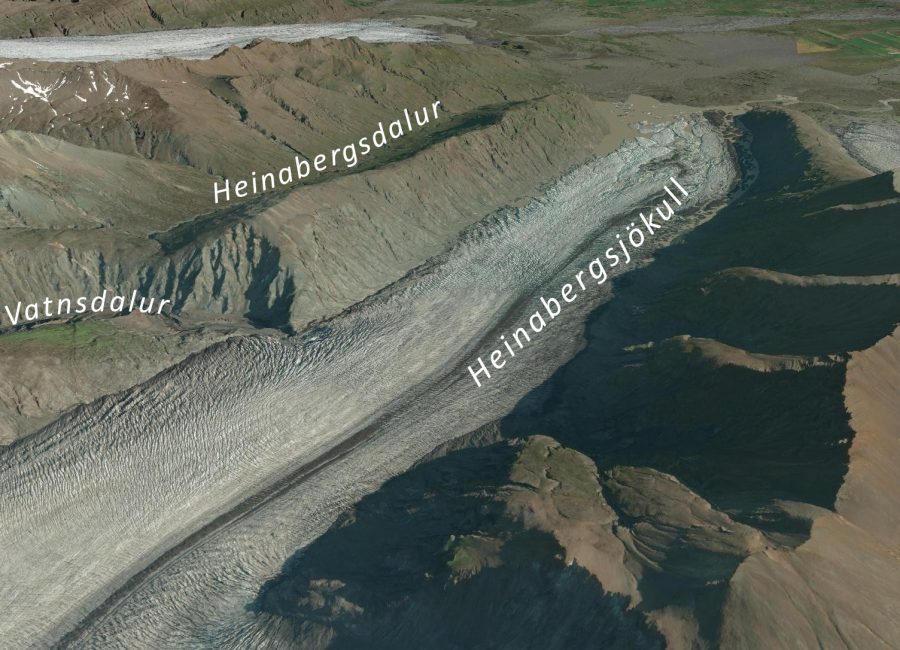
As the glacier thinned from the late 19th century, the maximum water level in the lakes lowered. Those different stages of ice thickness can therefore be recognized as former shorelines in the mountain slopes. At Dalvatn, 8 of such shorelines are present at different elevations. At Vatnsdalur, the sides of the valley even contain 12 prominent shorelines (Bennett et al., 2000).
Vatnsdalur lake has contributed to eroding the bed of Heinabergsjökull. With every drainage event, meltwater rushed underneath the glacier and transported a lot of sediment. Together with the erosional forces of the glacier, this gouged the glacier’s bed deep below sea level. In fact, the Heinabergsjökull overdeepening is the longest in Iceland, only after Breiðamerkurjökull. The snout lies in a 10 km long trench that is up to 220 m below sea level (Hannesdóttir et al., 2015a).
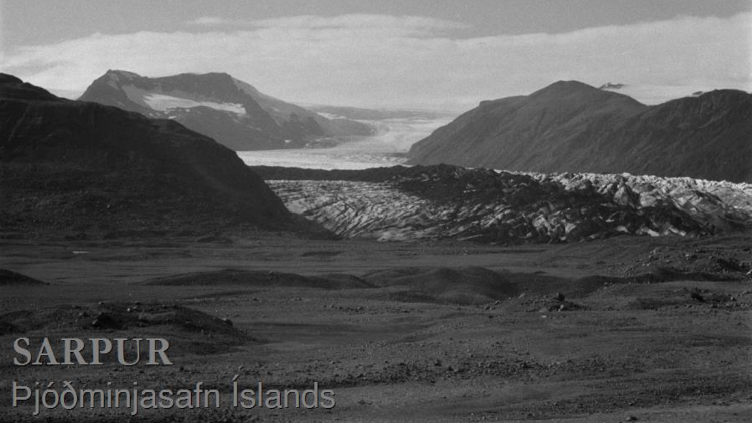
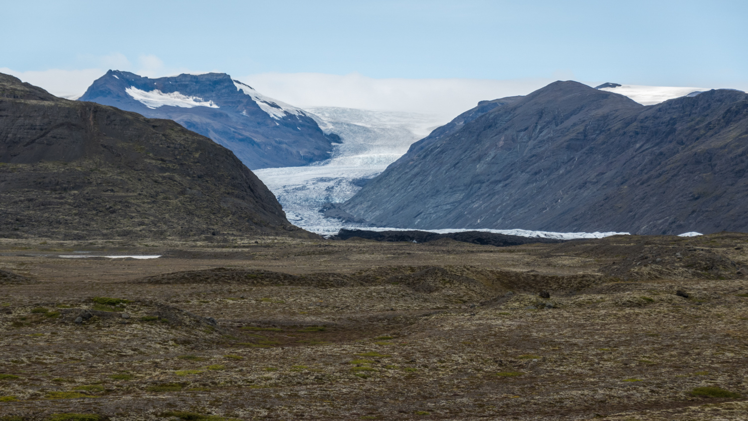
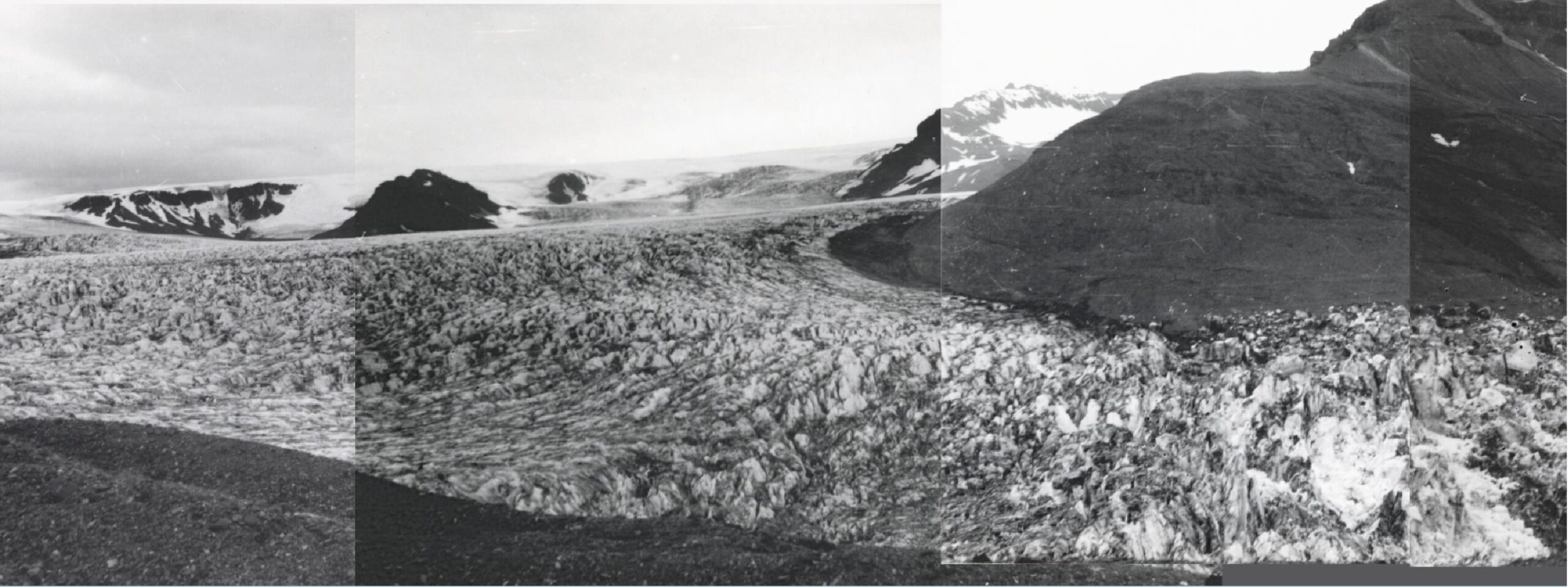
Heinabergsjökull in 1962 (left) and 2023. Photographer 1962: Björn Björnsson, Þjóðminjasafni Íslands nr. 1820-3.
When Heinabergsjökull was at its largest, its overdeepening wasn’t visible. After receding for a few decades, a first part of the lake appeared at the snout in the 1950’s. The lake expanded as the glacier retreated into the 1970’s, but since then the glacier length has hardly changed. That doesn’t mean melt stopped, though. The snout continued thinning and lost a staggering 300 m of its thickness since 1890, the total volume decreased by a third (Hannesdóttir et al., 2015b). By now, the lower 4 km of the glacier floats in the water and is susceptible to disintegration.
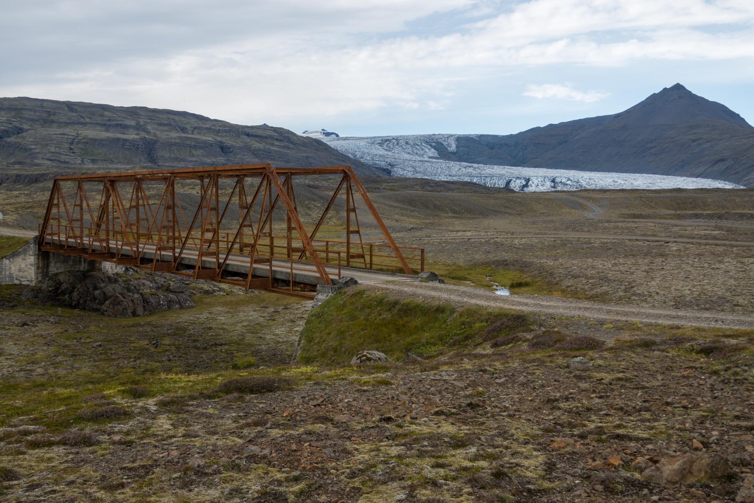
Heinabergsjökull’s wasting snout doesn’t only prevent the lakes from refilling, it also alters the course of meltwater rivers. Before 1948, the glacier had two meltwater rivers: Landvatn drained in a easterly direction and Heinabergsvötn in a southeasterly direction. The latter river was a huge obstacle for travelers, so a bridge was built in 1947-1948. But a few months after completion, the river changed its course. The retreating glacier opened up a new route for the river, so it moved westwards and merged with Kolgríma, a river emanating from Skálafellsjökull. The bridge still spans the dry riverbed, a reminder of the changing nature of glaciers.
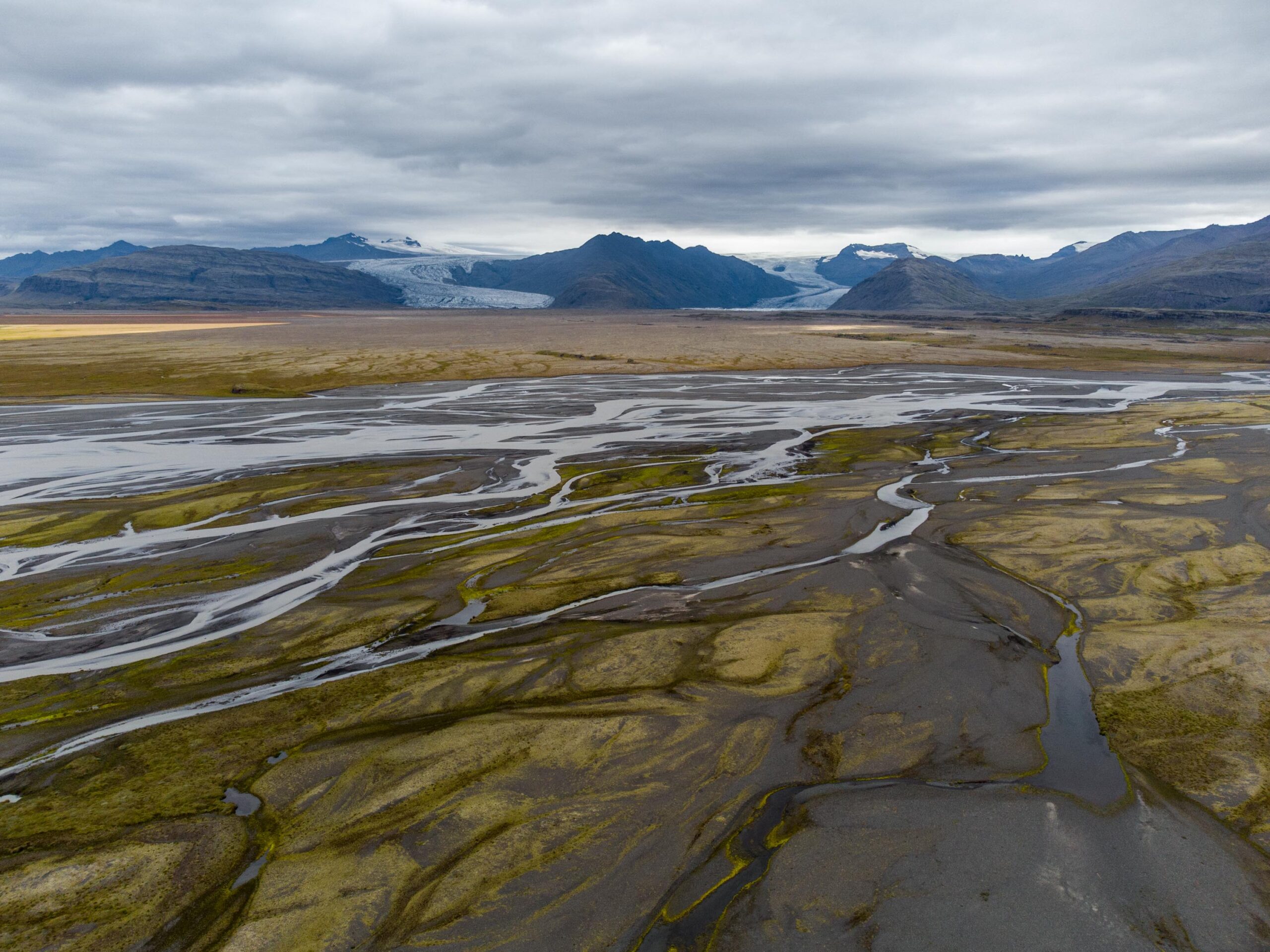
The foreland of Heinabergsjökull bears many marks of the former river courses. When the glacier was at its largest, meltwater was unconfined. If one of the ice-dammed lakes drained, chunks of ice would break loose from the snout. They stranded in the foreland and melted out, forming pits that are strewn over the braided outwash plain of Heinabergsjökull. But once the glacier retreated from its outwash head in the middle of the 20th century, rivers became confined and had to flow ice-parallel. They incised in stages, leaving a sequence of terraces along the shore of the proglacial lake (Evans & Orton, 2015).
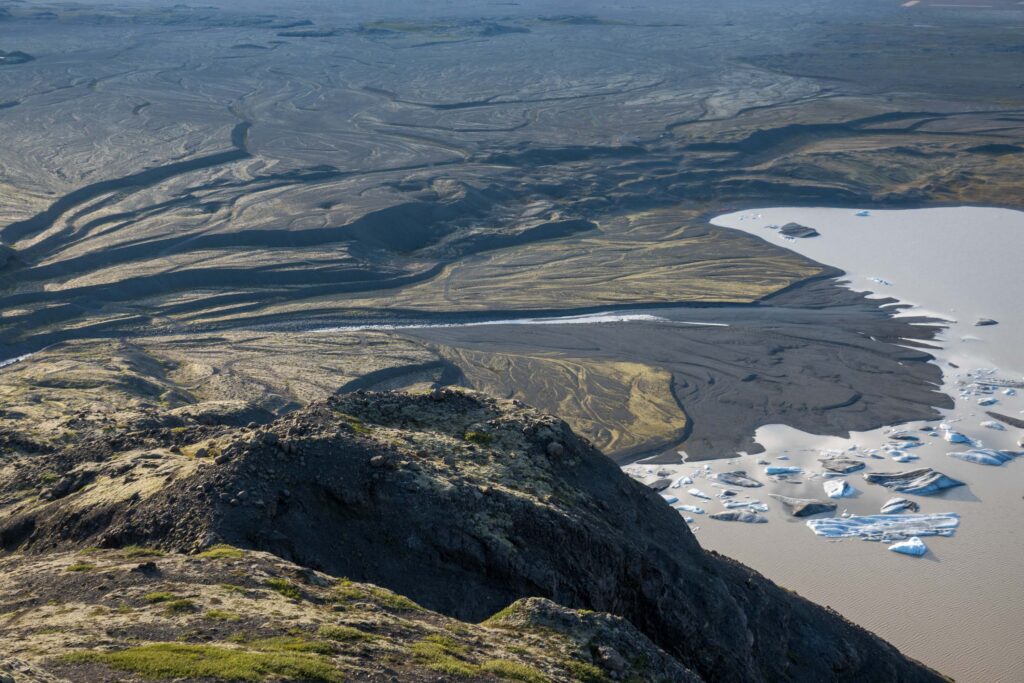
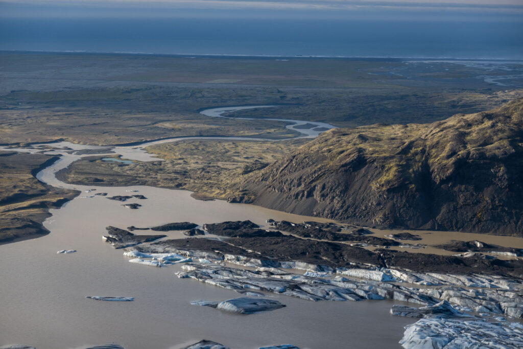
In the coming decades, the proglacial lake at Heinabergsjökull will expand as the glacier recedes. Now temperatures are about 1°C warmer than the 1980-2000 period, the glacier is modelled to lose another third of its volume. Should global warming lead to a temperature increase of 2°C, then Heinabergsjökull will completely disappear by 2100 (Hannesdóttir et al., 2015a). Only the upper parts of Breiðabunga will remain glaciated in such a scenario, which is far from unlikely.
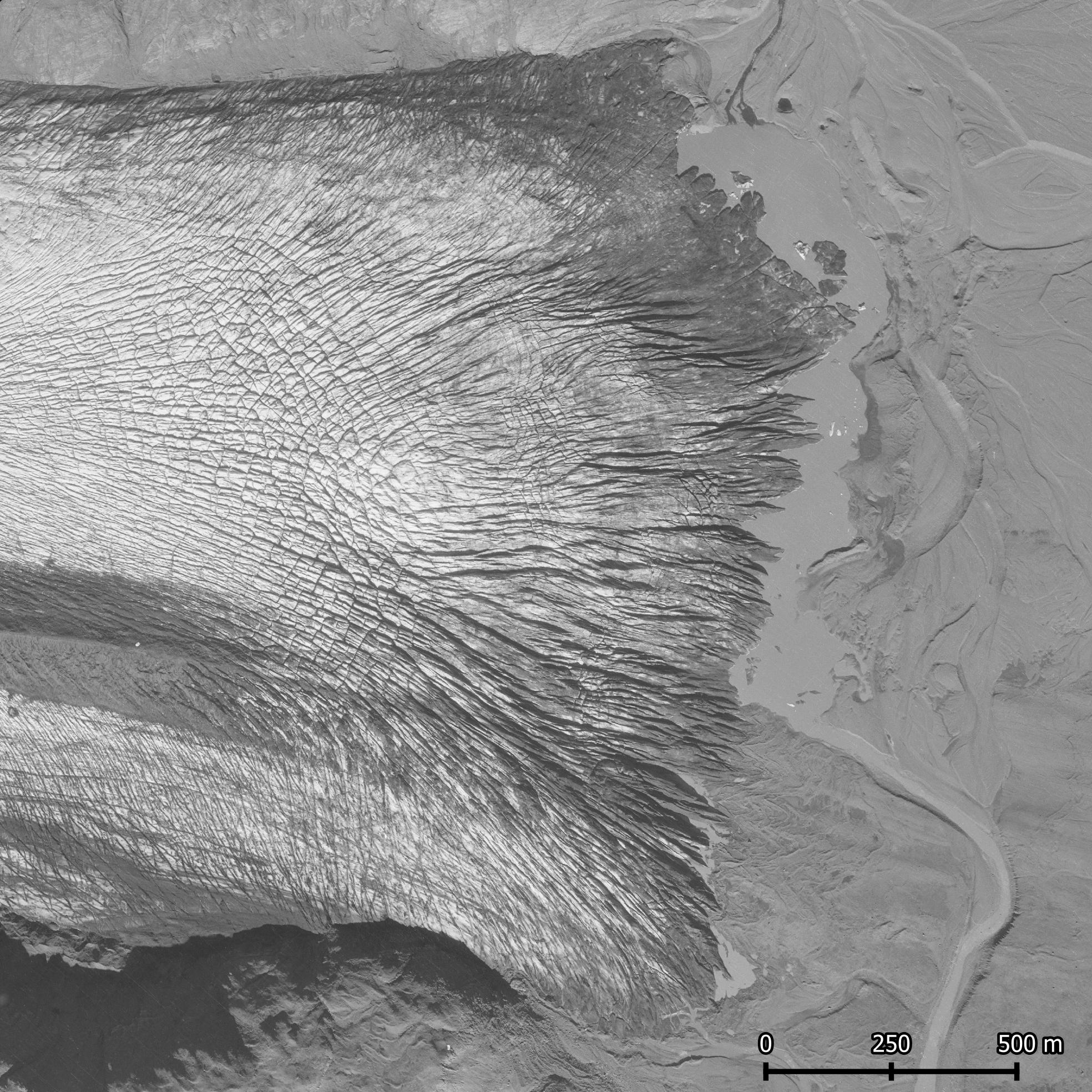
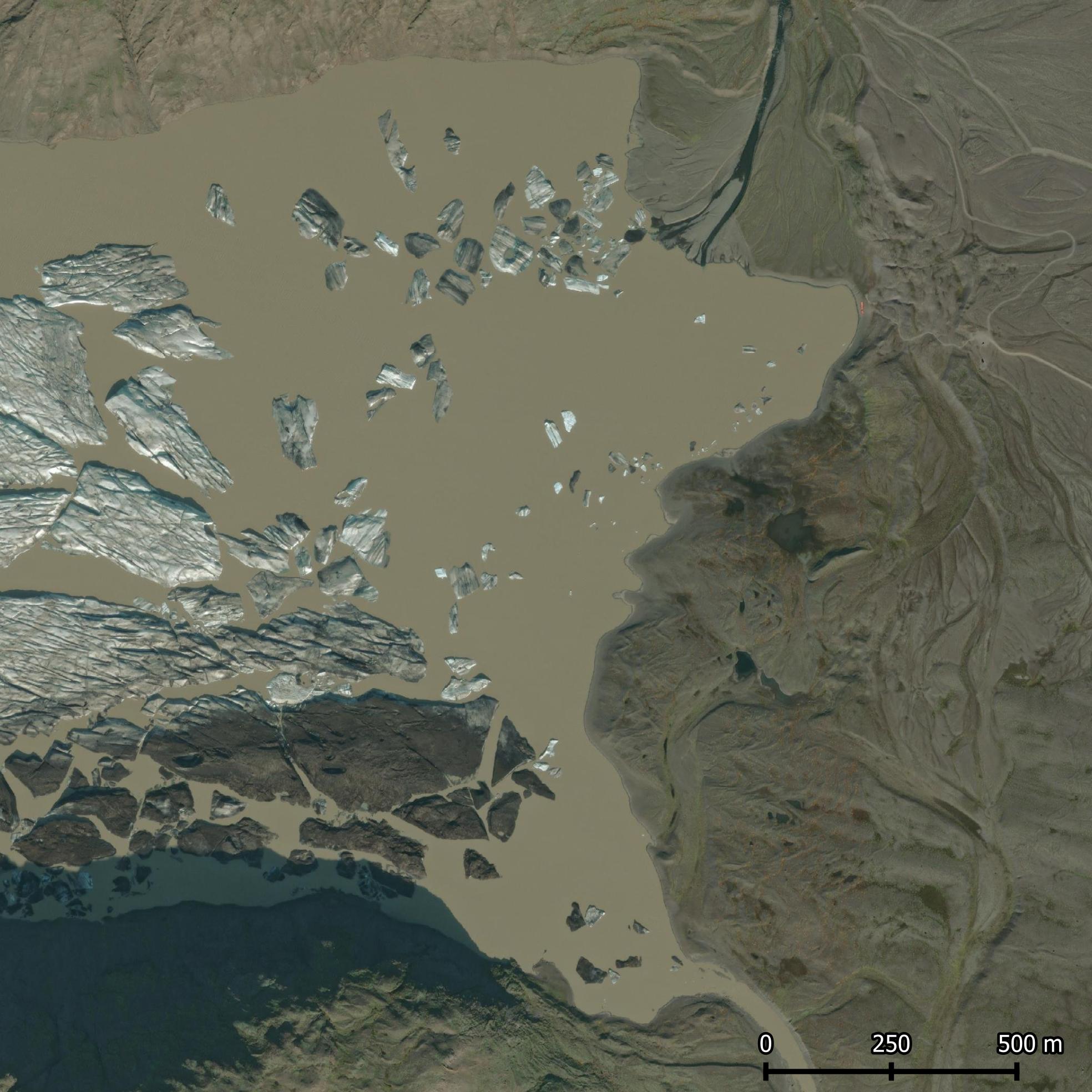
The snout of Heinabergsjökull in 1954 (left) and 2023. Sources: Landmælingar Íslands (1954) and ESRI World Imagery.
Search within glacierchange: