High above Kjøsnesfjorden there is a glacier on both sides of Tverrfjellet: Marabreen and Lundabreen. You can get there by taking Norway’s steepest path.
Kjøsnesfjorden is a beloved fjord because of its steep mountain sides. All the way at the end of the fjord lies Lunde, a hamlet of only two farms. They were very remote, until the Fjærland tunnel was opened in 1986. Since then road E5 runs through Kjøsnesfjorden, which also make Marabreen and Lundabreen more accessible.
Kjøsnesfjorden, August 2021.
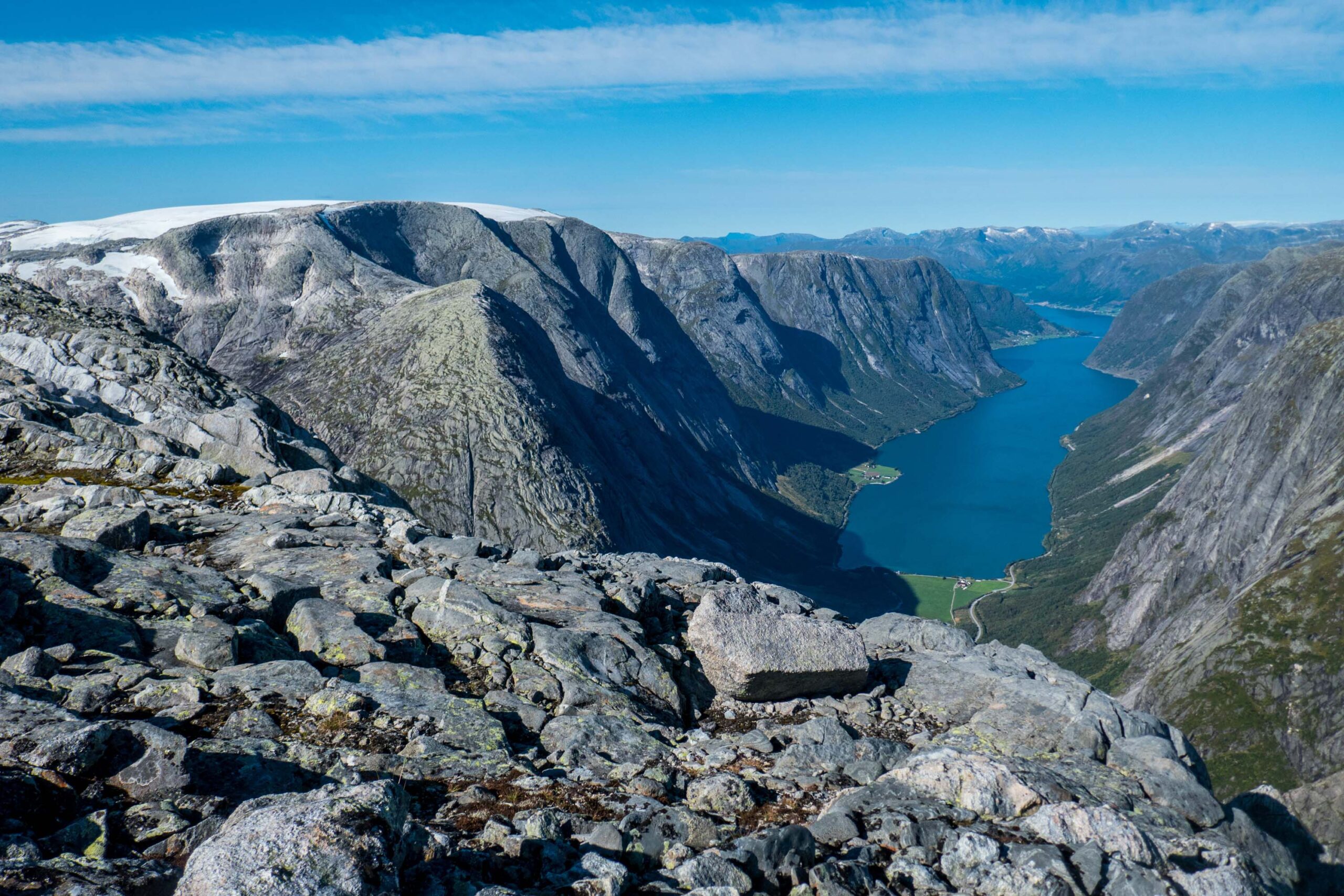
Traffic rushes over route E5 alongside Lunde. The steep path goed op the slopes in the background.
Nepalese Steps
Where the road disappears into the mountain, there is a small hiking trail. ‘’The steepest path in Norway’’, according to the farmer of Lunde. She may very well be right, as the trail ascends 500 m through a couloir called Lundeskaret. Rather than being a trail, it’s more a stairway with countless steps. It was constructed by Nepali people in 2014-2016 as part of an development cooperation between Norway and Nepal. The old path was severely eroded by water and avalanches.
View of Lundabreen once out of the couloir, August 2021.
Flattening Up High
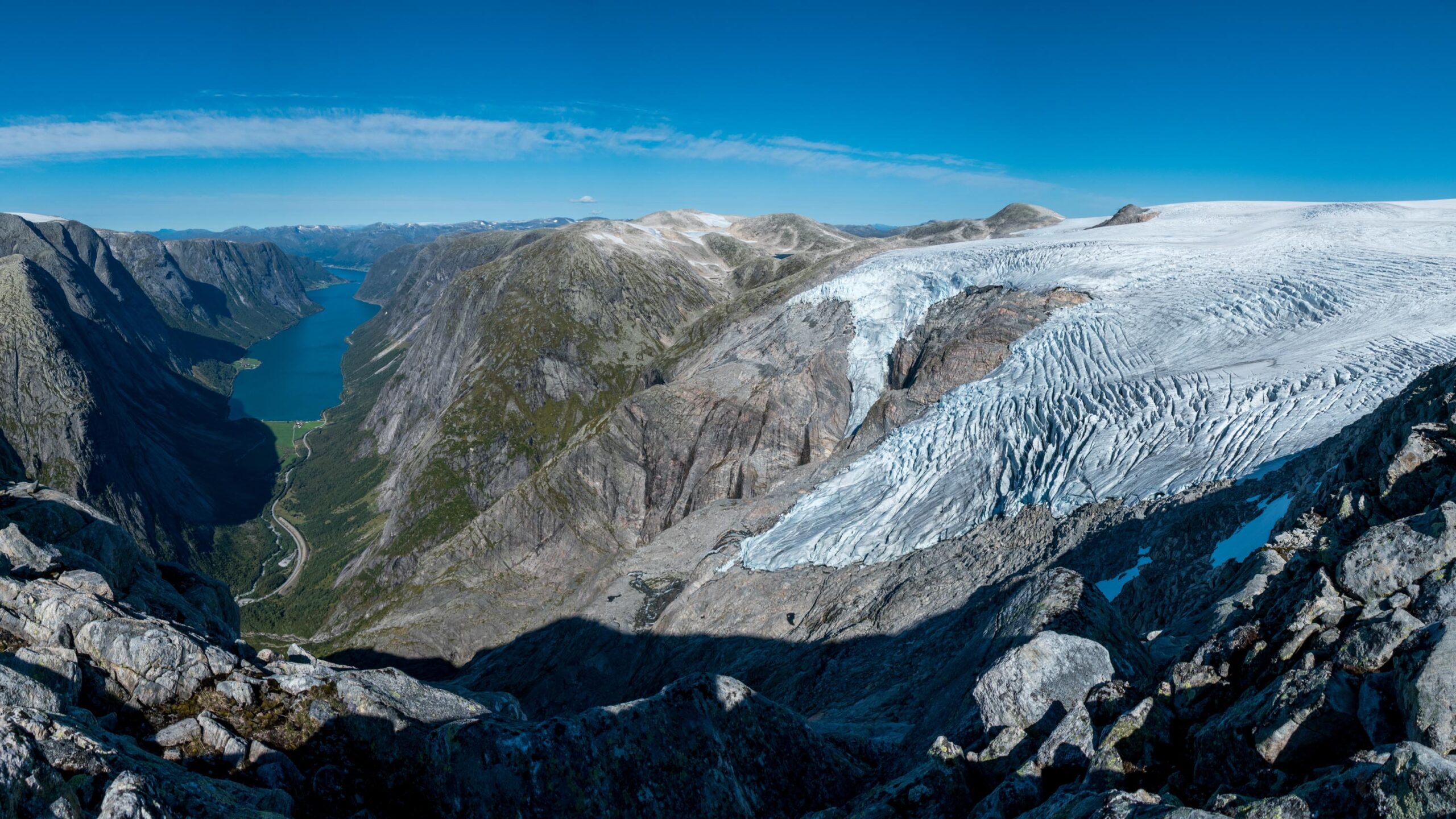
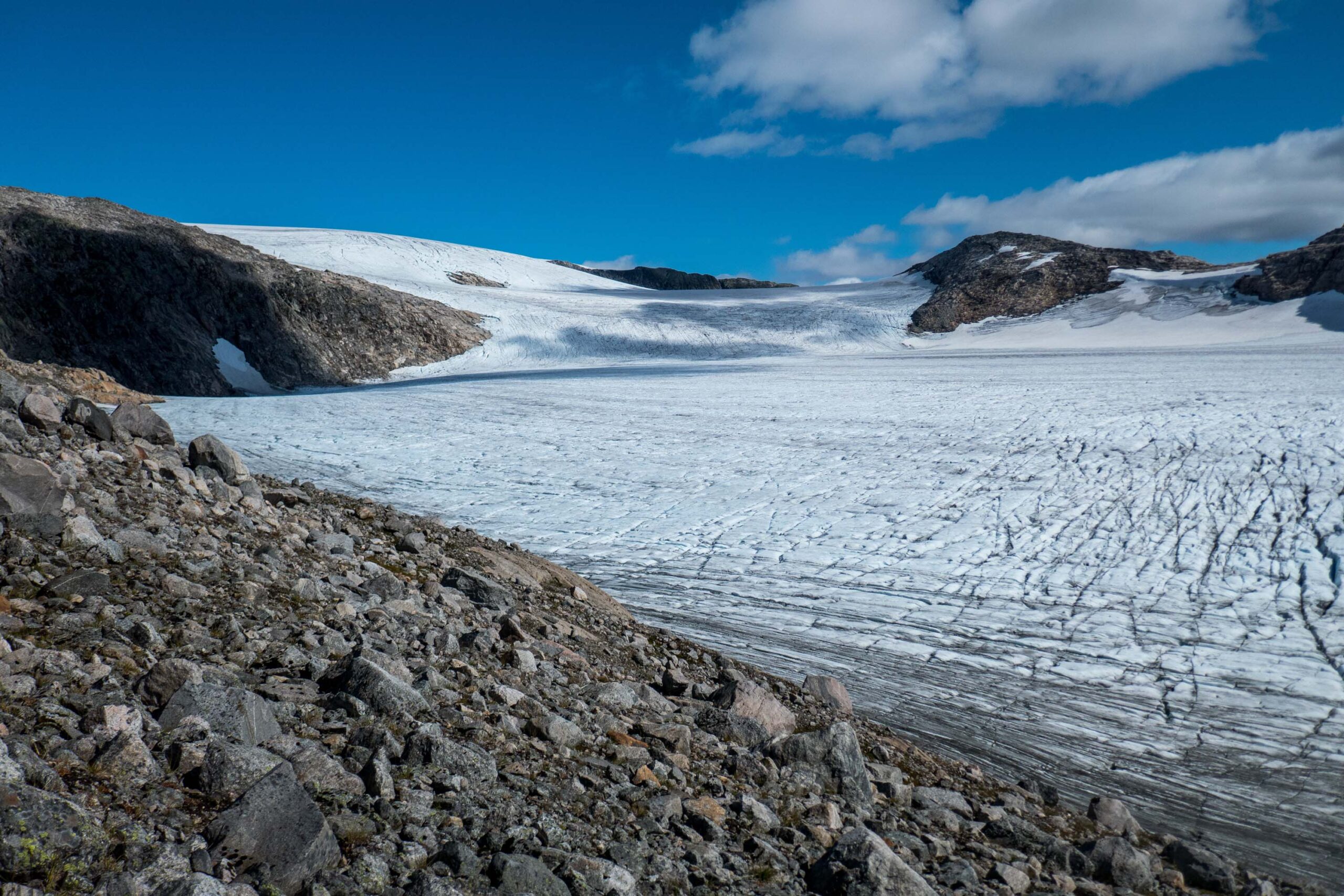
Despite the infrastructural improvements, this part of Jostedalsbreen remains very quiet. Maybe the steep terrain scares people off, or a snapshot of Kjøsnesfjorden is all they care for. That’s a shame, because once above the couloir a very nice landscape opens up. The terrain eases off at 1000 m and more and more of the surrounding glaciers comes into sight: Grovabreen, Lundabreen and Marabreen.
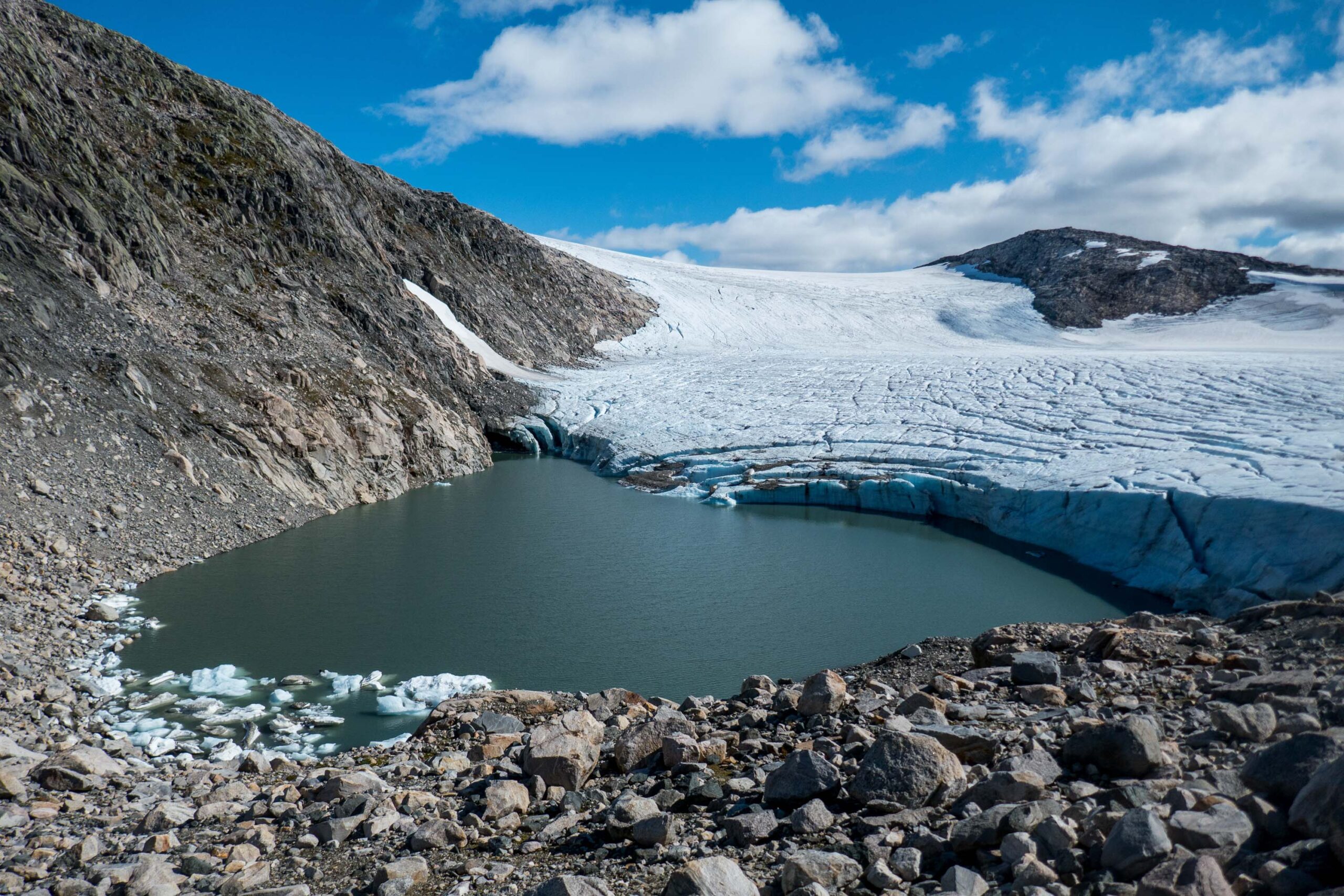
The snout of Marabreen terminates in a lake, August 2021.
Mara Lake
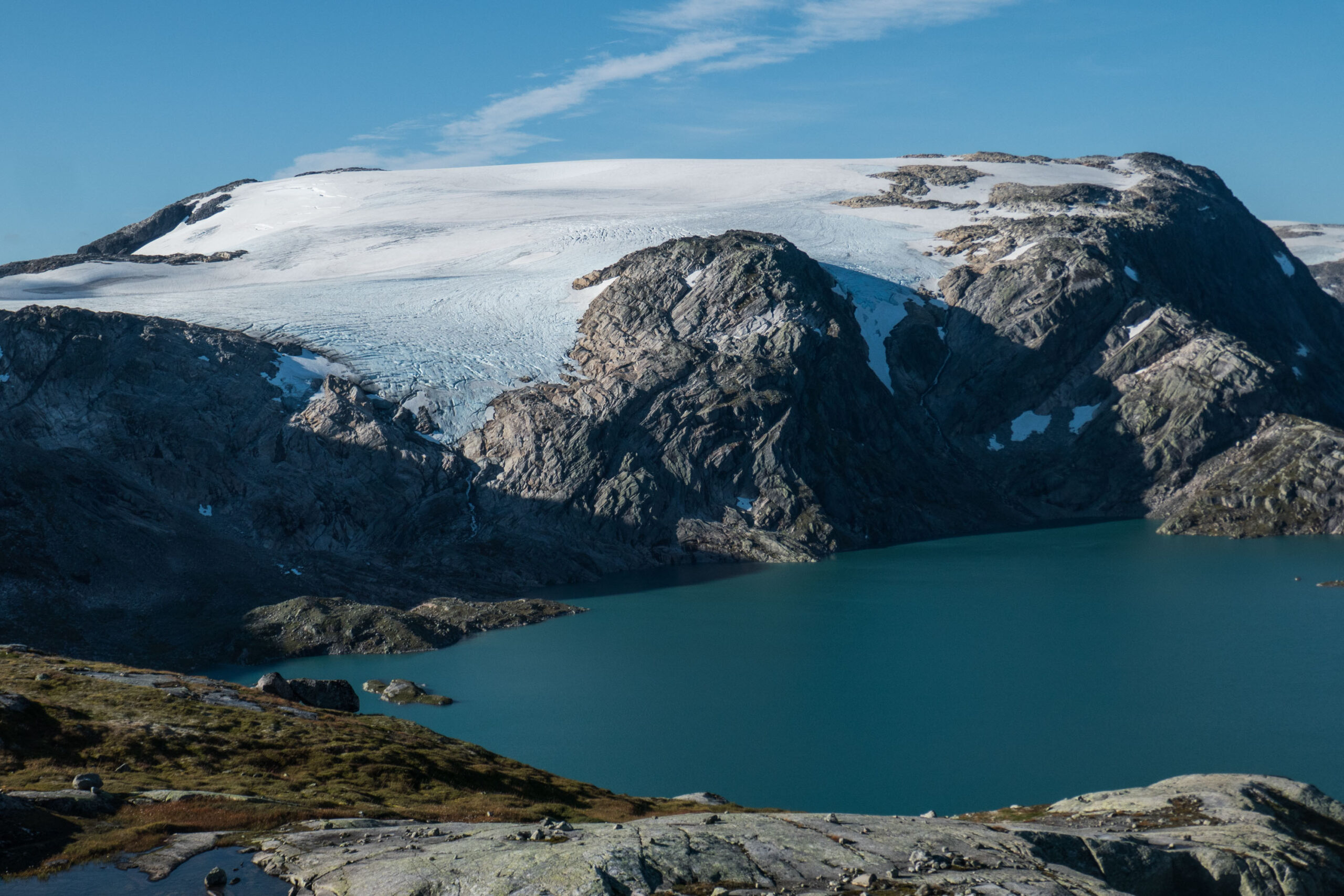
For a kilometer, the trail is more or less on flat terrain. Close to Trollavatnet reservoir, the trails goes up again towards Marabreen, an outlet glacier of Jostedalsbreen. Marabreen has a very flat snout and ends in a small lake. Sheets of ice float in the water. On the opposite side of lake Trollavatnet you see Troget mountain with a unnamed glacier in front of it.
Icebergs
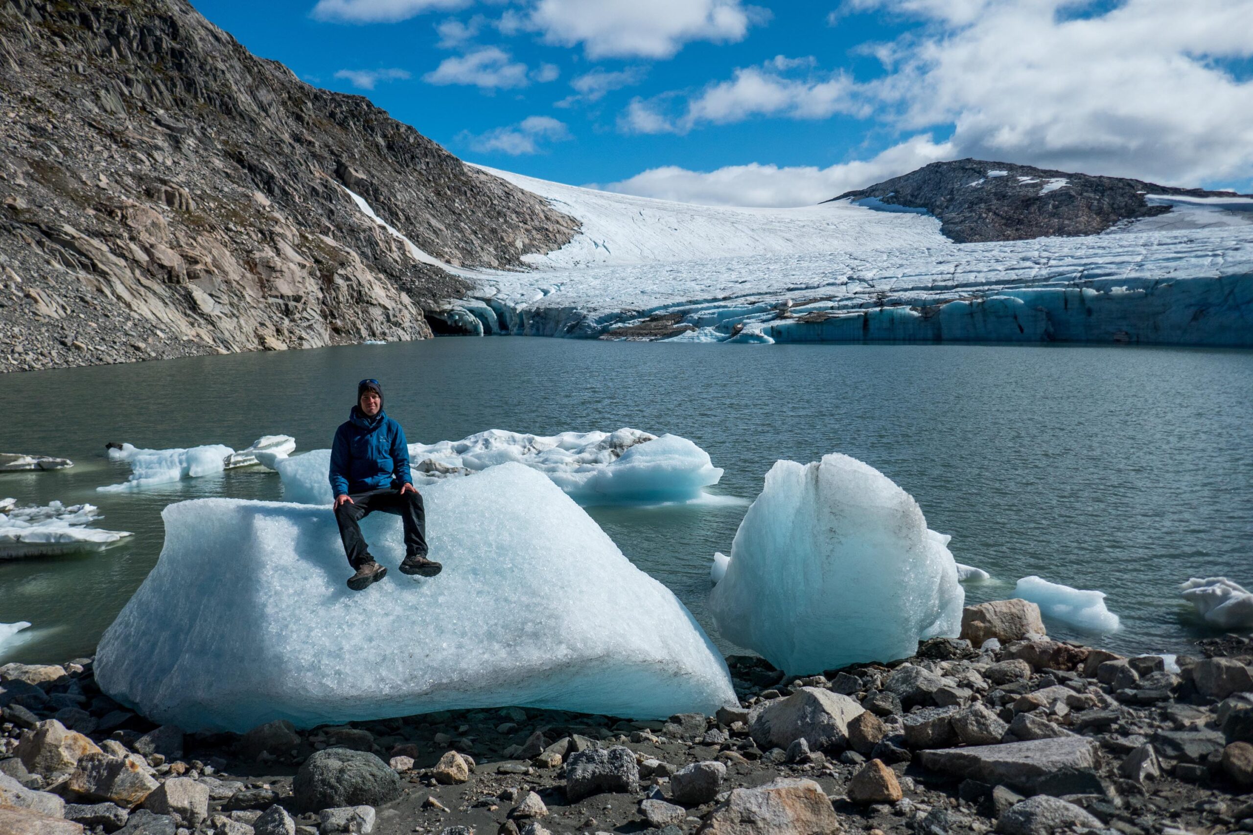
There is a second lake hidden in the northwestern corner of Marabreen. This one is dammed by the glacier. Every once in a while the lake drains, usually towards the end of summer. Suddenly the water finds a way underneath the glacier and the lake disappears. Icebergs lay stranded on the shores. Alongside the lake there is a clear side moraine that indicates how far Marabreen reached during the Little Ice Age, roughly in the period 1750-1860.
Icebergs lay stranded on the shore, August 2021.
Mount Troget above Trollavatnet, August 2021.
Lundabreen high above Kjøsnesfjorden, August 2021.
Tverrfjellet
North of Marabreen stands Tverfjellet (1494 m). The mountain marks the southern tip of Jostedalsbreen and can be reached, albeit with a little bit of persistence. From its summit Tverfjellet gives a splendid view over Kjøsnesfjorden and Lundabreen, a glacier named after the hamlet deep down in the valley. From here, it’s not hard to imagine how glaciers have carved out the fjords of Norway. And somewhere in the future they will do so again.


