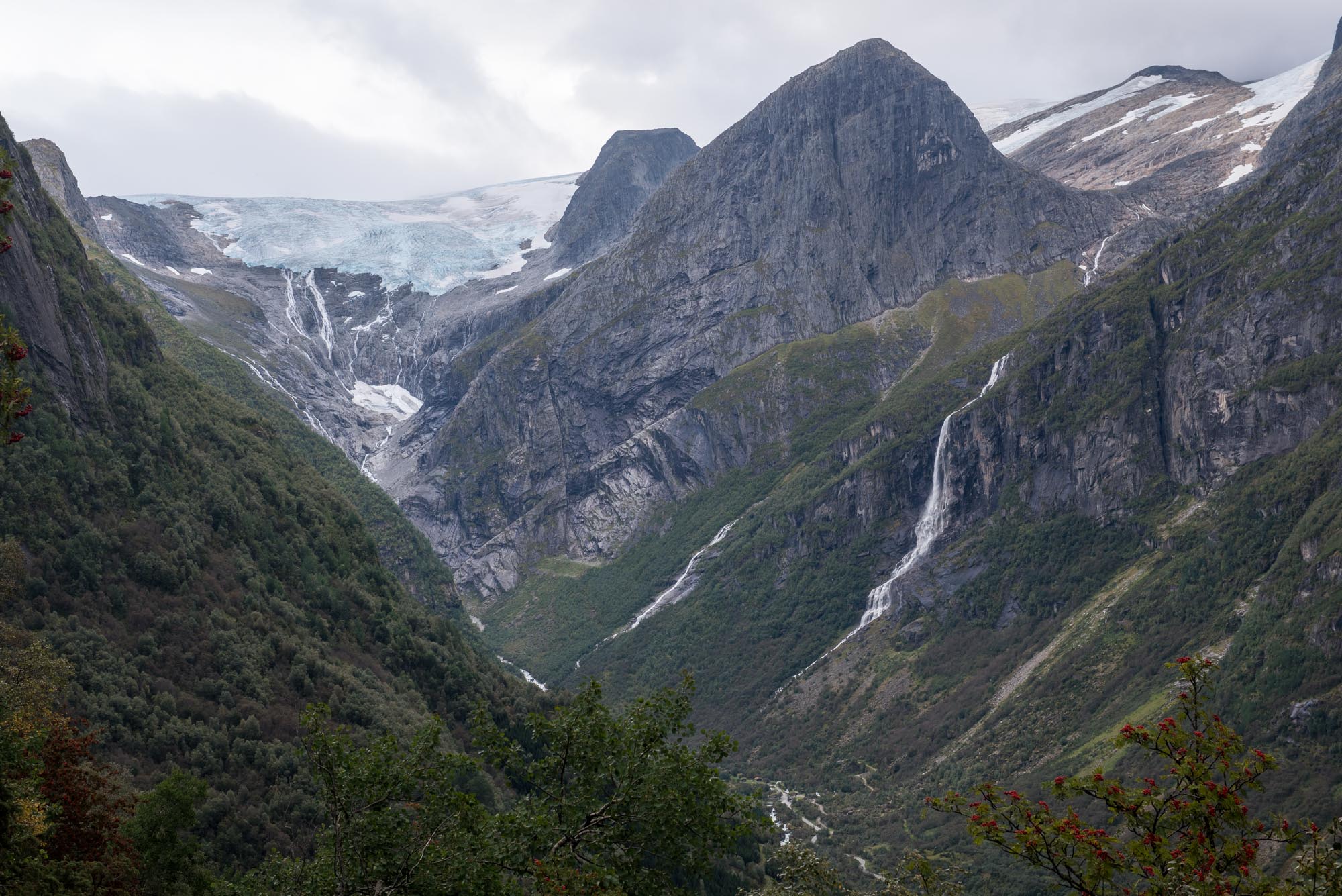
Oldedalen is a steep, north-south oriented valley to the west of Jostedalsbreen. It hosts three glacier snouts, of which Briksdalsbreen is the best known. The other two are Brenndalsbreen and Melkevollbreen. While the former is hidden, the latter is in plain sight. But there is not much to see anymore.
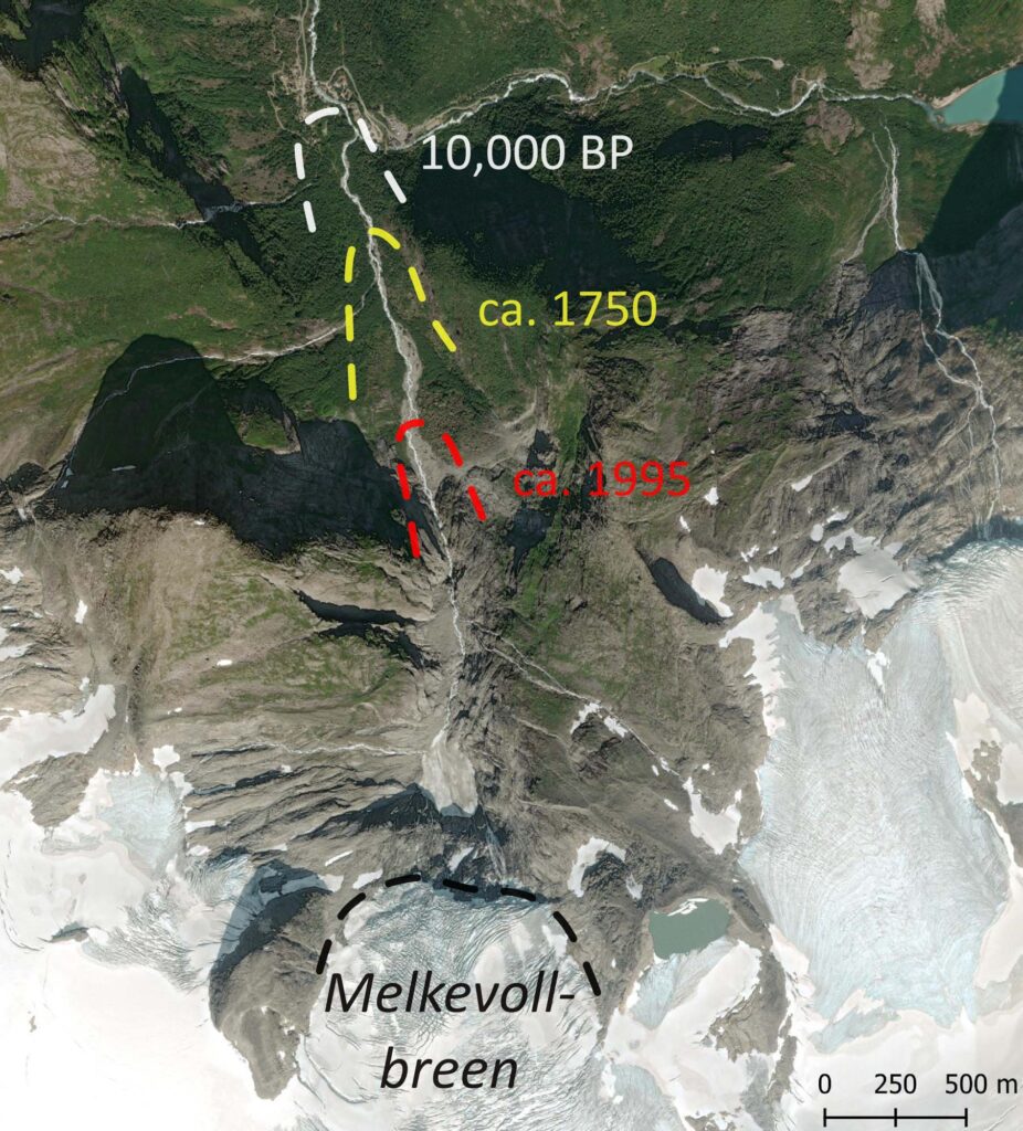
At present all glaciers in Norway are melting back quickly. However, in the past there have obviously been periods in which they grew. Traces of these advances can be found in the landscape, some of them very old. For example, moraines that were formed about 10,000 years ago can be found in front of Melkevollbreen. This phase of glacial expansion is known as the ‘Erdalen Event’ (after Erdalsbreen) and is identified all over the region. Moraine fragments at Melkevollbreen show that the glacier reached down to 150 m, where Melkevoll Bretun campsite is now located. It almost merged with neighboring Briksdalsbreen (Nesje, 2023).
The Erdalen Event represents the largest glacier extent in Norway after the end of the last ice age. A good second is the so-called ‘Little Ice Age’, a cool period that led to growing glaciers a few centuries ago. Most of Jostedalsbreen’s glacier arms reached their maximum extent in the mid-1700’s and Melkevollbreen is no exception. It was down to 220 m above sea level and only 400 m shorter than during the Erdalen Event.
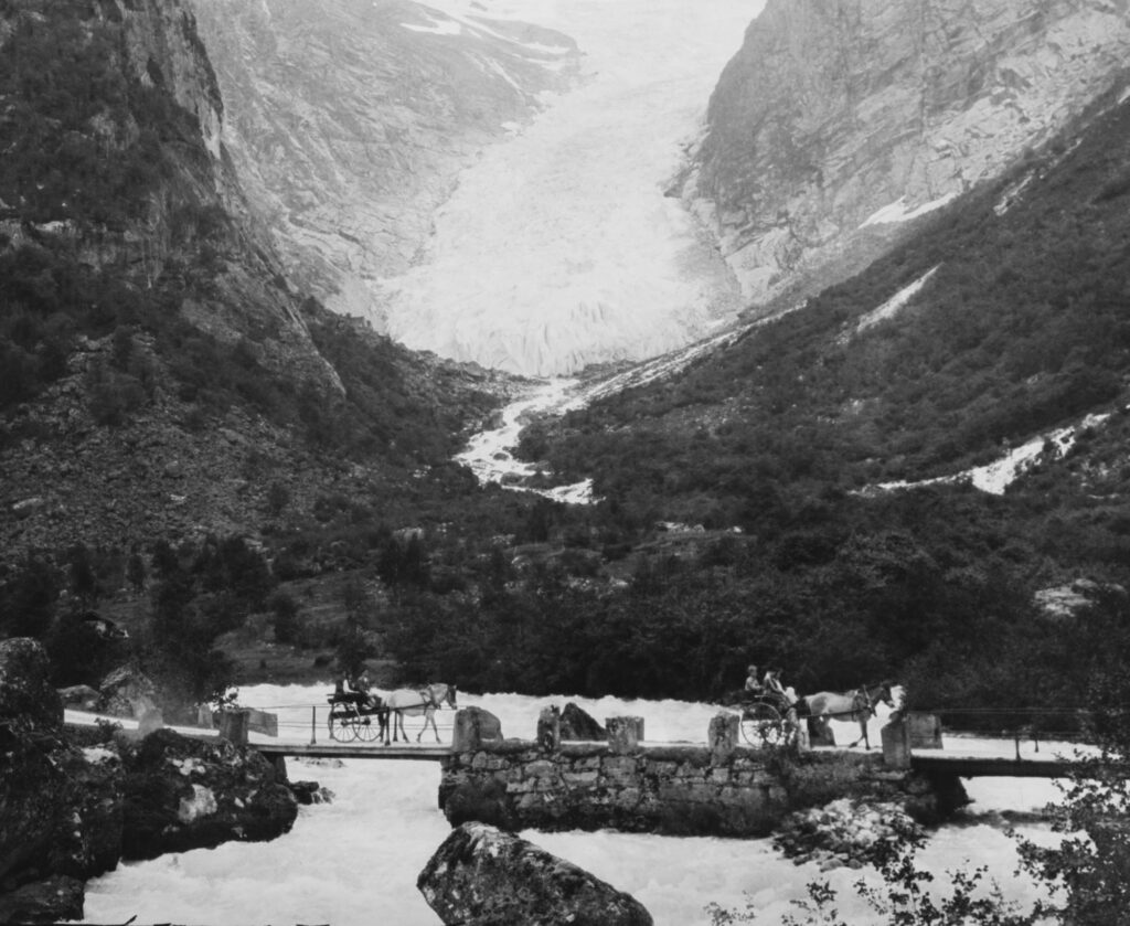
By the time the first photos were taken in the late 19th century, Melkevollbreen had shrunk by several hundreds of meters since the mid-1700’s. It nevertheless continued to be a prominent glacier that couldn’t be missed, not in the least by the upper class tourists who were driven in carriages to nearby Briksdalsbreen.
While most tourists preferred their horse ride over the bridleway to Briksdalsbreen, some people were also drawn to Melkevollbreen. Thanks to the pioneering photographer Knud Knudsen and the geologist John Bernhard Rekstad we have pictures of the glacier from the period 1872-1900. These show a glacier descending to about 300 m.
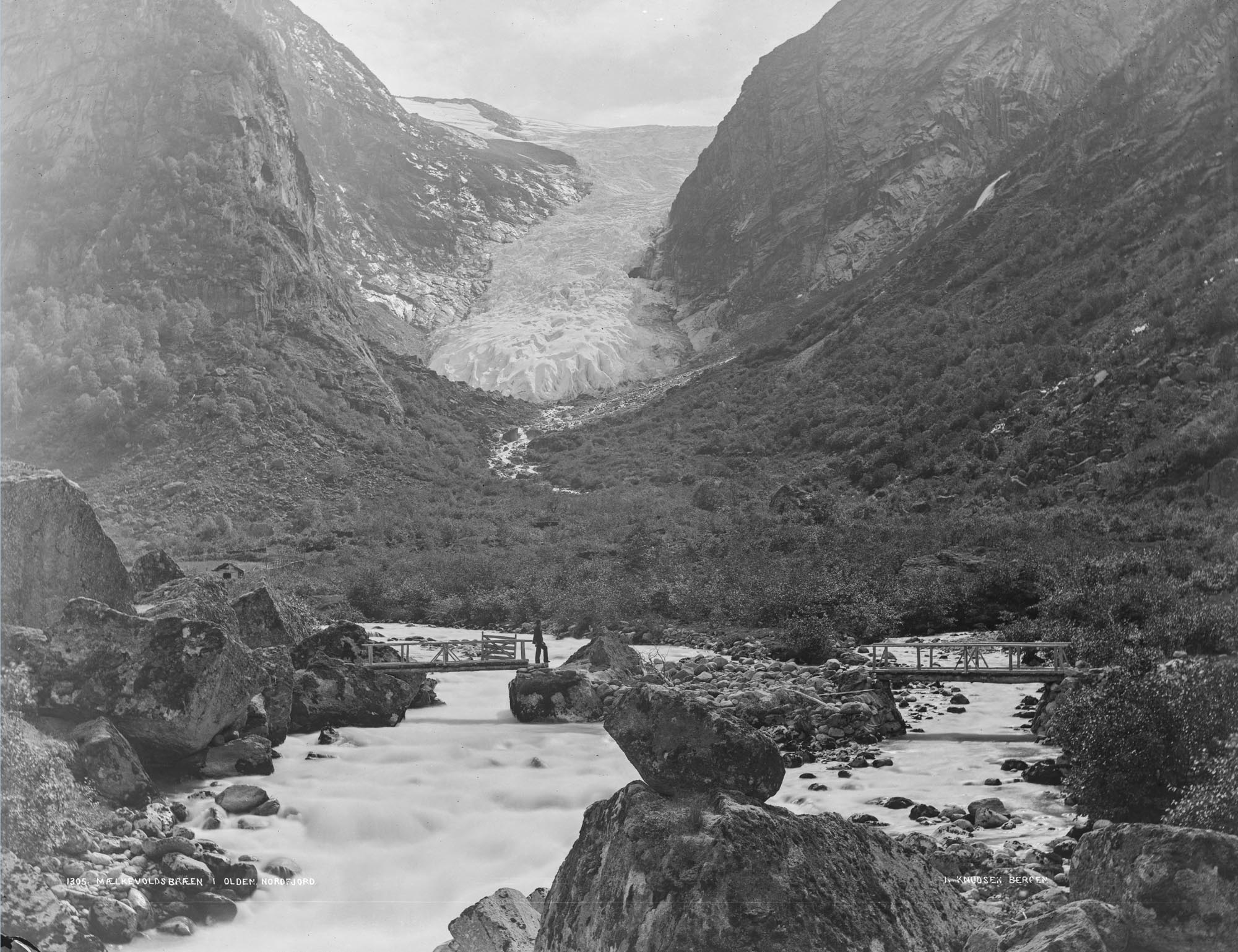
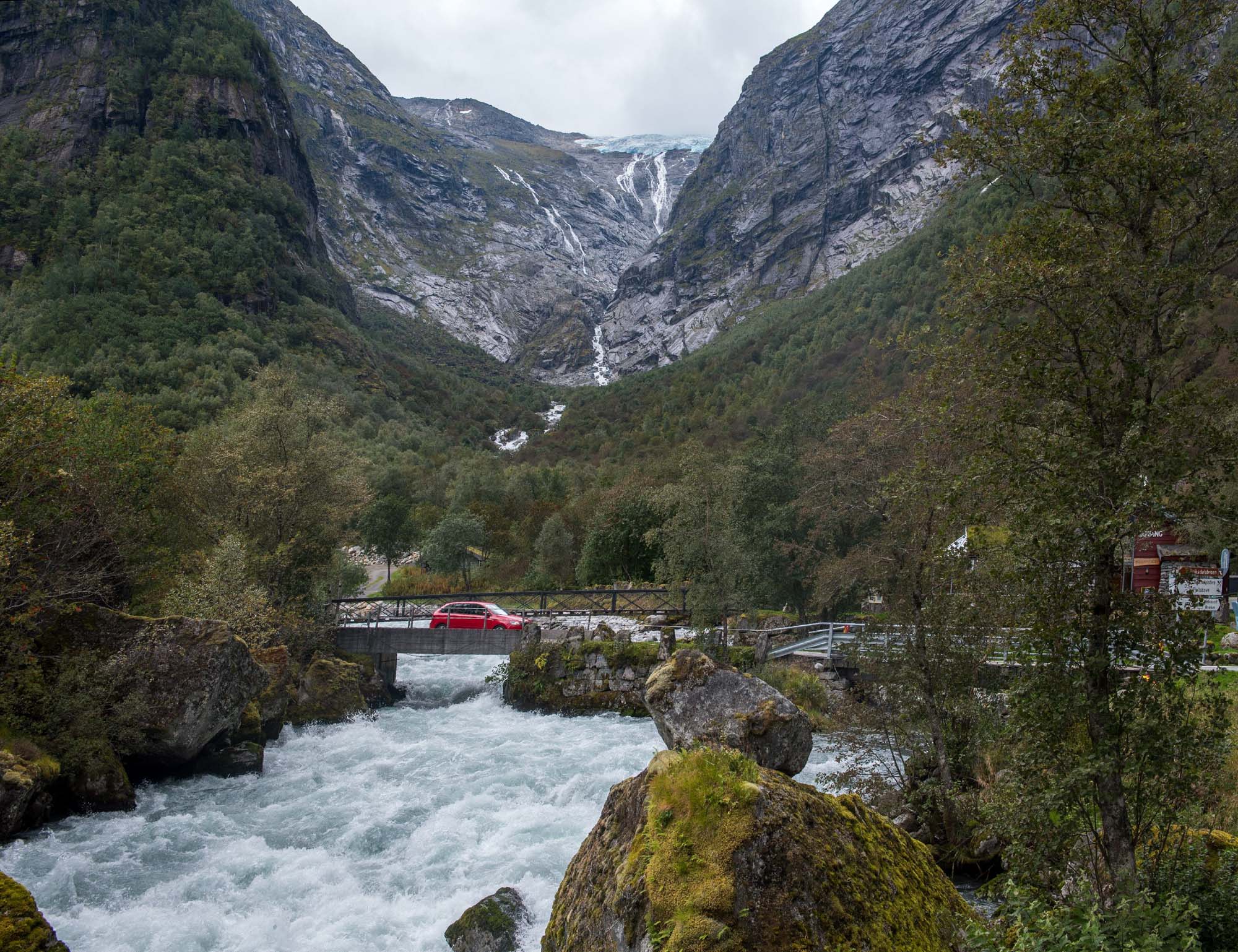
Melkevollbreen in 1888-1894 and 2024. Source: 1888: Knud Knudsen, University of Bergen Library phoyo ubb-kk-2127-1305.
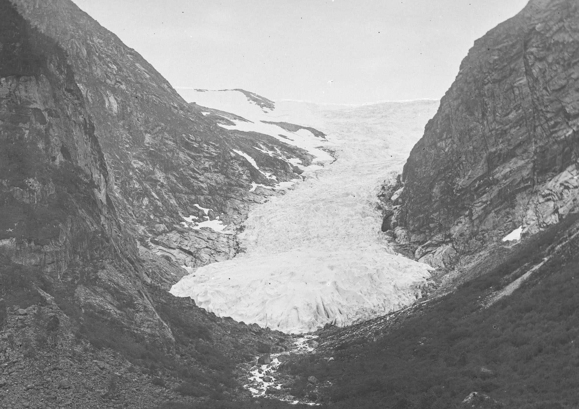
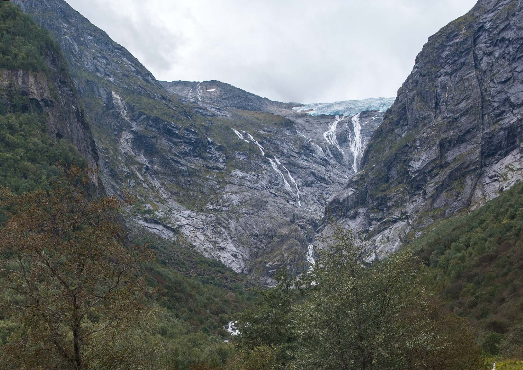
Melkevollbreen in 1872 and 2024. Source 1872: Knud Knudsen, University of Bergen Library photo ubb-kk-1318-0883.
With a few fluctuating the glacier retained its length until 1930. Then, the glacier melted back massively and the snout disappeared within ten years. Such rapid melt is typical for narrow glacier tongues located in narrow, gorge-like valleys, as they are exposed to long-wave radiation from the valley walls (Winkler et al., 2009).
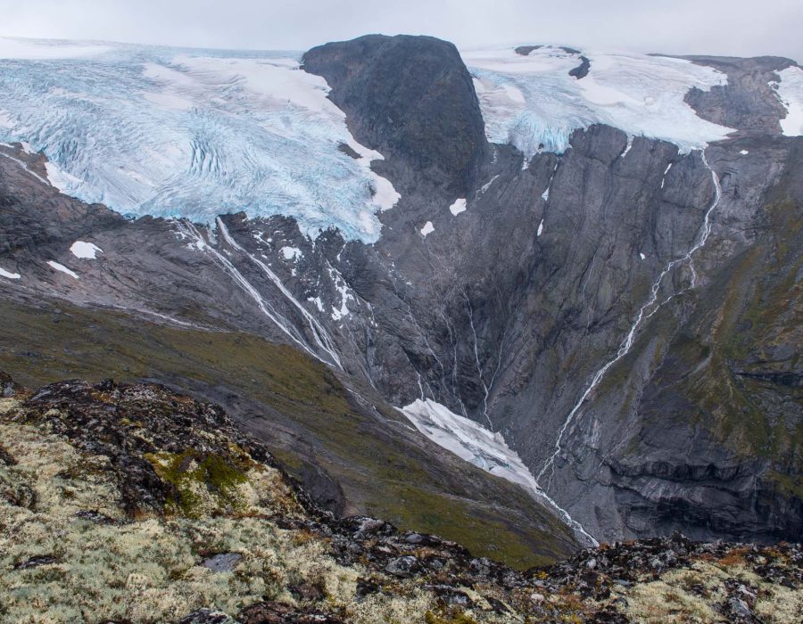
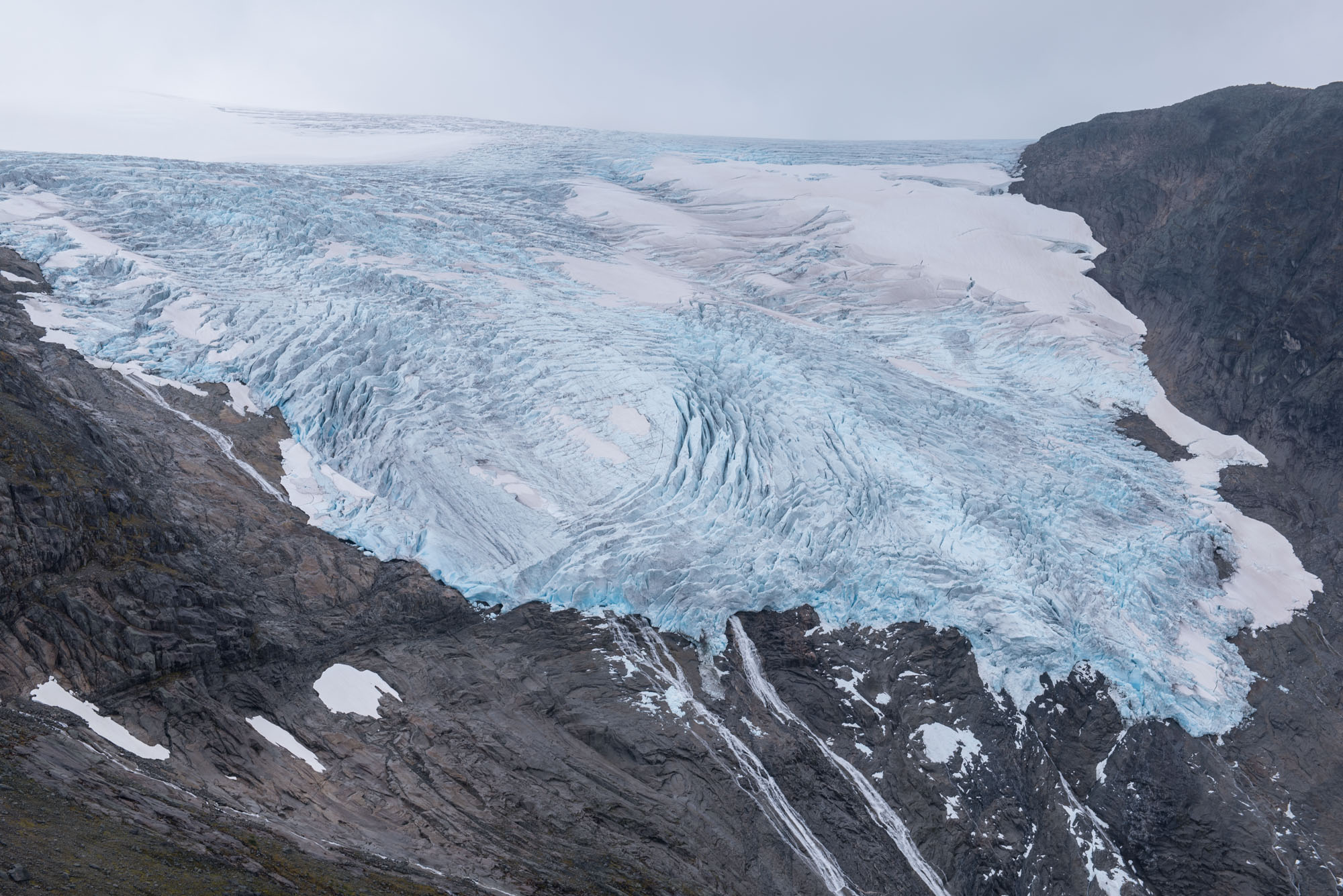
Under the right conditions, narrow glaciers can grow quickly as well. That’s exactly what happened in the 1980’s and 1990’s thanks to abundant snowfall. This period was followed by a collapse that proved to be even more devastating than in the 1930’s. Eventually, the glacier broke in two at 1000 m in 2008-2009 (NVE Glacier Periodic photo) and now terminates at 1050 m. Some ice breaks loose and accumulates at the foot of the steep valley sides, together with snow avalanches. This creates a permanent (though shrinking) ice/snow patch at 800 m above sea level.
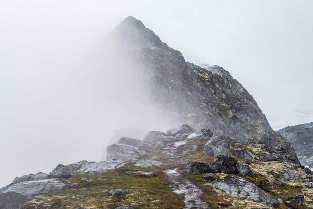
Now that the glacier has receded so far, there isn’t much to see from the valley. But as luck would have it, there is a spectacular trail leading towards the upper part of Melkevollbreen. It follows Kattanakken, an exposed ridge that offers splendid views over Oldedalen and the surrounding glaciers, at least for now.
Search within glacierchange: