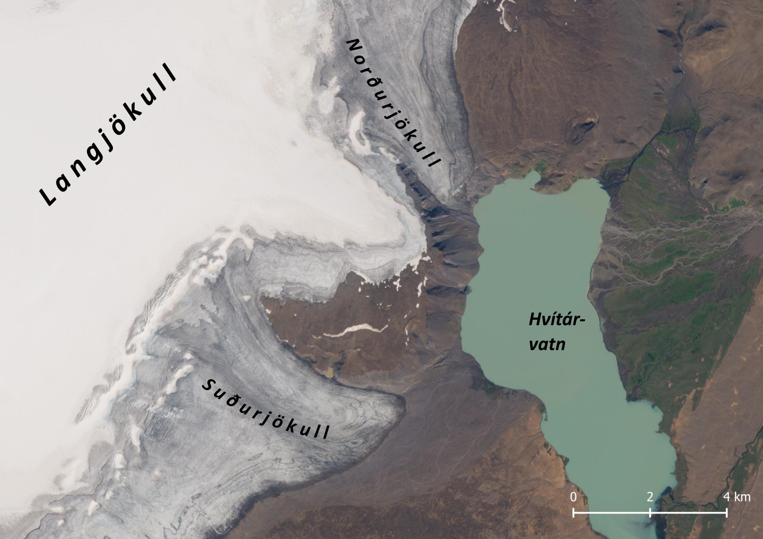
At the eastern side of Langjökull lies lake Hvítárvatn. In past times two glaciers calved into Hvítárvatn: Suðurjökull and Norðurjökull till 2009. Their names are derived from mountain Skriðufell, which they encompass.
Hvítárvatn is one of Iceland’s largest natural lakes. Two thirds of all input into Hvítárvatn is meltwater from Langjökull. This water is filled with sediments, as glaciers erode the mountains and bedrock. So the bigger Langjökull is, the more sediment makes its way into the lake. The sediment-loaden meltwater partly leaves lake Hvítárvatn again, but about half of the sediment subsides in the lake. In this way, a sedimental and thus glaciological record spanning thousands of years is saved at the bottom of lake Hvítárvatn (Black et al., 2004).
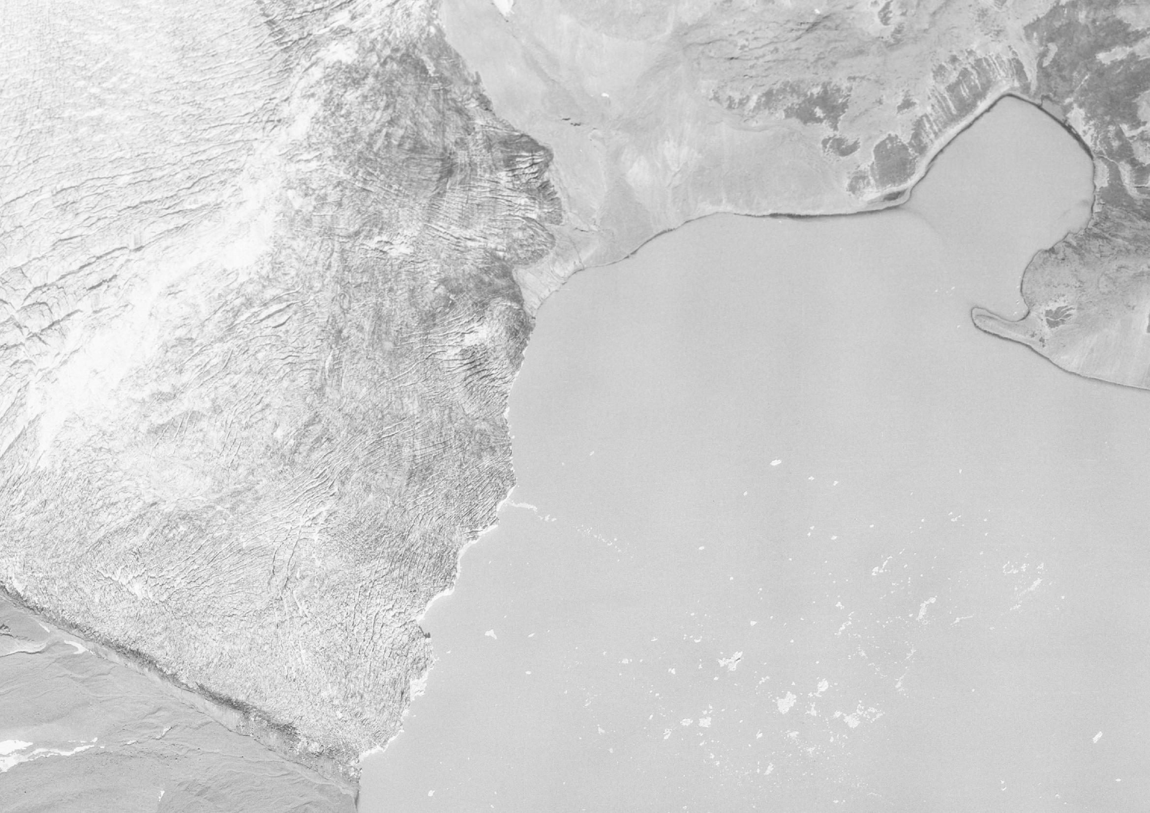
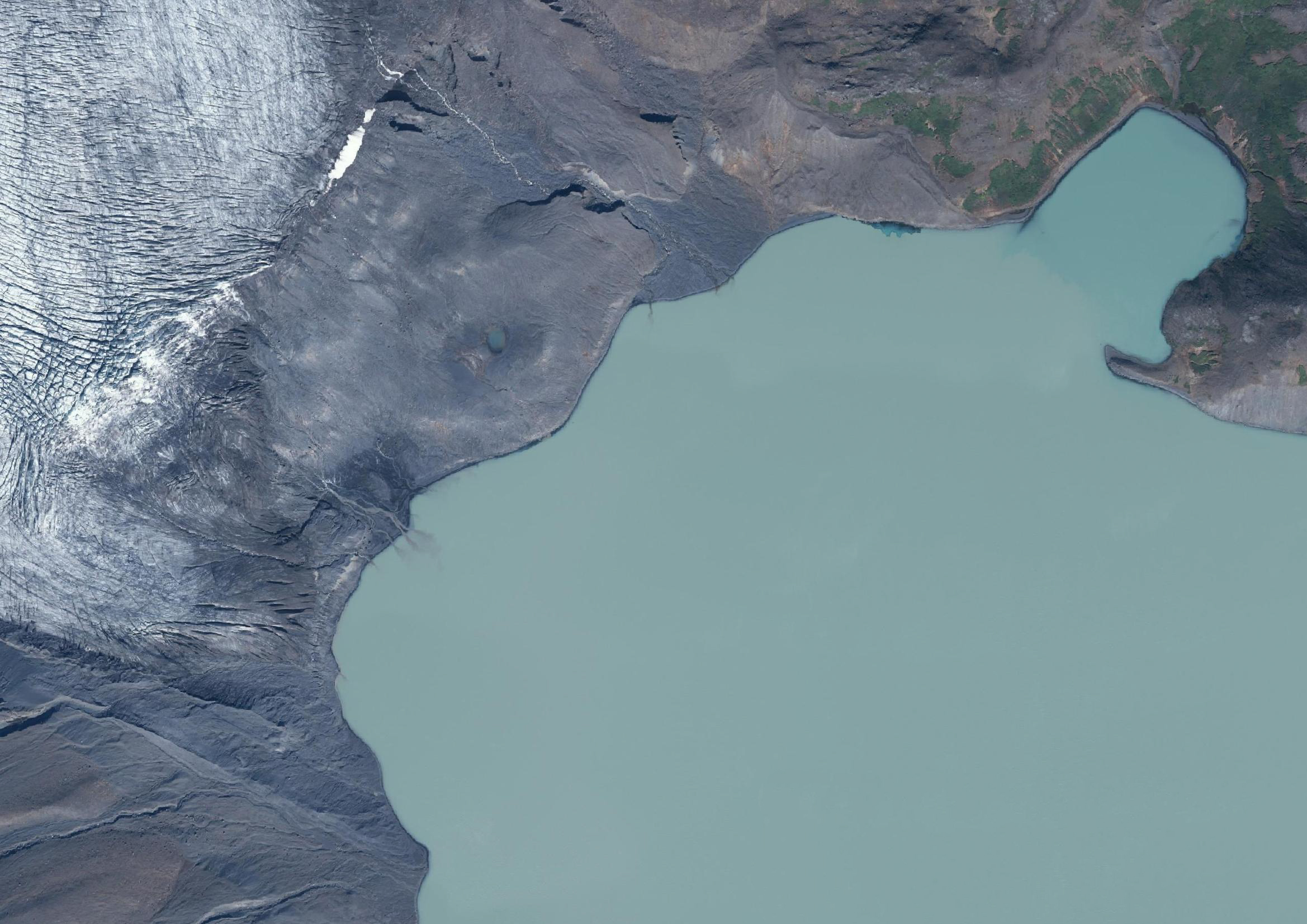
Orthophoto of Norðurjökull in 1987 (left) and 2022. Source: Landmælingar Íslands.
When the last ice age ended 10.000 years ago, Iceland emerged from underneath the ice. Since then, about 18 m of sediment has subsided in lake Hvítárvatn. The bottom layers are very thin, only half a millimeter each year. Together with high concentrations of organic material, they are indicative of the complete disappearance of Langjökull. After all, hardly any sediment was eroded and aquatic fauna (organic material) could flourish in the crystal clear waters. This warm period without any glaciers ended 5000 years ago, only to be interrupted shortly about 8000 years before present.
Between five and four thousand years ago, the climate deteriorated. Summers became cooler because of decreasing solar irradiation and a massive eruption of Hekla regionally amplified this cooling trend (Larsen et al., 2012). This created the conditions for Langjökull to slowly (re)appear, based on growing yearly varve thickness in the lake sediments. Those layers are now getting clearly stratified, with thin and fine wintertime-varves and thicker, more sandy summertime varves. Especially those sandy deposits are characteristic for glacial erosion.
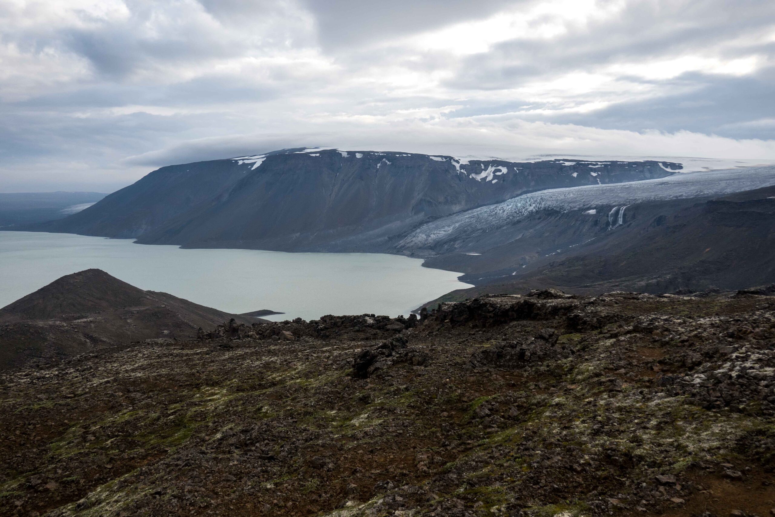
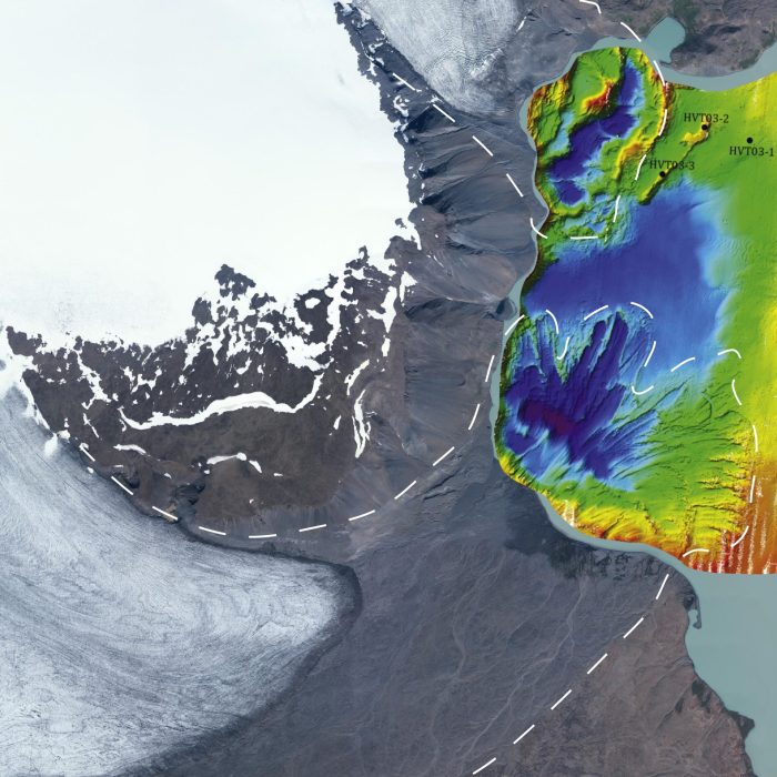
Although Langjökull appears 4000 years ago, it remains a very modest glacier for thousands of years. Yes, the varves grow fivefold, but don’t exceed 2.5 millimeters. It’s not before 700 years ago that varve thickness increases considerably, resulting in layers of half a centimeter around the year 1500. Such growing rates of deposition points to advancing glaciers. After two centuries of decreasing varve thickness, sediment deposits spike in the years 1845-1935, with over a centimeter annually. Langjökull is more extensive than it has been in ten millennia and draws deep tracks in the lake sediments, as shown by bathymetry (Larsen et al., 2011). That’s a technique to scan the bottom of a lake to reveal its topography.
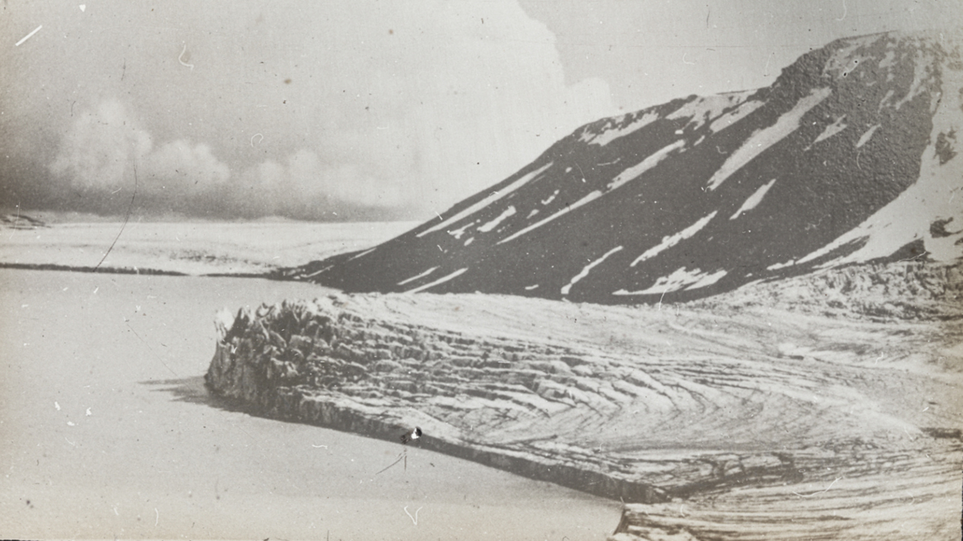
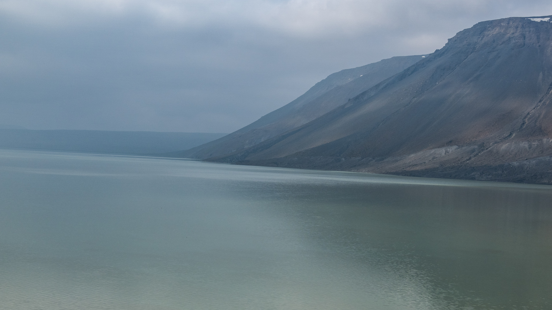
Hvítárvatn with Norðurjökull (foreground) and Suðurjökull in ca. 1935 (left) and 2023. Source ca. 1935: islenskirjoklar.is.
At least as interesting as the varve thickness is the occurrence of dropstones in the sediments. Normally, particles with a grain size over two millimeter would sink immediately to the bottom. They could never appear in the middle of lake Hvítárvatn, unless small icebergs carry them there. Such ice-rafted debris can therefore only appear in the sediments if a glacier calves into the lake. This only happened from 1820 onwards and the presence of stones peaks in the second half of the nineteenth century. After 1940 it quickly decreases as Suðurjökull retreats from the lake (Larsen et al., 2011).
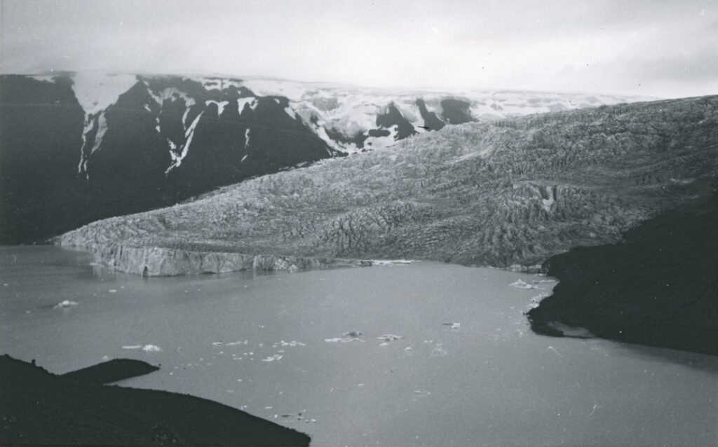
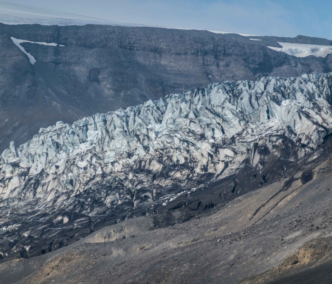
In the twentieth century other sources start to document the development of Nordðurjökull. Its calving front attracts people to the lake and in 1945 the first aerial image is taken, just in time to capture the front of Suðurjökull terminating in lake Hvítárvatn. The much steeper Norðurjökull kept producing icebergs until 2009.
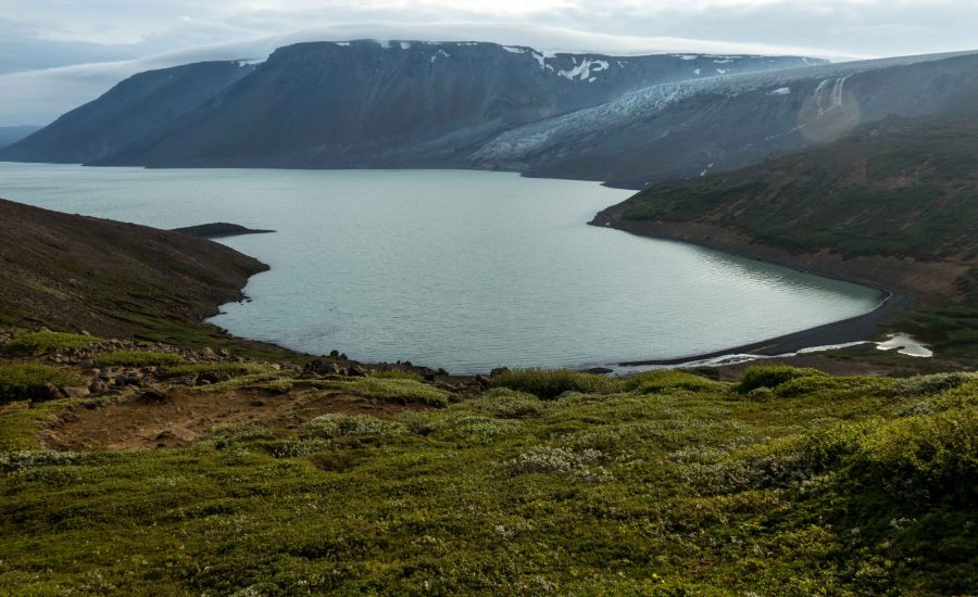
Most of the historic photos were taken from Karlsdráttur, a natural bay. This beloved place is situated in the north of lake Hvítárvatn and directly opposes Norðurjökull. Its south facing, sunny slopes are very rich in flowers and shrubs, sharply contrasting the otherwise mineral environment. Groundwater boils up along its shores, after infiltrating the barren lava fields 300 m higher up.
At times when Langjökull was non-existent, summers were 2 to 2.5°C warmer then over the 1960-1990 period (Geirsdóttir et al., 2009). At present, the Icelandic climate already is one degree warmer. Given the persistent global warming, Langjökull is bound to disappear completely. The record of it will sink to the bottom of lake Hvítárvatn as the most sudden change in ten millennia.
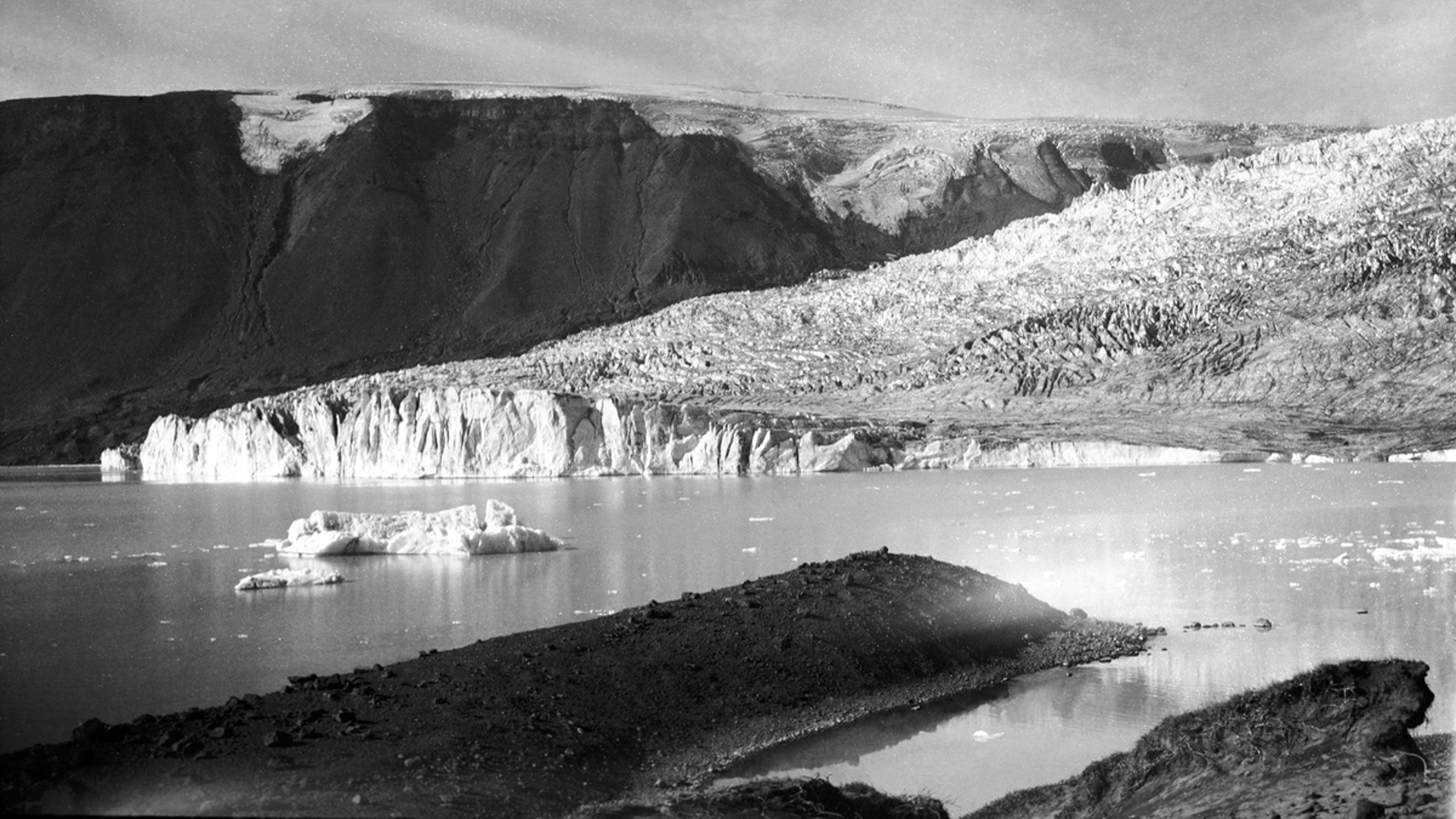
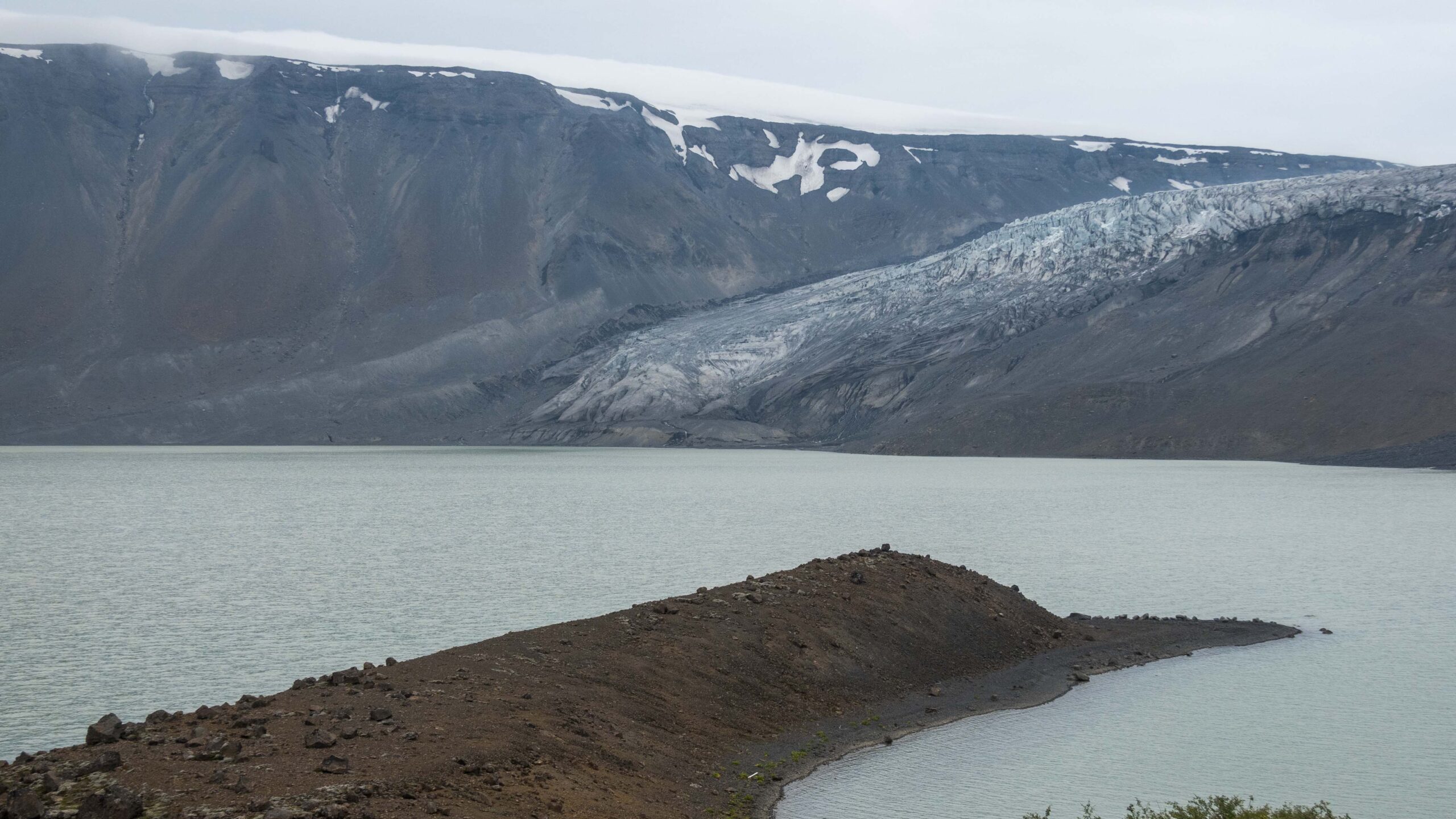
Norðurjökull in 1935 (left) and 2023. Source 1935: Ólafur Magnússon (Museum of Photography, Reykjavik, ÓLM 1214).
Search within glacierchange: