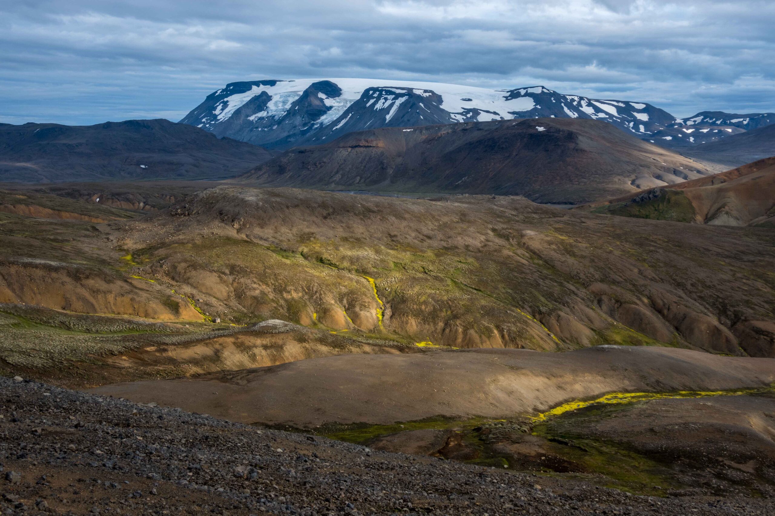
Regnbúðajökull (also known as Hrútfellsjökull) is a plateau icefield on top of Hrútfell mountain in central Iceland, a tuya of almost 1400 m high in the middle of Iceland.
Regnbúðajökull has four small but steep outlet glaciers descending to the north(west). From west to east these are Norðvesturjökull, Vesturjökull, Miðjökull and Norðurkinn-Eystri. In the past all glaciers reached the plain at 600 m, but nowadays they end halfway the slopes of Hrútfell.
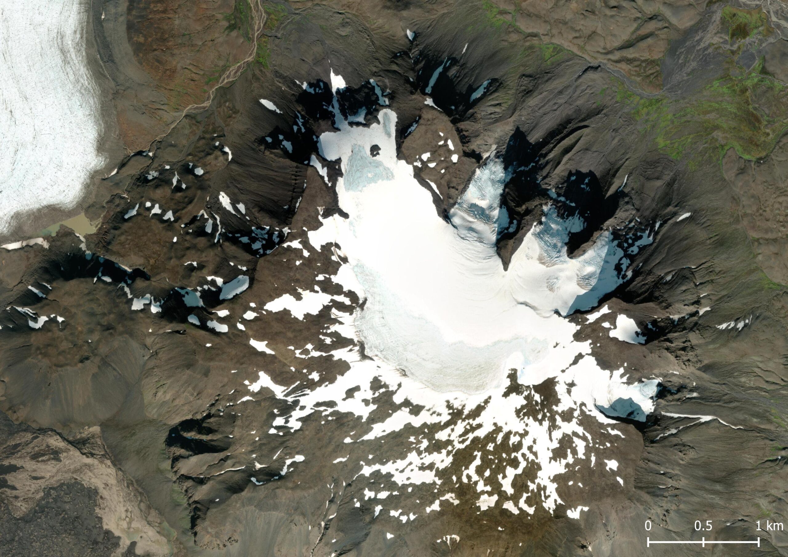
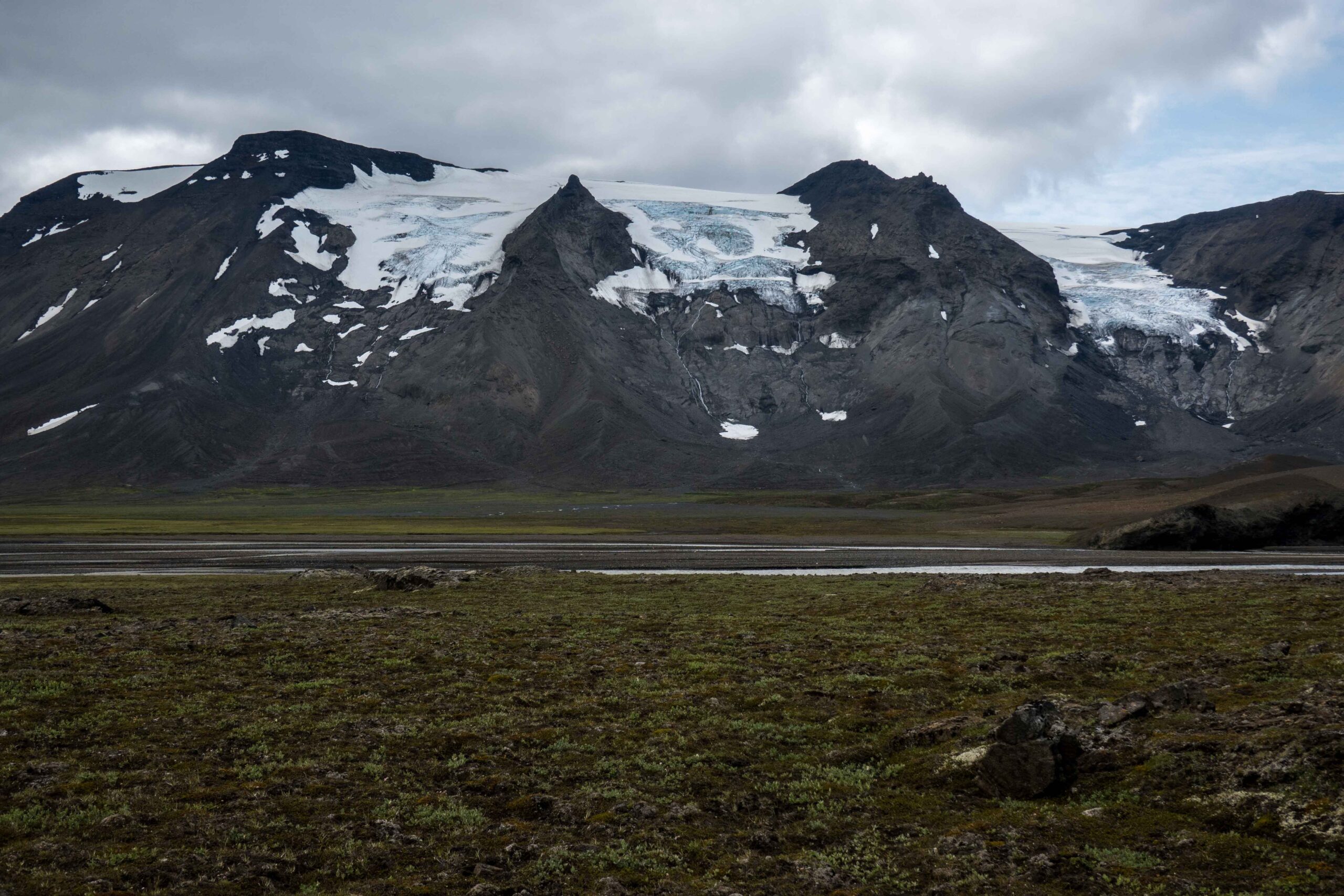
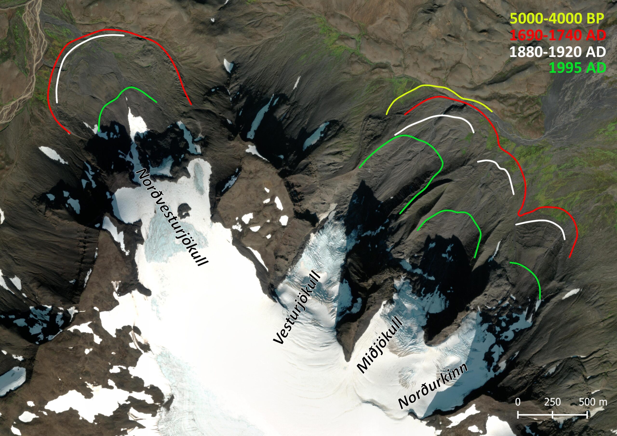
While nearby Langjökull reached its maximum extent in the 19th century, Regnbúðajökull was at its biggest thousands of years before. We know this thanks to the moraines that were formed by the glaciers back then. The soil around them contains tephra (ash) layers of Hekla volcano that has erupted regularly since the climate cooled about 5000 years ago. Close to one of the outlet glaciers (Vesturjökull) a moraine is covered by tephra layers of many millennia (Kirkbride and Dugmore, 2006).
At all outlet glaciers of Regnbúðajökull the oldest moraines have been washed away. The one exception is Vesturjökull, where the entire sequence of moraines spanning thousands of years has been preserved. Based on the tephra layers it could be determined that the glacier was a little bit longer 4000 years ago than it was during the most recent glacial maximum of 1700-1900. The contrasting timing of Regnbúðajökull and Langjökull is explained by their differences in topography: it takes much longer for vast, gently sloping ice caps like Langjökull to respond to changing climate conditions than it does for steep and small icefields like Regnbúðajökull. The cool period 4000 years ago just didn’t last long enough for Langjökull.
Regnbúðajökull proved its short response time once more in the 1990’s. A short period of cool summers resulted in Regnbúðajökull’s outlet glaciers to advance almost immediately. In 1995 they reached their maximum, albeit half a kilometer less than they were a century before. Afterwards, the glaciers receded quickly.
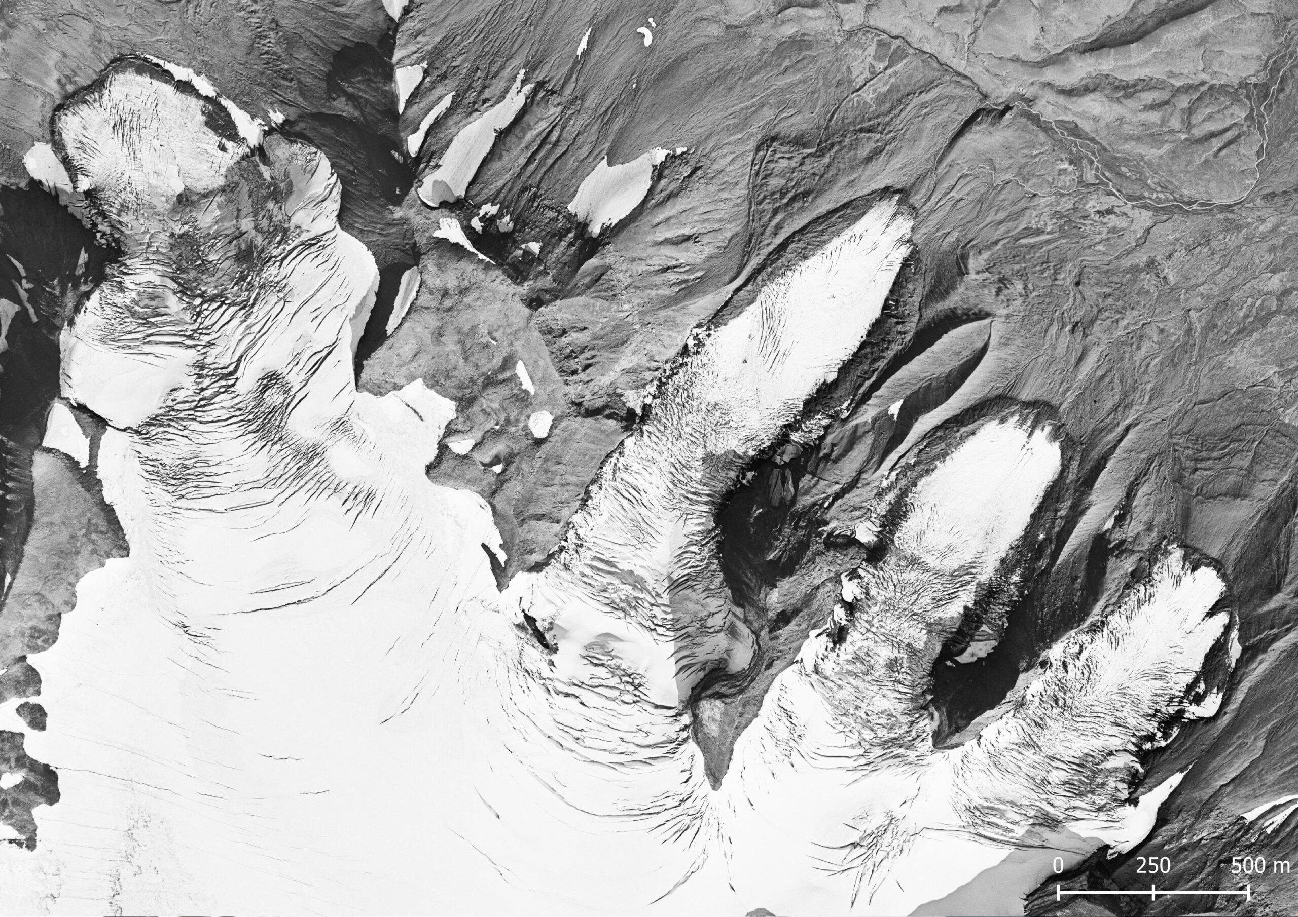
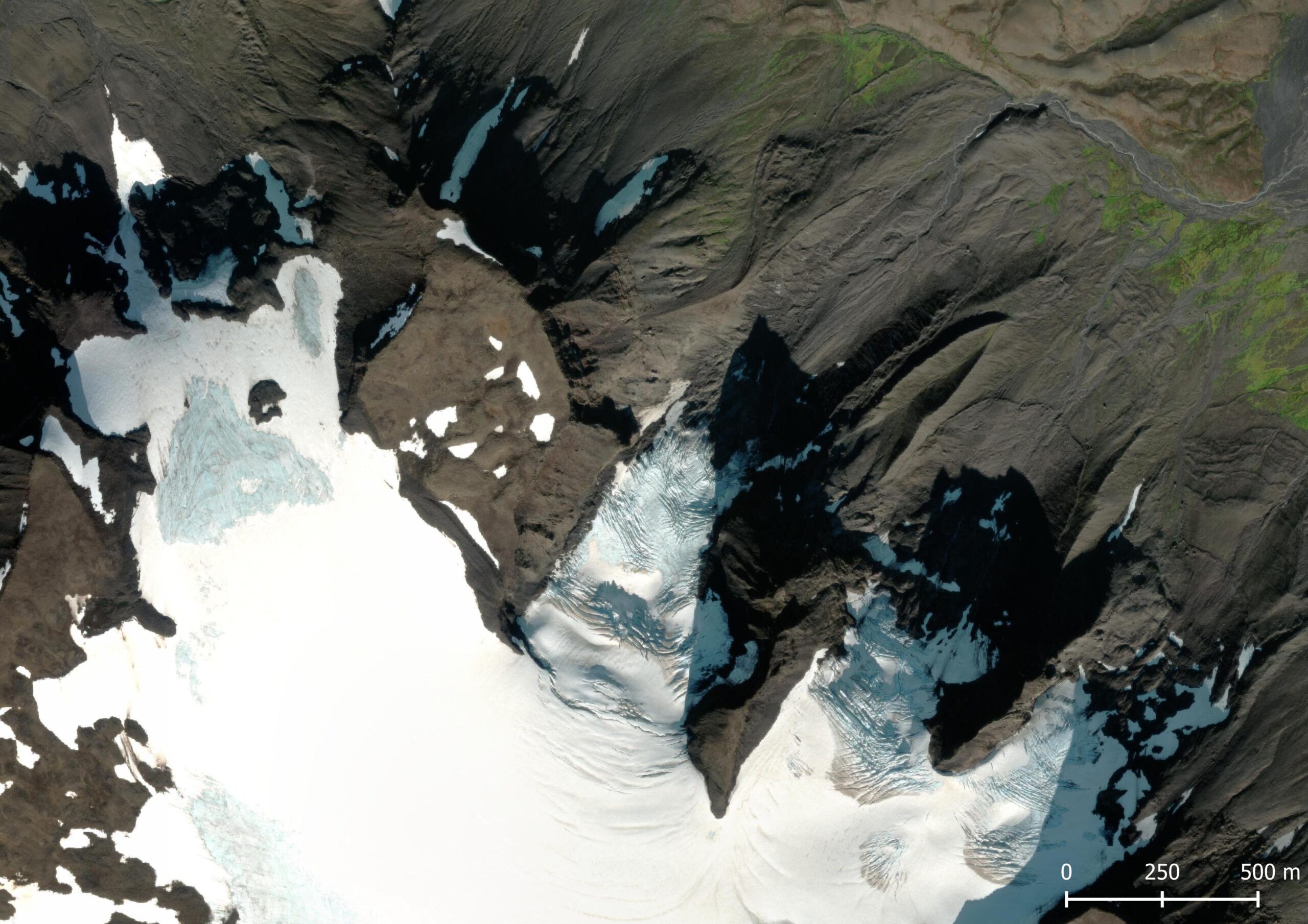
Regnbúðajökull in 1995 (left) and 2023. Source: Landmælingar Íslands (1995) and ESRI satellite.
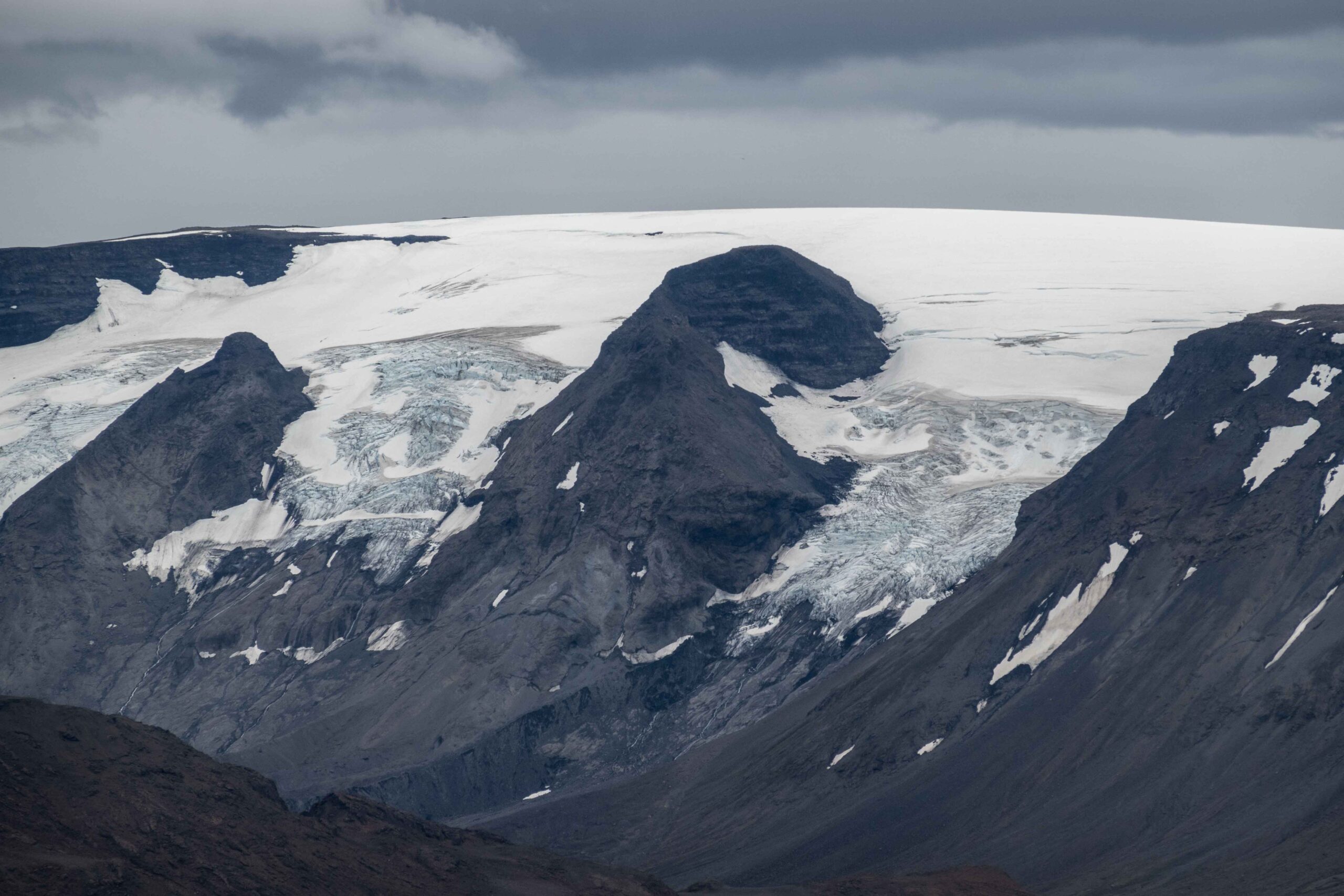
Recession isn’t limited to the outlet glaciers on the shaded northern side of mount Hrútfell. The Regnbúðajökull stretches all the way to the south side of Hrútfell, where the icefield is getting smaller every year. Where the glacier occupied an area of el11even square km in 1890 and 8 km2 in 1980, it now is only 4 km2.
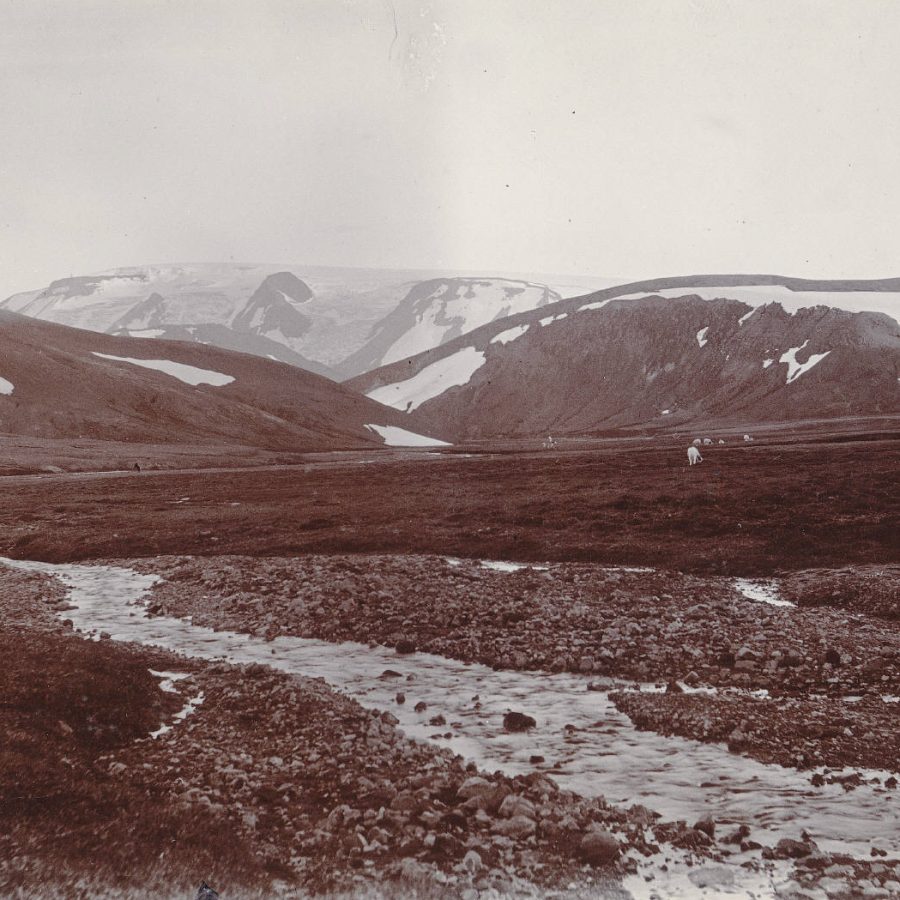
Besides smaller the icefield is also getting thinner, because even the top of Regnbúðajökull is deprived of snow in late summer. As a result the mountain actually is getting lower. In 1945 the summit was at 1428 m, but only 1386 m at present. Within a few decades all ice on its top will be melted and Regnbúðajökull literally hits rock bottom.
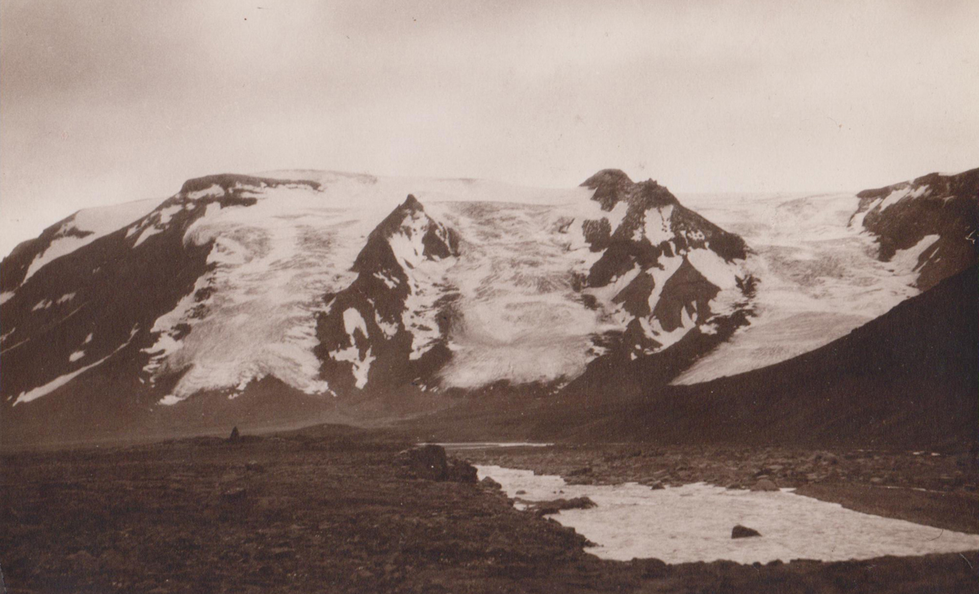
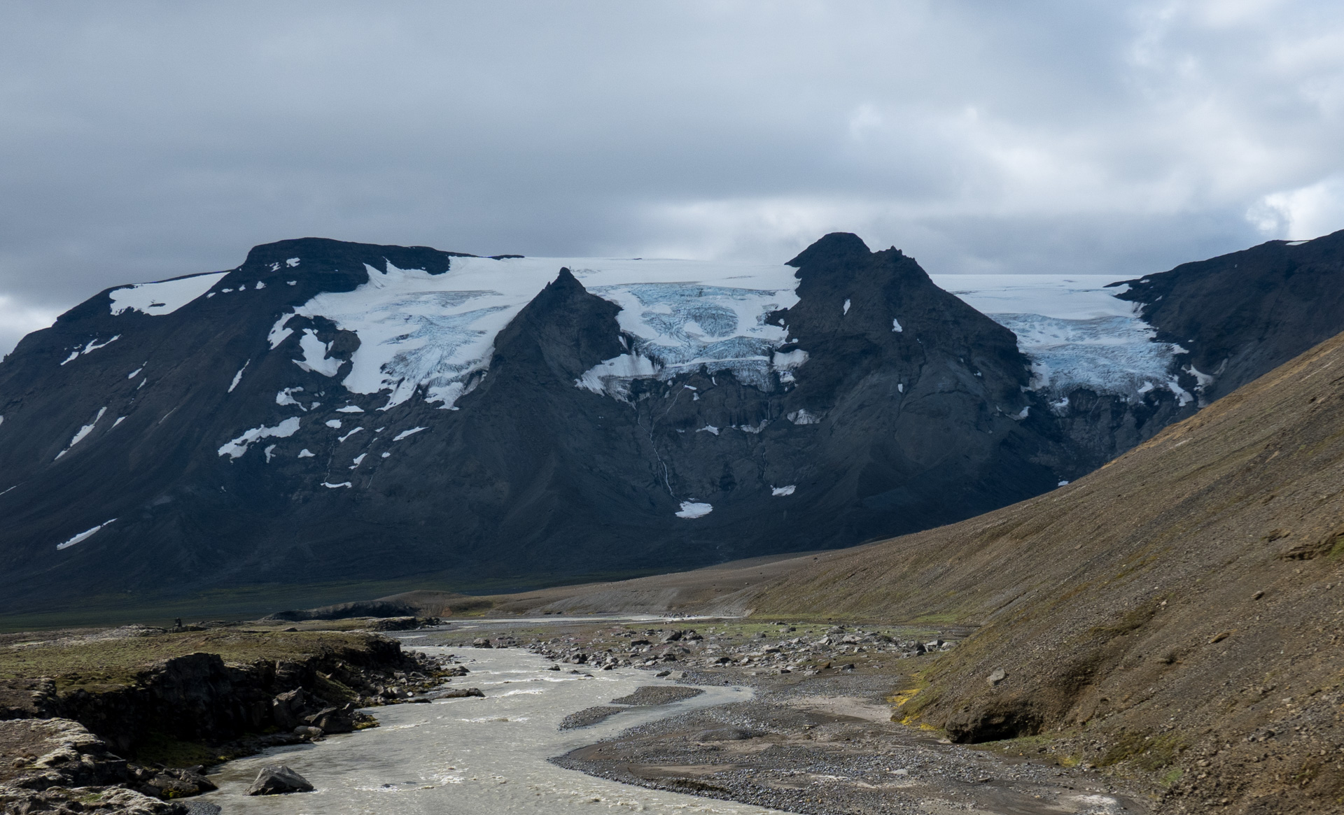
De Regnbúðajökull in 1938 (left) and 2023. Photographer 1938: Hákon Bjarnason, Jöklarannsóknafélag Íslands.
Search within glacierchange: