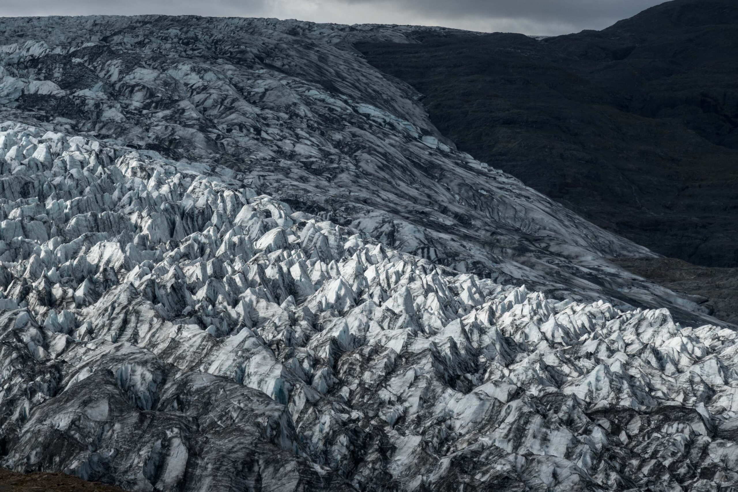
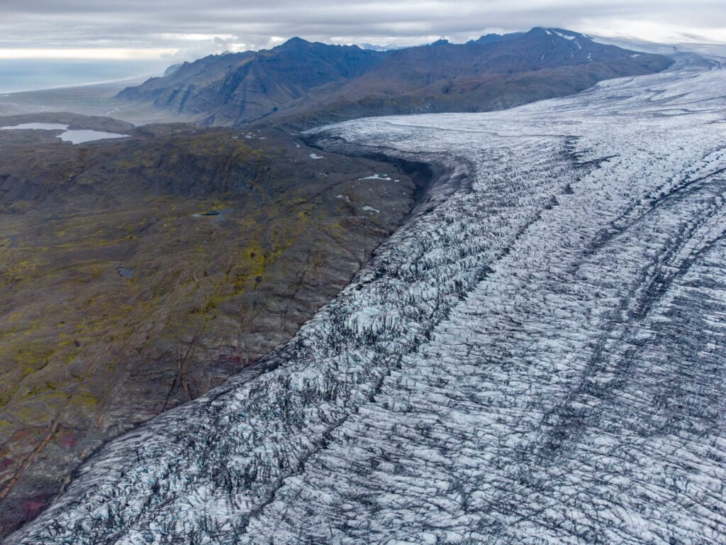
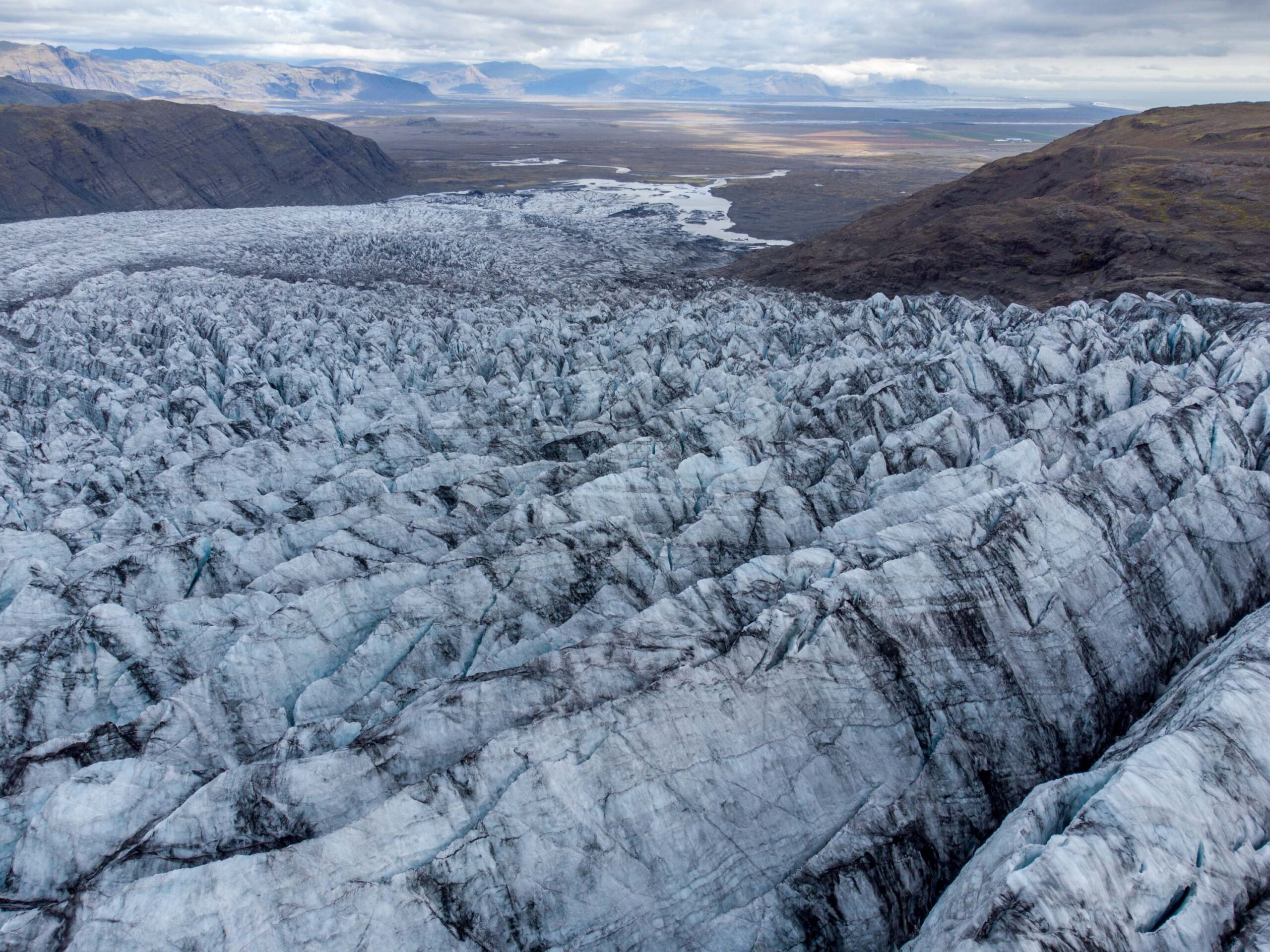
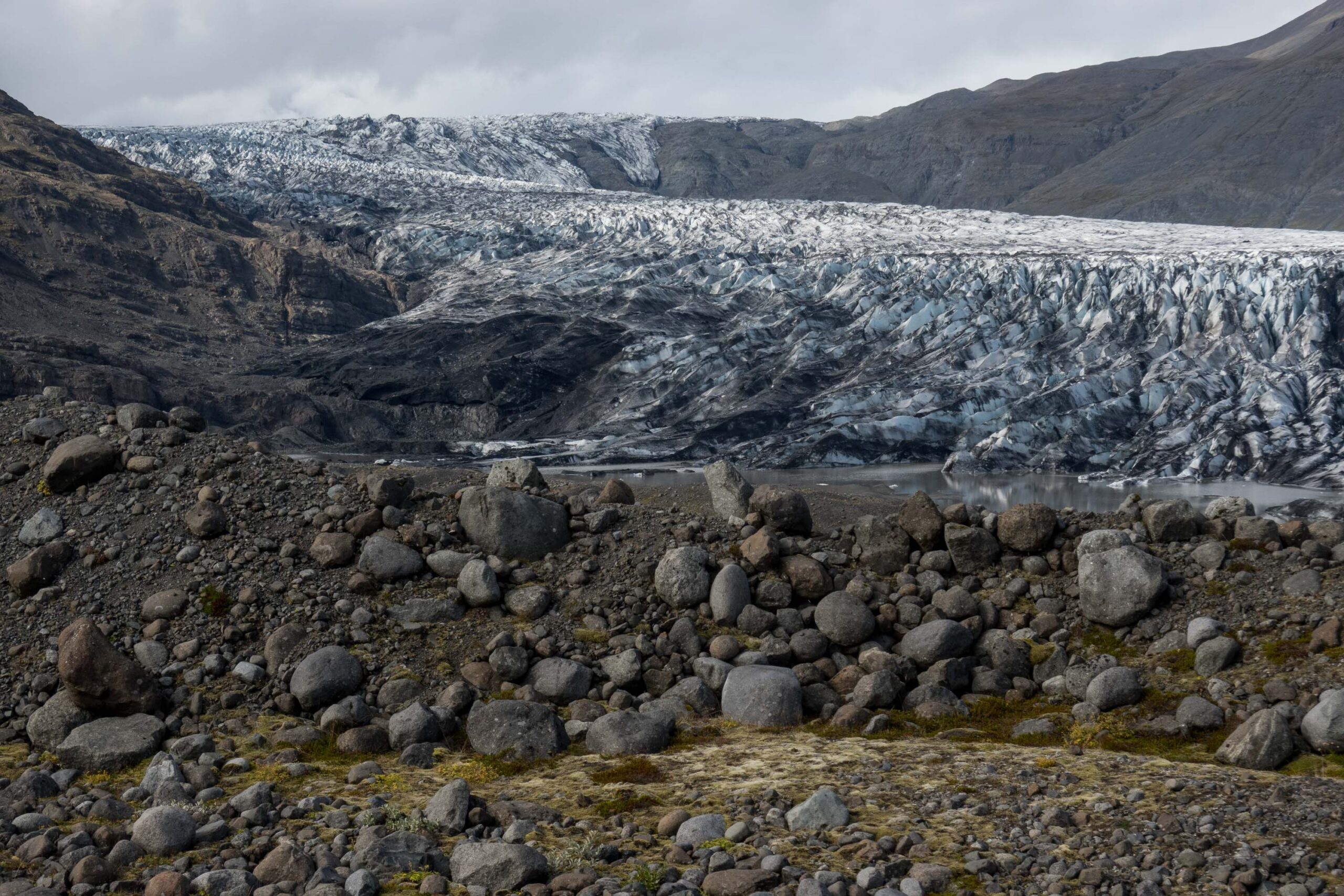
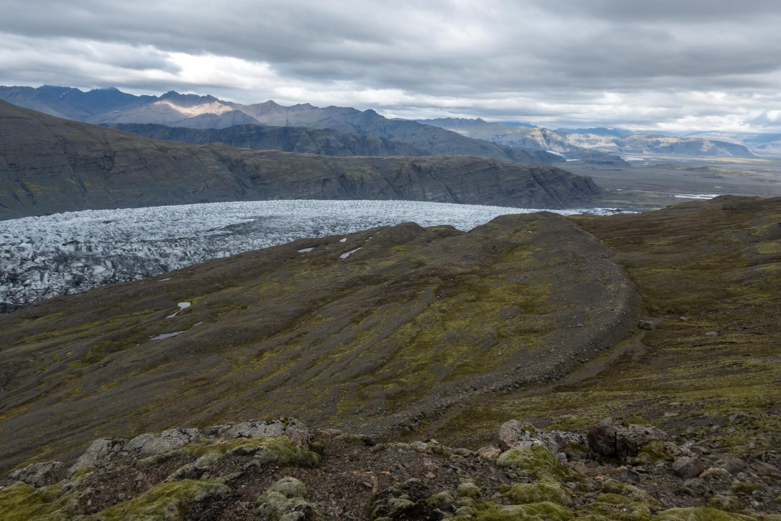
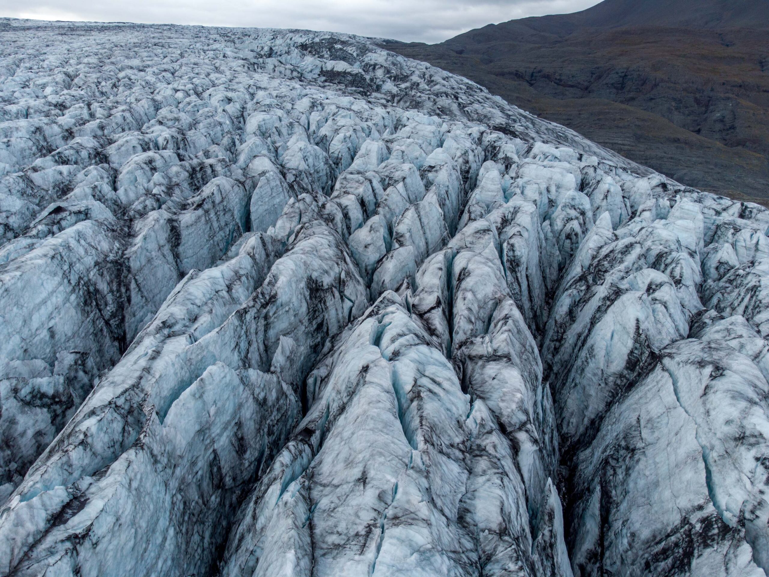
Skálafellsjökull is about 24 km long, flowing from the Breiðabunga ice plateau at 1500 m to close to sea level. Though the glacier descends quite evenly, there is a steeper part between 600 and 300 m above sea level. This is also the narrowest part of the glacier, measuring just under 1 km in width. Once through this bottle neck, the ice splays out, giving rise to one of the most beautiful fields of radial crevasses in Iceland.
The icefall of Skálafellsjökull, August 2023.
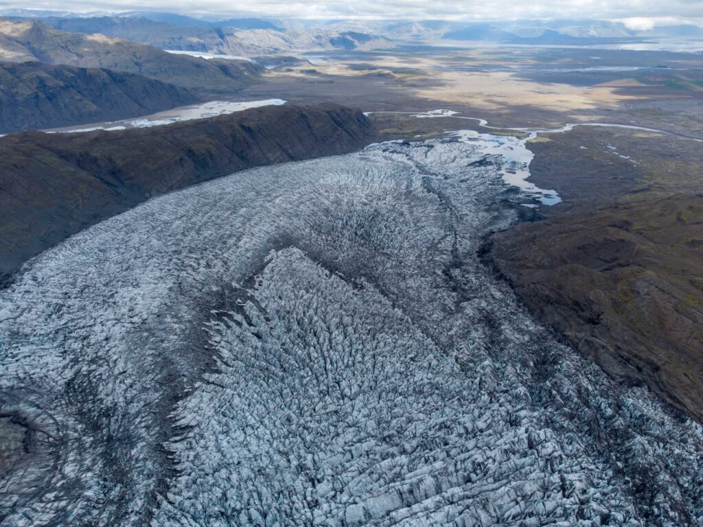
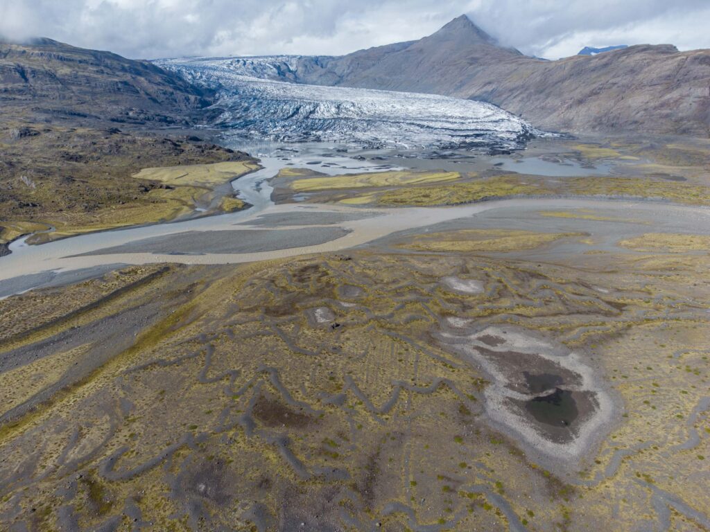
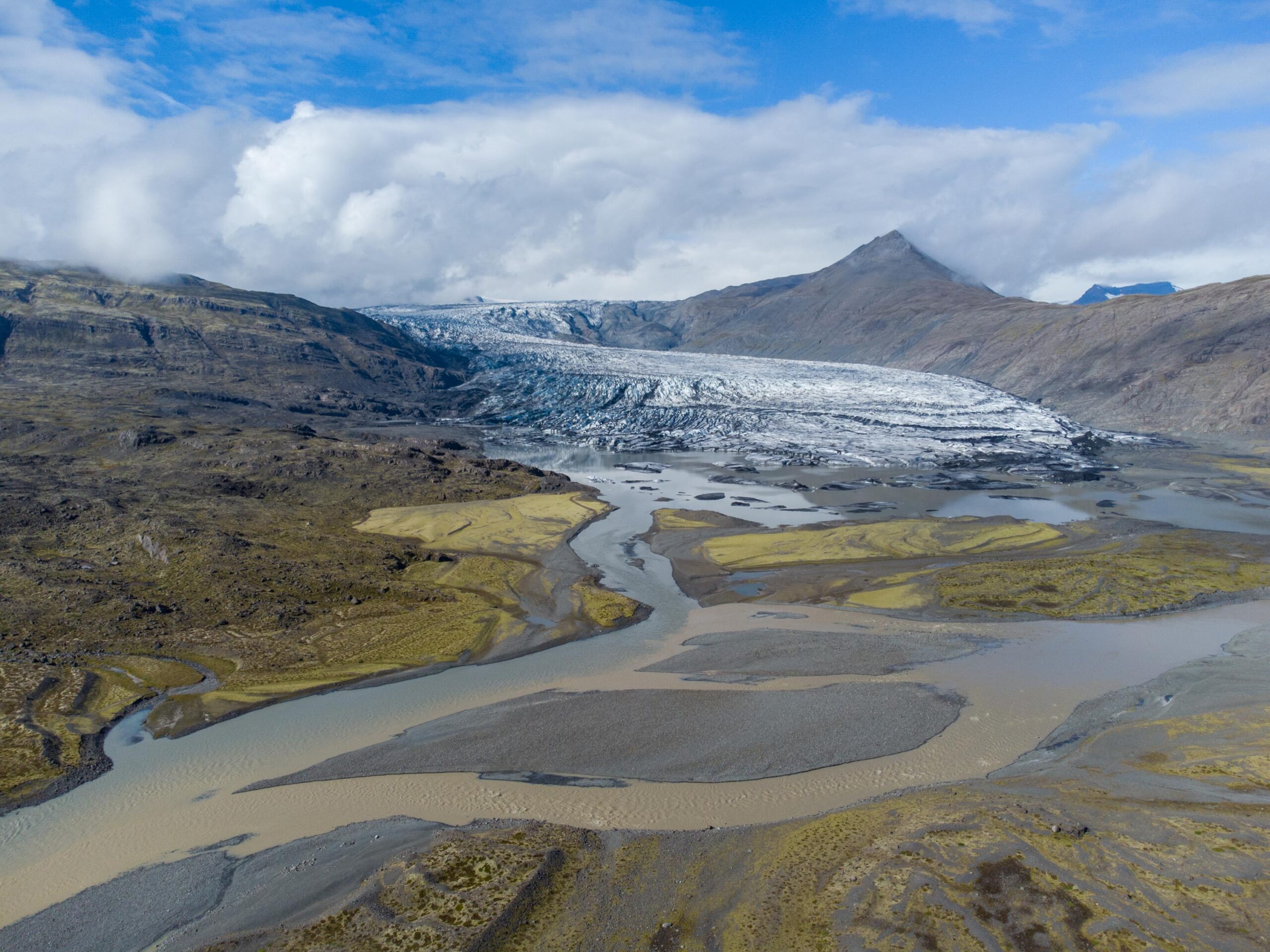
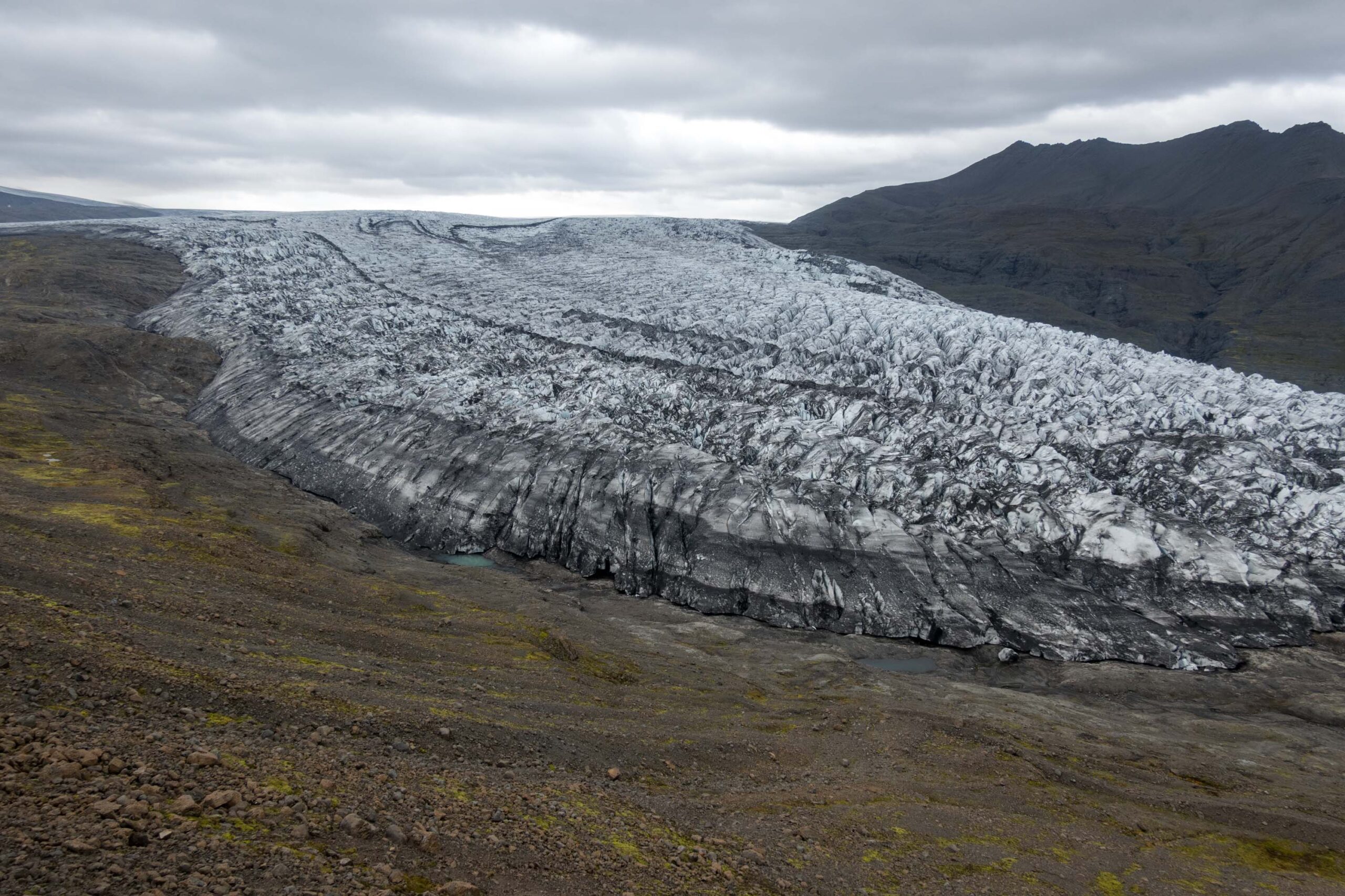
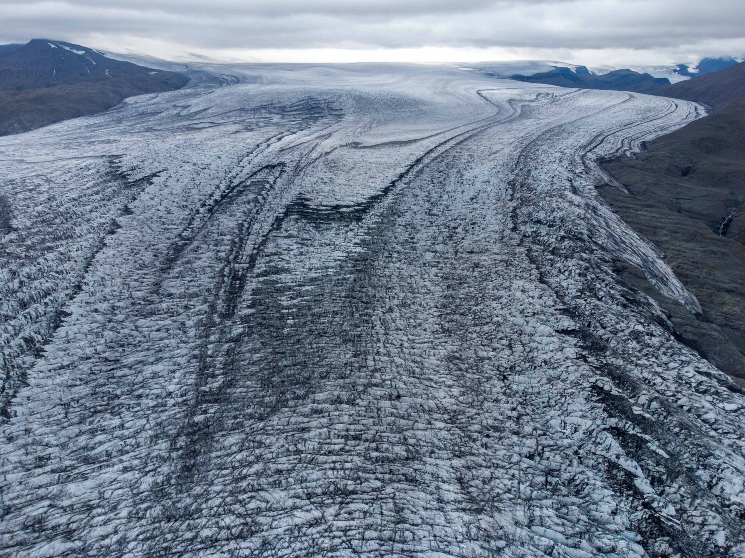
The snout spreads out, leading to radial crevasses. Drone photo, August 2023.
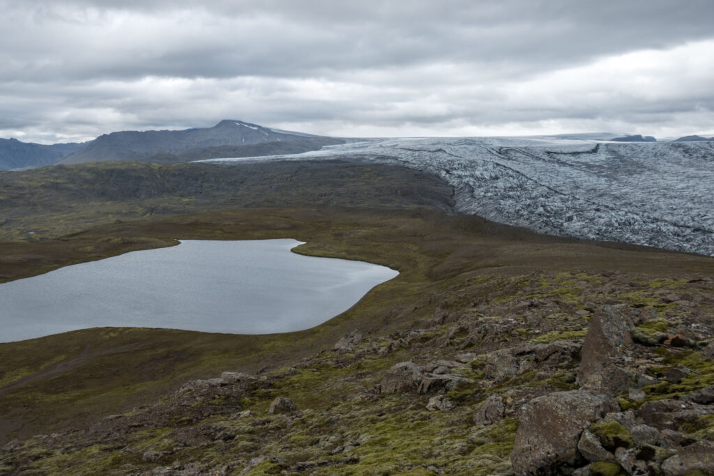
Splaying Glacier
After the glacier passes the confined icefall, it extends laterally (widens) and compresses in length (slows down). This change in stress leads to radial crevasses that run all the way to the margin. Therefore, the snout was highly crevassed in times when Skálafellsjökull spread out into a strongly indented lobate glacier (piedmont glacier) on its unconfined foreland.
Orthophoto of Skálafellsjökull in 1954 (left, Landmælingar Íslands) and 2023 (ESRI World View).
Retreated into a Lake
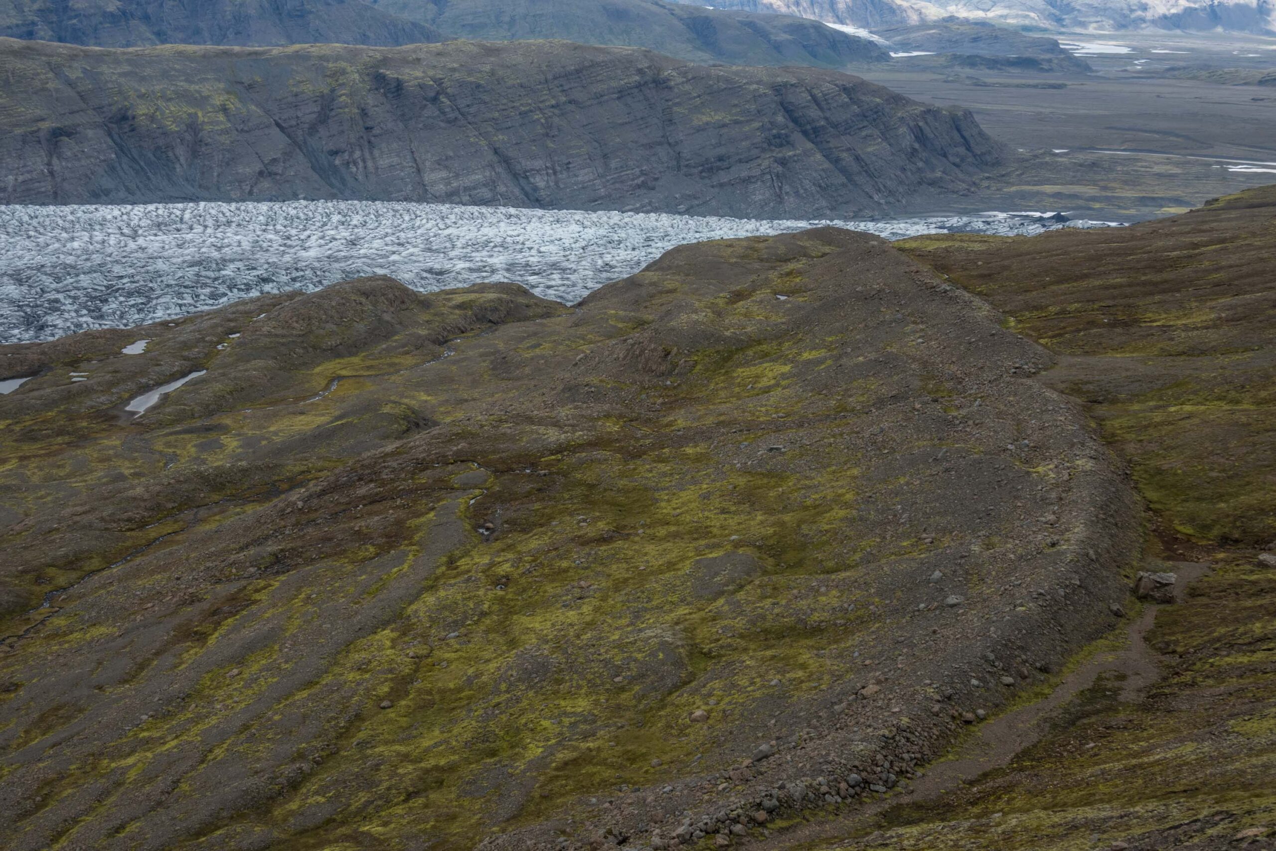
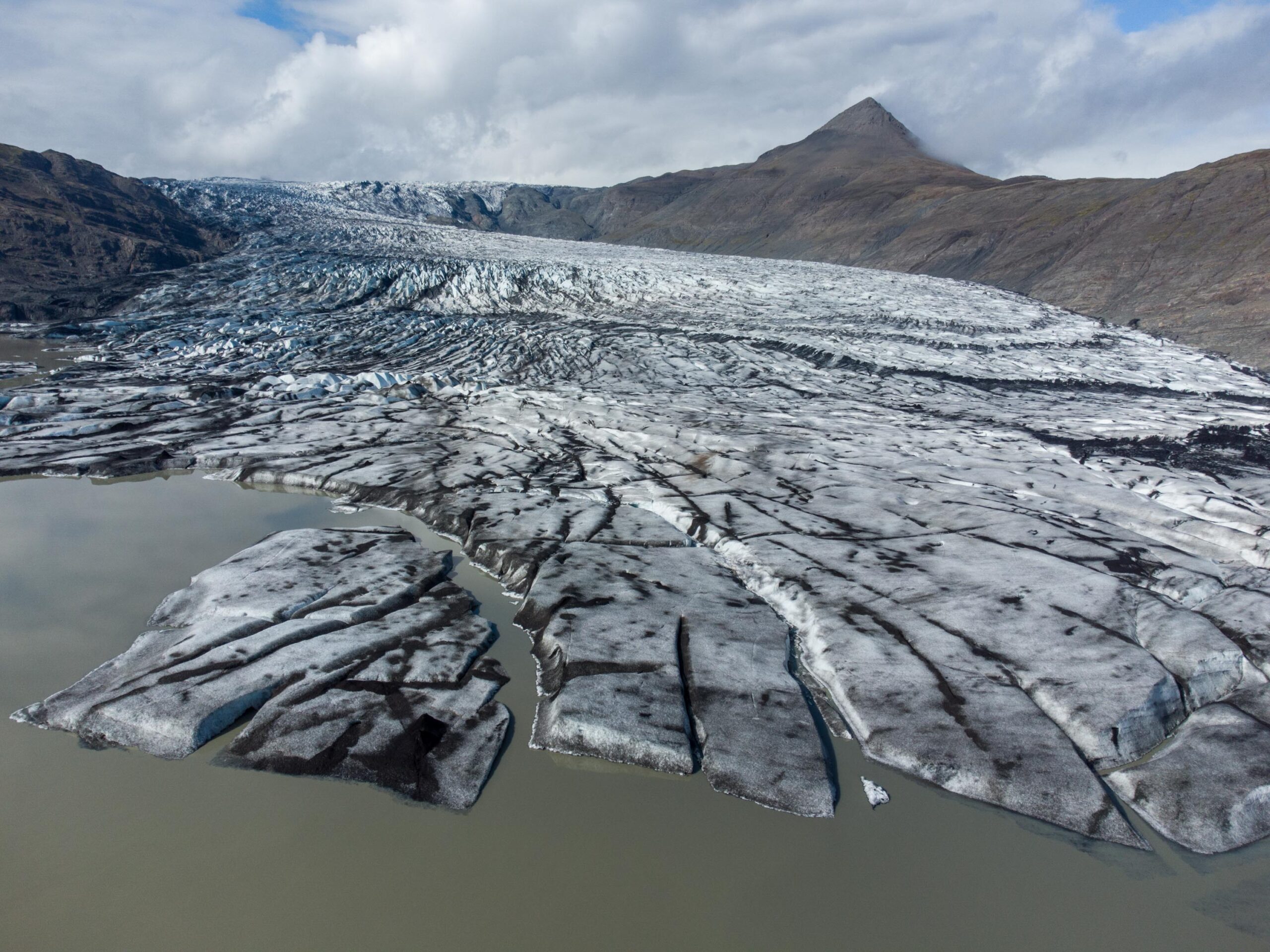
In the course of the last 100 years the glacier lost most of its arcuate shape, as it retreated into a valley. In total, the snout lost 2 km of its length since ca. 1890 and close to 200 m in thickness (Hannesdóttir et al., 2015). It presently terminates in a lake that is hemmed in by Hafrafell to the north and Skálafellshnúta to the south.
Annual Moraines
While the glacier retreated, it left behind so-called recessional or annual moraines. These ridges are formed during winters, when forward ice-front movement exceeds the negligible ablation. Minor readvances during overall recession bulldoze and squeeze subglacial sediments into up to 1.5 m high, generally 3-8 m wide moraines. They are sawtooth or crenulate in planform, reflecting the indented geometry of the ice-margin (Sharp, 1984; Chandler et al., 2016).
Recessional moraines in front of Skálafellsjökull, formed around 2010.
Composite Moraine 1990's
The space between annual moraines reflects summer weather: the higher summer air temperatures are, the more glacial retreat and thus the larger ridge-spacing is, like in the 1930’s and around 2010 (Chandler et al., 2019). In times when the glacier margin was stagnant (late 1960’s) or even advancing (early 1990’s) composite moraines were formed. Especially the large composite moraine from the 1990’s in the northern part of Skálafellsjökull’s foreland is not to miss. After the small readvance in the 1990’s, Skálafellsjökull quickly returned to recession mode. At present no (visible) moraines can be formed anymore, as the snout has retreated into a lake.
Skálafellsjökull formed a large composite moraine in the 1990's.
The annual moraines in the foreground with relatively large spacing were created in the period 1935-1950.
Flutes
Besides (recessional) moraines, there is another distinct landscape feature in the foreland of Skálafellsjökull: flutes or flutings. Flutes are parallel, straight ridges of several tens of meters long and a few decimeters high that give the impression of a ploughed field. They are formed under the glacier, often at the lee-side of a lodged stoss boulder. When the ice passes the (stuck) boulder, a cavity is created at the downflow side. Water-soaked till (sediments) are squeezes into this hollow because of differences in pressure. The flute that is created this way tends to propagate and grows downflow, sometimes for hundreds of meters (Evans, 2016:87). In front of Skálafellsjökull, an exceptional range of flutes is present and well-studied (Hart et al., 2018).
Flute at the lee-side of a lodged stoss bolder in the foreland of Skálafellsjökull.
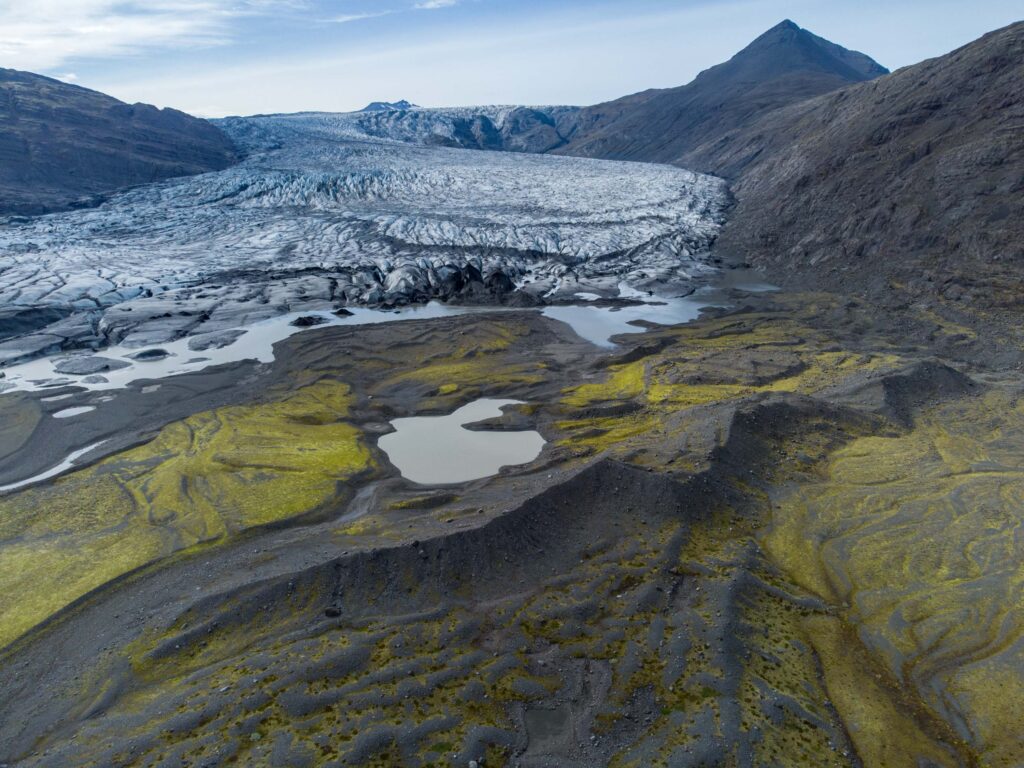
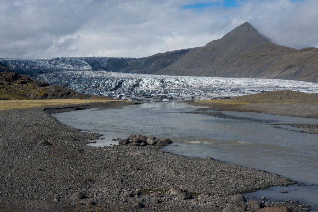
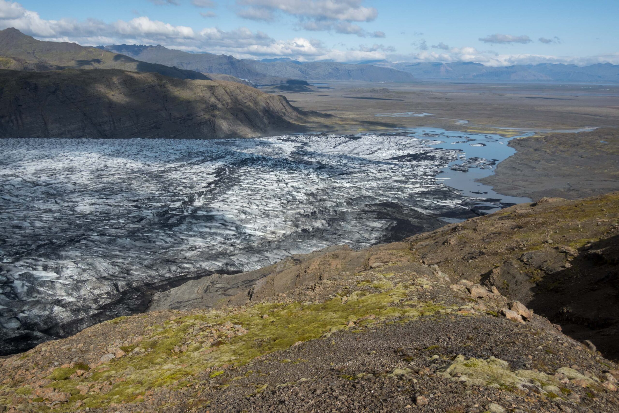
Southern side of Skálafellsjökull with Sultartungnajökull, August 2023.
Sultartungajökull
Most studies on glacial landforms focus on the foreland of the glacier, which is usually in front of the terminus. Skálafellsjökull, however, has an extra snout in the south. This Sultartungnajökull (or Eyvindstungnajökull) is a small south-flowing lobe that also retreated 2 km from its 19th-century position. To its east, ice previously spilled over a col. At both places (recessional) moraines and flutes are present, just like on the larger foreland. The main difference is that the outer moraine (dating from around 1890) is well preserved on the south margin, whereas it washed away in front of Skálafellsjökull for the most part (Walton et al., 2024).
Subglacial Processes
Sultartungnajökull is very easily accessible, thanks to a road that follows its margin and leads all the way up to the ice field at 900 m. This provides good opportunities for glacial research, like Jane Hart and colleague’s did. With the help of ground-penetrating radar, drones, boreholes and embedded probes/sensors (both into and below the ice) they tried to get a grip on the processes that take place at the bottom of the glacier.
Outermost lateral moraine to the south of Skálafellsjökull, dating from ca. 1890.
Lubricating Meltwater
They learned that meltwater quickly passes through the glacier and forms a thin, pressurized layer of water in between the glacier and its deformable bed during melt season. In winter, this drainage system is replaced by low-pressure channels. Depending on the water pressure, which is influenced by rain and melt events, ice velocity varies from a few to 20 cm a day. But that’s at the southern margin of the glacier: the icefall moves at speeds of 150 m a year (Hart et al., 2015; 2019).
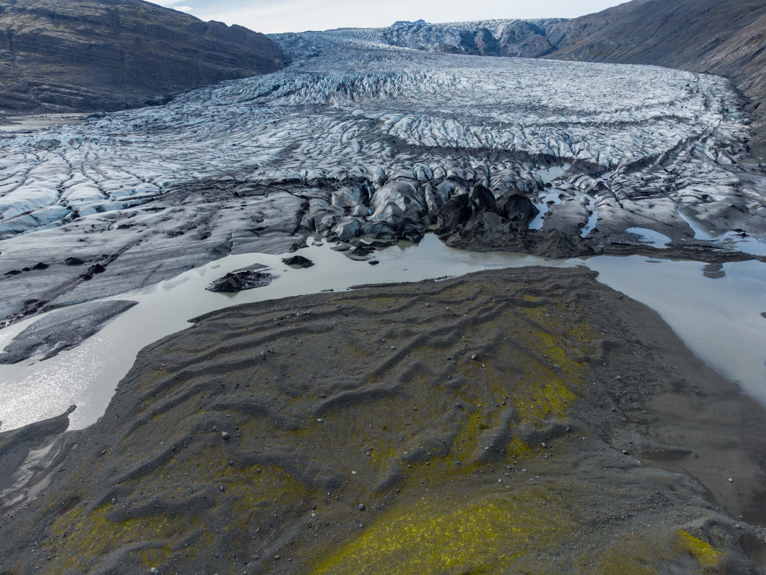
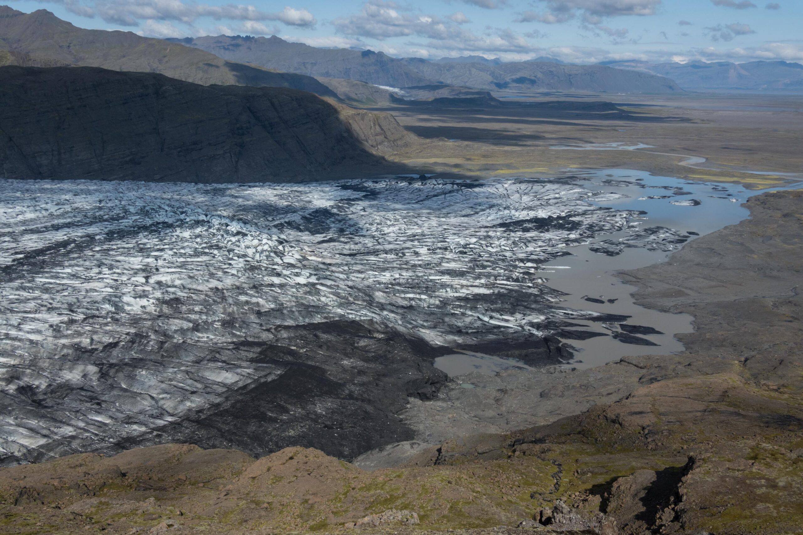
Southern margin of Skálafellsjökull with Káravatn Lake and Sultartungnajökull in the background, August 2023.
Meltwater at the snout of Skálafellsjökull.
Skálafellsjökull in 1955-1965 (left) and 2023. Photographer 1955: Þorsteinn Jósepsson, Þjóðminjasafni Íslands nr. ÞJ_ASkf-260 (via sarpur.is).
Melt Rates and Ice Loss
It makes sense that researchers focus on meltwater. As the climate changes, melt rates increase and could have a huge influence on glacier velocity and therefore the loss of ice. That’s very import for the large ice sheets of Greenland and Antarctica, whose future is uncertain. Skálafellsjökull’s behavior in the coming decades is more certain: it will continue to loose ice and, depending on the greenhouse gas emissions, could disappear by 2100 (Hannesdóttir et al., 2015).


 A3 v2")

