The most northerly glacier of the Mont Blanc massif lies in Switzerland and is called Glacier du Trient (Trient Glacier). Once a real tourist attraction, the glacier is now hardly visible.
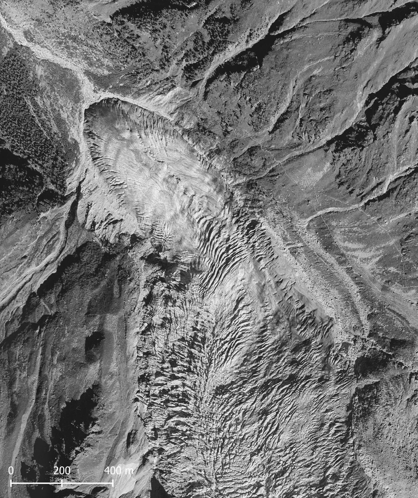
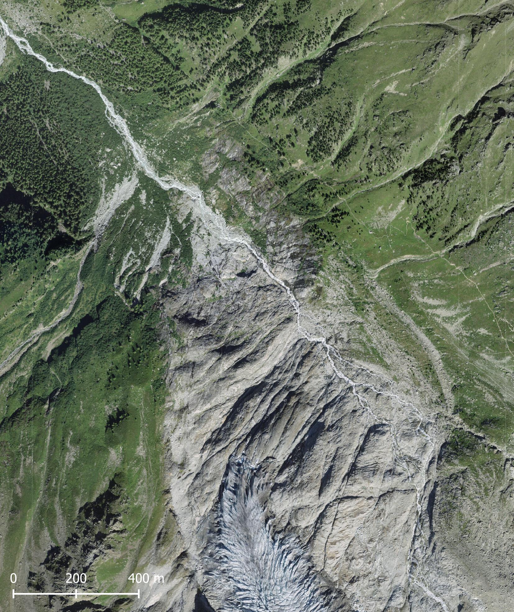
Glacier du Trient in 1988 (left) and 2020. Source: siwsstopo Zeitreise.
Glacier du Trient is named after the village of Trient down in the valley. A few hundred meters above it lies the mountain pass Col de la Forclaz. From there, a 3 km long path leads in the direction of the glacier. The path is remarkably flat, thanks to the water channel that runs alongside it. The channel (bisse in French) was dug to lead meltwater from the glacier to the dry meadows on the slopes of the valley. These irrigation systems are many centuries old.
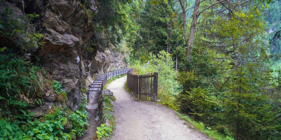
Back in the days, the path alongside the bisse came all the way up to the glacier. Therefore, Glacier du Trient was very easy to reach and even to exploit. Around 1870, dozens of workers were chopping off chunks of ice from the glacier every day. The blocks were brought to the railway station of Martigny and transported to Paris, where they were used for cooling.
Not only ice-workers found their way to Glacier du Trient, tourists did too. To many, according to Charles Durier. In 1877 he already complained about all those people flooding the Mont Blanc area. He blamed the authors of travel books for this, because by exaggerating everything they would attract thousands of people. No less than an invasion, in the words of Durier (C. Durier, Le Mont-Blanc, 1877). By the way, he wrote two books on the Mont Blanc himself.
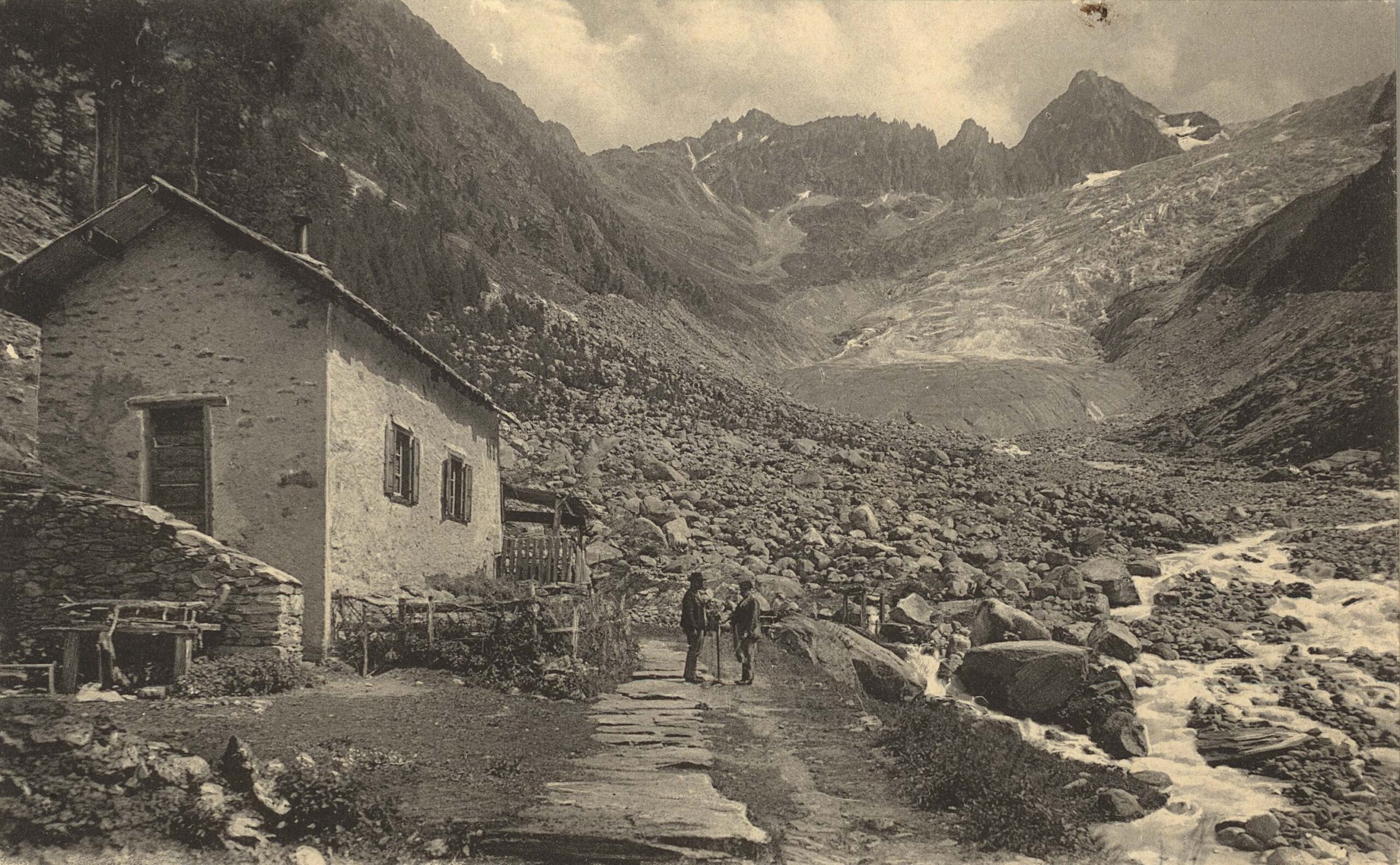
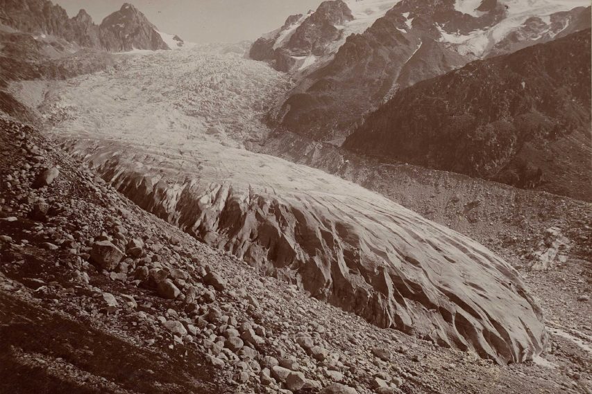
After 1850 the glacier generally receded, but this trend was interrupted three times. Between 1880 and 1895 the glacier advanced by 200 m and after 1915 it grew a bit as well. The third phase of forward expansion was by far the most prominent one. Between 1960 and 1985 Glacier du Trient advanced over 400 m and reached the same size as it had around 1900.
An advancing glacier looks different from a retreating one, with its steep sides and frontal crevasses. The photo from 1891 illustrates this, but the lateral moraine in the background also shows that the glacier is much smaller than it was forty years before. When the glacier advanced for the third time in 1960-1985 it bulldozered over terrain that had been deglaciated for fifty years. In the meantime, trees had colonized the valley and were almost engulfed by the ice in the 1980’s.

The remarkable growth of Glacier du Trient attracted many people to this already well-visited glacier. After all, the snout was just an easy one-hour walk away. The glacier advanced due to a prolonged period of cooler temperatures. But when temperatures started to rise quickly around 1990, the glacier also melted very quickly. It receded by 1.5 km in a little over thirty years. By now, you don’t see much ice when walking along the bisse.
The rise and fall of Glacier du Trient was captured by Pierre Mercier from 1972 to 2000. He made over a period of 30 years pictures from more or less the same location. The glacier grew until 1985 and melted quickly afterwards. Images from Library ETH Zürich, georeferenced for the ridge in the background .
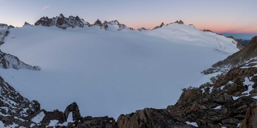
Glacier du Trient receives its ice from the Plateau du Trient. The Plateau is about 2 by 2 km and has an elevation of 3000-3400 m. Here, snow accumulates and is compressed into ice, after which it flows both to the north (Glacier du Trient) and a little bit to the east (Glacier d’Orny). At the edge of the ice field stands Cabane du Trient, a mountain hut at 3169 with beautiful views over Plateau du Trient.

But Plateau du Trient is no longer capable of producing ice. In the short but expanding summer, all snow is melted and nothing is left to become ice. The ice is therefore getting thinner each year, although it will take some time for the nearly 200 m thick Plateau du Trient to disappear completely.
Search within glacierchange: