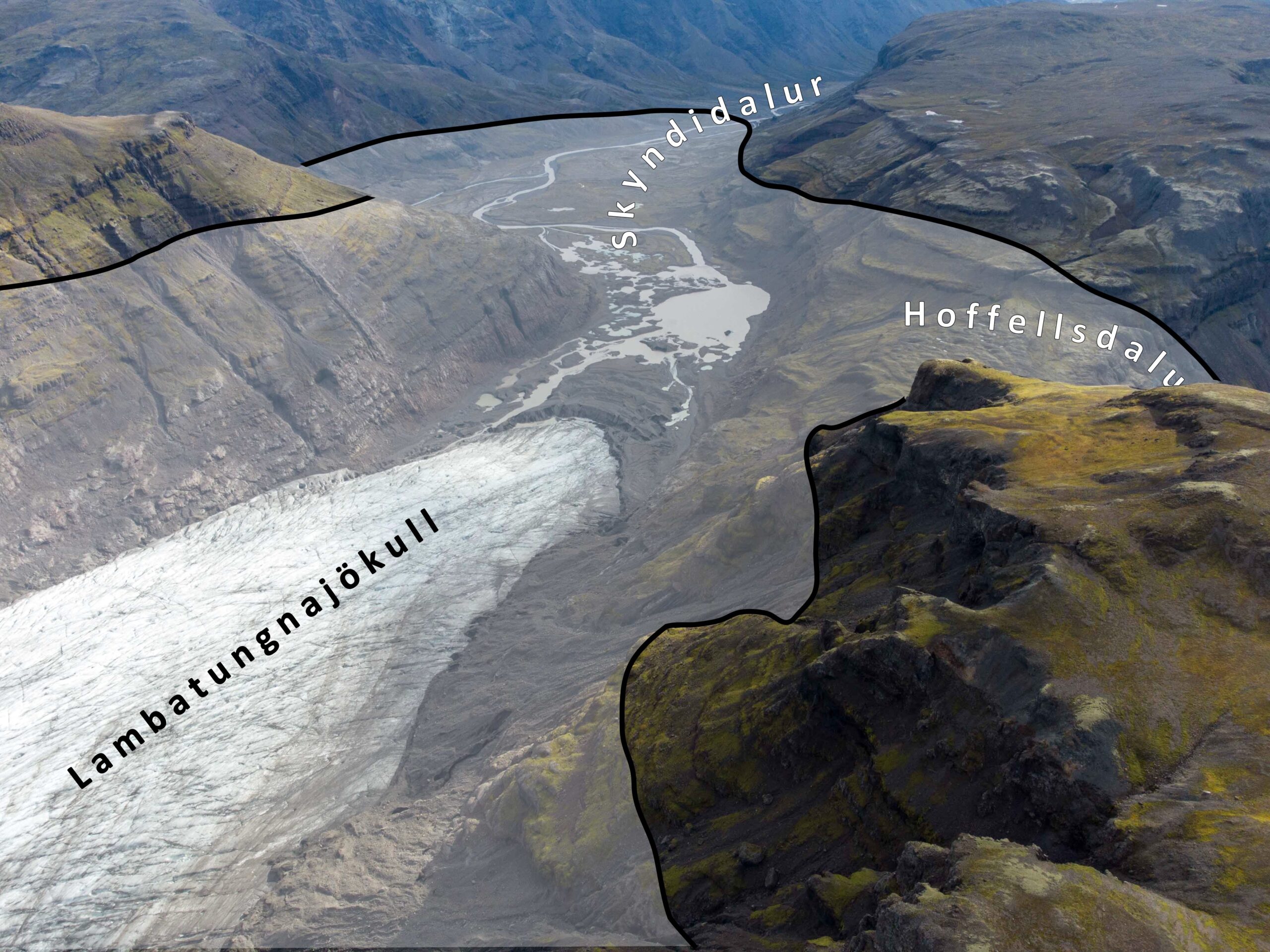
Lambatungnajökull is a glacier in southeast Iceland. It is located in Skyndidalur, a narrow valley confined by steep mountain slopes. But a long time ago, the glacier occupied a second valley.
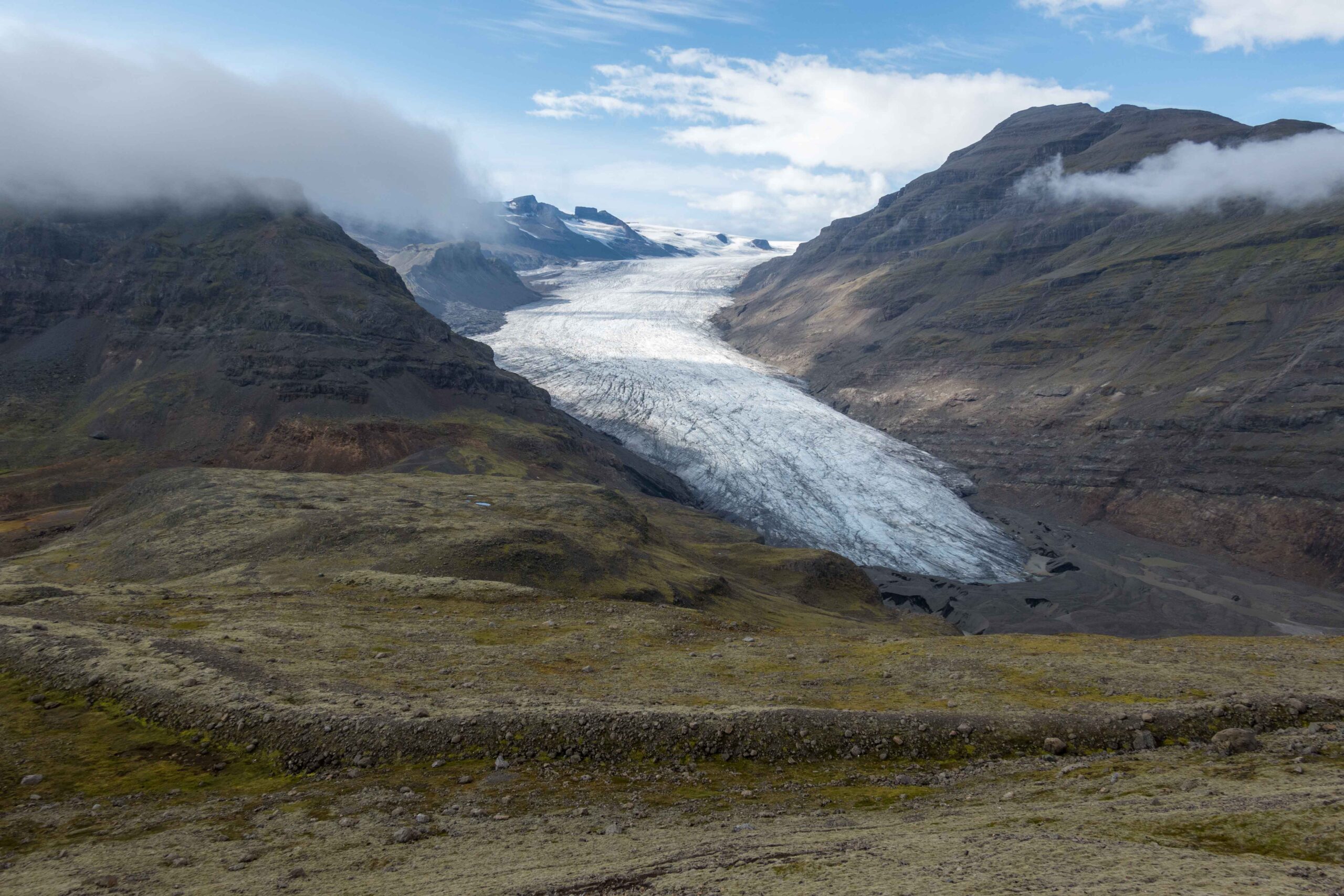
From its highest point (Goðahnjúkar, circa 1500 m) Lambatungnajökull flows down to an altitude of 200 m, spanning fourteen kilometers. The glacier terminates in a chaos of ice, water and sediments. They interact to form a kame and kettle topography, which is a landscape formed when thawing ice is partly covered by sediments. Where sand, gravel and rocks collect in holes or depressions in the glacier they will leave an kame or small hill after the surrounding ice is melted away. Conversely, a pond or kettle will form when remnants of ice prevent infill with sediments and melt out later.
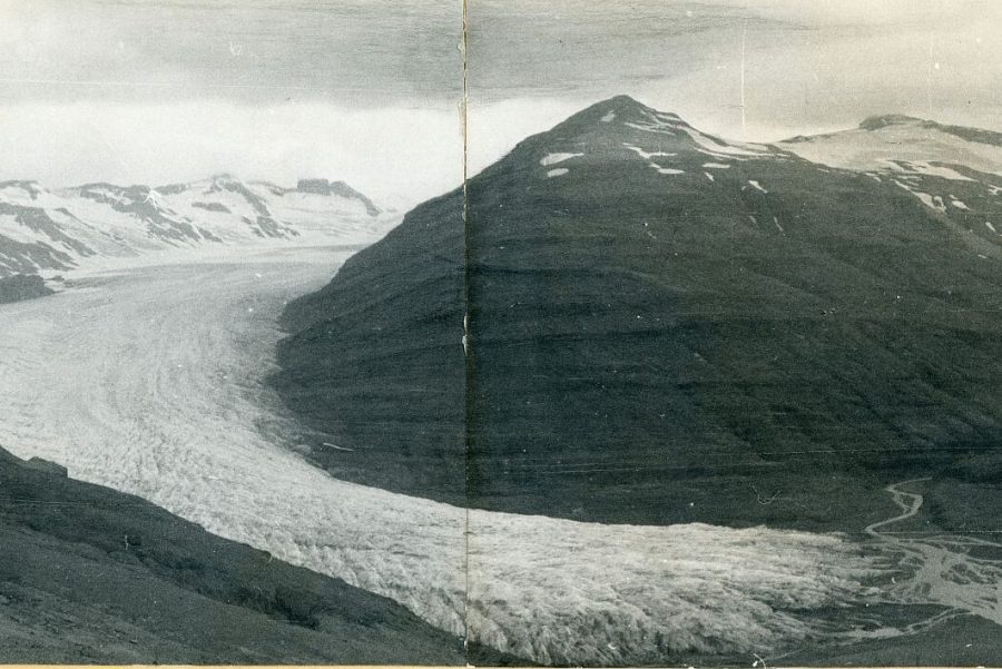
While the present day Lambatungnajökull has a smooth and curved snout, the terminus used to be full of cracks. This can be deduced from the sawtooth-shaped moraines lying a mile in front of the glacier. They are formed in the first half of the twentieth century, when Lambatungnajökull terminated in a wider part of the Skyndidalur valley. Stresses within the ice dictate radial crevasses to form when glaciers diverge (widen). In between and in front of the radial crevasses sediments collect, leaving a sawtooth moraine after the glacier recedes again.
Compared to other glaciers in southeast Iceland, reconstructing Lambatungnajökull’s history is easy. This is all thanks to the fact that Lambatungnajökull did not only occupy the Skyndidalur, but also entered Hoffelsdalur to the south via a pass. After the glacier left the col again, the moraines formed in the Hoffell valley were never affected by glacier meltwater. After all, the meltwater was confined to the Skyndidalur. Geomorphological evidence of past glacier extent is therefore much better preserved in the Hoffellsdalur (Bradwell et al., 2008).
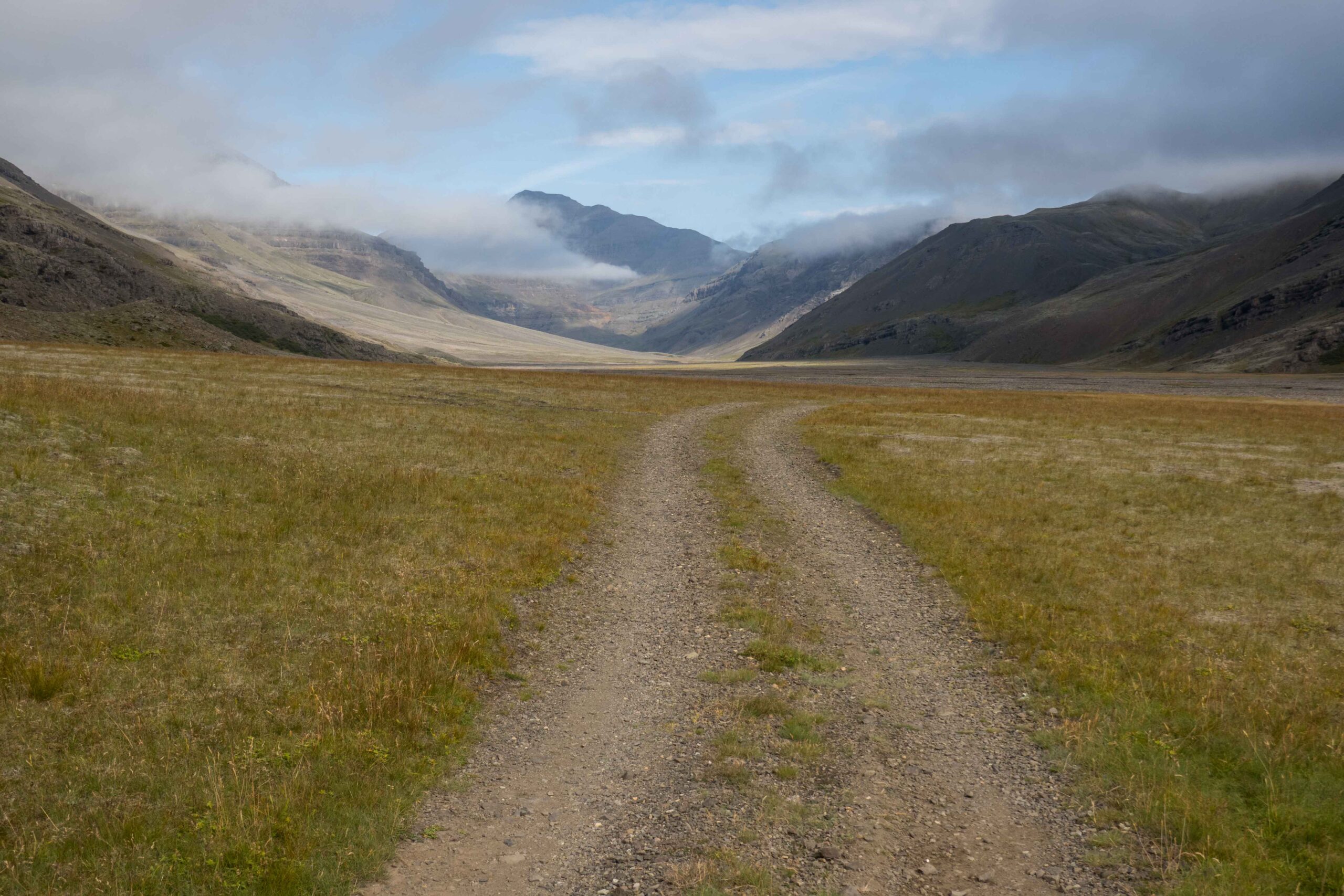
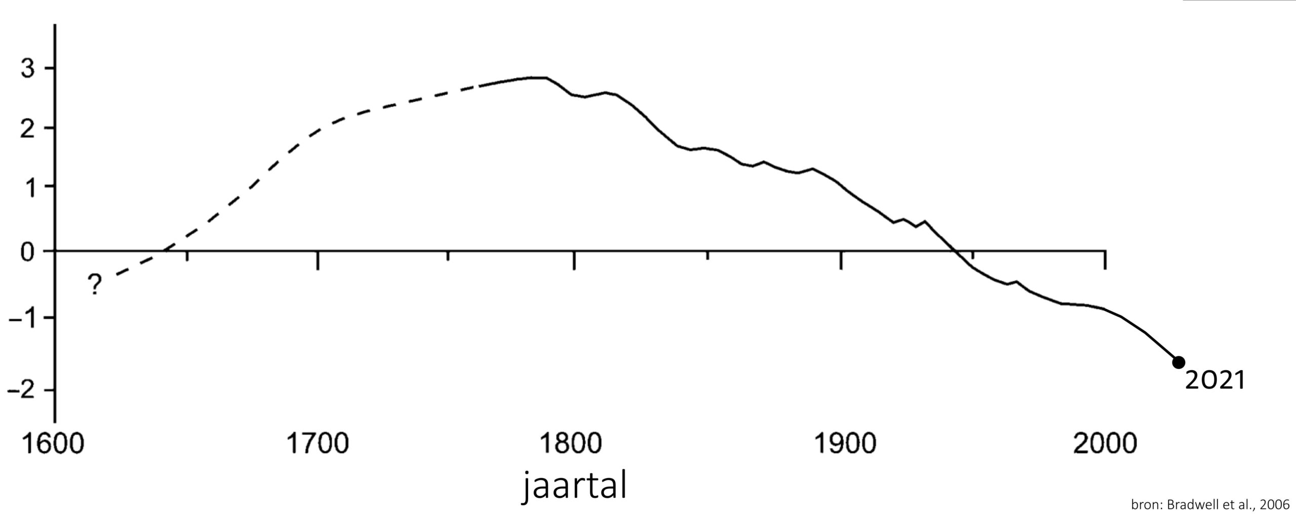
Geologist Tom Bradwell gratefully used the well-preserved moraine sequence to reconstruct 250 years of glacial change. By studying the size of lichens on boulders in the former glacier bed and knowing their growing rate of half a millimeter per year, he concluded that Lambatungnajökull was at its largest at the end of the eighteenth century. He calibrated his findings by digging pits in the soils between the moraines in order to find tephra (ash) layers. This way, he could couple the moraines to known volcanic eruptions and be extra sure about their age (Bradwell et al., 2008).
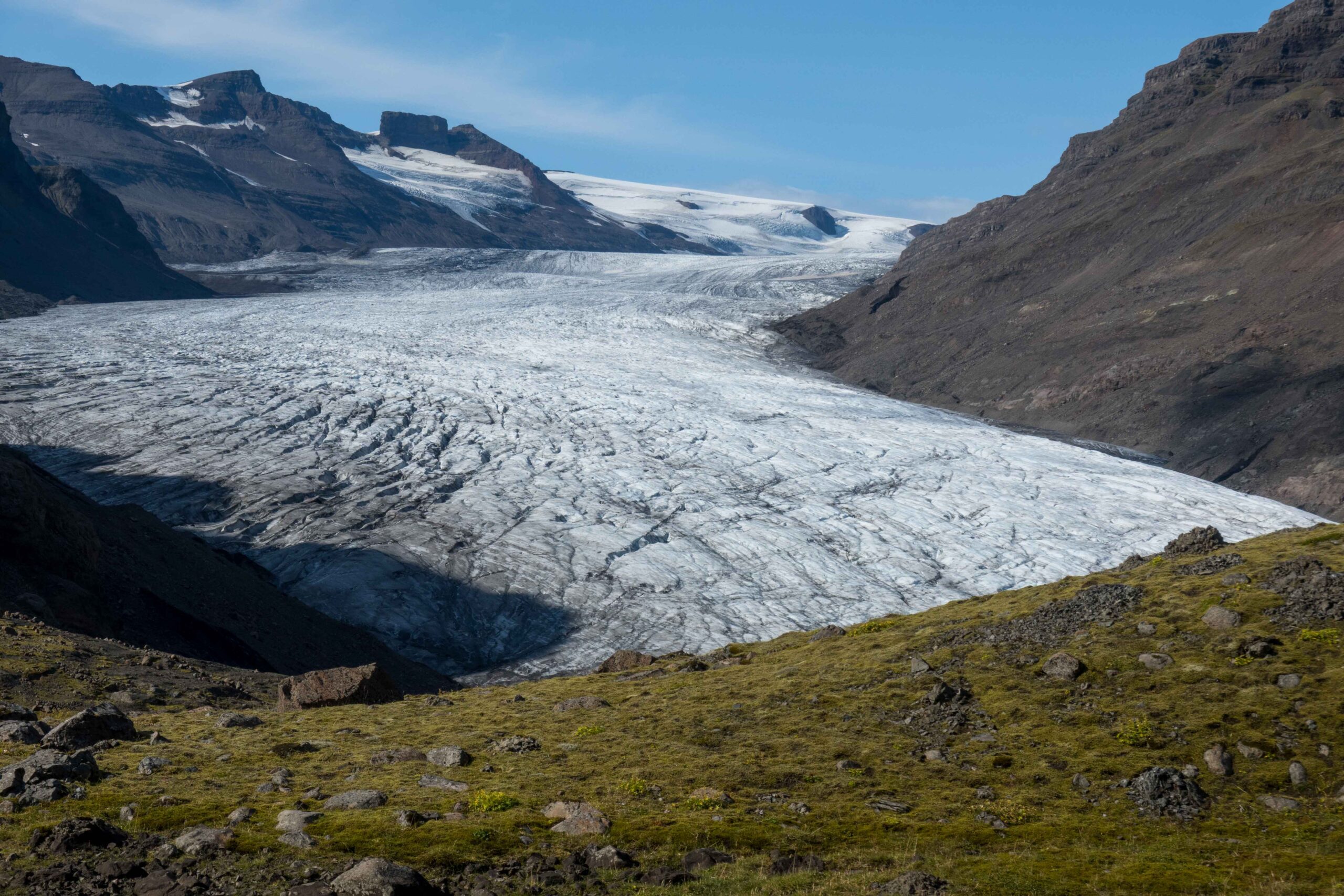
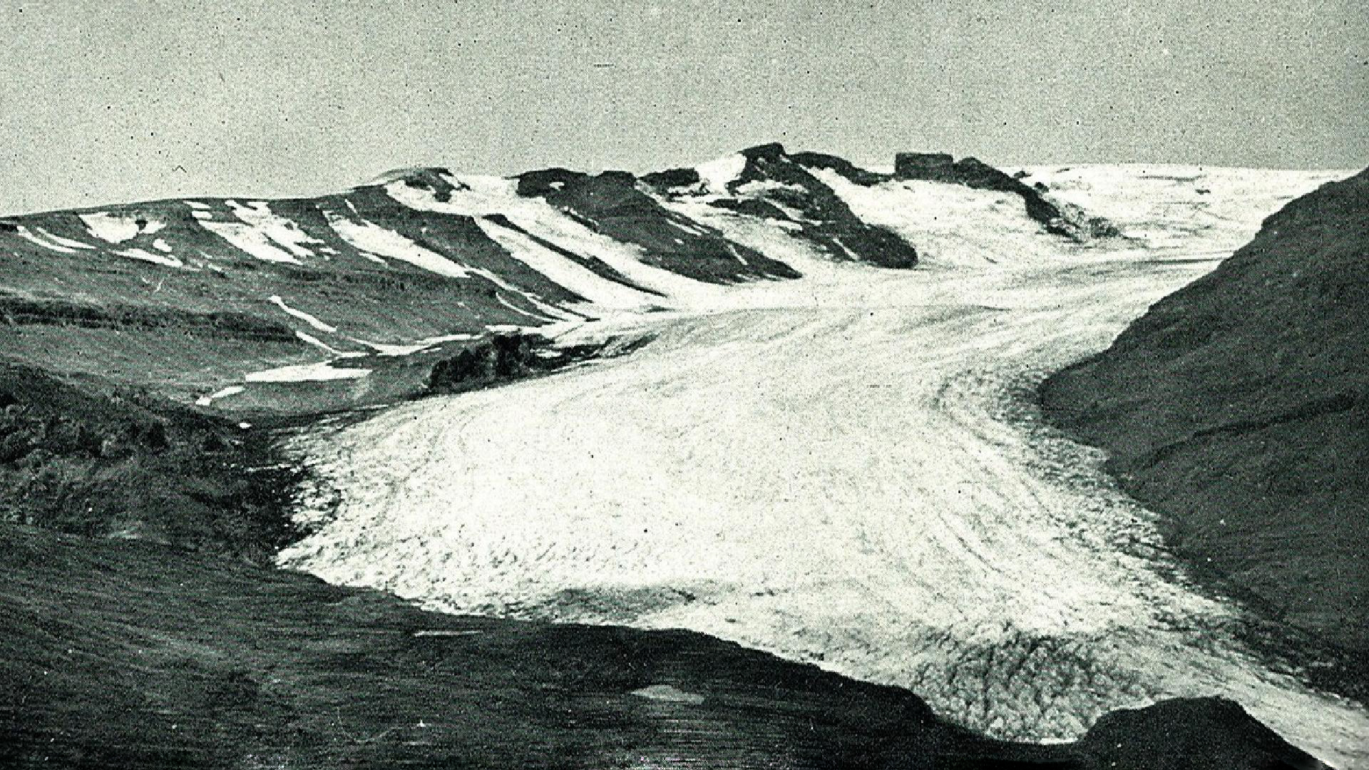
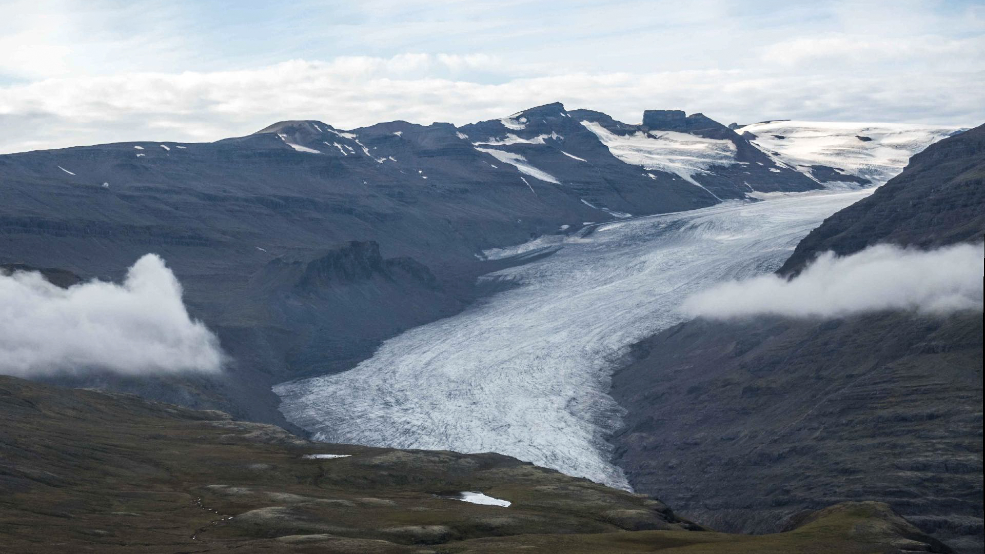
Lambatungnajökull in 1937 (links, Steinþór Sigurðsson) en 2023.
Hardly anyone noticed the vast extent of Lambatungnajökull over two hundred years ago. The glacier is remote an no farms lie in the area. The only persons that went there regularly were farmers of Hoffell, who let their sheep graze in the mountains. Because the glacier creeped into Hoffell valley from 1650 onwards, they could no longer get access to some of the meadows. This lasted until 1937. In the meantime nobody was really interested in the glacier. It wasn’t even before 1938 that the first decent map of the area was published. Since then, growing attention is being paid to the Lambatungnajökull and its changes.
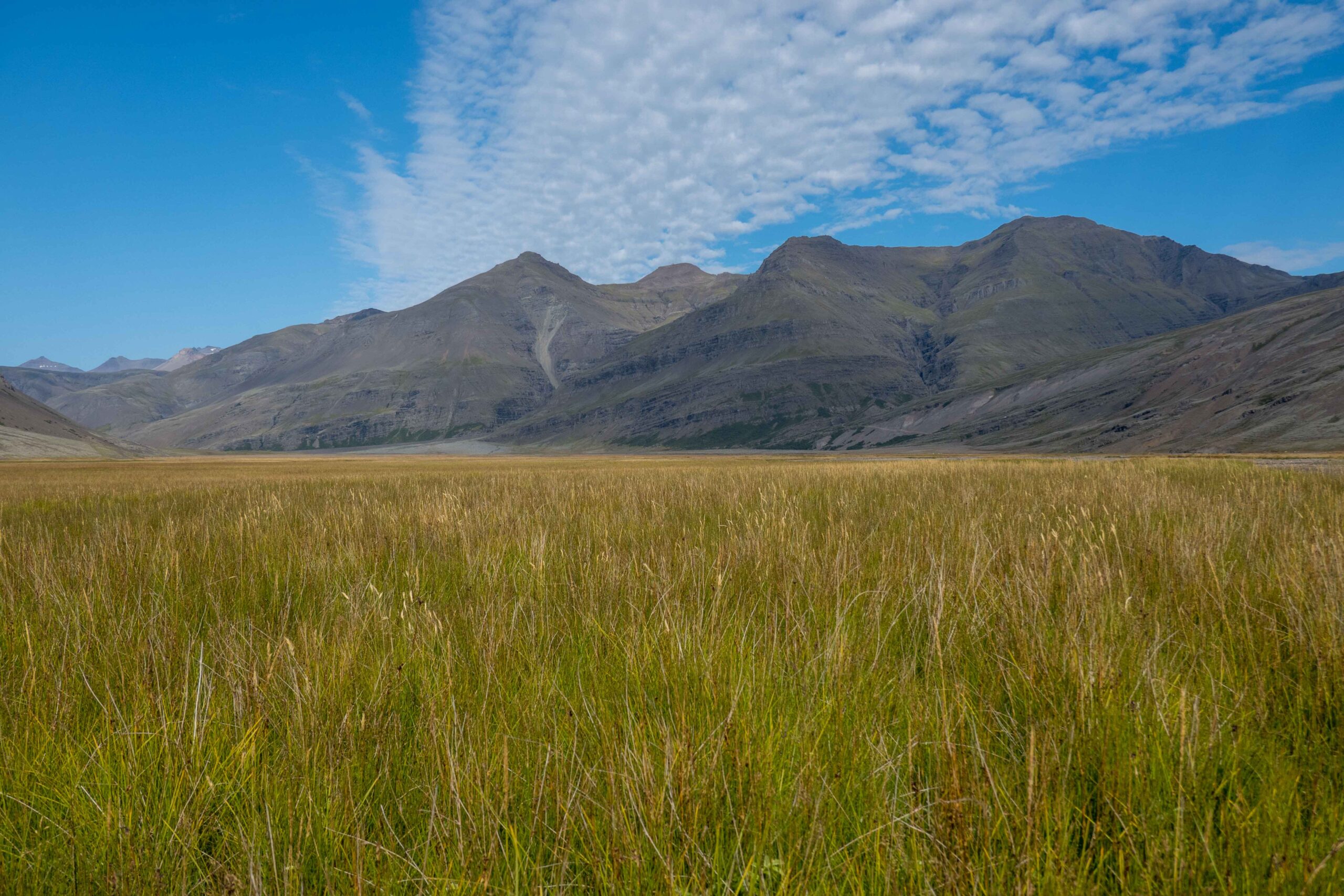
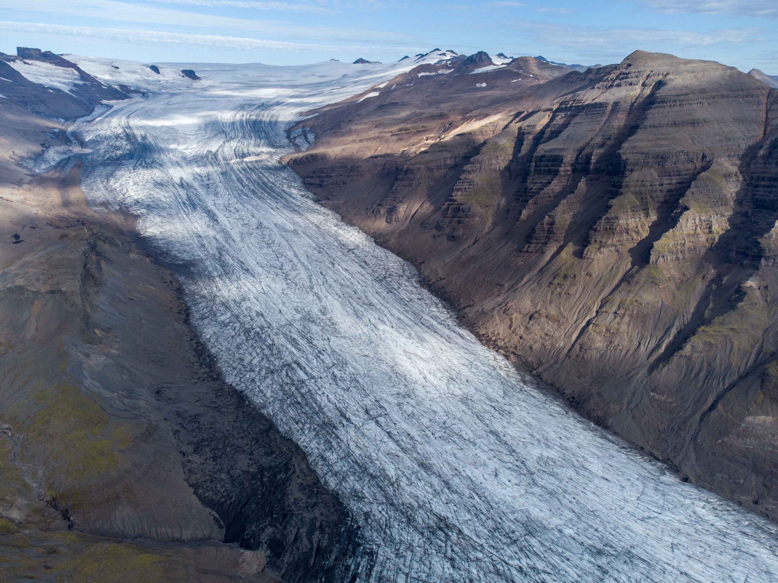
In this remote corner of Iceland’s biggest ice cap, Lambatungnajökull quietly moved along with climate fluctuations. In recent decades the glacier has attracted much more attention, leaving no change unnoticed. And lots of changes are ahead.
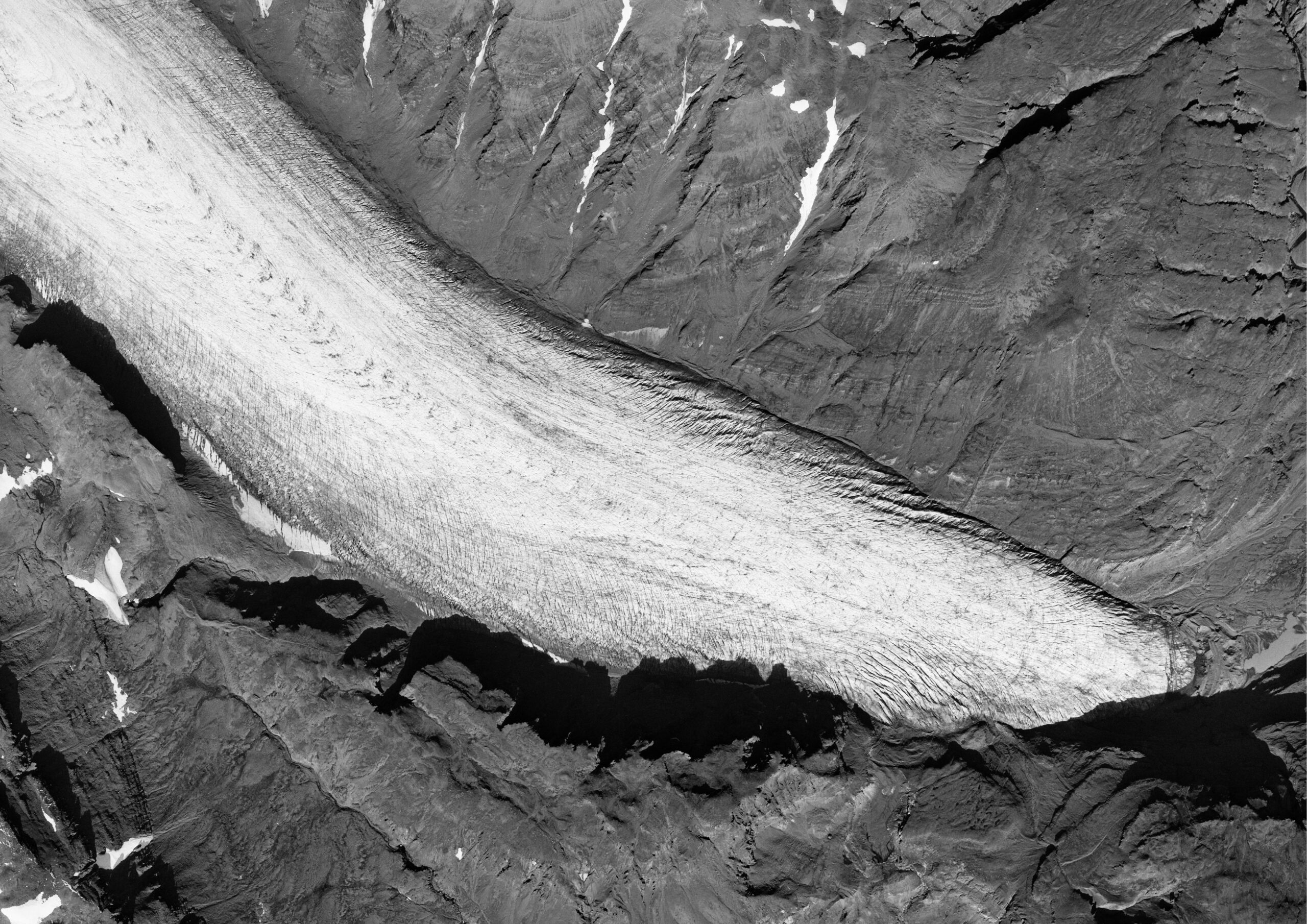
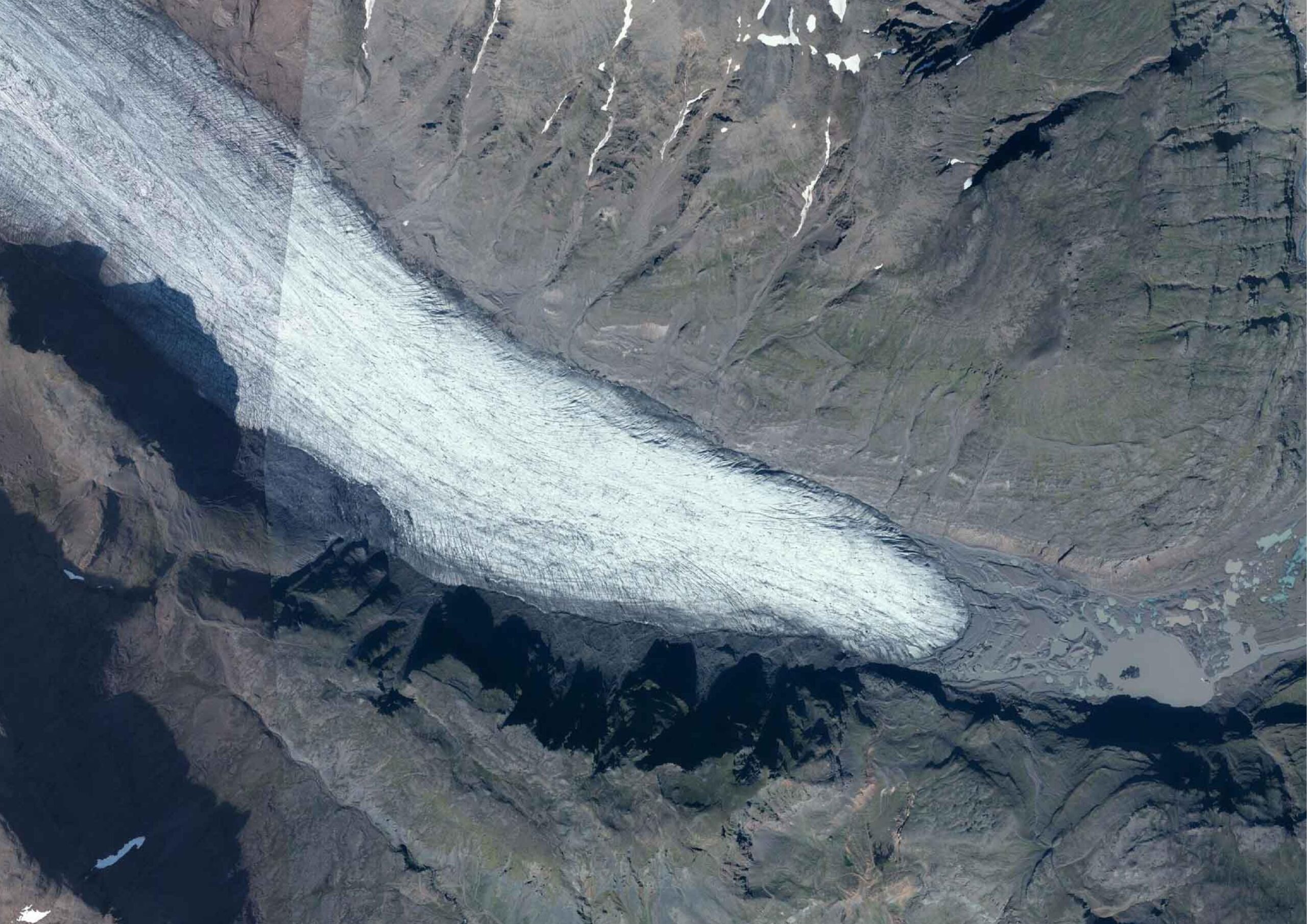
Lambatungnajokull in 1988 (left) and 2022.
Search within glacierchange: