In the southwest of Jotunheimen sits Hurrungane, a small mountain range. Its alpine peaks and steep rock faces make the area popular. In between the mountains are several glaciers, of which Styggedalsbreen is the longest.
Styggedalsbreen in 1981 (left) and 2017. Source: norgeibilder.no.
Hurrungane
To the south, Styggedalsbreen is surrounded by the highest peaks in Hurrungane, like Skagatølstindane, Sentraltind and Styggedalstindane. All are well over 2300 hundred meters high and catch plenty of snow. The snow falls down their steep northern slopes and collects in a cirque, where it is transformed into ice. From there Styggedalsbreen flows two kilometers northwards. In the past, the glacier was three kilometers long.
Carbon-14 Dating
In the 1970’s two scientists investigated the timing of Styggedalsbreen’s maximum extent. Nigel Griffey and John Matthwes excavated small parts of the outer moraine, where they expected to find buried soils (Griffey and Matthews, 1978). These soils must have been formed before Styggedalsbreen deposited material on top of them. Although the plants in it have died a long time ago, their date of death can be reconstructed with the help of the radiocarbon dating. In this method, organic material is dated on the basis of their radiocarbon (14C) proportion. The older the material, the less radiocarbon it contains, because the amount of radiocarbon halves every six thousand years.
Orthophoto of Styggedalsbreen from 2017, with its former extents.
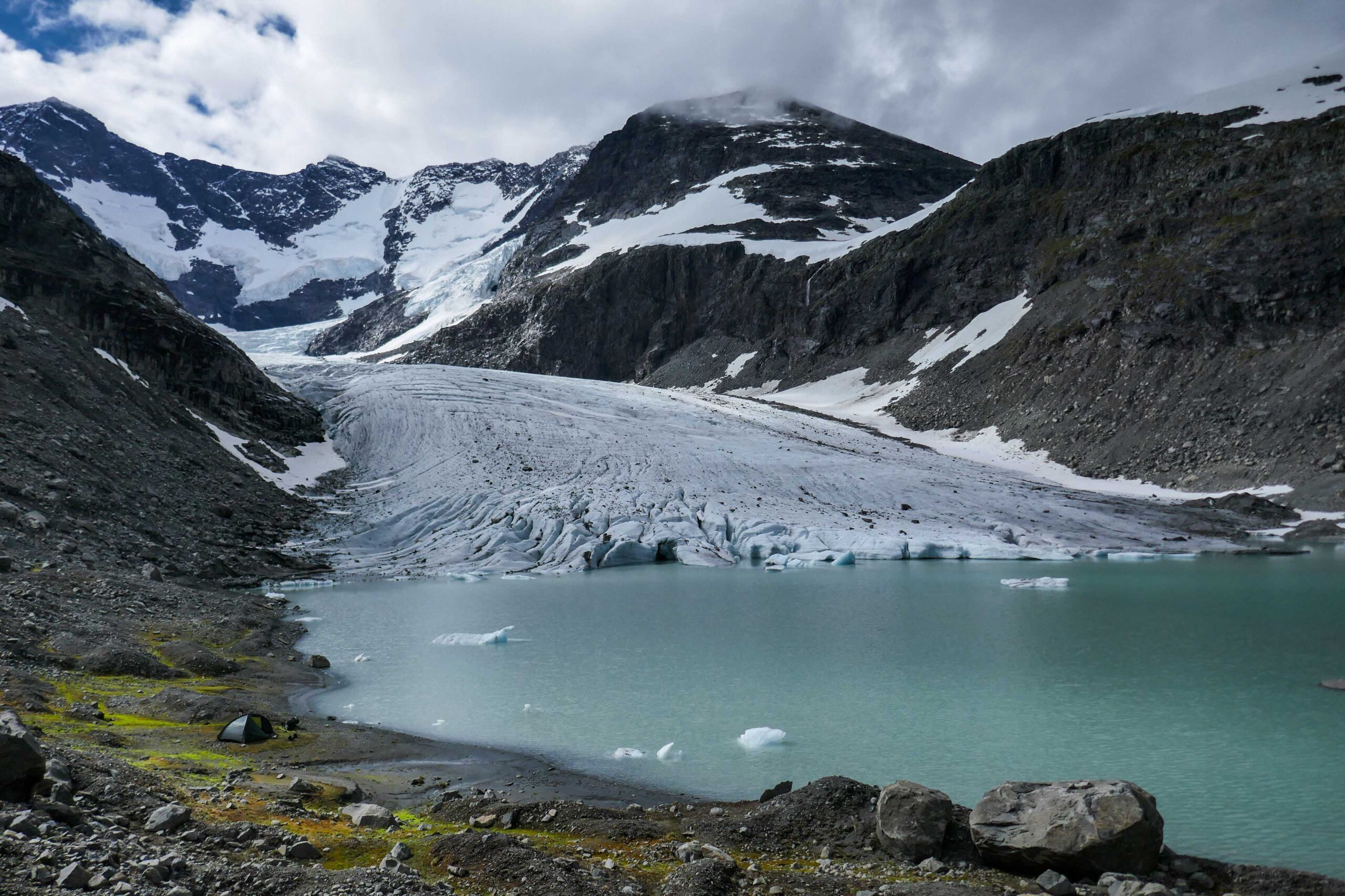
Styggedalsbreen receives snow from the highest summits of Hurrungane, July 2020.
Styggedalsbreen, juli 2020.
2700-year Old Moraine
Griffey and Matthews found that the plants below the moraine died approximately 2700 years ago, so Styggedalsbreen must have been at its maximum extent in those days. But there is a second moraine just a little downhill from this oldest moraine, dating from around 1750. That means that in ca. 1750 the glacier was almost as large as 2700 years ago. Since then the glacier receded by a kilometer, especially from the 1930’s onwards. Recently the yearly loss increased to 20-30 m annually.
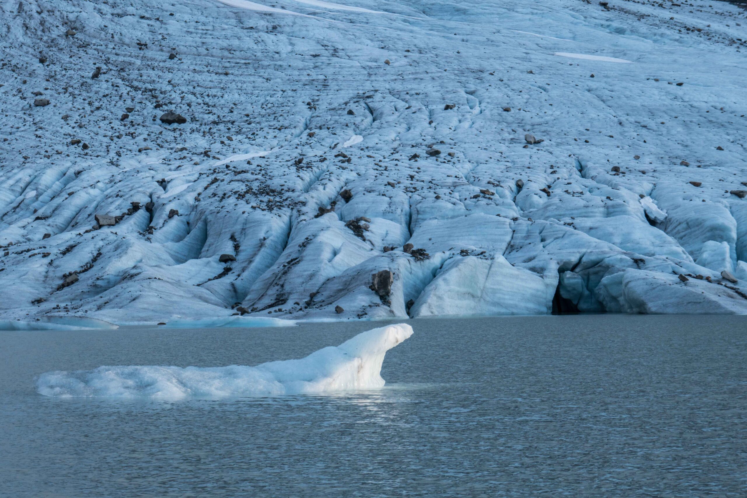
Floating icebergs in front of Styggedalsbreen, July 2020.
Glacial Lake
Styggedalsbreen terminated in a lake. This depression was formed over the course of many centuries, as the glacier eroded its bed. Only from 2005 onwards the depression emerged from underneath the ice and became an ever-expanding lake. The receding glacier enlarges the lake, but this can’t go on forever: in about two hundred meters the glacier will withdraw from the depression. At the current rate of recession the beautiful little icebergs will seize to exist in less than ten years.
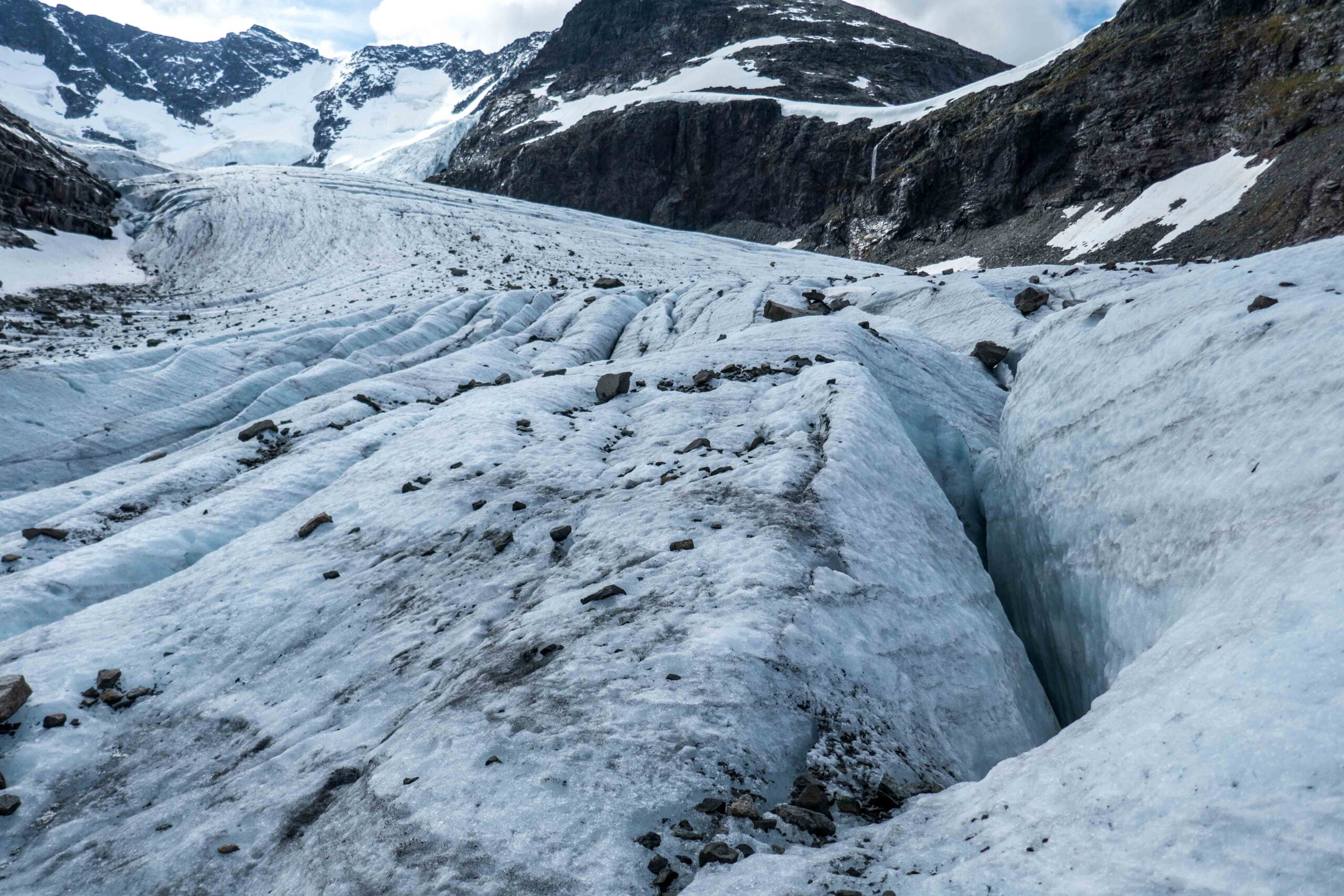
Forefield of Styggedalsbreen as sees from the glacier, July 2020.
Hike to the Glacier
Visiting Styggedalsbreen is quite easy. From the visitor center and adjoining hotel Turtagrø you walk into the lovely valley of Helgedalen. A series of hairpin bends help you to climb out of the valley and to reach a small reservoir four hundred meters higher up. Its southern shore is actually formed by the glacier in 1750. From here, just walk one kilometer upstream along the meltwater river of Styggedalsbreen to reach the glacier. Enjoy the icebergs while they last.


